North Carolina Turnpike Authority

Last updated
North Carolina Turnpike Authority
Ncturnpikeauthority.png
Agency overview
FormedOctober 3, 2002 (2002-10-03) [1]
Jurisdiction North Carolina
Headquarters1 S Wilmington St, Raleigh, NC 27601
Parent agency North Carolina Department of Transportation
Website http://www.ncdot.gov/turnpike/

The North Carolina Turnpike Authority was created in 2002 to speed the implementation of needed transportation improvements by funding some projects with tolls. Governed by a nine-member authority board, it is located within the Department of Transportation and under the direct supervision of the Secretary of Transportation. The authority has the power to study, plan, develop and undertake preliminary design work on up to eleven turnpike projects. At the conclusion of these actives, the authority is authorized to design, establish, purchase, construct, operate and maintain toll highways and bridges. The authority is also authorized to designate one or more lanes of any highway, or portion thereof, into a high-occupancy toll lanes (HOT lanes) or other type of managed lanes; provided that such designation does not reduce the number of existing non-toll general purpose lanes.

Contents

Structure

The nine-member Authority Board consist of eight appointees, from the General Assembly (four members) and Governor (four members), and the Secretary of Transportation. The General Assembly appoints four members, two by recommendation by the President pro tempore of the Senate and two by recommendation by the Speaker of the House of Representatives. Appointments to the board are four-year staggered terms. The Chair of the Authority is selected by the Authority Board. Members of the North Carolina Board of Transportation may serve as members of the Authority Board.

Upon end of term, all members of the Authority Board will remain in office until their successors are appointed and qualified. The original appointing authority may appoint a member to serve out the unexpired term of any member. Each member of the Authority Board serves at the pleasure of the appointing authority. The Chair of the Authority serves at the pleasure of the Authority Board. The appointed members of the Authority Board receives no salary for their services; however, are entitled to receive per diem and travel allowances.

An executive director, appointed by the Authority Board, serves as the Authority's chief administrative officer and is responsible for the daily administration of the toll roads and bridges constructed, maintained or operated. The Executive Director or his/her designee shall appoint, employ, dismiss and, within the limits approved by the Authority Board, fix the compensation of administrative employees as the executive director deems necessary. [2]

History

The North Carolina Turnpike Authority was established on October 3, 2002, by ratification of House Bill 644 (S.L. 2002-133) and signed by Governor Mike Easley. [1] In its original draft, the authority was independent and only able to establish the first three projects in the following conditions: one project located in whole or in part in a county with a population equal to or greater than 650,000 persons; one project located in a county or counties that each have a population of fewer that 650,000 persons; and one project shall be a bridge of more than two miles (3.2 km) in length going from the mainland to a peninsula bordering the state of Virginia. In 2005, Senate Bill 622 (S.L. 2005-276) added new language regarding establishing tollways on Federally funded highways designated as interstates; the purpose was so that the state can possibly add tolls along Interstate 95 (I-95), if approved by the Federal Highway Administration (FHWA) and all interested parties along the route. [3] [4] In 2006, Senate Bill 1381 (S.L. 2006-228) focused the project to the following:

The 2006 law also made an exception, to the prohibition of converting any segment of the nontolled state highway system to a toll, by specifically identifying I-540 that was currently under construction as of July 1, 2006, located in Wake and Durham counties, and extending from I-40 southwest to North Carolina Highway 55 (NC 55). In addition, the law also mandates the North Carolina Department of Transportation (NCDOT) to maintain an existing, alternate, comparable non-toll route for each toll route constructed by the authority. [5] In December 2006, FHWA approved the tolling project on what was going to be I-540 along the Western Wake Freeway. [6]

In 2008, Senate Bill 1697 (S.L. 2008-225) established the enforcement of tolls on turnpike projects and clarified and revised several sections, including: removal of I-540 from project list, collection of tolls (via mail or transponder), payment system for tolls, civil penalties for not paying tolls and procedures for contesting liability for unpaid tolls. The Triangle Parkway was also renamed the Triangle Expressway, which incorporated segments also known as NC 147 (Triangle Parkway) and NC 540 (Western Wake Freeway), in Wake and Durham counties. [7]

In 2009, House Bill 1617 (S.L. 2009-343) transferred the functions and funds of the North Carolina Turnpike Authority to NCDOT to conserve expenditures and improve efficiency. [8] [9] In August, the groundbreaking ceremony took place on the first phase of the Triangle Expressway. [6] On May 4, 2010, the Authority signed a contract with TransCore to provide transponders. [10]

In December 2011, phase one of the Triangle Expressway was open to traffic; on January 3, 2012, toll collection began. On June 26, 2012, Senate Bill 895 (S.L. 2012-85) gave the authority the ability to enter into reciprocal toll enforcement agreements with other toll agencies. [11] In August, 2012, phase two of the Triangle Expressway was open to traffic and immediately began toll collection. In December 2012, phase three of the Triangle Expressway was opened to traffic; on January 3, 2013, toll collection began on the final section. [6]

In 2013, House Bill 817 (S.R. 2013-183) made sweeping changes to the authority, including: removal of several turnpike projects, including the Triangle Expressway Southeast Extension, Garden Parkway, Cape Fear Skyway and the Mid-Currituck Bridge. reestablishing the turnpike project limit to nine, with the existing Triangle Expressway counting as three and the Monroe Connector/Bypass as one. New turnpike projects must follow new conditions prior to the letting of a contract for project. A limit of up to three agreements with a private entity, with an agreement of no more than 50 years from the date of the beginning of operations on the toll facility. The designation of HOT and managed lanes. [12]

Toll roads

As of 2018, the Authority operates 37.5 miles (60.4 km) of tollways in four counties in North Carolina:

Managed lanes

The authority currently has one set of HOT lanes in North Carolina:

Unlike the turnpike projects, the Authority is not limited to the number of managed lane projects it may construct and operate. The authority may also convert lanes that may previously have been designated as high-occupancy vehicle lane (HOV) or other type of managed lanes; provided that such designated does not reduce the number of existing non-toll general purpose lanes. In making such designations, the authority will specify the high-occupancy requirement or other conditions for use of such lanes, which may include restricting vehicle types, access controls, or the payment of tolls for vehicles that do not meet the high-occupancy requirements or conditions for use. [2]

As of 2023, two additional managed lane projects were fully funded and are either scheduled or are under construction:

Turnpike projects

As of 2018, one turnpike project is fully funded for construction:

Any other project proposed by the authority requires prior consultation with the Joint Legislative Commission on Governmental Operations. For a project to be considered a turnpike project, it must meet the following conditions prior to the letting of a contract for the project: 1) Two of the projects must be ranked in the top 35 based on total score on the department-produced list entitled "Mobility Fund Project Scores" dated June 6, 2012, and, in addition, may be subject to G.S. 136-18(39a). [lower-alpha 1] 2) Of the projects not ranked as provided in (1), one may be subject to G.S. 136-18(39a). 3) The project shall be included in any applicable locally adopted comprehensive transportation plans. 4) The project shall be shown in the current State Transportation Improvement Program (STIP). [26] 5) Toll projects must be approved by all affected Metropolitan Planning Organizations and Rural Transportation Planning Organizations for tolling.

Proposed projects

Stipulated in the 2013 law, proposed toll road and bridges must go through same process as other transportation projects, have an STIP score and rated with other criteria contained in the Strategic Mobility Formula. [12] NCDOT will circulate a draft of the STIP for public comment in December 2014. [27] NCDOT anticipates the Board of Transportation will adopt it in June 2015. Listed below are proposed projects, currently in review and subject to change:

Discontinued projects

NC Quick Pass

NC Quick Pass
Industry Electronic toll collection
FoundedJanuary 3, 2012;11 years ago (2012-01-03)
Area served
  • Delaware
  • Florida
  • Georgia
  • Illinois
  • Indiana
  • Kentucky
  • Maine
  • Maryland
  • Massachusetts
  • Minnesota
  • New Hampshire
  • New Jersey
  • New York
  • North Carolina
  • Ohio
  • Ontario
  • Pennsylvania
  • Rhode Island
  • Virginia
  • West Virginia
Products RFID transponders
Website ncquickpass.com

The NC Quick Pass is a pre-paid account used for all electronic toll collection (ETC) facilities in North Carolina. Three types of transponders are available: transponder sticker (free version), E-ZPass (hard case) transponder and E-ZPass bumper-mounted transponder. [45] Personal (limited to five transponders/vehicles) and business accounts (unlimited) are available; a $1 fee is imposed per month if the account has been inactive for 12 months. [46]

While NC Quick Pass users receive a discounted toll rate, non-users will be invoiced at a higher toll rate through the bill by mail program. This is done when a vehicle passes through a toll gantry, where an overhead camera will take a video image of the license plate. The registered owner of the vehicle is identified through the Division of Motor Vehicles and a bill by mail is sent for payment.

If the bill is not paid within 30 days from the date of the bill, it may escalate to include fees, civil penalties, DMV registration holds, submission to a collection agency, or all of the above. [47]

Interoperability

NC Quick Pass is interoperable with the following ETC systems:

The toll collection equipment used in North Carolina, Florida, and Georgia are compatible, so that NC Quick Pass drivers may simply use any NC Quick Pass transponder in Florida and Georgia, and vice versa (SunPass and Peach Pass drivers may simply use their transponder in North Carolina).

Criticism

No Tolls on 540, a citizens' group opposed to tolls on I-540, was formed in March 2007 Notollson540 square.gif
No Tolls on 540, a citizens' group opposed to tolls on I-540, was formed in March 2007

The North Carolina Turnpike Authority and North Carolina Department of Transportation received criticism following the introduction of a law allowing toll highways and bridges in the state in 2002. Introduced to speed along the implementation of transportation improvements, many of the projects selected by the Authority were controversial, leading to delays. Originally planned to be an extension of I-540, the Triangle Expressway garnered criticism from both politicians and residents for tolling the Western Wake Freeway and for the organisers being unable to sell bonds to fund the project. [50] [51] Following its opening, criticism shifted onto its expansion with towns raising issues about its routing and environmental concerns. [52] [53] [54] [55] Other projects, such as the Garden Parkway and Monroe Connector/Bypass prompted fear of additional urban sprawl, the criticism of politicians who had land deals along the routes, and generated lawsuits stemming from the flawed environmental studies. [56] [57] [58] Both the Cape Fear Skyway and Mid-Currituck Bridge were criticized[ by whom? ] as expensive pork projects. In response to the criticism the North Carolina General Assembly removed the Garden Parkway, Cape Fear Skyway and Mid-Currituck Bridge from the authority's purview. [59] [60] [61]

A more recent contract between the authority and Cintra to build I-77 HOT lanes and operate them for 50 years provoked local groups to hire legal counsel and attempt to have it nullified. [62] Additional criticisms have stemmed from the irregular distribution of toll roads recommended by the authority throughout the state. [63]

See also

Notes

Related Research Articles

E-ZPass is an electronic toll collection system used on toll roads, toll bridges, and toll tunnels in the Eastern United States, Midwestern United States, and Southern United States. The E-ZPass Interagency Group (IAG) consists of member agencies in several states, which use the same technology and allow travelers to use the same transponder on toll roads throughout the network.

<span class="mw-page-title-main">SunPass</span> Electronic toll collection system in Florida, United States

SunPass is an electronic toll collection system within the state of Florida, United States. It was created in 1999 by the Florida Department of Transportation's (FDOT's) Office of Toll Operations, operating now as a division of Florida's Turnpike Enterprise (FTE). The system utilizes windshield-mounted RFID transponders manufactured by TransCore and lane equipment designed by companies including TransCore, SAIC, and Raytheon.

State Road 589 (SR 589), also known as the Veterans Expressway and Suncoast Parkway, is a north–south toll road near the Florida Gulf Coast. Maintained and operated by Florida's Turnpike Enterprise, this 68-mile (109 km) transportation corridor extends from State Road 60 in Tampa, north to State Road 44 near Lecanto. The Veterans Expressway was built to accommodate the increasing commuter traffic in the Tampa-St. Petersburg metropolitan area, with the Suncoast Parkway opening in 2001, extending from near the northern terminus of the Veterans Expressway to U.S. Route 98, with a possible northern extension to U.S. Route 19/U.S. Route 98 in Crystal River in Citrus County in the planning and development stages. As of February 28, 2022, Phase I of the extension is now open between US 98 and Florida State Road 44. Phase II, which would further extend the highway to County Road 486, is undergoing the design phase.

<span class="mw-page-title-main">Interstate 540 (North Carolina)</span> State highway in North Carolina, US

Interstate 540 (I-540) and North Carolina Highway 540 (NC 540) are part of a partially completed beltway around the city of Raleigh in the US state of North Carolina, forming the Raleigh Outer Loop. When complete, the route will completely encircle the city, meeting its parent route of I-40 in two locations.

<span class="mw-page-title-main">Salem Parkway (North Carolina)</span>

The Salem Parkway is an 18.5-mile-long (29.8 km) freeway in the U.S. state of North Carolina, serving the city of Winston-Salem and the town of Kernersville. It is signed as U.S. Route 421 (US 421) for its entire length, though it is also concurrent with US 158 in downtown Winston-Salem and North Carolina Highway 150 (NC 150) between Winston-Salem and Kernersville. Originally known as the East–West Expressway, it was designated as part of Interstate 40 (I-40) and opened in 1958, becoming the first section of Interstate Highway in the state. I-40 was rerouted onto a new alignment bypassing Winston-Salem and Kernersville in 1992, at which time the road was designated Interstate 40 Business, nicknamed Business 40.

<span class="mw-page-title-main">Interstate 95 in North Carolina</span> Highway in North Carolina, US

Interstate 95 (I-95) is a part of the Interstate Highway System that runs along the East Coast of the United States from Miami, Florida, to the Canada–United States border at Houlton, Maine. In the state of North Carolina, the route runs for 181.36 miles (291.87 km) from the South Carolina border near Rowland to the Virginia border near Pleasant Hill. The highway serves the cities of Lumberton, Fayetteville, Wilson, Rocky Mount, and Roanoke Rapids. The route goes through a mostly rural area of the state, avoiding most of the major metro areas of North Carolina. It forms the informal border between the Piedmont and Atlantic Plain regions of the state.

<span class="mw-page-title-main">North Carolina Highway System</span>

The North Carolina Highway System consists of a vast network of Interstate, United States, and state highways, managed by the North Carolina Department of Transportation. North Carolina has the second largest state maintained highway network in the United States because all roads in North Carolina are maintained by either municipalities or the state. Since counties do not maintain roads, there is no such thing as a "county road" within the state.

<span class="mw-page-title-main">North Carolina Highway 55</span> State highway in North Carolina, US

North Carolina Highway 55 (NC 55) is a primary state highway in the U.S. state of North Carolina. It serves as a traffic artery connecting Durham with Cary and numerous small cities and towns in The Triangle on its way toward the Pamlico Sound. A portion of NC 55 extends through Research Triangle Park. NC 55 is a major artery in the central part of The Triangle region, and is a four lane, divided highway between Durham and Cary and Apex. NC 55 is also a divided highway between Apex and Fuquay-Varina.

<span class="mw-page-title-main">North Carolina Highway 147</span> State highway in North Carolina, US

North Carolina Highway 147 (NC 147) is a primary state highway in the U.S. state of North Carolina. The highway is an 8.1-mile-long (13.0 km) freeway through Durham running roughly southeast to northwest; the entire route lies within the city limits. To the southeast, it connects the city to the Research Triangle Park. NC 147 is the northern half of the Durham Freeway, which continues south onto Interstate 885 (I-885). The route is the main arterial through Durham, running alongside its downtown. It begins at a semi-directional T interchange with I-885 southeast of downtown Durham and runs northwest-southeast before merging into I-85 northwest of downtown Durham.

<span class="mw-page-title-main">Interstate 40 in North Carolina</span> Highway with its western terminus at the Tennessee state line

Interstate 40 (I-40) is a part of the Interstate Highway System that travels 2,556.61 miles (4,114.46 km) from Barstow, California, to Wilmington, North Carolina. In North Carolina, I-40 travels 420.21 miles (676.26 km) across the entirety of the state from the Tennessee state line along the Pigeon River Gorge to U.S. Route 117 (US 117) and North Carolina Highway 132 (NC 132) in Wilmington. I-40 is the longest Interstate Highway in North Carolina and is the only Interstate to completely span the state from west to east.

<span class="mw-page-title-main">Interstate 77 in North Carolina</span> Highway in North Carolina

Interstate 77 (I-77) is a part of the Interstate Highway System that runs from Columbia, South Carolina, to Cleveland, Ohio. In North Carolina, I-77 enters the state at Charlotte, from South Carolina. Crossing the Piedmont, it connects with Statesville before continuing north into Virginia. The landscapes traversed by I-77 is a contrast of urban and rural foothills, with views of the Blue Ridge Mountains seen from a distance on its most northern section. The Interstate extends for 105.7 miles (170.1 km) and has one auxiliary route.

<span class="mw-page-title-main">U.S. Route 1 in North Carolina</span>

U.S. Highway 1 (US 1) is a north–south United States Numbered Highway which runs along the East Coast of the U.S. between Key West, Florida, and the Canada–United States border near Fort Kent, Maine. In North Carolina, US 1 runs for 174.1 miles (280.2 km) across the central region of the state. The highway enters North Carolina from South Carolina, southwest of Rockingham. US 1 runs northeast, passing through or closely bypassing Southern Pines and Sanford in the Sandhills region. It next passes through Cary, the state capital of Raleigh, and Wake Forest. The highway continues north to Henderson, before leaving the state at the Virginia state line, near Wise. The route is mostly a multilane divided arterial road, with several freeway segments. It serves as a strategic highway, connecting the North Carolina Sandhills and Research Triangle regions northward to the Southside region.

The Triangle Expressway (TriEx) is the first modern toll road built in North Carolina, and one of the first toll roads in the United States built to use only electronic toll collection instead of toll booths. The overall freeway consists of two segments called the Triangle Parkway and the Western Wake Freeway. The six-lane Triangle Parkway extends Interstate 885 (I-885) 3.5 miles (5.6 km) via North Carolina Highway 885 (NC 885) in Durham County to meet North Carolina Highway 540 (NC 540) in Morrisville in Wake County. The Western Wake Freeway extends the total Triangle Expressway to 17.5 miles (28.2 km) long, extending NC 540 where it continues along to Holly Springs.

<span class="mw-page-title-main">Special routes of U.S. Route 74</span>

Several special routes of U.S. Route 74 exist. In order from west to east they are as follows.

The Mid-Currituck Bridge is a proposed 7-mile (11 km) long two-lane toll bridge that will span across Currituck Sound, connecting US 158 and NC 12. Its purpose is to alleviate summer traffic congestion and to improve both emergency response and evacuation time. Long a topic of study and debate, the bridge could be built in the 2020s.

<span class="mw-page-title-main">Interstate 87 (North Carolina)</span> Interstate Highway in Wake County, North Carolina, United States

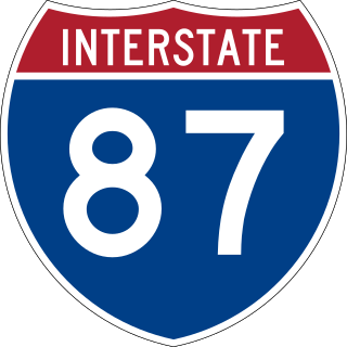
Interstate 87 (I-87) is a partially completed Interstate Highway in the US state of North Carolina, the shortest designated primary Interstate Highway at 12.9 miles (20.8 km). The completed portion is in eastern Wake County, between Raleigh and Wendell; the majority of the completed route is known as the Knightdale Bypass, while the remaining three miles (4.8 km) follows the Raleigh Beltline (I-440). It is planned to continue northeast through Rocky Mount, Williamston, and Elizabeth City, ending in Norfolk, Virginia. It is signed as north–south, in keeping with the sign convention for most odd-numbered interstates, but the route goes primarily east–west, with the eastern direction aligning to the north designation. The entire route is concurrent with US Highway 64 (US 64), with portions also concurrent with I-440 and US 264.

The Monroe Expressway, designated U.S. Route 74 Bypass, is a 18.68-mile (30.06 km) controlled-access toll road in Union County in the U.S. state of North Carolina, the first to be completed in the Charlotte area. It serves as a bypass of the communities of Indian Trail, Monroe, and Wingate for U.S. Route 74 (US 74), running generally parallel to the route.

<span class="mw-page-title-main">Interstate 885</span> Highway in North Carolina

Interstate 885 (I-885) and North Carolina Highway 885 (NC 885) is an 11.5-mile (18.5 km) auxiliary Interstate Highway and state highway in the U.S. state of North Carolina. It links NC 540 and I-40 to I-85 in the Durham area. The route consists of two previously preexisting segments of freeway—NC 147 to the south and US 70 to the north—connected by the East End Connector, which opened to traffic on June 30, 2022.

References

  1. 1 2 "House Bill 644 / S.L. 2002-133" (PDF). North Carolina General Assembly . Retrieved November 16, 2014.
  2. 1 2 "Article 6H: Public Toll Roads and Bridges" (PDF). North Carolina General Assembly. Retrieved November 16, 2014.
  3. "Senate Bill 622 / S.L. 2005-276" (PDF). North Carolina General Assembly. Retrieved November 16, 2014.
  4. Siceloff, Bruce (February 12, 2012). "Plan fights evasion of I-95 toll in North Carolina". The News & Observer. Raleigh, NC. Archived from the original on February 13, 2012. Retrieved November 16, 2014.
  5. "Senate Bill 1381 / S.L. 2006-228" (PDF). North Carolina General Assembly. Retrieved November 16, 2014.
  6. 1 2 3 "2012 Turnpike Annual Report" (PDF). North Carolina Turnpike Authority. 2012. Retrieved November 16, 2014.
  7. "Senate Bill 1697 / S.L. 2008-225" (PDF). North Carolina General Assembly. Retrieved November 16, 2014.
  8. "House Bill 1617 / S.L. 2009-343" (PDF). North Carolina General Assembly. Retrieved November 16, 2014.
  9. Baysden, Chris (June 3, 2010). "North Carolina Turnpike Authority merges into NC Department of Transportation". Triangle Business Journal. Retrieved November 16, 2014.
  10. Siceloff, Bruce (May 5, 2010). "Toll road won't stop you to pay". The News & Observer. Raleigh, NC. Retrieved May 21, 2010.
  11. "Senate Bill 895 / S.L. 2012-85" (PDF). North Carolina General Assembly. Retrieved November 16, 2014.
  12. 1 2 "House Bill 817 / S.L. 2013-183" (PDF). North Carolina General Assembly. Retrieved November 16, 2014.
  13. 1 2 "NCDOT: Turnpike Projects".
  14. "NCDOT: Monroe Bypass". North Carolina Department of Transportation. Retrieved November 17, 2014.
  15. Johnston, Melinda (August 19, 2014). "Land acquisition begins for Monroe Connector Bypass". The Charlotte Observer. Retrieved November 17, 2014.
  16. Elkins, Ken (November 27, 2018). "Photos: 30 years in the making, Monroe Expressway opens with sighs of relief, hopes for economic development". Charlotte Business Journal. Retrieved December 23, 2022.
  17. "I-77 Express Lanes". NC Quick Pass. North Carolina Turnpike Authority. Retrieved August 9, 2021.
  18. 1 2 "NCDOT: HOV Lanes". North Carolina Department of Transportation. Retrieved November 17, 2014.
  19. "SPOT ID: H128073" (PDF). North Carolina Department of Transportation. May 29, 2014. Retrieved November 16, 2014.
  20. 1 2 Harrison, Steve (November 16, 2014). "State plans early work on Independence Boulevard toll lanes". The Charlotte Observer . Archived from the original on November 27, 2014. Retrieved November 16, 2014.
  21. "NCDOT: I-485 Express Lanes". North Carolina Department of Transportation. Retrieved July 26, 2023.
  22. Wilson, Lexi (September 16, 2022). "Construction on I-485 sees delays". Charlotte, NC: WCNC-TV . Retrieved July 26, 2023.
  23. Burbeck, Tony (November 17, 2014). "Toll lanes on Independence Boulevard?". Charlotte, NC: WCNC-TV. Archived from the original on November 29, 2014. Retrieved November 17, 2014.
  24. Brierton, James (March 1, 2022). "Here's the plan for those empty lanes in the middle of Independence Blvd". Charlotte, NC: WCNC-TV. Retrieved July 26, 2023.
  25. 1 2 "NCDOT: Complete 540 Project". North Carolina Department of Transportation. Retrieved November 17, 2014.
  26. "NCDOT: Strategic Transportation Investments". North Carolina Department of Transportation. Retrieved November 17, 2014.
  27. "STIP Total Scores". North Carolina Department of Transportation. September 24, 2014. Retrieved November 17, 2014.
  28. "SPOT ID: H129646" (PDF). North Carolina Department of Transportation. May 29, 2014. Retrieved November 17, 2014.
  29. "SPOT ID: H111131" (PDF). North Carolina Department of Transportation. May 29, 2014. Retrieved November 17, 2014.
  30. "SPOT ID: H111013" (PDF). North Carolina Department of Transportation. May 29, 2014. Retrieved November 17, 2014.
  31. "SPOT ID: H140728" (PDF). North Carolina Department of Transportation. May 29, 2014. Retrieved November 17, 2014.
  32. "SPOT ID: H140359" (PDF). North Carolina Department of Transportation. May 29, 2014. Retrieved November 17, 2014.
  33. "SPOT ID: H140369" (PDF). North Carolina Department of Transportation. May 30, 2014. Retrieved November 17, 2014.
  34. "SPOT ID: H140273" (PDF). North Carolina Department of Transportation. May 30, 2014. Retrieved November 17, 2014.
  35. "SPOT ID: H128071" (PDF). North Carolina Department of Transportation. May 30, 2014. Retrieved November 17, 2014.
  36. "SPOT ID: H128072" (PDF). North Carolina Department of Transportation. May 30, 2014. Retrieved November 17, 2014.
  37. "SPOT ID: H111014" (PDF). North Carolina Department of Transportation. May 29, 2014. Retrieved November 17, 2014.
  38. "SPOT ID: H129515" (PDF). North Carolina Department of Transportation. September 22, 2014. Retrieved November 17, 2014.
  39. "NCDOT: Mid-Currituck Bridge". North Carolina Department of Transportation. Archived from the original on September 20, 2014. Retrieved November 17, 2014.
  40. "SPOT ID: H129617" (PDF). North Carolina Department of Transportation. May 29, 2014. Retrieved November 17, 2014.
  41. "SPOT ID: H129632" (PDF). North Carolina Department of Transportation. May 29, 2014. Retrieved November 17, 2014.
  42. "NCDOT: Garden Parkway". North Carolina Department of Transportation. Archived from the original on November 23, 2011. Retrieved November 17, 2014.
  43. Harrison, Steve (May 9, 2016). "In a postcard, DOT tells Gaston residents that the Garden Parkway is dead". Charlotte, NC: The Charlotte Observer. Retrieved May 9, 2016.
  44. "SPOT ID: H140560" (PDF). North Carolina Department of Transportation. May 30, 2014. Retrieved November 17, 2014.
  45. 1 2 "NC Quick Pass Transponders". North Carolina Turnpike Authority. Retrieved June 7, 2018.
  46. "Account Maintenance". North Carolina Turnpike Authority. Retrieved June 7, 2018.
  47. "NC Quick Pass: Frequently Asked Questions". North Carolina Turnpike Authority. Archived from the original on April 14, 2014. Retrieved November 16, 2014.
  48. "North Carolina's Quick Pass and Florida's SunPass Now Function As One" (Press release). North Carolina Department of Transportation. July 29, 2013. Archived from the original on August 5, 2013. Retrieved August 11, 2013.
  49. Huppertz, Karen (November 16, 2014). "Peach Pass now works on Florida and North Carolina toll roads". The Atlanta Journal-Constitution . Retrieved November 13, 2014.
  50. Baysden, Chris (October 14, 2008). "North Carolina Turnpike Authority unable to sell bonds for toll road". Triangle Business Journal.
  51. "Triangle Expressway System Senior Lien Revenue Bonds" (PDF). North Carolina Turnpike Authority.
  52. Siceloff, Bruce; Campbell, Colin (January 4, 2011). "Garner protest may kill one highway route". The News & Observer. Raleigh, NC. Retrieved January 4, 2011.
  53. Siceloff, Bruce (May 22, 2012). "New TriEx proposals may save Garner from Red Route". The News & Observer. Raleigh, NC. Retrieved May 22, 2012.
  54. Siceloff, Bruce (August 22, 2012). "Planners try restarting TriEx project in southern Wake". The News & Observer. Raleigh, NC. Retrieved August 22, 2012.
  55. Siceloff, Bruce (December 12, 2012). "Federal funding cut, state law challenged on NC 540 Red Route". The News & Observer. Raleigh, NC. Retrieved December 12, 2012.
  56. Barrett, Michael (June 21, 2012). "House and Senate pull funding for Garden Parkway". The Gaston Gazette . Gastonia, NC. Retrieved July 16, 2012.
  57. Harrison, Steve (July 12, 2012). "DOT withdraws Garden Parkway permit requests". The Charlotte Observer. Archived from the original on November 24, 2012. Retrieved July 16, 2012.
  58. Barrett, Michael (July 12, 2012). "Garden Parkway plan hits new snag". The Gaston Gazette. Gastonia, NC. Retrieved July 16, 2012.
  59. Harrison, Steve (April 24, 2014). "Garden Parkway ranks low in new NC highway rankings". The Charlotte Observer. Retrieved November 17, 2014.
  60. Robertson, Gary (June 7, 2013). "Skyway, other turnpike projects removed from NC House bill". Wilmington, NC: WWAY . Retrieved November 17, 2014.
  61. Robertson, Gary (July 16, 2012). "Pending North Carolina toll projects hit a roadblock". The Fayetteville Observer . Retrieved July 16, 2012.
  62. Marusak, Joe (October 29, 2014). "Cornelius-based group hires lawyers to fight I-77 toll lanes". The Charlotte Observer. Retrieved November 17, 2014.
  63. Siceloff, Bruce (November 17, 2014). "Road Worrier: NCDOT's urban loops depend on borrowed money". The News & Observer. Raleigh, NC. Retrieved November 18, 2014.