Nortonville, Kentucky

Last updated

Nortonville, Kentucky
Nortonville-Walnut-St-ky.jpg
Walnut Street in Nortonville
Hopkins County Kentucky Incorporated and Unincorporated areas Nortonville Highlighted 2156910.svg
Location of Nortonville in Hopkins County, Kentucky.
Coordinates: 37°11′16″N87°27′22″W / 37.18778°N 87.45611°W / 37.18778; -87.45611
Country United States
State Kentucky
County Hopkins
Incorporated1873 [1]
Area
[2]
  Total1.19 sq mi (3.09 km2)
  Land1.16 sq mi (3.00 km2)
  Water0.03 sq mi (0.09 km2)
Elevation
404 ft (123 m)
Population
 (2020)
  Total977
  Density842.97/sq mi (325.54/km2)
Time zone UTC-6 (Central (CST))
  Summer (DST) UTC-5 (CDT)
ZIP code
42442
Area code(s) 270 & 364
FIPS code 21-56910
GNIS feature ID0499617
Website www.nortonvilleky.us

Nortonville is a home rule-class city [3] in Hopkins County, Kentucky, in the United States. The population was 1,204 as of the 2010 census. [4]

Contents

History

Nortonville owes its existence to the railroad industry and is named for Eckstein Norton, a Kentucky-born investment banker who started as a clerk in a country store in Russellville, Kentucky, in 1846. Norton participated in the creation of the Elizabethtown and Paducah Railroad in the late 1860s (east-west tracks). He then purchased 2,000 acres (8.1 km2) of land in what would become "Norton Village", later changed to "Nortonville" around 1900. Norton became a shipping agent for the Illinois Central Railroad, which eventually acquired the Elizabethtown & Paducah Railroad. The north–south railroad, named the Evansville, Henderson and Nashville, was completed through Nortonville in 1872. It was purchased in a foreclosure sale in 1879 by the Louisville and Nashville Railroad. Norton became president of the L&N Railroad on October 6, 1886. [5] By 1886, Nortonville was one of only nine towns in the L&N system to have a steam hoist to unload and transfer freight. By then, the city was concentrated around a junction of the IC and L&N Railroads. Nortonville saw growth after 1902, when investors purchased land from the Norton heirs and opened a shaft coal mine as the Nortonville Coal Company. They also operated an electric power plant.

Nortonville implemented its first water system in 1936 and paved its streets in 1956. A centralized sewage treatment system was built in the late 1970s, opening an opportunity for continued growth. [6] The Nortonville City Hall occupies the well-maintained 1930s high school building, which was built by the WPA.

Geography

Nortonville is located in southeastern Hopkins County at 37°11′16″N87°27′22″W / 37.18778°N 87.45611°W / 37.18778; -87.45611 (37.187660, -87.456032). [7] U.S. Route 41 passes through the eastern and southern parts of the city, leading north 11 miles (18 km) to Madisonville, the county seat, and south 24 miles (39 km) to Hopkinsville. U.S. Route 62 passes through the northern part of Nortonville, leading east 18 miles (29 km) to Greenville and west 14 miles (23 km) to Dawson Springs.

The Western Kentucky Parkway and Pennyrile Parkway intersect 2 miles (3 km) northeast of Nortonville. Interstate 69 follows the Western Kentucky Parkway west from the interchange towards Eddyville and the Pennyrile Parkway north towards Henderson. Paducah is 72 miles (116 km) to the west, Evansville, Indiana, is 55 miles (89 km) to the north, Elizabethtown is 100 miles (160 km) to the east, and Clarksville, Tennessee, is 55 miles (89 km) south of the highway junction.

According to the United States Census Bureau, Nortonville has a total area of 1.1 square miles (2.9 km2), of which 0.012 square miles (0.03 km2), or 1.02%, are water. [4]

Demographics

Historical population
CensusPop.Note
1880 49
1910 254
1920 773204.3%
1930 8297.2%
1940 98919.3%
1950 909−8.1%
1960 755−16.9%
1970 699−7.4%
1980 1,33691.1%
1990 1,209−9.5%
2000 1,2644.5%
2010 1,204−4.7%
2020 977−18.9%
U.S. Decennial Census [8]

As of the census [9] of 2000, there were 1,264 people, 525 households, and 363 families residing in the city. The population density was 1,136.3 inhabitants per square mile (438.7/km2). There were 584 housing units at an average density of 525.0 units per square mile (202.7 units/km2). The racial makeup of the city was 96.44% White, 2.06% Black or African American, 0.55% Native American, 0.08% from other races, and 0.87% from two or more races. Hispanic or Latino of any race were 0.87% of the population.

There were 525 households, out of which 28.2% had children under the age of 18 living with them, 54.1% were married couples living together, 12.2% had a female householder with no husband present, and 30.7% were non-families. 28.4% of all households were made up of individuals, and 13.1% had someone living alone who was 65 years of age or older. The average household size was 2.41 and the average family size was 2.93.

In the city, the population was spread out, with 24.1% under the age of 18, 8.8% from 18 to 24, 29.0% from 25 to 44, 23.0% from 45 to 64, and 15.1% who were 65 years of age or older. The median age was 36 years. For every 100 females, there were 95.1 males. For every 100 females age 18 and over, there were 89.0 males.

The median income for a household in the city was $27,222, and the median income for a family was $31,466. Males had a median income of $27,986 versus $17,176 for females. The per capita income for the city was $13,179. About 17.9% of families and 20.3% of the population were below the poverty line, including 27.1% of those under age 18 and 13.1% of those age 65 or over.

Education

Local schools include Southside Elementary; South Hopkins Middle School and Hopkins County Central High School.

Related Research Articles

<span class="mw-page-title-main">Hopkins County, Kentucky</span> County in Kentucky, United States

Hopkins County is a county located in the western part of the U.S. state of Kentucky. As of the 2020 census, the population was 45,423. Its county seat is Madisonville. Hopkins County was created December 9, 1806, from Henderson County. It was named for General Samuel Hopkins, an officer in both the American Revolutionary War and War of 1812, and later a Kentucky legislator and U.S. Congressman.

<span class="mw-page-title-main">Nortonville, Kansas</span> City in Kansas, United States

Nortonville is a city in Jefferson County, Kansas, United States. As of the 2020 census, the population of the city was 601.

<span class="mw-page-title-main">Crofton, Kentucky</span> City in Kentucky, United States

Crofton is a home rule-class city in Christian County, Kentucky, in the United States. The population was 653 as of the 2020 census, down from 749 at the 2010 census.

<span class="mw-page-title-main">Hopkinsville, Kentucky</span> City in Kentucky, United States

Hopkinsville is a home rule-class city in and the county seat of Christian County, Kentucky, United States. The population at the 2020 census was 31,180.

<span class="mw-page-title-main">Caneyville, Kentucky</span> City in Kentucky, United States

Caneyville is a home rule-class city in Grayson County, Kentucky, in the United States. The population was 608 at the 2010 census. Named for its location on Caney Creek, Caneyville had a post office by 1837 and a town charter by 1840 and was incorporated by the state legislature in 1880.

<span class="mw-page-title-main">Sonora, Kentucky</span> City in Kentucky, United States

Sonora is a home rule-class city in Hardin County, Kentucky, United States. The population was 565 as of the 2020 Census, up from 513 from the 2010 census,. It is included in the Elizabethtown, Kentucky Metropolitan Statistical Area.

<span class="mw-page-title-main">Earlington, Kentucky</span> City in Kentucky, United States

Earlington is a home rule-class city in Hopkins County, Kentucky, in the United States. As of the 2010 census, the city had a population of 1,413, down from 1,649 at the 2000 census.

<span class="mw-page-title-main">Madisonville, Kentucky</span> City in Kentucky, United States

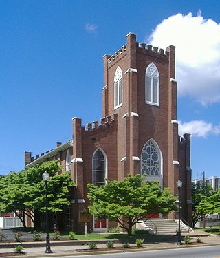
Madisonville is a home rule-class city in and the county seat of Hopkins County, Kentucky, United States, located along Interstate 69 in the state's Western Coal Fields region. The population was 19,591 at the 2010 census. Madisonville is a commercial center of the region and is home to Madisonville Community College.

<span class="mw-page-title-main">Mortons Gap, Kentucky</span> City in Kentucky, United States

Mortons Gap is a home rule-class city in Hopkins County, Kentucky, in the United States. The population was 728 at the 2020 census, down from 863 at the 2010 census.

<span class="mw-page-title-main">St. Charles, Kentucky</span> City in Kentucky, United States

St. Charles is a home rule-class city in Hopkins County, Kentucky, United States. The population was 277 at the 2010 U.S. Census.

<span class="mw-page-title-main">White Plains, Kentucky</span> City in Kentucky, United States

White Plains is a home rule-class city in Hopkins County, Kentucky, United States. The population was 884 at the 2010 census, up from 800 at the 2000 census.

<span class="mw-page-title-main">Hardin, Kentucky</span> City in Kentucky, United States

Hardin is a home rule-class city in Marshall County, Kentucky, United States. The population was 580 at the 2020 census.

Reidland is an unincorporated community and census-designated place (CDP) in McCracken County, Kentucky, United States. The population was 4,526 at the 2020 census. It is part of the Paducah, KY-IL Metropolitan Statistical Area.

<span class="mw-page-title-main">Central City, Kentucky</span> City in Kentucky, United States

Central City is a home rule-class city in Muhlenberg County, Kentucky, in the United States. The population was 5,819 at the 2020 census. It is the largest city in the county and the principal community in the Central City Micropolitan Statistical Area, which includes all of Muhlenberg County.

<span class="mw-page-title-main">Greenville, Kentucky</span> City in Kentucky, United States

Greenville is a home rule-class city in Muhlenberg County, Kentucky, in the United States. It is the seat of its county. The population was 4,492 as of the 2020 census.

<span class="mw-page-title-main">Paducah, Texas</span> Town in Cottle County, Texas, United States

Paducah is a town in Cottle County, Texas, United States. The population was 1,186 at the 2010 census, down from 1,498 in 2000. It is the county seat of Cottle County. It is just south of the Texas Panhandle and east of the Llano Estacado.

<span class="mw-page-title-main">Dawson Springs, Kentucky</span> City in Kentucky, United States

Dawson Springs is a home rule-class city in Hopkins and Caldwell counties in the U.S. state of Kentucky. As of the 2020 census, the population of the city was 2,452.

<span class="mw-page-title-main">Upton, Kentucky</span> City in Kentucky, United States

Upton is a home rule-class city in Hardin and LaRue counties in the U.S. state of Kentucky. The population was 704 as of the 2020 Census, up from 683 from the 2010 census. Its entire area is included in the Elizabethtown–Fort Knox Metropolitan Statistical Area.

<span class="mw-page-title-main">Western Kentucky Parkway</span> Highway in Kentucky

The Wendell H. Ford Western Kentucky Parkway is a 98.5-mile (158.5 km) freeway running from Elizabethtown, Kentucky to near Nortonville, Kentucky. It intersects with Interstate 65 (I-65) at its eastern terminus, and I-69 at its western terminus. It is one of seven highways that are part of the Kentucky parkway system. The road was renamed for Wendell H. Ford, a former Kentucky governor and United States senator, in 1998. Previously, it was simply the Western Kentucky Parkway, and often called the "WK Parkway" or "the WK" because of the acronym once used on its signs. The parkway carries the unsigned designation Kentucky Route 9001 for its entire length.

<span class="mw-page-title-main">Calvert City, Kentucky</span> City in Kentucky, United States

Calvert City is a home rule-class city in Marshall County, Kentucky, United States. The population was 2,514 at the 2020 census.

References

  1. Commonwealth of Kentucky. Office of the Secretary of State. Land Office. "Nortonville, Kentucky". Accessed 15 September 2013.
  2. "2020 U.S. Gazetteer Files". United States Census Bureau. Retrieved March 18, 2022.
  3. "Summary and Reference Guide to House Bill 331 City Classification Reform" (PDF). Kentucky League of Cities. Retrieved December 30, 2014.
  4. 1 2 "Geographic Identifiers: 2010 Demographic Profile Data (G001): Nortonville city, Kentucky". American Factfinder. U.S. Census Bureau. Retrieved July 6, 2017.[ dead link ]
  5. Klein, Maury (1972). History of the Louisville and Nashville Railroad . Macmillan.
  6. Hopkins County, Historical Society (1988). Heritage of Hopkins County. Paducah, KY: Turner Publishing.
  7. "US Gazetteer files: 2010, 2000, and 1990". United States Census Bureau. February 12, 2011. Retrieved April 23, 2011.
  8. "Census of Population and Housing". Census.gov. Retrieved June 4, 2015.
  9. "U.S. Census website". United States Census Bureau . Retrieved January 31, 2008.