Notch Mountain

Last updated

Notch Mountain
Notch Mountain.jpg
Northeast aspect
Highest point
Elevation 13,243 ft (4,036 m) [1]
Prominence 198 ft (60 m) [1]
Isolation 0.91 mi (1.46 km) [1]
Coordinates 39°28′39″N106°27′37″W / 39.4773805°N 106.4604033°W / 39.4773805; -106.4604033 [2]
Geography
USA Colorado relief location map.svg
Red triangle with thick white border.svg
Notch Mountain
Location in Colorado
Usa edcp relief location map.png
Red triangle with thick white border.svg
Notch Mountain
Notch Mountain (the United States)
CountryUnited States
State Colorado
County Eagle
Protected area Holy Cross Wilderness
Parent range Rocky Mountains
Sawatch Range [3]
Topo map USGS Mount of the Holy Cross
Climbing
Easiest route class 2 hiking [1]

Notch Mountain is a 13,243-foot-elevation (4,036-meter) summit in Eagle County, Colorado, United States. [2]

Contents

Description

Notch Mountain is set in the Sawatch Range and is located in the Holy Cross Wilderness, on land managed by White River National Forest. [1] Precipitation runoff from the mountain's east slope drains into Fall Creek and the west slope drains to Cross Creek which are both tributaries of the Eagle River. Topographic relief is significant as the summit rises over 1,800 feet (549 m) above Lake Patricia in one-half mile (0.8 km) and over 3,500 feet (1,067 m) above Cross Creek in 1.7 mile (2.7 km). The Notch Mountain Trail covers 5.3 miles (8.5 km) and gains 2,930 feet of elevation as it leads to the iconic viewpoint of Mount of the Holy Cross. [4]

History

Mount of the Holy Cross in 1873 seen from Notch Mountain, by William Henry Jackson Mountain of the Holy Cross, Colorado - NARA - 517691.jpg
Mount of the Holy Cross in 1873 seen from Notch Mountain, by William Henry Jackson

Word of the enormous white cross of snow on Mount of the Holy Cross was first published in 1869 and the historic first photograph of the mountain was taken by William Henry Jackson from Notch Mountain on August 24, 1873, with the assistance of a survey party who carried the heavy photographic equipment. [4] [5] In 1874, Thomas Moran sketched Mount of the Holy Cross from the top of Notch Mountain, then later created an oil painting from the sketch. [6] This led to the mountain becoming well-known, and from the late 1920s to the late 1930s people were making frequent pilgrimages to Notch Mountain to see the famous snowy cross on the northeast face of the neighboring mountain. A stone shelter was built on Notch Mountain in 1924 to protect these hundreds of visitors during storms. The shelter is on the National Register of Historic Places in Eagle County, Colorado. The mountain's toponym has been officially adopted by the United States Board on Geographic Names. [2]

Climate

According to the Köppen climate classification system, Notch Mountain is located in an alpine subarctic climate zone with cold, snowy winters, and cool to warm summers. [7] Due to its altitude, it receives precipitation all year, as snow in winter and as thunderstorms in summer, with a dry period in late spring. Climbers can expect afternoon rain, hail, and lightning from the seasonal monsoon in late July and August.

See also

Related Research Articles

<span class="mw-page-title-main">Mount Emma</span> Mountain in the state of Colorado

Mount Emma is a 13,581-foot-elevation (4,139-meter) mountain summit located in San Miguel County of Colorado, United States. It is situated three miles north of the community of Telluride, on the south side of Yankee Boy Basin, in the Uncompahgre National Forest. It is part of the Sneffels Range which is a subset of the San Juan Mountains, which in turn is part of the Rocky Mountains. Mount Emma is situated west of the Continental Divide, two miles south of Mount Sneffels, and 0.8 mile south of Gilpin Peak, the nearest higher neighbor. Emma ranks as the 197th-highest peak in Colorado, and the 10th-highest in the Sneffels Range. Topographic relief is significant as the south aspect rises 4,830 feet above Telluride in approximately three miles. An ascent of Mt. Emma is a difficult climb with 2,180 feet of elevation gain covering three miles from Yankee Boy Basin, or 4,836 feet of elevation gain from Telluride. This mountain's name was officially adopted by the U.S. Board on Geographic Names.

<span class="mw-page-title-main">Clyde Peak</span> Mountain in the state of Montana

Clyde Peak is an 8,610-foot-elevation (2,620-meter) mountain summit located in Glacier National Park in the U.S. state of Montana. The mountain straddles the border shared by Flathead County and Glacier County. It is situated on the Continental Divide so precipitation runoff from the west side of the mountain drains into Thompson Creek which is part of the Middle Fork Flathead River watershed, and the east side drains into headwaters of Red Eagle Creek, which flows to Red Eagle Lake, thence Saint Mary Lake. It is set in the Lewis Range, and the nearest higher neighbor is Mount Logan 1.44 mile to the northwest. Topographic relief is significant as the southwest aspect rises approximately 4,000 feet in one mile.

<span class="mw-page-title-main">Top Notch Peak</span>

Top Notch Peak is a 10,245-foot-elevation (3,123 meter) mountain summit located in Yellowstone National Park, in Park County, Wyoming, United States.

<span class="mw-page-title-main">Ostler Peak</span>

Ostler Peak is a 12,718-foot elevation (3,876 m) mountain summit located in Summit County, Utah, United States.

<span class="mw-page-title-main">Explorer Peak</span> Mountain in Utah, United States

Explorer Peak is a 12,708-foot elevation (3,873 m) mountain summit located in Duchesne County, Utah, United States.

<span class="mw-page-title-main">Dead Horse Peak</span> Mountain in the American state of Utah

Dead Horse Peak is a 12,642-foot elevation (3,853 m) mountain summit located on the common border that Duchesne County shares with Summit County in the U.S. state of Utah.

<span class="mw-page-title-main">Mount Beulah</span> Mountain in the American state of Utah

Mount Beulah is a 12,557-foot elevation (3,827 m) mountain summit located in Summit County, Utah, United States.

<span class="mw-page-title-main">Wasatch Peak</span> Mountain in the American state of Utah

Wasatch Peak is a 13,156-foot elevation (4,010 m) mountain summit located in Summit County, Utah, United States.

<span class="mw-page-title-main">Mount Grant (Montana)</span> Mountain in the American state of Montana

Mount Grant is an 8,590-foot-elevation (2,618 meter) mountain summit located in Flathead County in the U.S. state of Montana.

<span class="mw-page-title-main">Saint Mary Peak</span> Mountain in the state of Montana

Saint Mary Peak is a 9,351-foot elevation (2,850 m) mountain summit located in Ravalli County, Montana.

<span class="mw-page-title-main">Eagles Nest (Colorado)</span>

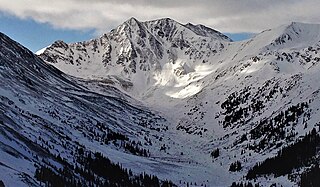
Eagles Nest is a 13,419-foot (4,090 m) mountain summit in Summit County, Colorado, United States.

<span class="mw-page-title-main">Mount Jasper</span> Mountain in the state of Colorado

Mount Jasper is a 12,923-foot (3,939 m) mountain summit on the boundary shared by Boulder County and Grand County, in Colorado, United States.

<span class="mw-page-title-main">The Spider (Colorado)</span>

The Spider is a 12,695-foot (3,869 m) mountain summit in Eagle County, Colorado, United States.

<span class="mw-page-title-main">Turner Peak</span> Mountain in the state of Colorado

Turner Peak is a 13,233-foot-elevation (4,033-meter) mountain summit in Chaffee County, Colorado, United States.

<span class="mw-page-title-main">Jones Mountain (Chaffee County, Colorado)</span> Mountain in the state of Colorado

Jones Mountain is a 13,218-foot-elevation (4,029-meter) mountain summit in Chaffee County, Colorado, United States.

<span class="mw-page-title-main">Emma Burr Mountain</span> Mountain in the state of Colorado

Emma Burr Mountain is a 13,544-foot-elevation (4,128-meter) mountain summit on the common border shared by Chaffee and Gunnison counties in Colorado, United States.

<span class="mw-page-title-main">Grizzly Peak (Gunnison County, Colorado)</span> Mountain in the state of Colorado

Grizzly Peak is a 13,309-foot-elevation (4,057-meter) mountain summit in Gunnison County, Colorado, United States.

<span class="mw-page-title-main">Cross Mountain (Colorado)</span> Mountain in the state of Colorado

Cross Mountain is a 12,703-foot-elevation (3,872-meter) summit on the border shared by Dolores and San Miguel County, in Colorado, United States.

<span class="mw-page-title-main">Twin Peaks (Ouray County, Colorado)</span> Mountain in Ouray County, Colorado

Twin Peaks is a 10,970-foot-elevation (3,340-meter) double summit mountain located in Ouray County, Colorado, United States.

<span class="mw-page-title-main">Grizzly Peak (Dolores/San Juan Counties, Colorado)</span> Mountain in the state of Colorado

Grizzly Peak is a 13,738-foot-elevation (4,187-meter) mountain summit on the boundary shared by Dolores County and San Juan County, in Colorado, United States.

References

  1. 1 2 3 4 5 "Notch Mountain - 13,243' CO". listsofjohn.com. Retrieved June 5, 2023.
  2. 1 2 3 "Notch Mountain". Geographic Names Information System . United States Geological Survey, United States Department of the Interior . Retrieved June 5, 2023.
  3. "Notch Mountain, Colorado". Peakbagger.com. Retrieved June 5, 2023.
  4. 1 2 Outdoor Books and Maps (1998), Best of Western Colorado Hiking Trails, ISBN   0-930657-17-9, p. 32.
  5. Dean Knudsen, A Legendary Mountain, National Park Service
  6. Thurman Wilkins (1998), Thomas Moran: Artist of the Mountains, University of Oklahoma Press, p. 140.
  7. Peel, M. C.; Finlayson, B. L.; McMahon, T. A. (2007). "Updated world map of the Köppen−Geiger climate classification". Hydrol. Earth Syst. Sci. 11 (5): 1633. Bibcode:2007HESS...11.1633P. doi:10.5194/hess-11-1633-2007. ISSN   1027-5606. S2CID   9654551.