Related Research Articles

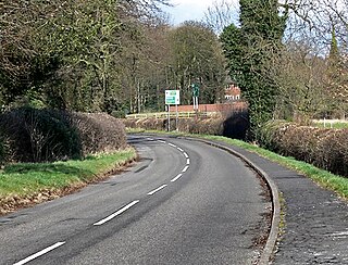
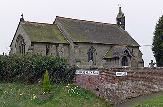
Donisthorpe is a village in the North West Leicestershire district of Leicestershire, England, historically an exclave of Derbyshire.

North West Leicestershire is a local government district in Leicestershire, England. The population of the Local Authority at the 2011 census was 93,348. Its main towns are Ashby-de-la-Zouch, Castle Donington, Coalville and Ibstock.

Willesley is a village and former civil parish, now in the parish of Ashby-de-la-Zouch, in the North West Leicestershire district, in the county of Leicestershire, England. It was originally in Derbyshire. Willesley Hall was the home of the Abney and later the Abney-Hastings family. In 1931 the parish had a population of 80.
Acresford is a hamlet in North West Leicestershire, it shares civil parish authorities with Donisthorpe and Oakthorpe and forms part of the border with South Derbyshire. Located in the settlement is an abandoned quarry.
Clawson, Hose and Harby is a civil parish in Leicestershire, England, forming part of the Melton district. It contains the villages of Harby, Hose and Long Clawson and the parish was created from those former parishes on the 1st of April 1936. The population of the civil parish at the 2011 census was 2,577.
Thurcaston and Cropston is a civil parish in Leicestershire, England. As its name suggests, it consists of the villages of Thurcaston and Cropston. The parish had a population at the 2001 Census of 2,076, with around 1,200 in Cropston and 800 in Thurcaston. The population of the civil parish was 2,074 at the 2011 census. The villages are separated by the Rothley Brook.

Charley is a civil parish located in the North West Leicestershire district of Leicestershire, England. According to the 2001 census, it had a population of 203, increasing to 236 at the 2011 census. It is set within the Charnwood Forest.

Ashby Woulds is a civil parish in Leicestershire, England. The population at the 2011 census was 3,763. It is in the North West Leicestershire district, to the west of Ashby de la Zouch. The main settlements in the parish are Moira and Norris Hill.
Ellistown and Battleflat is a civil parish in North West Leicestershire, England, just south of the unparished area of Coalville. Most of the parish's population lives in the village of Ellistown in the western part of the parish. The population of the civil parish at the 2011 census was 2,626.

Burton Overy is a village and civil parish in the Harborough district of Leicestershire, about nine miles south-east of Leicester city centre, and not far from Great Glen. According to the 2001 census, the parish had a population of 289., increasing at the 2011 census to 440.
Ravenstone with Snibston is a civil parish in the North West Leicestershire district of Leicestershire, England. According to the 2001 census it had a population of 2,149, increasing to 2,212 at the 2011 census. The parish includes Ravenstone, part of Snibston and the hamlet of Sinope. The parish was created in 1884.

Swinford is a nucleated village and civil parish in the Harborough district of the English county of Leicestershire. The population of the civil parish at the 2011 census was 586. It used to be on the former A427, which led under the M1, to Catthorpe. The parish church is All Saints, a 12th-century Norman rebuilding of an earlier Saxon church with a 14th-century square bell tower and a Grade II* listed building. The local pub is The Chequers on the High Street, formerly known as Chequer Inn.

Oakthorpe is a village in north-west Leicestershire, England.

Overseal is a village and civil parish in South Derbyshire district of Derbyshire, England. It is 3 miles (4.8 km) south of Swadlincote, 5 miles (8.0 km) west of Ashby-de-la-Zouch and 13 miles (21 km) south-southwest of Derby. It had a population of the civil parish at the 2011 census was 2,450. Situated within the National Forest area, it is near the villages of Netherseal and Lullington as well as being close to the border with Leicestershire. It is one of the southernmost settlements in Derbyshire.

Swannington is a former mining village situated between Coalville and Ashby-de-la-Zouch, Leicestershire, England. A document of 1520 mentions five pits at Swannington. It was a terminus of the early (1832) Leicester and Swannington Railway that was built to carry away chcvdidvdvdopened in 1825 to serve the townships of Swannington and Thringstone and is built on a spot reputedly chosen by William Wordsworth, a frequent guest of Sir George Beaumont of nearby Coleorton Hall. It is possible that the dedication of the church to Saint George is derived from its association with this George Beaumont.

Smisby is an ancient manor, civil parish and small village in South Derbyshire, England. It is 4 miles (6.4 km) from Melbourne and near the Leicestershire border and the town of Ashby-de-la-Zouch. The village including the outlying farms and houses has a population just over 200 that occupies some 110 properties. The population at the 2011 Census had increased to 260.

Coleorton is a village and civil parish in North West Leicestershire, England. It is situated on the A512 road approximately 2 miles (3.2 km) east of Ashby de la Zouch. Nearby villages include Newbold, to the north, Thringstone to the east, and Swannington to the south-east.
Chilcote is a village and civil parish in the North West Leicestershire district of Leicestershire, England. Until 1897 it was in Derbyshire. The parish had a population of 108 according to the 2001 census, including Stretton-en-le-Field and increasing to 200 at the 2011 census.

Lockington-Hemington is a civil parish in the North West Leicestershire district of Leicestershire, England. The parish includes the villages of Hemington and Lockington. According to the 2001 census it had a population of 556, rising to 838 at the 2011 census.

Isley cum Langley is a civil parish in the North West Leicestershire district of Leicestershire, England. According to the 2001 census it had a population of 64. At the 2011 census the population of the civil parish remained less than 100 and is included in the civil parish of Breedon on the Hill.
References
- ↑ Parish Council website
- ↑ "Civil Parish population 2011". Neighbourhood Statistics. Office for National Statistics. Retrieved 11 June 2016.
Coordinates: 52°43′05″N1°31′41″W / 52.718°N 1.528°W
| | This Leicestershire location article is a stub. You can help Wikipedia by expanding it. |