Octavia Boulevard

Last updated
Octavia Boulevard
San Francisco-Octavia Boulevard.jpg
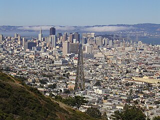
Looking south along Octavia Boulevard from Fell Street, where the Central Freeway once dominated the landscape.
NamesakeOctavia Gough
Location San Francisco, California
South endUS 101 (1961 cutout).svg US 101 (Central Freeway) in Hayes Valley
North endFell Street in Hayes Valley
Looking south along Octavia Street from Jackson Street. This is one of the few blocks in San Francisco still paved in brick. OctaviaStreetBetweenJacksonStreetAndWashingtonStreetBuiltInBricks.jpg
Looking south along Octavia Street from Jackson Street. This is one of the few blocks in San Francisco still paved in brick.

Octavia Boulevard (designated as Octavia Street north of Hayes Street) is a major street in San Francisco, California, that replaced the Hayes Valley portion of the damaged two-level Central Freeway. [1] Once a portion of Octavia Street alongside shadowy, fenced-off land beneath the elevated U.S. Route 101 roadway, Octavia Boulevard was redeveloped and redesigned upon the recommendation of a "Central Freeway" planning committee representing a broad array of neighborhoods, including the surrounding Hayes Valley and Western Addition, the Richmond District, Pacific Heights and the Sunset District with representatives appointed by Mayor Willie Brown and the Board of Supervisors and led by the Planning Department of San Francisco. Elements of the San Francisco General Plan were consulted for issues such as urban design, transportation mobility and congestion management, community safety and historic preservation, along with the evaluation of the impacts following the recent removal (1991) of the elevated Embarcadero Freeway and the revitalization of the Embarcadero as a surface boulevard complemented by an extension of the Muni Metro light-rail transit subway.

Contents

The committee was charged to come up with alternatives to rebuilding the damaged double-decked freeway in a six-month public planning process. During this time, the planning services of Allan Jacobs, the former Planning Director and Chair of the UC Berkeley College of Environmental Design and his business partner and UC Berkeley Landscape Architecture professor Elizabeth MacDonald, whose academic studies of landscaped, multi-lane surface roadways were being compiled for publication as "The Boulevard Book" (2002), were engaged. This lead to a proposal for rebuilding Octavia Boulevard without the freeway structure, which was concurrently reviewed and ultimately deemed "acceptable" in traffic carrying capacity as an alternative to a freeway ramp by Caltrans, which informed the endorsements of the civic design think-tank SPUR, both the Planning and the Parking and Traffic Commissions, and Mayor Willie Brown in his "State of the City" address in October 1997. Opponents to the demolition of the freeway structure north of Market Street, mostly based in the Richmond and Sunset Districts in the western half of San Francisco, responded by circulating petitions to place a ballot initiative (Proposition H) before voters calling to rebuild the freeway rather than to demolish it.

The ballot measure, which did not include references to the progress and design of the replacement surface boulevard, was passed by the voters in November 1997. Members of the Central Freeway planning committee, led by community activists Robin Levitt and Patricia Walkup, regrouped immediately to draft another ballot initiative (Proposition E) calling for the surface boulevard as the preferred alternative to rebuilding the elevated structure north of Market, supported by the urban design benefits of the boulevard and its acceptability per Caltrans' standards in carrying traffic. Proposition E was approved by the San Francisco voters in November 1998, setting the stage for a first and final side-by-side ballot showdown before the voters in November 1999: the pro-boulevard Proposition I against the pro-freeway initiative Proposition J. Proposition I won (54% to 46%) and Proposition J (47% to 53%) failed, and demolition of the elevated portions of the freeway north of Market was completed in 2003.

Octavia Boulevard is four blocks long from Market to Fell Street, containing multiple lanes that separate local and through traffic. On Octavia, homes and businesses located immediately on the street are served by the quieter outer roadways, while lanes leading to and from the rebuilt Central Freeway spur connect faster traffic with the inner roadways. Having replaced a freeway, the boulevard distributes traffic smoothly and evenly throughout the immediate neighborhood, while maintaining the links to the major San Francisco traffic arterials that the old elevated freeway used to connect to directly, including Fell and Oak Streets (which serve the city's western neighborhoods) and Franklin and Gough Streets (which serve northern neighborhoods and the Golden Gate Bridge). A brand new park named "Patricia's Green" (named in honor of Patricia Walkup, who died in 2006) was created as part of the boulevard project. It lies on Octavia between Fell and Hayes Street.

North of Hayes Street, Octavia continues as Octavia Street through the Western Addition, Pacific Heights and Marina neighborhoods to Bay Street, at Fort Mason.

Other freeway removal projects in the San Francisco Bay, due to seismic stability (or collapse), include the replacement of San Francisco's Embarcadero Freeway, and the reuse of the collapsed Cypress Structure's right-of-way in neighboring Oakland.

Origin of name

The name refers to Octavia Gough, sister of Charles H. Gough. A contractor who carried out the planking and paving of many San Francisco streets, Charles served on the commission to design the layout of streets in the Western Addition, according to an obituary published in the San Francisco Call on July 27, 1895.

Parallel to Octavia and immediately east of it is Gough Street.

Octavia is 8 blocks east of Divisadero, which at the time of its naming was the nearest major north–south thoroughfare. "Octavia" is a name which means, "the eighth".

There is an octagon-shaped building (named The Octagon House at 2645 Gough Street, on the northwest corner of Gough and Green streets. As of 2013, it operates as a historic museum, housing colonial-era folk art and documents.

Today, the Academy of Art University owns and operates a building on the street for housing purposes. [2]

Related Research Articles

<span class="mw-page-title-main">Interstate 880 (California)</span> Interstate highway in California

Interstate 880 (I-880) is a north–south auxiliary Interstate Highway in the San Francisco Bay Area of Northern California. It runs from I-280 and State Route 17 (SR 17) in San Jose to I-80 and I-580 in Oakland, running parallel to the eastern shore of San Francisco Bay. For most of its route, I-880 is officially known as the Nimitz Freeway, after World War II fleet admiral Chester W. Nimitz, who retired to the Bay Area. The northernmost five miles (8.0 km) is also commonly referred to as the Cypress Freeway, after the former alignment of the freeway and its subsequent replacement.

<span class="mw-page-title-main">Interstate 980</span> Interstate highway in California

Interstate 980 (I-980) is a short 2.03-mile (3.27 km) auxiliary Interstate Highway entirely within Oakland in Northern California, connecting I-580 and State Route 24 (SR 24) to I-880 near Downtown Oakland. I-980 passes the Oakland Convention Center and near the famous Jack London Square. I-980 is commonly considered the dividing line between Downtown Oakland and West Oakland. The freeway was planned as the eastern approach to the Southern Crossing. It is officially known as the John B. Williams Freeway, after the former director of the city of Oakland's Office of Community Development.

<span class="mw-page-title-main">Interstate 280 (California)</span> Interstate highway in California

Interstate 280 (I-280) is a 57.22-mile-long (92.09 km) major north–south auxiliary Interstate Highway in the San Francisco Bay Area of Northern California. It runs from I-680 and US Route 101 (US 101) in San Jose to King and 5th streets in San Francisco, running just to the west of the larger cities of San Francisco Peninsula for most of its route.

<span class="mw-page-title-main">Interstate 710 and State Route 710 (California)</span> Interstate and state highway in California

Route 710, consisting of the non-contiguous segments of State Route 710 (SR 710) and Interstate 710 (I-710), is a major north–south state highway and auxiliary Interstate Highway in the Los Angeles metropolitan area of the U.S. state of California. Also called the Los Angeles River Freeway prior to November 18, 1954, the highway was initially planned to connect Long Beach and Pasadena, but a gap in the route exists from Alhambra to Pasadena through South Pasadena due to community opposition to its construction.

<span class="mw-page-title-main">Interstate 105 (California)</span> Auxiliary Interstate Highway in Los Angeles County, California, United States

Interstate 105 (I-105) is an east–west auxiliary Interstate Highway in the Greater Los Angeles urban area of Southern California. It runs from State Route 1 (SR 1) near El Segundo and Los Angeles International Airport (LAX) to I-605 in the City of Norwalk. It is commonly known as the Century Freeway after Century Boulevard which it parallels, and also officially known as the Glenn Anderson Freeway after the late congressman Glenn M. Anderson who advocated for its construction.

<span class="mw-page-title-main">California State Route 60</span> State highway in California

State Route 60 (SR 60) is an east–west state highway in the U.S. state of California. It serves the cities and communities on the eastern side of the Los Angeles metropolitan area and runs along the south side of the San Gabriel Valley. It functions as a bypass route of Interstate 10 (I-10) through the area between the East Los Angeles Interchange in Los Angeles and Beaumont. SR 60 provides a route across several spurs of the Peninsular Ranges, linking the Los Angeles Basin with the Pomona Valley and San Gabriel Valley. The highway also runs concurrently with SR 57 and I-215. Portions of SR 60 are designated as either the Pomona Freeway or the Moreno Valley Freeway.

<span class="mw-page-title-main">California State Route 87</span> Highway in San Jose, California

State Route 87, known as the Guadalupe Freeway or referred to by the locals as Highway 87, is a north–south state highway in San Jose, California, United States. Before being upgraded to a freeway, it was Guadalupe Parkway.

<span class="mw-page-title-main">Embarcadero (San Francisco)</span> Waterfront and roadway along San Francisco Bay

The Embarcadero is the eastern waterfront of Port of San Francisco and a major roadway in San Francisco, California. It was constructed on reclaimed land along a three mile long engineered seawall, from which piers extend into the bay. It derives its name from the Spanish verb embarcar, meaning "to embark"; embarcadero itself means "the place to embark." The Central Embarcadero Piers Historic District was added to the National Register of Historic Places on November 20, 2002.

<span class="mw-page-title-main">Central Freeway</span> Elevated freeway in San Francisco, California, United States

The Central Freeway is a roughly one-mile (1.5 km) elevated freeway in San Francisco, California, United States, connecting the Bayshore/James Lick Freeway with the Hayes Valley neighborhood. Most of the freeway is part of US 101, which exits at Mission Street on the way to the Golden Gate Bridge. The freeway once extended north to Turk Street, and initially formed part of a loop around downtown, but was damaged along with the Embarcadero in the 1989 Loma Prieta earthquake; both highways have since been replaced with the surface-level Octavia Boulevard and Embarcadero, respectively.

<span class="mw-page-title-main">Hayes Valley, San Francisco</span> Neighborhood in San Francisco, California, United States

Hayes Valley is a neighborhood in the Western Addition district of San Francisco, California. It is located between the historical districts of Alamo Square and the Civic Center. Victorian, Queen Anne, and Edwardian townhouses are mixed with high-end boutiques, restaurants, and public housing complexes. The neighborhood gets its name from Hayes Street, which was named for Thomas Hayes, San Francisco's county clerk from 1853 to 1856 who also started the first Market Street Railway franchise.

<span class="mw-page-title-main">California State Route 480</span> Former highway in California

State Route 480 was a state highway in San Francisco, California, United States, consisting of the elevated double-decker Embarcadero Freeway, the partly elevated Doyle Drive approach to the Golden Gate Bridge and the proposed and unbuilt section in between. The unbuilt section from Doyle Drive to Van Ness Avenue was to have been called the Golden Gate Freeway and the Embarcadero Freeway as originally planned would have extended from Van Ness along the north side of Bay Street and then along the Embarcadero to the San Francisco-Oakland Bay Bridge.

<span class="mw-page-title-main">Geary Boulevard</span> Thoroughfare in San Francisco, United States

Geary Boulevard is a major east–west 5.8-mile-long (9 km) thoroughfare in San Francisco, California, United States, beginning downtown at Market Street near Market Street's intersection with Kearny Street, and running westbound through downtown, the Civic Center area, the Western Addition, and running for most of its length through the predominantly residential Richmond District. Geary Boulevard terminates near Sutro Heights Park at 48th Avenue, close to the Cliff House above Ocean Beach at the Pacific Ocean. At 42nd Avenue, Geary intersects with Point Lobos Avenue, which takes through traffic to the Cliff House, Ocean Beach and the Great Highway. It is a major commercial artery through the Richmond District; it is lined with stores and restaurants, many of them catering to the various immigrant groups who live in the area. The boulevard borders Japantown between Fillmore and Laguna Streets.

<span class="mw-page-title-main">Santa Monica Boulevard</span> East-west thoroughfare in Los Angeles, California, United States

Santa Monica Boulevard is a major west–east thoroughfare in Los Angeles County, California, United States. It runs from Ocean Avenue in Santa Monica near the Pacific Ocean to Sunset Boulevard at Sunset Junction in Los Angeles. It passes through Beverly Hills and West Hollywood. A portion of it is designated as California State Route 2, while the full avenue was Historic Route 66.

<span class="mw-page-title-main">U.S. Route 101 in California</span> U.S. Highway in California

U.S. Route 101 (US 101) is a major north–south United States Numbered Highway, stretching from Los Angeles, California, to Tumwater, Washington. The California portion of US 101 is one of the last remaining and longest U.S. Routes still active in the state, and the longest highway of any kind in California. US 101 was also one of the original national routes established in 1926. Significant portions of US 101 between the Los Angeles area and the San Francisco Bay Area follow El Camino Real, the commemorative route connecting the former Alta California's 21 missions.

<span class="mw-page-title-main">Interstate 80 in California</span> Section of Interstate Highway in California, United States

Interstate 80 (I-80) is a transcontinental Interstate Highway in the United States, stretching from San Francisco, California, to Teaneck, New Jersey. The segment of I-80 in California runs east from San Francisco across the San Francisco–Oakland Bay Bridge to Oakland, where it turns north and crosses the Carquinez Bridge before turning back northeast through the Sacramento Valley. I-80 then traverses the Sierra Nevada, cresting at Donner Summit, before crossing into the state of Nevada within the Truckee River Canyon. The speed limit is at most 65 mph (105 km/h) along the entire route instead of the state's maximum of 70 mph (110 km/h) as most of the route is in either urban areas or mountainous terrain. I-80 has portions designated as the Eastshore Freeway and Alan S. Hart Freeway.

<span class="mw-page-title-main">Market Street (San Francisco)</span> Thoroughfare in San Francisco, United States

Market Street is a major thoroughfare in San Francisco, California. It begins at The Embarcadero in front of the Ferry Building at the northeastern edge of the city and runs southwest through downtown, passing the Civic Center and the Castro District, to the intersection with Portola Drive in the Twin Peaks neighborhood. Beyond this point, the roadway continues into the southwestern quadrant of San Francisco. Portola Drive extends south to the intersection of St. Francis Boulevard and Sloat Boulevard, where it continues as Junipero Serra Boulevard.

<span class="mw-page-title-main">Freeway removal</span> Replacement of motorways with pedestrian-friendly and urbanist land uses

Freeway removal is a public policy of urban planning to demolish freeways and create mixed-use urban areas, parks, residential, commercial, or other land uses. Such highway removal is often part of a policy to promote smart growth, transit-oriented development, walkable and bicycle-friendly cities. In some cases freeways are re-imagined as boulevards, rebuilt as below-grade freeways underneath caps-and-stitches, or relocated through less densely-developed areas.

Highway revolts have occurred in cities and regions across the United States. In many cities, there remain unused highways, abruptly terminating freeway alignments, and short stretches of freeway in the middle of nowhere, all of which are evidence of larger projects which were never completed. In some instances, freeway revolts have led to the eventual removal or relocation of freeways that had been built.

References

  1. "Octavia Boulevard". CNU. 2017-07-27. Retrieved 2021-02-24.
  2. "Academy of Art University Campus Map" (PDF). academyart.edu. Academy of Art University . Retrieved 18 April 2017.
Template:Attached KML/Octavia Boulevard
KML is not from Wikidata