Old Baldy (Montana)

Last updated
Old Baldy
Variant name: Twin Peak [1]
Old Baldy, Our Lake.jpg
Aerial view of southeast aspect, upper right.
(Our Lake in lower left)
Highest point
Elevation 9,156 ft (2,791 m) [2]
Prominence 1,356 ft (413 m) [2]
Parent peak Rocky Mountain (9,392 ft) [3]
Isolation 3.03 mi (4.88 km) [3]
Coordinates 47°51′14″N112°49′23″W / 47.85386903°N 112.82292091°W / 47.85386903; -112.82292091 [1]
Geography
USA Montana relief location map.jpg
Red triangle with thick white border.svg
Old Baldy
Location in Montana
Usa edcp relief location map.png
Red triangle with thick white border.svg
Old Baldy
Location in the United States
Location Teton County, Montana, U.S.
Parent range Rocky Mountains
Rocky Mountain Front
Sawtooth Range
Topo map USGS Our Lake
Geology
Age of rock Mississippian
Type of rock dolomite, limestone

Old Baldy is a 9,156-foot (2,791-metre) double summit mountain located in Teton County of the U.S. state of Montana. [1]

Contents

Description

The west summit is slightly higher than the 9,150-foot east summit, and approximately 1,000 feet distance separates the two. [2] Old Baldy is located along the Rocky Mountain Front, which is a subset of the Rocky Mountains. It is situated 11 miles east of the Continental Divide, in the Bob Marshall Wilderness, on land managed by Lewis and Clark National Forest. The nearest town is Choteau, 29 miles to the east, and nearest access is the South Fork Teton Road 109. Precipitation runoff from the east side of the mountain drains into headwaters of South Fork Teton River, and the west side drains into tributaries of the North Fork Sun River. Topographic relief is significant as the east aspect rises 3,350 feet (1,020 meters) above South Fork Teton River in two miles. The Old Baldy name was officially adopted by the United States Board on Geographic Names on December 31, 1959. [1]

Geology

Old Baldy is composed of sedimentary rock laid down during the Precambrian to Jurassic periods. Formed in shallow seas, this sedimentary rock was pushed east and over the top of younger rock during the Laramide orogeny. [4] The Lewis Overthrust extends over 280 miles (450 km) from Mount Kidd in Alberta, south to Steamboat Mountain which is located 40 miles south of Old Baldy, which places Old Baldy within the southern extent of the Lewis Overthrust. [5]

Climate

Based on the Köppen climate classification, Old Baldy is located in a subarctic climate zone characterized by long, usually very cold winters, and mild to warm summers. [6] Winter temperatures can drop below −10 °F with wind chill factors below −30 °F.

Rocky Mountain (Montana) is a nearby peak to the south of Old Baldy. There is no weather station, but this climate table contains interpolated data.

Climate data for Rocky Mountain (MT) 47.8077 N, 112.8018 W, Elevation: 8,533 ft (2,601 m) (1991–2020 normals)
MonthJanFebMarAprMayJunJulAugSepOctNovDecYear
Average high °F (°C)23.8
(−4.6)
24.3
(−4.3)
30.1
(−1.1)
35.4
(1.9)
44.4
(6.9)
52.5
(11.4)
63.4
(17.4)
63.1
(17.3)
53.5
(11.9)
39.3
(4.1)
28.3
(−2.1)
22.5
(−5.3)
40.1
(4.5)
Daily mean °F (°C)17.2
(−8.2)
16.5
(−8.6)
21.1
(−6.1)
26.2
(−3.2)
34.7
(1.5)
42.2
(5.7)
51.9
(11.1)
51.7
(10.9)
43.2
(6.2)
31.3
(−0.4)
21.9
(−5.6)
16.2
(−8.8)
31.2
(−0.5)
Average low °F (°C)10.6
(−11.9)
8.7
(−12.9)
12.2
(−11.0)
16.9
(−8.4)
25.0
(−3.9)
32.0
(0.0)
40.4
(4.7)
40.2
(4.6)
32.8
(0.4)
23.3
(−4.8)
15.4
(−9.2)
9.9
(−12.3)
22.3
(−5.4)
Average precipitation inches (mm)5.39
(137)
4.90
(124)
4.84
(123)
4.47
(114)
4.39
(112)
4.81
(122)
1.82
(46)
1.78
(45)
2.53
(64)
3.82
(97)
4.97
(126)
5.54
(141)
49.26
(1,251)
Source: PRISM Climate Group [7]

See also

Related Research Articles

<span class="mw-page-title-main">Mount Cleveland (Montana)</span> Mountain in Montana, United States

Mount Cleveland is the highest mountain in Glacier National Park, located in Montana, United States. It is also the highest point in the Lewis Range, which spans part of the northern portion of the park and extends into Canada. It is located approximately 3 mi (4.8 km) southeast of the southern end of Waterton Lake, and approximately 5 mi (8.0 km) south of the US–Canada border. The east side of the future national park was purchased by the federal government from the Blackfoot Confederacy in 1895 during the second term of President Grover Cleveland. According to the United States Board on Geographic Names, the mountain is named for the former president.

<span class="mw-page-title-main">Mount Siyeh</span>


Mount Siyeh, with a height of 10,019 feet (3,054 m), is the fifth tallest and one of six peaks over 10,000 feet (3,048 m) in Glacier National Park, Montana, United States. Mount Siyeh was named after a Blackfeet Indian, Sai-yeh, whose name means "Crazy Dog" or "Mad Wolf."

<span class="mw-page-title-main">Mount Jackson (Montana)</span> Mountain in Montana, United States

Mount Jackson is located in the Lewis Range, Glacier National Park in the U.S. state of Montana. Mount Jackson is the fourth tallest mountain in Glacier National Park and it is situated on the Continental Divide. Both the mountain and its namesake Jackson Glacier are easily seen from the Going-to-the-Sun Road. Harrison Glacier, the park's largest remaining glacier, is located on the mountain's southern flank. Based on the Köppen climate classification, Mount Jackson has an alpine climate characterized by long, usually very cold winters, and short, cool to mild summers. Temperatures can drop below −10 °F with wind chill factors below −30 °F.

<span class="mw-page-title-main">Mount James Walker</span> Mountain in the country of Canada

Mount James Walker is a 3,035-metre (9,957-foot) mountain summit located in Kananaskis Country in the Canadian Rockies of Alberta, Canada. Mount James Walker is situated within Spray Valley Provincial Park, and its nearest higher peak is Mount Galatea, 5.0 km (3.1 mi) to the northwest.

<span class="mw-page-title-main">Red Mountain (Glacier County, Montana)</span> Mountain in the state of Montana

Red Mountain is located in the Lewis Range, Glacier National Park in the U.S. state of Montana. Red Mountain is 2.75 miles (4.43 km) north of Rising Wolf Mountain.

<span class="mw-page-title-main">El Capitan (Montana)</span> Mountain in the state of Montana

El Capitan is a mountain summit in the Bitterroot Range of Montana. The peak is located in the Selway-Bitterroot Wilderness on land managed by the Bitterroot National Forest. The summit lies 12 miles west of the town of Darby, Montana, and three miles east of the Idaho–Montana border. The highest point of the Central Bitterroot Range is line parent Trapper Peak, 9.3 miles south-southeast.

<span class="mw-page-title-main">Spot Mountain</span> Mountain summit in Montana, USA

Spot Mountain is a 7,831-foot-elevation (2,387-meter) mountain summit located in the Two Medicine area of Glacier National Park, in Glacier County, Montana, United States. It is situated in the Lewis Range, nine miles northwest of East Glacier Park Village, and approximately five miles east of the Continental Divide. Precipitation runoff from the mountain drains into tributaries of Cut Bank Creek and Two Medicine River, which merge to form the Marias River. Topographic relief is significant as the south aspect rises nearly 3,000 feet above Lower Two Medicine Lake in two miles. The mountain's name was officially adopted in 1929 by the United States Board on Geographic Names.

<span class="mw-page-title-main">Pentagon Mountain</span> Mountain in the American state of Montana

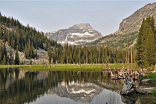
Pentagon Mountain is an 8,873-foot (2,704-metre) mountain summit located in Flathead County of the U.S. state of Montana.

<span class="mw-page-title-main">Gable Peaks</span> Mountain in the American state of Montana

Gable Peaks is a remote 7,700-foot (2,347-metre) double summit mountain located in Flathead County of the U.S. state of Montana.

<span class="mw-page-title-main">Union Mountain</span> Mountain in the American state of Montana

Union Mountain is a 7,601-foot (2,317-metre) summit located in Flathead County of the U.S. state of Montana.

<span class="mw-page-title-main">Capitol Mountain</span> Mountain in the American state of Montana

Capitol Mountain is a 7,868-foot (2,398-metre) summit located in Flathead County of the U.S. state of Montana.

<span class="mw-page-title-main">Argosy Mountain</span> Mountain in the American state of Montana

Argosy Mountain is an 8,155-foot (2,486-metre) summit located in Flathead County of the U.S. state of Montana.

<span class="mw-page-title-main">Ear Mountain (Montana)</span>

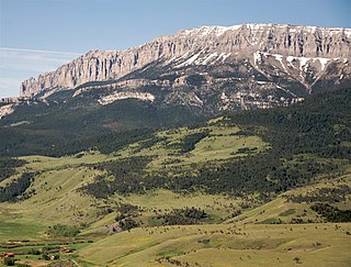
Ear Mountain is an 8,560-foot (2,610-metre) mountain summit located in Teton County of the U.S. state of Montana.

<span class="mw-page-title-main">Castle Reef</span> American mountain summit

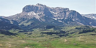
Castle Reef is an 8,330-foot (2,539-metre) mountain summit located in Teton County of the U.S. state of Montana.

<span class="mw-page-title-main">Old Man of the Hills</span> Mountain in the state of Montana

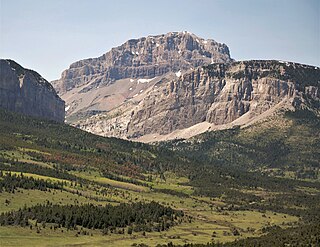
Old Man of the Hills is an 8,229-foot (2,508-metre) mountain summit located in Teton County of the U.S. state of Montana.

<span class="mw-page-title-main">Mount Frazier (Montana)</span> Mountain in the state of Montana

Mount Frazier is an 8,315-foot (2,534-metre) mountain summit located in Teton County of the U.S. state of Montana.

<span class="mw-page-title-main">Choteau Mountain</span> Mountain in Montana, US

Choteau Mountain is an 8,398-foot (2,560-metre) mountain summit located in Teton County, Montana.

<span class="mw-page-title-main">Sawtooth Ridge</span>

Sawtooth Ridge is an 8,179-foot (2,493-metre) mountain ridge located in Lewis and Clark County, Montana.

<span class="mw-page-title-main">Mount Beulah</span> Mountain in the American state of Utah

Mount Beulah is a 12,557-foot elevation (3,827 m) mountain summit located in Summit County, Utah, United States.

<span class="mw-page-title-main">Sentinel Mountain (Montana)</span> Mountain in the American state of Montana

Sentinel Mountain is an 8,245-foot-elevation (2,513 meter) summit in Glacier County, Montana, United States.

References

  1. 1 2 3 4 "Old Baldy". Geographic Names Information System . United States Geological Survey, United States Department of the Interior . Retrieved 2021-11-07.
  2. 1 2 3 "Old Baldy, Montana". Peakbagger.com. Retrieved 2021-11-07.
  3. 1 2 "Old Baldy - 9,156' MT". listsofjohn.com. Retrieved 2021-11-07.
  4. Gadd, Ben (2008). "Geology of the Rocky Mountains and Columbias".{{cite journal}}: Cite journal requires |journal= (help)
  5. Feinstein, Shimon; Kohn, Barry; Osadetz, Kirk; Price, Raymond A. (2007-01-01). "Thermochronometric reconstruction of the prethrust paleogeothermal gradient and initial thickness of the Lewis thrust sheet, southeastern Canadian Cordillera foreland belt". Geological Society of America Special Papers. 433: 167–182. doi:10.1130/2007.2433(08). ISBN   978-0-8137-2433-1. ISSN   0072-1077.
  6. Peel, M. C.; Finlayson, B. L.; McMahon, T. A. (2007). "Updated world map of the Köppen−Geiger climate classification". Hydrol. Earth Syst. Sci. 11 (5): 1633–1644. Bibcode:2007HESS...11.1633P. doi: 10.5194/hess-11-1633-2007 . ISSN   1027-5606. S2CID   9654551.
  7. "PRISM Climate Group, Oregon State University". PRISM Climate Group, Oregon State University. Retrieved October 4, 2023. To find the table data on the PRISM website, start by clicking Coordinates (under Location); copy Latitude and Longitude figures from top of table; click Zoom to location; click Precipitation, Minimum temp, Mean temp, Maximum temp; click 30-year normals, 1991-2020; click 800m; click Retrieve Time Series button.