
Bottineau County is a county in the U.S. state of North Dakota. As of the 2010 census, the population was 6,579. Its county seat is Bottineau.

Bottineau is a city in Bottineau County, North Dakota, United States. It is the county seat of Bottineau County and is located just over ten miles (16 km) south of the Canada–United States border. The city's population was 2,211 at the 2010 census.

This is a list of sites in Minnesota which are included in the National Register of Historic Places. There are more than 1,700 properties and historic districts listed on the NRHP; each of Minnesota's 87 counties has at least 2 listings. Twenty-two sites are also National Historic Landmarks.

There are 460 properties and historic districts listed on the National Register of Historic Places in North Dakota. There are listings in 52 of North Dakota's 53 counties.

Turtle Mountain, or the Turtle Mountains, is an area in central North America, in the north-central portion of the U.S. state of North Dakota and southwestern portion of the Canadian province of Manitoba, approximately 100 km south of the city of Brandon on provincial highway 10. It is a plateau 2,000 ft above sea level, 300 ft to 400 ft above the surrounding countryside, extending 20 mi (32 km) from north to south and 40 mi (64 km) from east to west. Rising 1,031 feet, North Dakota's most prominent peak, Boundary Butte, is located at the western edge of the plateau.

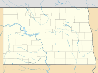
Mystical Horizons is an astronomical-themed site located near Carbury, North Dakota on North Dakota Highway 43 near the North Dakota and Manitoba border. The attraction contains a working solar calendar built from granite pillars, intended to represent a 21st-century Stonehenge, and other instruments intended to explain astronomical phenomena and principles.

Old Main, constructed in 1907–1908, is a historic building at Dakota College at Bottineau, a two-year college in Bottineau, North Dakota. The building previously housed the North Dakota School of Forestry. The building is listed in the National Register of Historic Places.

The O. E. Rølvaag House was the home of Ole Edvart Rølvaag (1876–1931), Norwegian-American novelist and professor at St. Olaf College. The home is located at 311 Manitou Street in Northfield, Minnesota, United States. Rølvaag wrote most of his works in this house, which is near St. Olaf College, where he taught.

The Frederick A. and Sophia Bagg Bonanza Farm, also known as Bagg Bonanza Farm or F. A. Bagg Farm, is a former bonanza farm in Richland County, North Dakota, United States. Operated between about 1915 and 1935, the farm of the Baggs encompasses as many as 7,000 acres (2,800 ha), and was operated virtually like a factory according to modern business practices of the period. The surviving farm complex is now owned by a local non-profit organization and operates as a museum. It is one of the best-preserved examples of a bonanza farm complex in the nation, and was declared a National Historic Landmark in 2005. It is located approximately 1 mile (1.6 km) south of Mooreton.

This is a list of the National Register of Historic Places listings in Dakota County, Minnesota. It is intended to be a complete list of the properties and districts on the National Register of Historic Places in Dakota County, Minnesota, United States. Dakota County is located in the southeastern part of the U.S. state of Minnesota, bounded on the northeast side by the Upper Mississippi River and on the northwest by the Minnesota River. The locations of National Register properties and districts for which the latitude and longitude coordinates are included below, may be seen in an online map.
The Rural Municipality of Morton is a former rural municipality (RM) in the Canadian province of Manitoba. It was originally incorporated as a rural municipality on November 1, 1890. It ceased on January 1, 2015 as a result of its provincially mandated amalgamation with the Town of Boissevain to form the Municipality of Boissevain – Morton.

This is a list of the National Register of Historic Places listings in Grand Forks County, North Dakota. This is intended to be a complete list of the properties and districts on the National Register of Historic Places in Grand Forks County, North Dakota, United States. The locations of National Register properties and districts for which the latitude and longitude coordinates are included below, may be seen in an online map.

This is a list of the National Register of Historic Places listings in Lincoln County, South Dakota.

This is a list of the National Register of Historic Places listings in Spink County, South Dakota.

Theodore B. Wells (1889-1976) was an American architect. He was born in North Dakota. He studied at L'ecole des Beaux Arts. Back in North Dakota, he designed many public and commercial buildings.

Joseph A. Shannon (1859-1934), known in at least one source as John A. Shannon, was an architect in Devils Lake, North Dakota.

The Vang Evangelical Lutheran Church is a historic church located in Wells County, North Dakota.
The Wells County Fairgrounds in Fessenden, North Dakota was listed on the National Register of Historic Places in 1991. The listing included 18 contributing buildings and one other contributing object on 35 acres (14 ha).

Gran Evangelical Lutheran Church is a historic church in Popple Township, Clearwater County, Minnesota. Gran Church in Clearwater County is situated near the junction of Clearwater County Road 45 and 20 outside Bagley, Minnesota.

Waterloo Ridge Lutheran Church is located northwest of the unincorporated community of Dorchester, Iowa, United States. It and the churchyard form a nationally recognized historic district that was listed on the National Register of Historic Places in 2015. At the time of its nomination, it consisted of three resources, which included one contributing building, one contributing site, and one contributing structure.

