Orlando, Oklahoma

Last updated

Orlando, Oklahoma
OKMap-doton-Orlando.PNG
Location of Orlando, Oklahoma
Coordinates: 36°8′54″N97°22′39″W / 36.14833°N 97.37750°W / 36.14833; -97.37750
Country United States
State Oklahoma
Counties Logan, Payne
Area
[1]
  Total0.39 sq mi (1.01 km2)
  Land0.39 sq mi (1.01 km2)
  Water0.00 sq mi (0.00 km2)
Elevation
[2]
1,089 ft (332 m)
Population
 (2020)
  Total130
  Density331.63/sq mi (128.12/km2)
Time zone UTC-6 (Central (CST))
  Summer (DST) UTC-5 (CDT)
ZIP code
73073
Area code 580
FIPS code 40-56050 [3]
GNIS feature ID2413091 [2]

Orlando is a town in Logan and Payne counties in the U.S. state of Oklahoma. The population was 148 at the 2010 census, compared to the figure of 201 in 2000. [4] It is part of the Oklahoma City Metropolitan Statistical Area.

Contents

History

Before the opening of the Cherokee Outlet for settlement, this community was called Cherokee, but the name was changed to Orlando, when a post office was opened on July 18, 1889. [4]

Early Orlando had a colorful history. In 1892, Oliver Yantis, a member of the Doolin Gang, was wounded and captured outside of the town. He was brought into Orlando, where he died. In 1896, a group of con artists bought some homesteads near the town, salted them with gold nuggets and started a gold rush. Several townspeople lost a great deal of money before the plot was exposed. In 1902, a woman who had bought adulterated kerosene for the lamps in her house. The impure material exploded when she lit the lamps, starting a fire that killed her, two children and spread to several nearby houses. [4]

A 1927 tornado killed two people and destroyed several houses. Construction of Lake Carl Blackwell in the 1930s forced about 100 families that had regularly traded in Orlando to move away. [4]

Passenger train service through Orlando ceased after World War II ended, and construction of I-35 caused the town to lose most of its commercial highway traffic after 1964. [4]

Geography

Orlando is 21 miles (34 km) north of Guthrie, the county seat, 1 mile (1.6 km) west of the Payne County line, and 1 mile (1.6 km) south of the Noble County line. [4]

According to the United States Census Bureau, the town has a total area of 0.2 square miles (0.52 km2), all land.

Demographics

Historical population
CensusPop.Note
1900 300
1910 34013.3%
1920 161−52.6%
1930 22640.4%
1940 33246.9%
1950 262−21.1%
1960 194−26.0%
1970 2024.1%
1980 2187.9%
1990 198−9.2%
2000 2011.5%
2010 148−26.4%
2020 130−12.2%
U.S. Decennial Census [5]

At the 2000 census there were 201 people, 74 households, and 52 families in the town. The population density was 942.5 inhabitants per square mile (363.9/km2). There were 88 housing units at an average density of 412.6 per square mile (159.3/km2). The racial makeup of the town was 86.07% White, 9.95% Native American, 1.00% Asian, and 2.99% from two or more races. [3] Of the 74 households 33.8% had children under the age of 18 living with them, 51.4% were married couples living together, 10.8% had a female householder with no husband present, and 29.7% were non-families. 25.7% of households were one person and 12.2% were one person aged 65 or older. The average household size was 2.72 and the average family size was 3.29.

The age distribution was 29.9% under the age of 18, 11.9% from 18 to 24, 24.4% from 25 to 44, 22.4% from 45 to 64, and 11.4% 65 or older. The median age was 32 years. For every 100 females, there were 105.1 males. For every 100 females age 18 and over, there were 98.6 males.

The median household income was $28,929 and the median family income was $35,625. Males had a median income of $30,000 versus $27,500 for females. The per capita income for the town was $12,826. About 18.0% of families and 17.8% of the population were below the poverty line, including 15.4% of those under the age of eighteen and 14.3% of those sixty five or over.

Related Research Articles

<span class="mw-page-title-main">Payne County, Oklahoma</span> County in Oklahoma, United States

Payne County is located in the U.S. state of Oklahoma. As of the 2020 census, its population was 81,646. Its county seat is Stillwater. The county was created in 1890 as part of Oklahoma Territory and is named for Capt. David L. Payne, a leader of the "Boomers".

<span class="mw-page-title-main">Pawnee County, Oklahoma</span> County in Oklahoma, United States

Pawnee County is a county located in the U.S. state of Oklahoma. As of the 2020 census, the population was 15,553. Its county seat is Pawnee. The county is named after the Pawnee Nation, whose reservation used to encompass the county prior to allotment in 1893.

<span class="mw-page-title-main">Noble County, Oklahoma</span> County in Oklahoma, United States

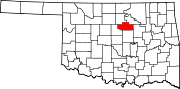
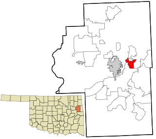
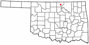
Noble County is located in the north central part of Oklahoma. As of the 2020 census, the population was 10,924. Its county seat is Perry. It was part of the Cherokee Outlet in Indian Territory until Oklahoma Territory was created in 1890, and the present county land was designated as County P. After the U. S. government opened the area to non-Indian settlement in 1893, it was renamed Noble County for John Willock Noble, then the United States Secretary of the Interior.

<span class="mw-page-title-main">Gaylesville, Alabama</span> Town in Alabama, United States

Gaylesville is a town in Cherokee County, Alabama, United States. The population was 144 at the 2010 census.

<span class="mw-page-title-main">Greasy, Oklahoma</span> Census-designated place in Oklahoma, United States

Greasy is a census-designated place (CDP) in Adair County, Oklahoma, United States. The population was 372 at the 2010 census.

<span class="mw-page-title-main">Briggs, Oklahoma</span> Census-designated place in Oklahoma, United States

Briggs is an unincorporated community and census-designated place (CDP) in Cherokee County, Oklahoma, United States. The population was 303 at the 2010 census.

<span class="mw-page-title-main">Dry Creek, Oklahoma</span> Census-designated place in Oklahoma, United States

Dry Creek is an unincorporated community and census-designated place (CDP) in Cherokee County, Oklahoma, United States. The population was 227 at the 2010 census.

<span class="mw-page-title-main">Hulbert, Oklahoma</span> Town in Oklahoma, United States

Hulbert is a town in Cherokee County, Oklahoma, United States, named after Ben H. Hulbert, a prominent Cherokee man. The population was 483 at the 2020 census, previously it was 590 in 2010. Our Lady of the Annunciation of Clear Creek Monastery is a Benedictine monastery located in Hulbert. The Clear Creek Monastery, recently elevated to the status of an abbey, is a foundation abbey of France's Notre Dame de Fontgombault, which is itself a foundation abbey of Saint Pierre de Solesmes, also in France.

<span class="mw-page-title-main">Shady Grove, Cherokee County, Oklahoma</span> Census-designated place in Oklahoma, United States

Shady Grove is an unincorporated community and census-designated place (CDP) in Cherokee County, Oklahoma, United States. The population was 556 at the 2010 census. This is not to be confused with the similarly-named Shady Grove in McIntosh County, or the Shady Grove in Pawnee County.

<span class="mw-page-title-main">Tenkiller, Oklahoma</span> Census-designated place in Oklahoma, United States

Tenkiller is an unincorporated community and census-designated place (CDP) in Cherokee County, Oklahoma, United States. The population was 633 at the 2010 census.

<span class="mw-page-title-main">Welling, Oklahoma</span> Census-designated place in Oklahoma, United States

Welling is an unincorporated community and census-designated place (CDP) in Cherokee County, Oklahoma, United States. The population was 771 at the 2010 census, an increase of 15.25 percent over the figure of 669 recorded in 2000. It is home to The Salvation Army's Heart o' Hills camp and conference center.

<span class="mw-page-title-main">Woodall, Oklahoma</span> Census-designated place in Oklahoma, United States

Woodall is an unincorporated community and census-designated place (CDP) in Cherokee County, Oklahoma, United States. The population was 823 at the 2010 census.

Rocky Ford is a census-designated place (CDP) in Delaware and Cherokee counties, Oklahoma, United States. The population was 61 at the 2010 census.

<span class="mw-page-title-main">Kremlin, Oklahoma</span> Town in Oklahoma, United States

Kremlin is a town in Garfield County, Oklahoma, United States. The population was 255 at the 2010 census, a 6.25 percent increase from the figure of 240 in 2000.

<span class="mw-page-title-main">Kildare, Oklahoma</span> Town in Oklahoma, United States

Kildare is a town in Kay County, Oklahoma, United States. The population was 100 at the 2010 census, an 8.7 percent increase from the figure of 92 in 2000.

<span class="mw-page-title-main">Porum, Oklahoma</span> Town in Oklahoma, United States

Porum is a town in Muskogee County, Oklahoma, United States. It was named for John Porum Davis, a rancher, Civil War veteran, and Cherokee Nation councilman from the Canadian District in Indian Territory. The community was first known as Porum Gap, which united with another village named Starvilla in 1905. The product of this union became the present town of Porum. The population was 727 at the 2010 census, an increase of 0.3 percent from the figure of 725 recorded in 2000.

<span class="mw-page-title-main">Talala, Oklahoma</span> Town in Oklahoma, United States

Talala is a town in Rogers County, Oklahoma, United States. The population was 273 at the 2010 census.

<span class="mw-page-title-main">Moffett, Oklahoma</span> Town in Oklahoma, United States

Moffett is a town in Sequoyah County, Oklahoma, United States. It is part of the Fort Smith, Arkansas-Oklahoma Metropolitan Statistical Area. The population was 128 at the 2010 census, a decline of 28.5 percent from the figure of 179 recorded in 2000.

<span class="mw-page-title-main">Roland, Oklahoma</span> Town in Oklahoma, United States

Roland is a town in Sequoyah County, Oklahoma, United States. It is part of the Fort Smith, Arkansas-Oklahoma Metropolitan Statistical Area. The population was 3,169 at the 2010 census, compared to the figure of 2,842 recorded in 2000.

<span class="mw-page-title-main">Sparrowhawk, Oklahoma</span> Census-designated place in Oklahoma, United States

Sparrowhawk is an unincorporated community and census-designated place (CDP) in Cherokee County, Oklahoma, United States. The population was 191 as of the 2010 census, at which time the CDP was known as Scraper. The older name of the community was given for Captain Archibald Scraper of the 2nd Regiment, Indian Home Guard. Sparrowhawk takes its name from Sparrow Hawk Mountain, which occupies most of the CDP.

References

  1. "ArcGIS REST Services Directory". United States Census Bureau. Retrieved September 20, 2022.
  2. 1 2 U.S. Geological Survey Geographic Names Information System: Orlando, Oklahoma
  3. 1 2 "U.S. Census website". United States Census Bureau . Retrieved January 31, 2008.
  4. 1 2 3 4 5 6 Thomas L. Hedglen, "Orlando," Encyclopedia of Oklahoma History and Culture. Accessed May 28, 2015.
  5. "Census of Population and Housing". Census.gov. Retrieved June 4, 2015.