Orleans, Nebraska

Last updated

Orleans, Nebraska
Orleans, Nebraska - Orleans Ave 3.JPG
Downtown Orleans: corner of Orleans Ave. and Maple St.
Harlan County Nebraska Incorporated and Unincorporated areas Orleans Highlighted.svg
Location of Orleans, Nebraska
USA Nebraska relief location map.svg
Red pog.svg
Orleans
Location within Nebraska
Usa edcp relief location map.png
Red pog.svg
Orleans
Location within the United States
Coordinates: 40°07′54″N99°27′18″W / 40.13167°N 99.45500°W / 40.13167; -99.45500
Country United States
State Nebraska
County Harlan
Township Orleans
Area
[1]
  Total0.60 sq mi (1.55 km2)
  Land0.60 sq mi (1.55 km2)
  Water0.00 sq mi (0.00 km2)
Elevation
[2]
2,024 ft (617 m)
Population
 (2020)
  Total341
  Density568.33/sq mi (219.49/km2)
Time zone UTC-6 (Central (CST))
  Summer (DST) UTC-5 (CDT)
ZIP code
68966
Area code 308
FIPS code 31-37420 [3]
GNIS feature ID2399587 [2]

Orleans is a village in Harlan County, Nebraska, United States. The population was 386 at the 2010 census.

Contents

History

Orleans was founded in the 1870s. [4] It was likely named after Orleans, Massachusetts. [5]

Geography

According to the United States Census Bureau, the village has a total area of 0.60 square miles (1.55 km2), all land. [6]

Demographics

Historical population
CensusPop.Note
1880 409
1890 81298.5%
1900 656−19.2%
1910 94243.6%
1920 9541.3%
1930 9853.2%
1940 815−17.3%
1950 95617.3%
1960 608−36.4%
1970 592−2.6%
1980 527−11.0%
1990 490−7.0%
2000 425−13.3%
2010 386−9.2%
2020 341−11.7%
U.S. Decennial Census [7]

2010 census

As of the census [8] of 2010, there were 386 people, 190 households, and 108 families living in the village. The population density was 643.3 inhabitants per square mile (248.4/km2). There were 258 housing units at an average density of 430.0 per square mile (166.0/km2). The racial makeup of the village was 98.7% White, 0.5% Asian, and 0.8% from other races. Hispanic or Latino of any race were 1.6% of the population.

There were 190 households, of which 17.9% had children under the age of 18 living with them, 47.9% were married couples living together, 5.3% had a female householder with no husband present, 3.7% had a male householder with no wife present, and 43.2% were non-families. 36.8% of all households were made up of individuals, and 17.4% had someone living alone who was 65 years of age or older. The average household size was 2.03 and the average family size was 2.63.

The median age in the village was 50 years. 15.8% of residents were under the age of 18; 6.7% were between the ages of 18 and 24; 19.7% were from 25 to 44; 29.7% were from 45 to 64; and 28.2% were 65 years of age or older. The gender makeup of the village was 51.0% male and 49.0% female.

2000 census

As of the census [3] of 2000, there were 425 people, 203 households, and 119 families living in the village. The population density was 701.9 inhabitants per square mile (271.0/km2). There were 240 housing units at an average density of 396.4 per square mile (153.1/km2). The racial makeup of the village was 98.82% White, 0.24% Native American, 0.24% Asian, and 0.71% from two or more races. Hispanic or Latino of any race were 1.18% of the population.

There were 203 households, out of which 20.7% had children under the age of 18 living with them, 51.7% were married couples living together, 5.9% had a female householder with no husband present, and 40.9% were non-families. 36.0% of all households were made up of individuals, and 18.2% had someone living alone who was 65 years of age or older. The average household size was 2.09 and the average family size was 2.68.

In the village, the population was spread out, with 18.6% under the age of 18, 5.6% from 18 to 24, 20.5% from 25 to 44, 28.2% from 45 to 64, and 27.1% who were 65 years of age or older. The median age was 49 years. For every 100 females, there were 88.9 males. For every 100 females age 18 and over, there were 88.0 males.

As of 2000 the median income for a household in the village was $25,179, and the median income for a family was $28,056. Males had a median income of $25,208 versus $16,875 for females. The per capita income for the village was $13,015. About 16.9% of families and 16.8% of the population were below the poverty line, including 29.8% of those under age 18 and 8.9% of those age 65 or over.

Notable people

Related Research Articles

<span class="mw-page-title-main">Dunning, Nebraska</span> Village in Blaine County, Nebraska, United States

Dunning is the most populous village in Blaine County, Nebraska, United States. The population was 80 at the 2020 census.

<span class="mw-page-title-main">Garrison, Nebraska</span> Village in Nebraska, United States

Garrison is a village in Butler County, Nebraska, United States. The population was 54 at the 2010 census.

<span class="mw-page-title-main">Farnam, Nebraska</span> Village in Nebraska, United States

Farnam is a village in Dawson County, Nebraska, United States. It is part of the Lexington, Nebraska Micropolitan Statistical Area. The population was 171 at the 2010 census.

<span class="mw-page-title-main">Dixon, Nebraska</span> Village in Dixon County, Nebraska, United States

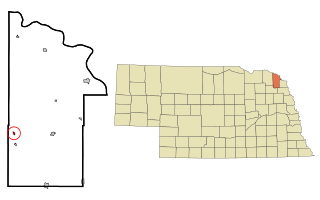
Dixon is a rural village in Dixon County, Nebraska, United States. The population was 87 at the 2010 census. There is a granary at Dixon, a post office, a community center, a small cafe, and a fire and rescue department.

<span class="mw-page-title-main">Snyder, Nebraska</span> Village in Nebraska, United States

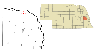
Snyder is a village in Dodge County, Nebraska, United States. The population was 300 at the 2010 census.

<span class="mw-page-title-main">Stamford, Nebraska</span> Village in Nebraska, United States

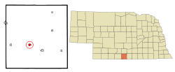
Stamford is a village in Harlan County, Nebraska, United States. The population was 183 at the 2010 census.

<span class="mw-page-title-main">Trenton, Nebraska</span> Village in Hitchcock County, Nebraska, United States

Trenton is a village in Hitchcock County, Nebraska, United States. The population was 516 at the 2020 census. It is the county seat of Hitchcock County.

<span class="mw-page-title-main">Sutherland, Nebraska</span> Village in Nebraska, United States

Sutherland is a village in Lincoln County, Nebraska, United States. It is part of the North Platte, Nebraska Micropolitan Statistical Area. The population was 1,286 at the 2010 census.

<span class="mw-page-title-main">Unadilla, Nebraska</span> Village in Nebraska, United States

Unadilla is a village in Otoe County, Nebraska, United States. The population was 296 at the 2020 census.

<span class="mw-page-title-main">Du Bois, Nebraska</span> Village in Nebraska, United States

Du Bois( doo-BOYZ) is a village in the southeast corner of Pawnee County, Nebraska, United States. The population was 124 at the 2020 census.

<span class="mw-page-title-main">Bertrand, Nebraska</span> Village in Nebraska, United States

Bertrand is a village in Phelps County, Nebraska, United States. The population was 750 at the 2010 census.

<span class="mw-page-title-main">Creston, Nebraska</span> Village in Platte County, Nebraska, United States

Creston is a village in Platte County, Nebraska, United States. The population was 203 at the 2010 census.

<span class="mw-page-title-main">Platte Center, Nebraska</span> Village in Platte County, Nebraska, United States

Platte Center is a village in Platte County, Nebraska, United States. The population was 336 at the 2010 census.

<span class="mw-page-title-main">Dorchester, Nebraska</span> Village in Nebraska, United States

Dorchester is a village in Saline County, Nebraska, United States. It is thirty-eight miles southwest from the Lincoln, Nebraska metropolitan area. The population was 596 at the 2020 census.

<span class="mw-page-title-main">Cedar Bluffs, Nebraska</span> Village in Saunders County, Nebraska, United States

Cedar Bluffs is a village in Saunders County, Nebraska, United States. The population was 615 at the 2020 census. Cedar Bluffs was a point on the Mormon, Oregon, and California Trails.

<span class="mw-page-title-main">Ceresco, Nebraska</span> Village in Saunders County, Nebraska, United States

Ceresco is a farming village in Saunders County, Nebraska, United States. The population was 919 at the 2020 census. It is located near U.S. Highway 77, just north of Lincoln, just south of Wahoo, and a short distance southwest of Omaha.

<span class="mw-page-title-main">Staplehurst, Nebraska</span> Village in Seward County, Nebraska, United States

Staplehurst is a village in Seward County, Nebraska, United States. It is part of the Lincoln, Nebraska Metropolitan Statistical Area. The population was 242 at the 2010 census.

<span class="mw-page-title-main">Thedford, Nebraska</span> Village in and county seat of Thomas County Nebraska, United States

Thedford is a village and county seat of Thomas County, Nebraska, United States. The population was 208 at the 2020 census.

<span class="mw-page-title-main">Trumbull, Nebraska</span> Village in Clay and Adams counties in Nebraska, United States

Trumbull is a village in Clay and Adams counties in Nebraska, United States. The population was 198 at the 2020 census. It is part of the Hastings, Nebraska Micropolitan Statistical Area.

<span class="mw-page-title-main">Halsey, Nebraska</span> Village in Blaine and Thomas counties in Nebraska, United States

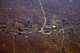
Halsey is a village in Blaine and Thomas counties in Nebraska, United States. The population was 76 at the 2010 census.

References

  1. "ArcGIS REST Services Directory". United States Census Bureau. Retrieved September 18, 2022.
  2. 1 2 U.S. Geological Survey Geographic Names Information System: Orleans, Nebraska
  3. 1 2 "U.S. Census website". United States Census Bureau . Retrieved January 31, 2008.
  4. "Orleans, Harlan County". Center for Advanced Land Management Information Technologies. University of Nebraska. Retrieved August 12, 2014.
  5. Fitzpatrick, Lillian L. (1960). Nebraska Place-Names. University of Nebraska Press. p. 72. ISBN   0-8032-5060-6. A 1925 edition is available for download at University of Nebraska—Lincoln Digital Commons.
  6. "US Gazetteer files 2010". United States Census Bureau. Archived from the original on January 12, 2012. Retrieved June 24, 2012.
  7. "Census of Population and Housing". Census.gov. Retrieved June 4, 2015.
  8. "U.S. Census website". United States Census Bureau . Retrieved June 24, 2012.