Osborn, Detroit

Last updated

Osborn is a community in northeast Detroit, Michigan. The Skillman Foundation selected Osborn to be one of the neighborhoods covered by the Good Neighborhoods Initiative. [1]

Contents

History

An April 2011 report from the office of Mayor of Detroit Dave Bing said that gangs, "especially transient gangs that are less organized — and often, randomly violent — terrorize some of our neighborhoods including … Osborn," [2]

In 2012, as part of the 100 Houses project, volunteers boarded up various vacant houses in Osborn. [3]

Cityscape

Osborn is bounded by 8 Mile Road, McNichols Road, Gratiot Avenue, and Van Dyke. [1]

In 2012 Jeff Siedel of the Detroit Free Press said "The neighborhood surrounding [ Osborn High School ] looks like a cracked, empty shell. Everywhere you look, there are broken windows, overgrown weeds, barbed wire fences and abandoned homes." [4]

Demographics

As of 2012, according to the Detroit Center for Family Advocacy the median family income was $32,421. Single parents are the heads of over 30% of Osborne families, while in the U.S. the national percentage is 9.1%. Of children born to parents living in Osborn, 22.4% were born to teenage parents. 35.7% of Osborn residents are children who live in poverty, while 13.9% of all Michigan residents are children in poverty. [1]

A 2010 report from Data Driven Detroit, City Connect Detroit, stated that Osborn had 27,166 residents. [5] The community was 91.3% black, 4.3% white, 2.1% Asian, 1.4% reporting more than one race, and .7% Hispanic and Latino; the Hmong people were most of the Asians in Osborn. The report said that the Hmong, which numbered at 560, "had established a tight-knit community in Osborn". [6]

According to the 2000 U.S. Census Osborn had 37,358 people, [5] with 84.1% being black, and 8.6% white. There were 1,700 Hmong people in Osborn. [6] Between the 2000 census and the 2010 U.S. Census the population experienced a 27.3% decline. The number of children and youth in Osborn decreased by 5,912, a 39.3% decline. [5] The number of African-Americans decreased by 21.1%, but proportionately became a higher percentage of the community. The numbers of White, multiethnic, and Asian/Hmong groups had the most severe declines. The white population declined by 64%. The Hmong population declined by 66%. Most Hmong moving from Osborn settled in Macomb County, mainly in Hmong communities in Warren and Center Line. [6] In addition, some Hmong moved to Sterling Heights. [7]

According to Matthew Lewis of Model D, the language differences and other factors made the black population perceive the Hmong as being "insular" and make false assumptions about the Hmong. [7]

Education

Osborn is within the Detroit Public Schools. The Pulaski, Brenda Scott, and Trix K-8 schools in Osborn and Law K-8 School outside Osborn serve Osborn for elementary and middle school. [8] [9] Most of Osborn is zoned to Osborn High School while a portion is zoned to Pershing High School. [10]

Elementary schools formerly serving Osborn within Osborne included Fleming, Genesis EL/MS, Richard, and Von Steuben. Schools outside of Osborn formerly serving it included Grant EL/MS. [11] Middle schools formerly serving Fleming included Genesis EL/MS and Farwell; Farwell was outside of Osborn. [12]

Fleming is now the Fleming Administration Building. The Early Childhood / Pre-Kindergarten Office is based out of the Fleming Administration Building. [13] Other than that, it now is only used for Head Start Program and Great Start Readiness Program classrooms, as well as the headquarters of the GSRP in DPS.[ citation needed ]

Parks and recreation

Parks in Osborn include Bessy Playfield, Wish Egan Playfield, Marruso Playground, Calimera Park and the Lipke Recreation Center. [14] Bessy Playfield is adjacent to Brenda Scott School. [15]

Calimera Park is the home of the Edible Hut Edible Hut. The Edible Hut is a community gathering space in Calimera Park on the eastside of Detroit with a living, edible roof and oculus to the sky. The Edible Hut combines elements of a traditional hut, an outdoor sculpture, a neighborhood garage and an edible garden. The roof is a garden of edible perennial plants such as sage, thyme, lavender and oregano. The inside of the space incorporates peaceful colors to create an enchanting space for gathering, rest and pleasure. [16]

Related Research Articles

Detroit Largest city in Michigan, United States

Detroit is the largest city in the U.S. state of Michigan. It is also the largest U.S. city on the United States–Canada border, and the seat of government of Wayne County. The city of Detroit had a population of 639,111 at the 2020 census, making it the 27th-most populous city in the United States. The metropolitan area, known as Metro Detroit, is home to 4.3 million people, making it the second-largest in the Midwest after the Chicago metropolitan area, and 14th-largest in the United States. Regarded as a major cultural center, Detroit is known for its contributions to music and as a repository for art, architecture and design, along with its historical automotive background.

Warrendale is a community in far western Detroit, Michigan. It is bordered by Greenfield East Road, Joy Road, and the Detroit city limits. Warrendale neighbors Dearborn on two sides and Dearborn Heights on another side.

Hmong Americans Americans of Hmong birth or descent

Hmong Americans are Americans of Hmong ancestry. Most Hmong Americans consist of those that fled to the United States as refugees in the late 1970s due to their cooperation with the United States' Central Intelligence Agency operatives in northern Laos during the Vietnam War, and their descendants. Over half of the Hmong population from Laos left the country, or attempted to leave, in 1975, at the culmination of the war. At the time, the Pathet Lao launched an aggressive campaign to capture or kill Hmong soldiers and families who aided the CIA. Thousands of Hmong were evacuated or escaped on their own to Hmong refugee camps in Thailand. About 90% of those who made it to refugee camps in Thailand were ultimately resettled in the United States. The rest, about 8 to 10%, resettled in countries including Canada, France, the Netherlands, and Australia. According to the 2019 American Community Survey by the US Census Bureau, the population count for Hmong Americans was 327,000.

Brightmoor, Detroit Neighborhood of Detroit in Wayne, Michigan

Brightmoor is a roughly 4-square-mile (10 km2) neighborhood in Detroit, Michigan, near the northwest border of the city. Brightmoor is defined by the Brightmoor Alliance as being bordered by Puritan Road to the north, the CSX railway to the south, Evergreen Road to the east, and Outer Drive West, Dacosta Street, and Telegraph Road to the west. However, the demographics given here for the neighborhood are the city's statistical Master Plan Neighborhood area, which consists of eight census tracts that includes some areas outside of the Alliance's boundaries, but does not include some areas within its boundaries.

Conant Gardens is a historically Black neighborhood in northeast Detroit, Michigan. The neighborhood was once the most exclusive Black neighborhood in that city, and residents of Conant Gardens comprised the most highly educated Black enclave in Detroit.

Graem Whyte is an American sculptor and gallerist. White was born and raised in metropolitan Detroit and now lives in Hamtramck, Michigan.

Glenshire is a subdivision in the Brays Oaks district in Houston, Texas. The community is in proximity to Fort Bend County. In 1989 the community had about 5,000 residents. R.A. Dyer and Claire Osborn of the Houston Chronicle said in 1989 that Glenshire was "a middle-class residential area".

Boston–Edison Historic District United States historic place

The Boston–Edison Historic District is a historic neighborhood located in the geographic center of Detroit, Michigan. It consists of over 900 homes built on four east/west streets: West Boston Boulevard, Chicago Boulevard, Longfellow Avenue, and Edison Avenue, stretching from Woodward Avenue on the east to Linwood Avenue on the west. It is one of the largest residential historic districts in the nation. It is surrounded by Sacred Heart Major Seminary to the west, the Arden Park-East Boston Historic District and the Cathedral of the Most Blessed Sacrament to the east, and the Atkinson Avenue Historic District to the south. The district was designated a Michigan State Historic Site in 1973 and listed on the National Register of Historic Places in 1975.

<i>Gran Torino</i> 2008 film directed by Clint Eastwood

Gran Torino is a 2008 American drama film directed and produced by Clint Eastwood, who also starred in the film. The film co-stars Christopher Carley, Bee Vang, and Ahney Her. This was Eastwood's first starring role since 2004's Million Dollar Baby. The film features a large Hmong American cast, as well as one of Eastwood's younger sons, Scott. Eastwood's oldest son, Kyle, provided the score. Set in Highland Park, Michigan, it is the first mainstream American film to feature Hmong Americans. Many Lao Hmong war refugees resettled in the U.S. following the establishment of a socialist government in Laos in 1975.
Atkinson Avenue Historic District

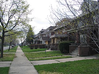
Atkinson Avenue is an east/west street located in the geographic heart of the city of Detroit, Michigan. The historic district had 225 houses in 2010.

Palmer Woods United States historic place

The Palmer Woods Historic District is a residential historic district bounded by Seven Mile Road, Woodward Avenue, and Strathcona Drive in Detroit, Michigan. There are approximately 295 homes in the 188-acre (0.76 km2) district, which is between the City of Highland Park in Wayne County and the City of Ferndale in Oakland County. It was listed on the National Register of Historic Places in 1983. The Detroit Golf Club is nearby.

Rosedale Park, Detroit United States historic place

Rosedale Park is a historic district located in Detroit, Michigan. It is roughly bounded by Lyndon, Outer Drive, Grand River Avenue, Southfield Freeway, Glastonbury Avenue, Lyndon Street and Westwood Drive. It was listed on the National Register of Historic Places in 2006. The Rosedale Park district has the largest number of individual properties of any district nominated to the National Register of Historic Places in Michigan, with 1533.

Sherwood Forest is an area in Detroit, Michigan, United States. The district is bounded by Seven Mile Road, Livernois, Pembroke, and Parkside. The community, with about 435 houses, consists of two subdivisions: Sherwood Forest and Sherwood Forest Manor.
Chaldean Town

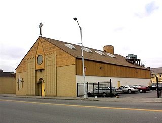
Chaldean Town was a historically Chaldo-Assyrian neighborhood in Detroit located along West Seven Mile Road in a segment in between Woodward Avenue to the west and John R St. to the east. Circa 2007 the population of the district was mainly low income elderly people and recent immigrants, who were mostly made up of Chaldean Catholic Assyrians. The neighborhood was usually just a stop point for newly arrived immigrants, who then typically preferred to move to the suburbs of Detroit when they could afford to.

Springwells, Detroit Neighborhoods of Detroit in Wayne, United States

Springwells is a neighborhood in Southwest Detroit, near the Ford Motor Company River Rouge Plant.

Osborn High School Public school in Detroit, Michigan, United States

Osborn High School, also known as Osborn Academy of Mathematics is a four-year high school in the Detroit Public Schools Community District (DPSCD), located in Northeast Detroit.

MorningSide, Detroit

MorningSide is a neighborhood on the east side of Detroit, Michigan. The area is bounded by Harper Avenue and Interstate 94 on the north, Mack Avenue to the south, East Outer Drive and Whittier on the east and Alter Road and East Outer Drive to the west. The local association that shares the name MorningSide with the community is a collaboration of residents working together to take care of this area.

Boynton–Oakwood Heights Neighborhoods of Detroit in Wayne, Michigan, United States

Boynton and Oakwood Heights are the two southernmost neighborhoods of the city of Detroit in the U.S. state of Michigan. The two neighborhoods occupy the only portions of Detroit located south of the River Rouge.

Krainz Woods is a neighborhood in Detroit, Michigan.

As of 2007 most Hmong people in the State of Michigan live in northeastern Detroit, but they have been increasingly moving to Pontiac and Warren.

References

Notes

  1. 1 2 3 "Detroit Center for Family Advocacy." (Archived November 30, 2012, at the Wayback Machine ) University of Michigan Law School. Retrieved on November 8, 2012.
  2. Hunter, George and Mike Wilkinson. "Detroit's deadliest neighborhood" (Archived 2015-07-02 at WebCite ). The Detroit News . September 2, 2011. Retrieved on November 8, 2012. "Gangs, especially transient gangs that are less organized — and often, randomly violent — terrorize some of our neighborhoods including … Osborn,"
  3. Satyanarayana, Megha. "In Detroit neighborhood, volunteers from across region board up 105 houses." Detroit Free Press . August 25, 2012. Retrieved on November 8, 2012.
  4. Siedel, Jeff. "Jeff Seidel: Detroit Osborn football team tries to learn lessons from star's murder." Detroit Free Press . August 24, 2012. Retrieved on November 8, 2012.
  5. 1 2 3 "Osborn Neighborhood Profile." (Archive." (Archived September 11, 2013, at the Wayback Machine ) Data Driven Detroit, City Connect Detroit. p. 1. Retrieved on November 8, 2012.
  6. 1 2 3 "Osborn Neighborhood Profile." (Archive." (Archived September 11, 2013, at the Wayback Machine ) Data Driven Detroit, City Connect Detroit. p. 3. Retrieved on November 8, 2012.
  7. 1 2 Lewis, Matthew (Model D). "Young and Hmong in a Detroit east side neighborhood" (Archived 2015-07-05 at WebCite ). MLive. September 29, 2013. Retrieved on February 19, 2014.
  8. "Elementary Boundaries - 2012/13 School Year." (Archived 2012-11-01 at WebCite ) Detroit Public Schools. Retrieved on November 1, 2012.
  9. "Middle School Boundaries - 2012/13 School Year." (Archived 2012-11-01 at WebCite ) Detroit Public Schools. Retrieved on November 1, 2012.
  10. "High School Boundaries - 2012/13 School Year." (Archived 2012-11-01 at WebCite ) Detroit Public Schools. Retrieved on November 1, 2012.
  11. "Elementary School Attendance Areas." Detroit Public Schools. July 10, 2003. Retrieved on December 20, 2012.
  12. "Middle School Attendance Areas." Detroit Public Schools . July 10, 2003. Retrieved on December 20, 2012.
  13. "Early Childhood." Detroit Public Schools. Retrieved on November 29, 2015. "Fleming Administration Bldg. 18501 Waltham Detroit, MI 48205"
  14. "Filling in the Gaps: A Plan for Vacant Properties in Osborn." (Archive) Urban and Regional Planning Program, University of Michigan Ann Arbor. February 2009. p. 39. Retrieved on November 9, 2012.
  15. "MAYOR KWAME M. KILPATRICK TO ANNOUNCE DETAILS OF."[ sic ] (Archived December 20, 2013, at the Wayback Machine ) City of Detroit. May 11, 2007. Retrieved on November 9, 2012.
  16. "ABOUT". 31 May 2013.

Further reading

Coordinates: 42°26′12″N83°00′04″W / 42.4368°N 83.0011°W / 42.4368; -83.0011