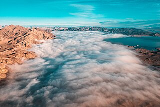
Lake Mead is a reservoir formed by the Hoover Dam on the Colorado River in the Southwestern United States. It is located in the states of Nevada and Arizona, 24 mi (39 km) east from Las Vegas Strip. It is the largest reservoir in the United States in terms of water capacity. Formed by the Hoover Dam on September 30, 1935, the reservoir serves water to the states of Arizona, California, and Nevada, as well as some of Mexico, providing sustenance to nearly 20 million people and large areas of farmland.

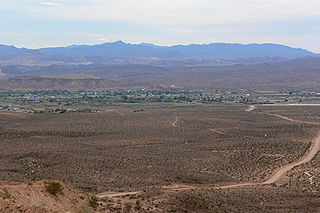
The Mohave Valley is a valley located mostly on the east shore of the south-flowing Colorado River in northwest Arizona. The valley extends into California's San Bernardino County; the northern side of the valley extends into extreme southeast Clark County, Nevada. The main part of the valley lies in southwest Mohave County, Arizona and is at the intersection of the southeast Mojave and northwest Sonoran deserts.

St. Thomas, Nevada is a ghost town in Clark County, Nevada, near where the Muddy River flows into the Colorado River. St. Thomas was purchased by the US Federal Government and abandoned as the waters of Lake Mead submerged the town in the 1930s. However, as the level of Lake Mead dropped in the 2000s, the ruins of the town resurfaced. It is now located within the Lake Mead National Recreation Area.

The Muddy River, formerly known as the Moapa River, is a short river located in Clark County, in southern Nevada, United States. It is in the Mojave Desert, approximately 60 miles (97 km) north of Las Vegas.
Overton is a community that is part of the unincorporated town of Moapa Valley in Clark County, Nevada. Overton is on the north end of Lake Mead. It is home to Perkins Field airport and Echo Bay Airport.

Las Vegas Bay is a bay at the western edge of Lake Mead in the U.S. state of Nevada. The bay is located within the Lake Mead National Recreation Area to the northeast of the city of Henderson, Nevada, near the junction of Lake Mead Drive and Lake Mead Boulevard. A public campground and boat access are available in Las Vegas Bay. Low water levels of Lake Mead have rendered the marina there inoperable, and it has moved to the Hemenway Boat Harbor, in the south end of the Boulder Basin. The launch ramp there has also been closed due to the water levels.

Cottonwood Cove is situated at the banks of Lake Mohave on the Nevada-Arizona border in Clark County, Nevada, United States. It stands just 13.1 miles and 23 minutes east of Searchlight, 12.5 miles north of Laughlin and an hour away from Las Vegas. It is the site of the Cottonwood Cove Resort and Marina. The cove is part of the Lake Mead National Recreation Area administered by the U.S. National Park Service. The desert lake is approximately 67 miles long and is backed by the Davis Dam on the Colorado River.

State Route 169 is a state highway in Clark County, Nevada, United States. It connects the northern reaches of Lake Mead National Recreation Area to Interstate 15 (I-15) via Moapa Valley and the communities of Overton and Logandale. It is also called Northshore Road, Moapa Valley Boulevard, and Logandale Road.

Pueblo Grande de Nevada,, is a complex of villages located near Overton, Nevada, and listed on the National Register of Historic Places.
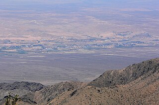
The Virgin Valley is a valley in northwest Arizona and southeast Nevada on the Virgin River. The Virgin River drains southwest Utah and southeast Nevada; parts of Arizona, especially the Arizona Strip region drain southwards into the Virgin River and Valley.

Callville Bay is a waterway on the northwestern side of Lake Mead in the U.S. state of Nevada. It has a marina and camping resort. Situated east of Las Vegas and upstream from Las Vegas Bay, it lies within the Lake Mead National Recreation Area, which was established in 1935. Its name derives from the settlement of Callville which was established in 1865 by Anson Call under a directive led by Brigham Young. Though the settlement was abandoned in 1869, and submerged under Lake Mead when the Colorado River was dammed, Callville Bay retained the name.

Callville is a former settlement of Clark County in the U.S. state of Nevada. Abandoned in 1869, it was submerged under Lake Mead when the Colorado River was dammed, Callville Bay retaining the name. At one time, it was noted to be the southernmost outpost of the Mormon settlement.

Little Finland is a scenic red rock area, located in a remote section of Clark County, Nevada south of Mesquite, known for its red rock scenery and strangely-shaped, delicate rock formations. The landscape is similar to Valley of Fire State Park, which is about 20 miles (32 km) to the west, across Lake Mead. The rock formations are composed of red Aztec Sandstone, fossil sand dunes. Many of the features are small erosional fins, hence the name.

Boulder Canyon, originally Devils Gate Canyon, is a canyon on the Colorado River, above Hoover Dam, now flooded by Lake Mead. It lies between Clark County, Nevada and Mohave County, Arizona. It heads at western end of the Virgin River Basin of Lake Mead, at about 36°09′05″N114°32′51″W. Boulder Canyon divides the Black Mountains into the Black Mountains of Arizona, and the Black Mountains of Nevada. Its mouth is now under the eastern end of the Boulder Basin of Lake Mead, between Canyon Point in Nevada and Canyon Ridge in Arizona. Its original mouth is now underneath Lake Mead between Beacon Rock and Fortification Ridge on the southern shore in Arizona.
Boulder Wash is an ephemeral stream or wash in Clark County, Nevada. Its mouth is at its confluence with the Boulder Wash Cove of Lake Mead at an elevation 1,276 feet / 389 meters at when Lake Mead is at its full level. Currently as the reservoir is at a much lower level its mouth is found at approximately 36°10′07″N114°33′07″W. Its source is at 36°13′36″N114°31′22″W at an elevation of 2,841 feet / 866 meters in the Black Mountains. It flows down a canyon into the upper Pinto Valley southwestward before turning southeastward to Boulder Wash Cove.
West End Wash is an ephemeral stream or wash in Clark County, Nevada. Its mouth is at its confluence with the Callville Wash of Lake Mead at an elevation 1,250 feet / 381 meters at when Lake Mead is at its full level. Currently as the reservoir is at a much lower level its mouth is found at approximately 36°08′24″N114°42′57″W. Its source is at 36°15′55″N114°43′58″W at 3,083 feet / 940 meters in the Gale Hills.
Gale Hills, formerly considered part of the Muddy Range (1879), and later the South Muddy Mountains (1980s), are a range of hills southwest of the Muddy Mountains and about three miles north of the Boulder Basin of Lake Mead, in Clark County, Nevada. It is bounded on the east by Callville Wash; on the south by the Black Mesa lava flows; on the northwest by the valley of Gypsum Wash. Its highpoint is at 36°15′32″N114°43′12″W which lies at 3,756 feet / 1,145 meters.
Auxiliary Point is a cape in the Lake Mead reservoir in Clark County, Nevada. Auxiliary Point marks the mouth of Boulder Canyon, a canyon on the Colorado River, above Hoover Dam, now flooded by Lake Mead.
Lime Canyon Wilderness is a unit of the National Wilderness Preservation System located in eastern Nevada, United States, within the Gold Butte National Monument. The 23,710-acre (9,600 ha) wilderness area is administered by the Bureau of Land Management, and was designated in 2002 to protect roadless, undeveloped mountains bordering Lake Mead National Recreation Area.

Rogers Warm Spring is a geothermal spring located in Clark County, Nevada near the town of Overton.