
The San Francisco Peninsula is a peninsula in the San Francisco Bay Area that separates San Francisco Bay from the Pacific Ocean. On its northern tip is the City and County of San Francisco. Its southern base is in northern Santa Clara County, including the cities of Sunnyvale, Palo Alto, Mountain View, and Los Altos. Most of the Peninsula is occupied by San Mateo County, between San Francisco and Santa Clara counties, and including the cities and towns of Atherton, Belmont, Brisbane, Burlingame, Colma, Daly City, East Palo Alto, El Granada, Foster City, Hillsborough, Half Moon Bay, La Honda, Loma Mar, Los Altos, Menlo Park, Millbrae, Mountain View, Pacifica, Palo Alto, Pescadero, Portola Valley, Redwood City, San Bruno, San Carlos, San Mateo, South San Francisco, Sunnyvale, and Woodside.
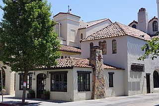
Palo Alto is a charter city located in the northwestern corner of Santa Clara County, California, United States, in the San Francisco Bay Area. Palo Alto means tall stick in Spanish; the city is named after a coastal redwood tree called El Palo Alto.

East Palo Alto is a city in San Mateo County, California, United States. As of the 2010 census, the population of East Palo Alto was 28,155. It is situated on the San Francisco Peninsula, roughly halfway between the cities of San Francisco and San Jose. To the north and east is the San Francisco Bay, to the west is the city of Menlo Park, and to the south the city of Palo Alto. Despite being called "East" Palo Alto, the city is directly north of Palo Alto. While often incorrectly assumed to be part of the city of Palo Alto, East Palo Alto has always been a separate entity since its founding as an unincorporated community until its incorporation in July 1983. It is also in San Mateo County, while Palo Alto is in Santa Clara County. The two cities are separated only by San Francisquito Creek and, largely, the Bayshore Freeway. The revitalization projects in 2000, and high income high-tech professionals moving into new developments, including employees from Google and Facebook, have begun to eliminate the cultural and economic differences between the two cities. East Palo Alto and Palo Alto share both telephone area codes and postal ZIP codes.

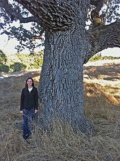
El Palo Alto is a coastal redwood located in El Palo Alto Park on the banks of San Francisquito Creek in Palo Alto, California, United States. It is famous for its historical significance and as the namesake of the city of Palo Alto.
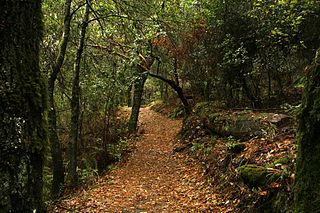
Los Trancos Open Space Preserve is a 274-acre open space preserve, located in San Mateo and Santa Clara Counties, California, near Los Altos Hills, California. The preserve contains about 5 miles of hiking trails, of which 2.1 miles are open to equestrians, and none are open to bicycles.

Don Edwards San Francisco Bay National Wildlife Refuge (DESFBNWR) is a United States National Wildlife Refuge located in the southern part of San Francisco Bay, California. The Refuge headquarters and visitor center is located in the Baylands district of Fremont, next to Coyote Hills Regional Park, in Alameda County. The visitor center is on Marshlands Rd, off Thornton Ave.
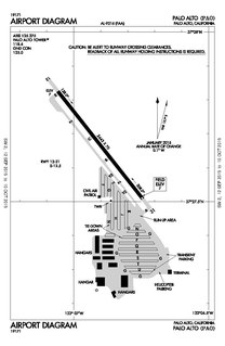
Palo Alto Airport is a general aviation airport in the city of Palo Alto in Santa Clara County, California, United States, near the south end of San Francisco Bay on the western shore.

Arastradero Preserve, officially known as Enid W. Pearson–Arastradero Preserve, is a nature preserve that protects most of the Arastradero Creek watershed, including its ephemeral Mayfly Creek tributary. The preserve is owned and operated by the City of Palo Alto, California. The main parking lot hosts an interpretive center and is located at 1530 Arastradero Road.
San Francisquito Creek is a creek that flows into southwest San Francisco Bay in California, United States. Historically it was called the Arroyo de San Francisco by Juan Bautista de Anza in 1776. San Francisquito Creek courses through the towns of Portola Valley and Woodside, as well as the cities of Menlo Park, Palo Alto, and East Palo Alto. The creek and its Los Trancos Creek tributary define the boundary between San Mateo and Santa Clara counties.

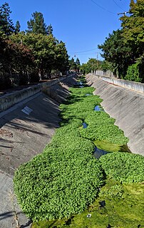
Adobe Creek is a 14.2-mile-long (22.9 km) northward-flowing stream originating on Black Mountain in Santa Clara County, California, United States. It courses through the cities of Los Altos Hills, Los Altos, and Palo Alto. Historically, Adobe Creek was perennial and hosted runs of steelhead trout entering from southwestern San Francisco Bay.

Monte Bello Open Space Preserve is a 3,133-acre (12.68 km2) open space preserve, located near Palo Alto in the Santa Cruz Mountains, in San Mateo and Santa Clara Counties, California, United States. The preserve encompasses the upper Stevens Creek watershed in the valley between Monte Bello Ridge and Skyline Ridge. "Monte Bello" means "beautiful mountain" in Italian, and refers to Black Mountain which is the highest part of Montebello Ridge. The straight valley of upper Stevens Creek is also the rift valley of the San Andreas Fault.

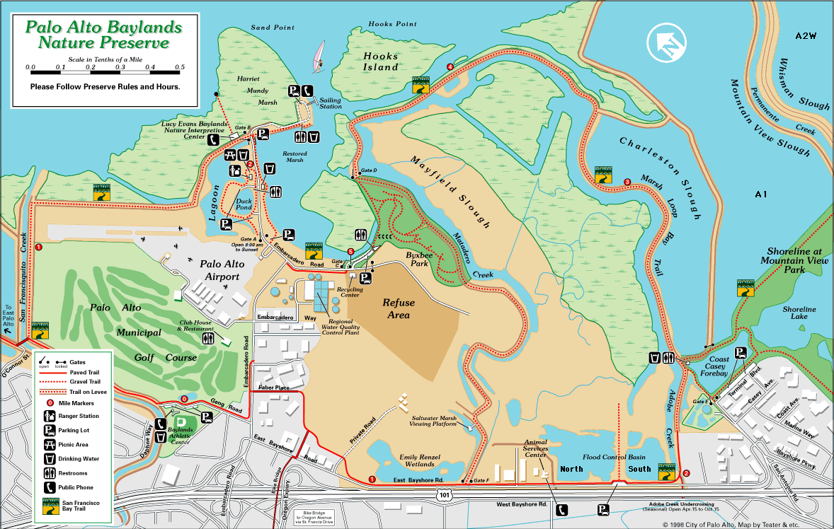
Matadero Creek is a stream originating in the foothills of the Santa Cruz Mountains in Santa Clara County, California, United States. The creek flows in a northeasterly direction for 8 miles (13 km) until it enters the Palo Alto Flood Basin, where it joins Adobe Creek in the Palo Alto Baylands at the north end of the Mayfield Slough, just before its culmination in southwest San Francisco Bay. Matadero Creek begins in the city of Los Altos Hills, then traverses the Stanford University lands and Palo Alto.

Corte Madera Creek is a 7.3-mile-long (11.7 km) creek that flows north-northwest to Searsville Dam and then joins with Bear Creek to form San Francisquito Creek in California.
Los Trancos Creek is a creek that flows northerly from Monte Bello Ridge on the northeast slope of the Santa Cruz Mountains to its confluence with San Francisquito Creek at Stanford University in California, United States. The creek forms the boundary between northwestern Santa Clara County and southeastern San Mateo County.
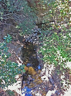
Arastradero Creek is a mainly seasonal 2.4-mile-long (3.9 km) generally north by northeastward-flowing stream originating in the Palo Alto foothills of the Santa Cruz Mountains in Santa Clara County, California, United States. It is almost wholly protected by the Pearson–Arastradero Preserve, before joining Matadero Creek where its waters descend to San Francisco Bay.
Barron Creek is a 5.8-mile-long (9.3 km) northward-flowing stream originating in the lower foothills of the Santa Cruz Mountains in Los Altos Hills in Santa Clara County, California, United States. It courses northerly through the cities of Los Altos Hills and Palo Alto, before joining Adobe Creek just south of U.S. Highway 101. As Adobe Creek, its waters continue northwards to southwest San Francisco Bay after crossing under Highway 101 and traversing the Palo Alto Flood Basin.
Sausal Creek is a 2.5-mile-long (4.0 km) northwesterly-flowing stream originating in Portola Valley along the northeastern edge of the Windy Hill Open Space Preserve in the eastern foothills of the Santa Cruz Mountains, in San Mateo County, California, United States. It joins a nexus of creeks becoming Corte Madera Creek in a natural marsh above Searsville Reservoir on Stanford University lands. Below Searsville Reservoir, Corte Madera Creek joins with Bear Creek to form San Francisquito Creek and flows to San Francisco Bay.

Foothills Park is a 1,400-acre (570 ha) park and nature preserve in the Santa Cruz Mountains of California within the city of Palo Alto. From 1969 until 2020, only residents or city employees of Palo Alto and their guests had lawful access to it, a restriction that has sparked "decades-long" controversy and a 2020 ACLU lawsuit. The park was opened to the general public on December 17, 2020.

Hooks Island is an approximately 36-acre (15 ha) tidal salt marsh island in the San Francisco Bay, in the city of Palo Alto, California, United States. It is home to members of several endangered species, as well as five transmission towers. It is described in a 2020 Santa Clara Valley Water report as an "undisturbed tidal salt marsh" consisting partly of an "estuarine intertidal emergent wetland". Its northern tip, located at 37°27′30″N122°05′49″W, is known as Hooks Point. Hooks Island is located directly east of the Palo Alto Baylands Sailing Station.


