
Linn County is a county in the U.S. state of Kansas, located in along the eastern edge of Kansas, and is part of the Kansas City metropolitan area. Its county seat is Mound City, and its most populous city is Pleasanton. As of the 2020 census, the county population was 9,591. The county was named for Lewis Linn, a U.S. Senator from Missouri.

La Cygne is a city in Linn County, Kansas, United States, and situated along the Marais des Cygnes River. As of the 2020 census, the population of the city was 1,050. The city is named after the Marais des Cygnes River which is a French translation of an Osage appellation meaning "marsh of the swans".

The Osage River is a 276-mile-long (444 km) tributary of the Missouri River in central Missouri in the United States. The eighth-largest river in the state, it drains a mostly rural area of 15,300 square miles (40,000 km2). The watershed includes an area of east-central Kansas and a large portion of west-central and central Missouri, where it drains northwest areas of the Ozark Plateau.
The Battle of Marais des Cygnes took place on October 25, 1864, in Linn County, Kansas, during Price's Missouri Campaign during the American Civil War. It is also known as the Battle of Trading Post. In late 1864, Confederate Major-General Sterling Price invaded the state of Missouri with a cavalry force, attempting to draw Union troops away from the primary theaters of fighting further east. After several victories early in the campaign, Price's Confederate troops were defeated at the Battle of Westport on October 23 near Kansas City, Missouri. The Confederates then withdrew into Kansas, camping along the banks of the Marais des Cygnes River on the night of October 24. Union cavalry pursuers under Brigadier General John B. Sanborn skirmished with Price's rearguard that night, but disengaged without participating in heavy combat.

The Battle of Mine Creek, also known as the Battle of Little Osage, was fought on October 25, 1864, in Linn County, Kansas, as part of Price's Missouri Campaign during the American Civil War. Major-General Sterling Price had begun an expedition in September 1864 to restore Confederate control of Missouri. After being defeated at Westport near Kansas City on October 23, Price's army began to retreat south through Kansas. Early on October 25, Price's army was defeated at the Marais des Cygnes. After Marais des Cygnes, the Confederates fell back, but were stalled at the crossing of Mine Creek while a wagon train attempted to cross.

The Marais des Cygnes River is a principal tributary of the Osage River, about 217 miles (349 km) long, in eastern Kansas and western Missouri in the United States. Via the Osage and Missouri rivers, it is part of the watershed of the Mississippi River.

The Marais des Cygnes massacre is considered the last significant act of violence in Bleeding Kansas prior to the outbreak of the American Civil War. On May 19, 1858, approximately 30 men led by Charles Hamilton, a Georgia native and proslavery leader, crossed into the Kansas Territory from Missouri. They arrived at Trading Post, Kansas, in the morning and then headed back to Missouri. Along the way, they captured 11 Free-Staters, none of whom were armed and, it is said, none of whom had participated in the ongoing violence. Most of the men knew Hamilton and apparently did not realize he meant them harm. These prisoners were led into a defile, where Hamilton ordered his men to shoot, firing the first and last bullet himself. Five men were killed and five severely wounded. Only one Free-Stater escaped injury.
The Kansas City Bridge Company was a bridge building company that built many bridges throughout the Midwest United States in the early 1900s. The company was founded in 1893 and ceased business around 1960.
Prairie Spirit Trail State Park is a rail trail that is a Kansas State Park.

New Home Township is one of twenty-four townships in Bates County, Missouri, and is part of the Kansas City metropolitan area within the USA. As of the 2000 census, its population was 222.

Prairie Township is one of twenty-four townships in Bates County, Missouri, and is part of the Kansas City metropolitan area within the USA. As of the 2000 census, its population was 153.

There are eight properties listed on the National Register of Historic Places (NRHP) in Linn County, Kansas. Two of the sites are the location of historic events. The Marais des Cygnes Massacre Site is the location of the Marais des Cygnes massacre, an 1858 event during Bleeding Kansas in which pro-slavery advocates kidnapped 11 anti-slavery settlers, killing five of them. John Brown temporarily used the site as a fort, and the property was listed on the NRHP in 1971. The Battle of Mine Creek Site preserves the location of the Battle of Mine Creek, which was fought in 1864 as part of Price's Raid during the American Civil War. Confederate general Sterling Price's army was retreating after being defeated at the Battle of Westport and was attacked by pursuing Union troops. Price's Confederate lost heavily in men and supplies. The site was added to the NRHP in 1973.

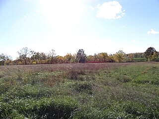
The Marais des Cygnes Massacre Site, also known as Marais des Cygnes Massacre Memorial Park, is a state historic site near Trading Post, Kansas that commemorates the 1858 massacre of the same name. On May 19, 1858, during a period of political instability and sporadic violence known as Bleeding Kansas, a group of pro-slavery border ruffians captured 11 abolitionist free-staters. The prisoners were forced to a nearby ravine, where 10 of them were shot, resulting in five fatalities. The abolitionist John Brown later built a fort near the site. The first commemoration at the site was two stone markers erected by men of the 3rd Iowa Cavalry Regiment in 1864, although these monuments had been destroyed by souvenir hunters by 1895. In 1941, the land where the massacre occurred, as well as an 1870s-era house constructed by a friend of Brown, were transferred to the state of Kansas. The site was listed on the National Register of Historic Places in 1971 and designated a National Historic Landmark in 1974. The Kansas Historical Society administers the site, which is interpreted by signage and a hand-cranked audio recording.
Double Branch is a stream in Bates County in the U.S. state of Missouri. It is a tributary to the Marais des Cygnes River.
Miami Creek is a stream in Bates County, Missouri. It is a tributary of the Marais des Cygnes River.
Mission Branch is a stream in Bates County in the U.S. state of Missouri. It is a tributary of Sycamore Branch. The stream headwaters are at 38°08′54″N94°12′47″W and the stream flows to the southwest to its confluence with Sycamore Branch at 38°05′16″N94°15′44″W within the floodplain of the Marais des Cygnes River.
Mulberry Creek is a stream in Bates County in the U.S. state of Missouri. It is a tributary of the Marais des Cygnes River.
Sycamore Branch is a stream in Bates County in the U.S. state of Missouri. It is a tributary of the Marais des Cygnes River. The stream headwaters arise at 38°08′31″N94°14′19″W and the stream flows south-southwest until it reaches the floodplain of the Marais des Cygnes at which point it turns to the southeast for about 1.5 kilometers prior to its confluence at 38°04′37″N94°15′37″W. The source area for the stream is at an elevation of about 875 feet and the confluence is at 738 feet.
Walnut Creek is a stream in Linn County, Kansas and Bates County, Missouri in the United States. It is a tributary of the Marais des Cygnes River.
Papinville Marais des Cygnes River Bridge, is a historic Pinned Pratt through truss located at Papinville, Bates County, Missouri. It was built in 1884 by the Kansas City Bridge and Iron Co. and spans the Marais des Cygnes River. It is a three span bridge with a central Pratt truss measuring 116 feet and two connected Warren-pony truss spans. It rests on stone abutments with concrete and steel piers and measures a total 234 feet long.

