The Mid-Atlantic is a region of the United States located in the overlap between the Northeastern and Southeastern states of the United States. The region typically includes the five states of New York, New Jersey, Pennsylvania, Delaware, and Maryland, the District of Columbia, and occasionally Virginia, and West Virginia.

The Northeastern United States, also referred to as the Northeast, the East Coast, or the American Northeast, is a geographic region of the United States located on the Atlantic coast of North America, with Canada to its north, the Southern United States to its south, and the Midwestern United States to its west. The Northeast is one of the four regions defined by the U.S. Census Bureau for the collection and analysis of statistics. The United States Census Bureau defines the region as including nine U.S. states: Connecticut, Maine, Massachusetts, New Hampshire, New Jersey, New York, Pennsylvania, Rhode Island, and Vermont. Some broader definitions also include Maryland, Delaware, and Washington, D.C., and on rare occasions, West Virginia, and Virginia.

The Northern United States, commonly referred to as the American North, the Northern States, or simply the North, is a geographical or historical region of the United States.

A subregion is a part of a larger region or continent and is usually based on location. Cardinal directions, such as south are commonly used to define a subregion.

Northeast is the northeastern quadrant of Washington, D.C., the capital of the United States. It encompasses the area located north of East Capitol Street and east of North Capitol Street.

Northeast Glacier is a steep, heavily crevassed glacier on the west side of Hemimont Plateau, 21 km (13 mi) long and 8 km (5 mi) wide at its mouth, which flows from McLeod Hill westward and then south-westwards into Marguerite Bay between the Debenham Islands and Roman Four Promontory, on the west coast of Graham Land, Antarctica. Northeast Glacier was first surveyed in 1936 by the British Graham Land Expedition (BGLE) under John Riddoch Rymill. It was resurveyed in 1940 by members of the United States Antarctic Service (USAS), who first used the glacier as a sledging route, and so named by them because it lay on the north-eastern side of their base at Stonington Island.

There are more than 1,500 properties and historic districts in the U.S. State of Colorado listed on the National Register of Historic Places. They are distributed over 63 of Colorado's 64 counties; only the City and County of Broomfield currently has none.

The Northeast megalopolis, also known as the Northeast Corridor, Acela Corridor, Boston–Washington corridor, or BosWash, is the world's largest megalopolis in terms of economic output and the second-most populous megalopolis in the United States with approximately 50 million residents as of 2020.
Blake Peak is a mountain located in Essex County, New York. The mountain is named after Mills Blake, Verplanck Colvin’s chief assistant during the Adirondack Survey. It is part of the Colvin Range. Blake Peak is flanked to the northeast by Mount Colvin, and to the southwest by Pinnacle.
Macomb Mountain is a mountain located in Essex County, New York. The mountain is named after Maj. Gen. Alexander Macomb (1782–1841), who won acclaim during the War of 1812 at the Battle of Plattsburgh, and served as Commanding General of the United States Army (1828–1841).
Mount Redfield is a mountain located in Essex County, New York. The mountain is part of the Marcy Group of the Great Range of the Adirondack Mountains. Mount Redfield is flanked to the northwest by Cliff Mountain, and to the northeast by Mount Skylight.
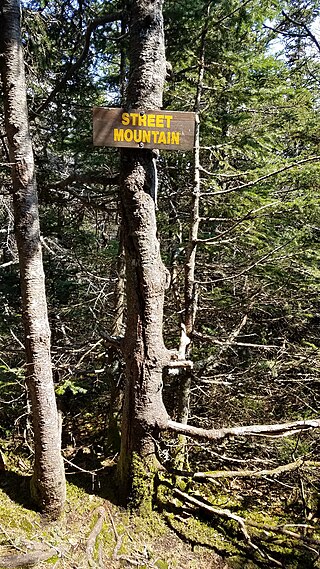
Street Mountain is a mountain located in Essex County, New York, named after Alfred Billings Street (1811–1881), a poet and New York State Librarian. The mountain is the high point of the Street Range of the Adirondack Mountains. Street's northeast ridge is Nye Mountain.

Wittenberg Mountain, locally "the Wittenberg," is a mountain located in Ulster County, New York. The mountain is part of the Burroughs Range of the Catskill Mountains. Wittenberg is flanked to the southwest by Cornell Mountain and to the northeast by Terrace Mountain.
El-Sayed Glacier is a glacier about 15 nautical miles long which drains the northeast slopes of Zuncich Hill in Marie Byrd Land. It flows northeast to enter Land Glacier at the south side of Mount Shirley. It was mapped by the United States Geological Survey from surveys and U.S. Navy air photos, 1959–65, and was named by the Advisory Committee on Antarctic Names for Sayed Z. El-Sayed, a United States Antarctic Research Program oceanographer on the International Weddell Sea Oceanographic Expeditions, 1967–68 and 1969–70.
Astapenko Glacier is a glacier, 11 miles (18 km) long, draining the north and northeast slopes of Stanwix Peak in the Bowers Mountains and flowing east-northeast to Ob' Bay, situated in Victoria Land, Antarctica. It was mapped by the United States Geological Survey from surveys and from U.S. Navy air photos, 1960–62, and named by the Advisory Committee on Antarctic Names for Pavel D. Astapenko, Soviet IGY observer, a Weather Central meteorologist at Little America V in 1958. The glacier lies on the Pennell Coast, a portion of Antarctica lying between Cape Williams and Cape Adare.

Frankenfield Glacier is a small glacier in the northeast part of Noville Peninsula, Thurston Island, in Antarctica. It flows east-northeast to the Bellingshausen Sea between Mount Feury and Mulroy Island. The glacier was first roughly delineated from air photos taken by U.S. Navy Operation Highjump in December 1946, and was named by the Advisory Committee on Antarctic Names for Lieutenant Chester Frankenfield, a meteorologist on the U.S. Navy Bellingshausen Sea Expedition, who established an automated weather station on Thurston Island in February 1960.
Richmond Mountain is a mountain located in the Catskill Mountains of New York east-northeast of Hunter. Richtmyer Peak is located northeast, Bump Mountain is located south, Steenburg Mountain is located north, and Ashland Pinnacle is located west-southwest of Richmond Mountain.
Bump Mountain is a mountain located in the Catskill Mountains of New York northeast of Ashland. Richtmyer Peak is located north-northeast, The Knob is located west, and Ashland Pinnacle is located west-southwest of Bump Mountain.

NISA Nation is a semi-professional men's soccer league in the United States. The league is below the professional leagues in the United States soccer league system and began play in 2021. NISA Nation is affiliated with the third tier professional league National Independent Soccer Association.


