Pentwater, Michigan | |
---|---|
Coordinates: 43°46′49″N86°25′48″W / 43.78028°N 86.43000°W | |
Country | United States |
State | Michigan |
County | Oceana |
Township | Pentwater |
Area | |
• Total | 1.72 sq mi (4.46 km2) |
• Land | 1.34 sq mi (3.46 km2) |
• Water | 0.38 sq mi (0.99 km2) |
Elevation | 610 ft (186 m) |
Population (2020) | |
• Total | 890 |
• Density | 665.17/sq mi (256.92/km2) |
Time zone | UTC-5 (Eastern (EST)) |
• Summer (DST) | UTC-4 (EDT) |
ZIP code | 49449 |
Area code | 231 |
FIPS code | 26-63540 [2] |
GNIS feature ID | 1621203 [3] |
Pentwater is a village in Oceana County in the U.S. state of Michigan. The population was 890 at the 2020 census. The village is located within Pentwater Township. Pentwater is home to Mears State Park. The name Pentwater comes from Pent or Penned up waters. [4] The entrance to the channel is notoriously shallow and for many years dictated the size of vessels that the village was able to accommodate. [5]
According to the United States Census Bureau, the hamlet has a total area of 1.62 square miles (4.20 km2), of which 1.28 square miles (3.32 km2) is land and 0.34 square miles (0.88 km2) is water. Pentwater is the biggest community in Oceana County due to the community's area. [6]
Eight streets within the village: Hancock, Carroll, Wythe, Rutledge, Rush, Ellery, Morris, and Clymer, are named after signers of the Declaration of Independence.
Census | Pop. | Note | %± |
---|---|---|---|
1870 | 1,294 | — | |
1890 | 1,510 | — | |
1900 | 1,061 | −29.7% | |
1910 | 1,129 | 6.4% | |
1920 | 956 | −15.3% | |
1930 | 772 | −19.2% | |
1940 | 820 | 6.2% | |
1950 | 1,097 | 33.8% | |
1960 | 1,030 | −6.1% | |
1970 | 993 | −3.6% | |
1980 | 1,165 | 17.3% | |
1990 | 1,050 | −9.9% | |
2000 | 958 | −8.8% | |
2010 | 857 | −10.5% | |
2020 | 890 | 3.9% | |
U.S. Decennial Census [7] |
As of the census [8] of 2010, there were 857 people, 450 households, and 269 families residing in the village. The population density was 669.5 inhabitants per square mile (258.5/km2). There were 997 housing units at an average density of 778.9 per square mile (300.7/km2). The racial makeup of the village was 97.3% White, 0.1% African American, 0.2% Native American, 0.9% from other races, and 1.4% from two or more races. Hispanic or Latino of any race were 2.5% of the population.
There were 450 households, of which 13.1% had children under the age of 18 living with them, 50.0% were married couples living together, 7.8% had a female householder with no husband present, 2.0% had a male householder with no wife present, and 40.2% were non-families. 36.0% of all households were made up of individuals, and 19.7% had someone living alone who was 65 years of age or older. The average household size was 1.89 and the average family size was 2.38.
The median age in the village was 60.3 years. 11.2% of residents were under the age of 18; 4.3% were between the ages of 18 and 24; 10.1% were from 25 to 44; 36.2% were from 45 to 64; and 38.3% were 65 years of age or older. The gender makeup of the village was 45.5% male and 54.5% female.
As of the census [2] of 2000, there were 958 people, 463 households, and 301 families residing in the village. The population density was 733.8 inhabitants per square mile (283.3/km2). There were 904 housing units at an average density of 692.5 per square mile (267.4/km2). The racial makeup of the village was 97.60% White, 0.21% African American, 0.31% Native American, 0.42% Asian, 0.10% Pacific Islander, 0.63% from other races, and 0.73% from two or more races. Hispanic or Latino of any race were 1.15% of the population.
There were 463 households, out of which 17.7% had children under the age of 18 living with them, 54.4% were married couples living together, 8.0% had a female householder with no husband present, and 34.8% were non-families. 31.3% of all households were made up of individuals, and 14.9% had someone living alone who was 65 years of age or older. The average household size was 2.06 and the average family size was 2.51.
In the village, the population was spread out, with 15.8% under the age of 18, 5.4% from 18 to 24, 15.1% from 25 to 44, 33.6% from 45 to 64, and 30.1% who were 65 years of age or older. The median age was 53 years. For every 100 females, there were 89.0 males. For every 100 females age 18 and over, there were 86.4 males.
The median income for a household in the village was $38,542, and the median income for a family was $45,909. Males had a median income of $40,750 versus $25,833 for females. The per capita income for the village was $22,783. About 6.6% of families and 8.4% of the population were below the poverty line, including 17.1% of those under age 18 and 2.7% of those age 65 or over.
Pentwater's specialty is its location to Lake Michigan. The area is a tourist mecca in the summer, frequently visited by Chicagoans looking to get away. Pentwater has a number of bed and breakfasts, in addition to the more traditional motels. Sportfishing is popular in the area, as is shopping. The village has a number of art galleries. Nearby Charles Mears State Park is a popular location during the summer months as well. The village hosts a juried art fair mid-July. Memorial Day in Pentwater is considered the beginning of the summer season, and there is a popular annual fishing contest.
Pentwater is home to several bands, which play concerts Thursday nights during the summer, beginning in late June, in the outdoor bandshell at the village green, a park and natural amphitheatre located downtown on the shore of Pentwater Lake.
Pentwater holds an annual Homecoming, which is usually the week of second Thursday of August. Homecoming festivities include a parade, fireworks, and sandcastle-building contest.
Oceana County is a county located in the U.S. state of Michigan. As of the 2020 Census, the population was 26,659. The county seat is Hart. Long known as part of the large Ojibwe territory, the county was founded by European Americans in 1840 and organized in 1855.
Mason County is a county located in the U.S. state of Michigan. As of the 2020 Census, the population was 29,052. The county seat is Ludington.
Tekonsha is a village in Tekonsha Township, Calhoun County in the U.S. state of Michigan. It is part of the Battle Creek, Michigan Metropolitan Statistical Area. The population was 653 at the 2020 census.
Maple River Township is a civil township of Emmet County in the U.S. state of Michigan. The population was 1,295 at the 2020 census.
Woodbridge Township is a civil township of Hillsdale County in the U.S. state of Michigan. The township had a population of 1,421 at the 2020 census.
Kinde is a village in Huron County in the U.S. state of Michigan. The population was 448 at the 2010 census.
Port Austin is a village in Huron County in the U.S. state of Michigan. The population was 664 at the 2010 census. The village is within Port Austin Township.
Holton Township is a civil township of Muskegon County in the U.S. state of Michigan. As of the 2020 census, the township population was 2,586.
Montague is a city in Muskegon County, Michigan, United States. The population was 2,417 at the 2020 census. The city is politically independent from Montague Township, which borders it on three sides.
Montague Township is a civil township of Muskegon County in the U.S. state of Michigan. The population was 1,555 at the 2020 census. It is adjacent to the city of Montague.
White River Township is a civil township of Muskegon County in the U.S. state of Michigan. The population was 1,383 at the 2020 census.
Golden Township is a civil township of Oceana County in the U.S. state of Michigan. The population was 1,660 at the 2020 census. The township is home to the Silver Lake Sand Dunes, and is located along the shore of Lake Michigan.
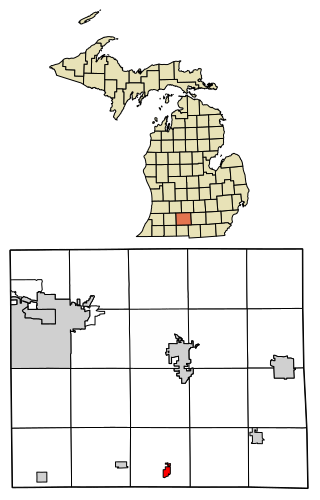
New Era is a village in Shelby Township, Oceana County in the U.S. state of Michigan. The population was 451 at the 2010 census.
Newfield Township is a civil township of Oceana County in the U.S. state of Michigan. As of the 2020 census, the township had a population of 2,329.
Otto Township is a civil township of Oceana County in the U.S. state of Michigan. It was originally named Ottawa or Ottaway in the 1840 census and was organized as Otto Township in 1860. The population was 858 according to the 2020 census.
Pentwater Township is a civil township of Oceana County in the U.S. state of Michigan. The population was 1,652 at the 2020 census. The Village of Pentwater is located within the township.
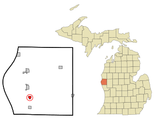
Rothbury is a village in Grant Township, Oceana County in the U.S. state of Michigan. The population was 486 at the 2010 census.
Cashton is a village in Monroe County, Wisconsin, United States. The population was 1,158 at the 2020 census.
Hesperia is a village in Newaygo and Oceana Counties in the U.S. state of Michigan; it is also the only village in Newaygo County. About half of the village lies in Newfield Township in Oceana County and half in Denver Township in Newaygo County. The population was determined to be 954 in both the 2000 and the 2010 Census.
Montfort is a village in Grant and Iowa Counties in the U.S. state of Wisconsin. The population was 718 at the 2010 census. Of this, 622 were in Grant County, and 96 were in Iowa County.