Related Research Articles

Wine Country is the region of California, in the northern San Francisco Bay Area, known worldwide as a premier wine-growing region. The region is famed for its wineries, its cuisine, Michelin star restaurants, boutique hotels, luxury resorts, historic architecture, and culture. Viticulture and wine-making have been practiced in the region since the Spanish missionaries from Mission San Francisco Solano established the first vineyards in 1812.
Tolay Creek is a 12.5-mile-long (20.1 km) southward-flowing stream in southern Sonoma County, California, United States, which flows through Tolay Lake and ends in north San Pablo Bay.

The Suisun Valley AVA is an American Viticultural Area in Solano County, California, located just east of the Napa Valley wine region in the Coast Range. It was established as a wine appellation on 27 December 1982, making it among the first AVAs of California, Napa Valley being the first.

The Mendocino County wine is an appellation that designates wine made from grapes grown mostly in Mendocino County, California. The region is part of the larger North Coast AVA and one of California's largest and most climatically diverse wine growing regions. Mendocino County is one of the northernmost commercial wine grape regions in the state with two distinct climate zones separated by the Mendocino Range. Ten American Viticultural Areas have been designated within Mendocino County. Mendocino is one of the leading wine growing regions for organically produced wine grapes. Nearly 25% of the acreage in Mendocino County is grown organically. In 2004, the residents of the county voted to become the first GMO-free county in the United States in an initiative that was supported by many of the county's largest wineries. The county's widespread focus on organic viticulture has inspired journalists to describe it as "California's organic wine Mecca".
Sonoma County wine is wine made in Sonoma County, California, in the United States.

San Francisco Bay is a multi-county American Viticultural Area (AVA) which is centered and surrounds the San Francisco Bay Area of Northern California. It was established on March 22, 1999 by the Bureau of Alcohol, Tobacco and Firearms (ATF), Treasury after evaluating the petition submitted by a consortium of nearly 75 growers and vintners led by Wente Bros. to establish the viticultural area known as "San Francisco Bay." It lies within the larger Central Coast viticultural area and includes San Francisco and counties encompassing the areas known as “South” and “East Bay.” This consists of Alameda, Contra Costa, Santa Clara, and San Mateo as well as portions of Santa Cruz and San Benito Counties. “North Bay” counties of Sonoma, Napa and Marin were excluded for they reside within the North Coast viticultural area with its distinct properties. ATF also concluded the established Santa Cruz Mountains viticultural area exhibits features and characteristics unique to its boundaries when compared to the surrounding areas, therefore, it was excluded from the "San Francisco Bay" viticultural area.

Santa Cruz Mountains AVA is an American Viticultural Area (AVA) centered on the Santa Cruz Mountains. Its territory spans three California counties, Santa Clara, Santa Cruz and San Mateo and was established January 4, 1982 by the Bureau of Alcohol, Tobacco and Firearms (ATF), Treasury. Santa Cruz Mountains AVA was among the first AVA to be defined by its mountainous topography. Based on elevation, it largely follows the fog line along the coast, extending down to 800 feet (240 m) on the eastern slope toward San Francisco Bay, 400 feet (120 m) on the western slope to the Pacific Ocean and extending along the ridge crest line at 3,000 feet (910 m) elevation plus.
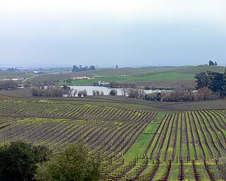
Los Carneros AVA is an American Viticultural Area which includes parts of both Sonoma and Napa counties in California, U.S.A. It is located north of San Pablo Bay. The proximity to the cool fog and breezes from the bay makes the climate in Los Carneros cooler and more moderate than the wine regions farther north in Napa Valley and Sonoma Valley. The cooler climate has made Los Carneros attractive for the cultivation of cooler climate varietals like Pinot noir and Chardonnay. Many of the grapes grown in Los Carneros are used for sparkling wine production. Receiving its AVA status in 1983, the Carneros area was the first wine region in California to be defined by its climate characteristics rather than political boundaries.
The North Coast AVA is an American Viticultural Area in the state of California that encompasses grape-growing regions in six counties located north of San Francisco: Lake, Marin, Mendocino, Napa, Sonoma, and Solano. This large appellation covers over 3,000,000 acres (5,000 sq mi) and includes a number of smaller sub-appellations that all share the common ecology trait of weather affected by the fog and breezes off the Pacific Ocean.
The Northern Sonoma AVA is an American Viticultural Area in Sonoma County, California, United States. The appellation covers most of the county with the notable exceptions of the Los Carneros AVA and Sonoma Valley AVA wine regions, which are located in the southern portion of the county. The creation of this AVA was largely based on the petitioning of the E & J Gallo Winery as part of their expansion of their Gallo of Sonoma brand. The viticultural area incorporates the Alexander Valley AVA, Chalk Hill AVA, Dry Creek Valley AVA, Knights Valley AVA, Russian River Valley AVA, Sonoma Coast AVA, and parts of the Green Valley of Russian River Valley AVA and Rockpile AVA valleys.

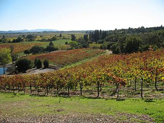
The Russian River Valley AVA is an American Viticultural Area (AVA) in Sonoma County, California. Centered on the Russian River, the Russian River Valley AVA accounts for about one-sixth of the total planted vineyard acreage in Sonoma County. The appellation was granted AVA status in 1983 and enlarged in 2005. The area generally lies between Sebastopol and Santa Rosa in the south, and Forestville and Healdsburg in the north. The Russian River Valley has a characteristically cool climate, heavily affected by fog generated by the valley's proximity to the Pacific Ocean. The area is known for its success with cool climate varietals, notably Pinot noir and Chardonnay.
The Sonoma Coast AVA is an American Viticultural Area in Sonoma County, California, United States containing more than 500,000 acres (2,000 km2), mostly along the coastline of the Pacific Ocean. It extends from San Pablo Bay to the border with Mendocino County. The appellation is known for its cool climate and high rainfall relative to other parts of Sonoma County. The area has such a broad range of microclimates that petitions have been made to the United States Department of the Treasury Alcohol and Tobacco Tax and Trade Bureau for the creation of sub-AVAs such as the Fort Ross-Seaview AVA which was approved in December 2011.

The Sonoma Valley AVA is an American Viticultural Area in Sonoma County, California which centers on the Sonoma Valley in the southern portion of the county. The name 'Sonoma' means 'Valley of the Moon' in the local Native American dialect. The appellation is bordered by two mountain ranges: the Mayacamas Mountains to the east and the Sonoma Mountains to the west.

The Spring Mountain District AVA is an American Viticultural Area located in the Napa Valley AVA in California. Spring Mountain District AVA was officially established as an American Viticulture Area in 1993. Encompassed within its bounds are about 8,600 acres (3,480 ha), of which about 1,000 acres (400 ha) are planted to vineyards. Given the small crop yields on hillsides, the region represents less than 2% of Napa Valley wine. Currently the region has just over 30 winegrowers.

California wine production has a rich viticulture history since 1680 when Spanish Jesuit missionaries planted Vitis vinifera vines native to the Mediterranean region in their established missions to produce wine for religious services. In the 1770s, Spanish missionaries continued the practice under the direction of the Father Junípero Serra who planted California's first vineyard at Mission San Juan Capistrano.
Lamorinda is an American Viticultural Area (AVA) in the San Francisco Bay Area located due east of the Berkeley Hills in Contra Costa County encompassing the region around the cities of Lafayette, Moraga and Orinda. The name Lamorinda is a portmanteau from the names of the three locales defining the region: Lafayette, Moraga, and Orinda. The AVA is a sub-region within the existing San Francisco Bay AVA and the larger, multi-county Central Coast AVA stretching approximately 30,000 acres (47 sq mi) with 46 commercially-producing vineyards that cover approximately 139 acres (56 ha). The USDA plant hardiness zone for the AVA is 9b. The AVA was proposed as the growers in the area found the wider San Francisco Bay and Central Coast AVA titles too generic and not indicative of its terroir. The area was officially established March 25, 2016 by the Alcohol and Tobacco Tax and Trade Bureau (TTB) after reviewing the petition from Patrick L. Shabram, on behalf of the Lamorinda Wine Growers Association, proposing the establishment of the "Lamorinda" viticultural area.

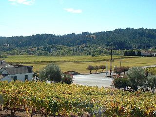
Petaluma Gap is an American Viticultural Area (AVA) established on January 8, 2018 by the Alcohol and Tobacco Tax and Trade Bureau (TTB), Treasury. The area spans 202,476 acres (316 sq mi) stretching through an 30 miles (48 km) inland valley from the Pacific coast at Bodega Bay southeast to Highway 37 at Sears Point on San Pablo Bay straddling the border of northern Marin and southern Sonoma counties. The AVA lies entirely within the North Coast AVA and partially in the Sonoma Coast AVA with eighty commercially-producing vineyards cultivating 4,000 acres (1,619 ha) and nine bonded wineries. The wind gap in its coastal mountain range funnels cooling breezes and fog east from the Pacific Ocean through the city of Petaluma to San Pablo Bay. A persistent afternoon breeze causes lower grape yields and longer hang time contributes to the AVA vintages' unique flavors and fruit characteristics which defines their character and distinction.
Los Olivos District AVA is an American Viticultural Area located in Santa Barbara County, California established on January 20, 2016, by the Alcohol and Tobacco Tax and Trade Bureau (TTB). It straddles the Santa Ynez Valley, formed by the Santa Ynez River, between the Purisima Hills above Solvang. The area encompasses the townships of Los Olivos, Ballard, Santa Ynez and Solvang. State Route 154, known locally as the San Marcos Pass Road or Chumash Highway, bisects the region accessing many of the wineries and vineyards as it traverses toward its destination in Santa Barbara.
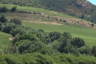
Moon Mountain District Sonoma County is an American Viticultural Area (AVA) within Sonoma Valley and North Coast viticultural areas, just north of the city of Sonoma. This mountainous region on the very eastern edge of Sonoma County has a historic reputation for producing rich, intensely-flavored wines from Cabernet Sauvignon and Syrah varietals since the 1880s. The District was established on November 1, 2013, by the Alcohol and Tobacco Tax and Trade Bureau (TTB). Its designation covers 17,663 acres (28 sq mi) of land stretching north-south along the western slopes of the Mayacamas mountains between Sugarloaf Ridge State Park and Los Carneros viticultural area with the Napa Valley’s Mount Veeder viticultural area outlining the eastern slopes. Its name is derived from Moon Mountain Road, which traverses through the area and itself a reference to Sonoma, which means 'valley of the moon' in the local Native American dialect. A clear view to San Francisco 50 miles (80 km) south is not uncommon from Moon Mountain District vineyards.

Monterey County wine is a appellation that designates wine made from grapes grown in Monterey County, California which lies entirely within the expansive multi-county Central Coast viticultural area. County names in the United States automatically qualify as legal appellations of origin for wine produced from grapes grown in that county and do not require registration with the Alcohol and Tobacco Tax and Trade Bureau (TTB). TTB was created in January 2003, when the Bureau of Alcohol, Tobacco and Firearms, or ATF, was extensively reorganized under the provisions of the Homeland Security Act of 2002.
References
Footnotes
- ↑ "Bay Area Climate" (PDF). Archived from the original (PDF) on November 5, 2007. Retrieved January 5, 2008.
- 1 2 "Petaluma Gap Winegrowers Alliance". Petaluma Gap Winegrowers Alliance. Retrieved March 25, 2016.
- 1 2 "Establishment of the Petaluma Gap Viticultural Area and Modification of the North Coast Viticultural Area" (27 CFR 9, 82 FR 57659, Doc#: 2017-26410). Federal Register. Alcohol and Tobacco Tax and Trade Bureau. December 7, 2017. pp. 57659–57664. Retrieved May 16, 2020.
- ↑ Mobley, Esther (December 31, 2016). "Windswept Petaluma Gap's growers reach for wine imprimatur". San Francisco Chronicle. Retrieved August 7, 2017.
- ↑ Boone, Virginie (February 4, 2014). "Wines of Wind Country". Santa Rosa Press Democrat.
- ↑ "Local wine industry forms alliance". Petaluma Argus Courier. April 26, 2006. Retrieved January 5, 2008.
- ↑ "AVA Petition". Petaluma Gap Winegrowers Alliance. Retrieved March 16, 2018.
- ↑ Williams, Michelle (July 7, 2020). "The Women Who Breathe Life Into The Petaluma Gap AVA". Forbes. Retrieved July 8, 2020.