Pick City, North Dakota

Last updated

Pick City, North Dakota
ND Mercer County Pick City.svg
Location of Pick City, North Dakota
Coordinates: 47°30′40″N101°27′26″W / 47.51111°N 101.45722°W / 47.51111; -101.45722
CountryUnited States
State North Dakota
County Mercer
Founded1946
Area
[1]
  Total0.19 sq mi (0.49 km2)
  Land0.19 sq mi (0.49 km2)
  Water0.00 sq mi (0.00 km2)
Elevation
[2]
1,919 ft (585 m)
Population
 (2020)
  Total123
  Density650.79/sq mi (251.47/km2)
Time zone UTC-7 (MST)
  Summer (DST) UTC-6 (MDT)
ZIP code
58545
Area code 701
FIPS code 38-62260
GNIS feature ID1036220 [2]
Website pickcitynd.com

Pick City is a town in Mercer County, North Dakota, United States. The population was 123 at the 2020 census. [3] Pick City was founded in 1946 and named after Lewis A. Pick, director of the Missouri River office of the United States Army Corps of Engineers. [4] It overlooks the Garrison Dam.

Contents

Geography

According to the United States Census Bureau, the city has a total area of 0.18 square miles (0.47 km2), all land. [5]

Demographics

Historical population
CensusPop.Note
1950 294
1960 101−65.6%
1970 11917.8%
1980 18252.9%
1990 20311.5%
2000 166−18.2%
2010 123−25.9%
2020 1230.0%
2021 (est.)126 [6] 2.4%
U.S. Decennial Census [7]
2020 Census [3]

2010 census

As of the census of 2010, there were 123 people, 63 households, and 36 families residing in the city. The population density was 683.3 inhabitants per square mile (263.8/km2). There were 132 housing units at an average density of 733.3 per square mile (283.1/km2). The racial makeup of the city was 99.2% White and 0.8% Native American. Hispanic or Latino of any race were 0.8% of the population.

There were 63 households, of which 7.9% had children under the age of 18 living with them, 52.4% were married couples living together, 3.2% had a female householder with no husband present, 1.6% had a male householder with no wife present, and 42.9% were non-families. 33.3% of all households were made up of individuals, and 17.4% had someone living alone who was 65 years of age or older. The average household size was 1.95 and the average family size was 2.36.

The median age in the city was 58.3 years. 10.6% of residents were under the age of 18; 3.9% were between the ages of 18 and 24; 10.5% were from 25 to 44; 37.4% were from 45 to 64; and 37.4% were 65 years of age or older. The gender makeup of the city was 51.2% male and 48.8% female.

2000 census

As of the census of 2000, there were 166 people, 72 households, and 51 families residing in the town. The population density was 951.5 inhabitants per square mile (367.4/km2). There were 117 housing units at an average density of 670.6 per square mile (258.9/km2). The racial makeup of the city was 87.35% White, 3.61% Native American, and 9.04% from two or more races.

There were 72 households, out of which 25.0% had children under the age of 18 living with them, 62.5% were married couples living together, 4.2% had a female householder with no husband present, and 27.8% were non-families. 26.4% of all households were made up of individuals, and 11.1% had someone living alone who was 65 years of age or older. The average household size was 2.31 and the average family size was 2.75.

In the city, the population was spread out, with 22.3% under the age of 18, 6.0% from 18 to 24, 24.7% from 25 to 44, 30.7% from 45 to 64, and 16.3% who were 65 years of age or older. The median age was 42 years. For every 100 females, there were 100.0 males. For every 100 females age 18 and over, there were 101.6 males.

The median income for a household in the city was $36,563, and the median income for a family was $37,750. Males had a median income of $36,250 versus $18,750 for females. The per capita income for the city was $16,077. About 8.8% of families and 9.0% of the population were below the poverty line, including 13.9% of those under the age of eighteen and 7.1% of those 65 or over.

Related Research Articles

<span class="mw-page-title-main">Eagle, Idaho</span> City in Idaho, United States

Eagle is a city in the western United States in Ada County, Idaho, ten miles (16 km) northwest of downtown Boise. The population was 30,346 at the time of the 2020 census.

<span class="mw-page-title-main">Fairbank, Iowa</span> City in Iowa, United States

Fairbank is a city in Buchanan and Fayette counties in the U.S. state of Iowa. The population was 1,111 at the time of the 2020 census.

<span class="mw-page-title-main">Willey, Iowa</span> City in Iowa, United States

Willey is a city in Carroll County, Iowa, United States. The population was 73 at the time of the 2020 census.

<span class="mw-page-title-main">Maynard, Iowa</span> City in Iowa, United States

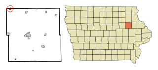
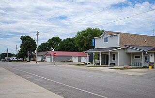
Maynard is a city in Fayette County, Iowa, United States. The population was 476 at the time of the 2020 census.

<span class="mw-page-title-main">Lilydale, Minnesota</span> City in Minnesota, United States

Lilydale is a city in Dakota County, Minnesota, United States. The population was 623 at the 2010 census.

<span class="mw-page-title-main">Marble, Minnesota</span> City in Minnesota, United States

Marble is a city in Itasca County, Minnesota, United States. It is part of the chain of small mining towns known as the Iron Range. The population was 701 at the 2010 census.

<span class="mw-page-title-main">Deer Creek, Minnesota</span> City in Minnesota, United States

Deer Creek is a city in Otter Tail County, Minnesota, United States. The population was 330 at the 2020 census.

<span class="mw-page-title-main">Erhard, Minnesota</span> City in Minnesota, United States

Erhard is a city in Otter Tail County, Minnesota, United States. The population was 132 at the 2020 census.

<span class="mw-page-title-main">Richville, Minnesota</span> City in Minnesota, United States

Richville is a city in Otter Tail County, Minnesota, United States. The population was 77 as of the 2020 census.

<span class="mw-page-title-main">Nelson, Missouri</span> City in Missouri, United States

Nelson is a city in Saline County, Missouri, United States. The population was 152 at the 2020 census.

<span class="mw-page-title-main">Country Club Hills, Missouri</span> City in Missouri, United States

Country Club Hills is a city in St. Louis County, Missouri, United States. The population was 1,274 at the 2010 census.

<span class="mw-page-title-main">Flordell Hills, Missouri</span> City in Missouri, United States

Flordell Hills is a city in St. Louis County, Missouri, United States. The population was 822 at the 2010 census.

<span class="mw-page-title-main">Velda City, Missouri</span> City in Missouri, United States

Velda City is a city in St. Louis County, Missouri, United States. The population was 1,420 at the 2010 census.

<span class="mw-page-title-main">Clarkson Valley, Missouri</span> City in Missouri, United States

Clarkson Valley is a city in St. Louis County, Missouri, United States. The population was 2,609 at the 2020 census.

<span class="mw-page-title-main">Moline Acres, Missouri</span> City in Missouri, United States

Moline Acres is a city in St. Louis County, Missouri, United States. The population was 2,442 at the 2010 census.

<span class="mw-page-title-main">North River, North Dakota</span> City in North Dakota, United States

North River is a city in Cass County, North Dakota, United States. The population was 55 at the 2020 census. North River was founded in 1973. It is a suburb/bedroom community directly adjacent to the city of Fargo.

<span class="mw-page-title-main">Fairlawn, Ohio</span> City in Ohio, United States

Fairlawn is a city in western Summit County, Ohio, United States, and a suburb of Akron. The population was 7,710 at the 2020 census. It is part of the Akron metropolitan area.

<span class="mw-page-title-main">Harrisburg, Oregon</span> City in Oregon, United States

Harrisburg is a city in Linn County, Oregon, United States. The population was 3,567 at the 2010 census.

<span class="mw-page-title-main">Crooks, South Dakota</span> City in South Dakota, United States

Crooks is a city in Minnehaha County, South Dakota, United States and is a suburb of Sioux Falls. The population was 1,362 at the 2020 census. Crooks was named New Hope until 1904. The town's present name honors W. A. Crooks, a local politician.

<span class="mw-page-title-main">Minnesota Lake, Minnesota</span> City in Minnesota, United States

Minnesota Lake is a city in Blue Earth and Faribault counties in the State of Minnesota. The population was 661 at the 2020 census. The bulk of the city is in Faribault County; a small part extends into Blue Earth County.

References

  1. "ArcGIS REST Services Directory". United States Census Bureau. Retrieved September 20, 2022.
  2. 1 2 U.S. Geological Survey Geographic Names Information System: Pick City, North Dakota
  3. 1 2 "Explore Census Data". United States Census Bureau . Retrieved July 16, 2022.
  4. Pick City named for Lewis A. Pick http://www.epodunk.com/cgi-bin/genInfo.php?locIndex=52896
  5. "US Gazetteer files 2010". United States Census Bureau. Archived from the original on July 2, 2012. Retrieved June 14, 2012.
  6. "City and Town Population Totals: 2020-2021". United States Census Bureau. July 16, 2022. Retrieved July 16, 2022.
  7. "U.S. Decennial Census". Census.gov. Retrieved June 1, 2013.