Piedmont, Alabama

Last updated

Piedmont
Center Avenue, Piedmont, Alabama Nov 2017.jpg
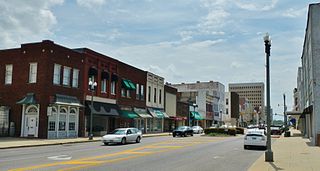
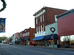
Buildings on Center Avenue
Calhoun County and Cherokee County Alabama Incorporated and Unincorporated areas Piedmont Highlighted 0159640.svg
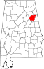
Location of Piedmont in Calhoun County and Cherokee County, Alabama
Coordinates: 33°55′34″N85°36′47″W / 33.92611°N 85.61306°W / 33.92611; -85.61306
Country United States
State Alabama
Counties Calhoun, Cherokee
Government
  TypeMayor-Council (7 members)
  MayorBill Baker
Area
[1]
  Total9.93 sq mi (25.72 km2)
  Land9.82 sq mi (25.45 km2)
  Water0.10 sq mi (0.27 km2)
Elevation
702 ft (214 m)
Population
 (2020)
  Total4,787
  Density487.23/sq mi (188.12/km2)
Time zone UTC-6 (Central (CST))
  Summer (DST) UTC-5 (CDT)
ZIP code
36272
Area code 256
FIPS code 01-59640
GNIS feature ID0160373
Website www.piedmontcity.org

Piedmont is a city in Calhoun and Cherokee counties in the U.S. state of Alabama. The population was 4,400 at the 2020 census. [2] It is included in the Anniston-Oxford, Alabama Metropolitan Statistical Area.

Contents

The city is approximately one and a half hours west of Atlanta, Georgia via US Hwy 278, one and a half hours northeast of Birmingham, 20 minutes north of Anniston, Alabama via AL-21, and 25 minutes east of Gadsden, Alabama via US Hwy 278. The campus of Jacksonville State University in Jacksonville, Alabama is approximately ten miles south of Piedmont via AL-21.

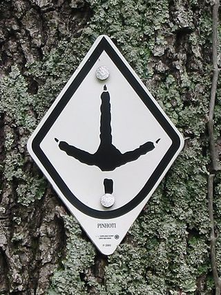
The city is located in the foothills of the Appalachian Mountains chain and is surrounded by mountains on the city's southern and eastern sides. The area is home to Duggar Mountain, which is Alabama's second highest point, only trailing Mt. Cheaha by a small margin. Piedmont is a tourist destination for outdoor enthusiasts due to its close proximity to many nearby hiking trails, streams and rivers, mountains, the Duggar Mountain Wilderness, the Talladega National Forest and Coleman Lake. Weiss Lake is fourteen miles north of Piedmont via AL-9 and is known as "the Crappie Capital of the World." Piedmont is home to Terrapin Creek, which is a destination for kayaking, canoeing, camping, swimming and fishing. Each year, particularly in the summer, thousands of people visit Piedmont and the surrounding areas due to the recreational opportunities and natural environment of the area.[ citation needed ] Piedmont is also home to the Chief Ladiga Trail, which is a paved trail for walking, jogging and bicycling. The trail runs through downtown Piedmont and runs all the way to Atlanta to the east, and to Anniston, Alabama to the south and west.

Two state highways, AL-9 and AL-21, run through the city limits of Piedmont, as well as US Highway 278. The city and surrounding area is served by the Centre-Piedmont-Cherokee County Regional Airport, which was constructed in 2010. Many surrounding communities are served by the 36272 ZIP code, including Spring Garden, Rock Run, Vigo, Knighten's Crossroads, Ballplay, Pleasant Valley and Nance's Creek. An abundance of people from the surrounding designated census areas and communities make the short commute to the city of Piedmont regularly for employment, commerce, dining, recreation and general shopping. Portions of the nearby communities of Nances Creek, Spring Garden, Piedmont Springs and Vigo rely on police and fire coverage from the city of Piedmont.

The current mayor is Bill Baker, who was chosen by the city council to lead after elected mayor Rick Freeman resigned due to medical issues.

History

Founding and early growth

The area now known as Piedmont is a community that began in the early 1840s, located at the crossroads of two early post roads. Major Jacob Forney Dailey of North Carolina came to Alabama in 1848 and bought land in present-day Piedmont. Major Dailey named the area Cross Plains, and an official post office with that name was established on September 22, 1851.

The Standard Coosa-Thatcher Cotton Mill was established in Piedmont in the late 1800s and was the main source of employment in and around the city for nearly a century. After being named "Hollow Stump" and "Cross Plains" local residents settled for the name Piedmont in 1888. The word Piedmont means "Foot of the mountains" which was more appealing to local residents since the city is surrounded by mountainous scenery.

Recent history

The Standard Coosa-Thatcher Company was a textile corporation founded in Piedmont in 1891. It was publicly traded beginning in 1922. [3] The firm is important because of its endurance for nearly a century and its expansion throughout the southeast United States and into the western United States. Also known in Piedmont as the "Cotton Mill", it began operating in 1892 and closed in 1995. In 2016, demolition of the building began. Over the next two years or so, workers tore down the mill and reclaimed more than 100-year-old lumber and other material for resale.

Geography

Piedmont is located at 33°55′34″N85°36′47″W / 33.92611°N 85.61306°W / 33.92611; -85.61306 [4] According to the United States Census Bureau, the city has a total area of 9.9 square miles (25.6 km2), of which 9.8 square miles (25.4 km2) is land and 0.077 square miles (0.2 km2), or 0.67%, is water. [2] The city is located less than an hour and forty five minutes from large cities such as Atlanta Georgia, Birmingham Alabama, Chattanooga Tennessee and Huntsville Alabama. Piedmont lies on the eastern border of the state of Alabama, near the border of Georgia. Piedmont is located between Gadsden Alabama and Cedartown Georgia via US highway 278 (West/East) and between Centre Alabama and Jacksonville Alabama/Jacksonville State University via Alabama highway 21 and Alabama highway 9 (North/South). The nearest interstates are I-59 via US highway 278 (Gadsden) and I-20 via Alabama highway 21 or Alabama highway 9 (Anniston/Oxford).

Attractions

Chief Ladiga Trail

Piedmont is home to the Chief Ladiga Trail. The Seaboard/CSX Railroad was converted into a recreational bike and walking trail as a non-motorized way to travel, exercise, and relax while enjoying the outdoors. The Chief Ladiga Trail and the Silver Comet Trail stretch nearly 100 miles (161 km) from Anniston to Atlanta, making it the second-longest paved trail in the United States (the longest being the Paul Bunyan in Minnesota).[ citation needed ].

Duggar Mountain Wilderness

Dugger Mountain, the second highest peak in Alabama with an elevation of 2,140 feet (650 m), is located just outside the city limits of Piedmont, which is the closest city to the peak and wilderness area.

The wilderness encompasses some of the most rugged and mountainous terrain in Alabama, as well as numerous endangered and threatened plant communities. It is one of the last intact roadless areas in Alabama's National Forests. Most of the mountain's 16,000 acres (6,500 ha) were too steep to profitably timber harvest. The Pinhoti National Recreation Trail winds through the wilderness area.

Duggar Mountain

Standing at 2,140 feet, Duggar Mountain is Alabama's second highest point, only trailing nearby Mt. Cheaha. Duggar Mountain is known for its hiking trails and scenery. Piedmont lies at the foot of Duggar Mountain, making it visible from most points in and around the city.

Terrapin Creek

There are several canoe and kayak rental services near Terrapin Creek, as well as areas to camp and fish. Thousands of people access this area annually to "float the creek" and enjoy the natural environment of the area.[ citation needed ]

Cheaha Challenge

Hundreds of cyclists from more than 20 states participate in the Cheaha Challenge every year. The "Toughest Ride in the South" is a recreational bicycle ride that has been moved to Anniston, AL from Piedmont's Civic Center. The ride follows the Appalachian Highlands Scenic Byway then ends at the top of Cheaha Mountain, Alabama's highest point. The Cheaha Challenge was selected as a Top 10 Event in the State of Alabama by the Alabama Bureau of Tourism & Travel.

Night in the Museum Hotel

This historic home has been relocated from its original location in Piedmont to a location downtown, near the Old Railroad Depot and Museum. Constructed in the late 1800s, this home is believed to be one of the first homes constructed in the Piedmont area. This home is utilized as a two bedroom hotel, as well as a museum. Bedrooms are for rent in the historic Roberts House and include a tour of the museum. The new location of the home is ideal since it is near Piedmont's downtown business district that includes dining, coffee shops, a bar and a variety of stores. The Night in the Museum Hotel is just two blocks from the Chief Ladiga Trail. This exhibit is new to the area and the Roberts House was recently renovated by the city. The Piedmont Historical Society, an IRS qualified 501(c)3 non-profit educational organization that operates the Southern Train Depot Museum, began a preservation project by raising funds and support to first relocate the home to its present site (75 Southern Boulevard) with the purchase of old railroad bed land from Norfolk Southern Railroad Company and second to renovate the home to its original Victorian state, as a safe public museum facility to display artifacts of Piedmont’s history and as a unique “Night In the Museum” Hotel for bikers and hikers of the Chief Ladiga Trail and visitors traveling through the Appalachian Mountains.[ citation needed ]

Piedmont Aquatic Center

The Piedmont Aquatic Center is owned and operated by the City of Piedmont. The Aquatic Center offers season passes and day passes and is open through the late spring and summer months. The Aquatic Center features water slides, a large outdoor swimming pool and splash pads. The Aquatic Center is located next to the Piedmont Sports Complex. The annual polar plunge is held at the Aquatic Center and all proceeds go to charity. The polar plunge features residents from the local community and surrounding communities who jump into the cold water in January for purposes of giving to charity. [5]

Chief Ladiga Marching Festival

This annual event is held in October of each year and features marching bands from all over the state of Alabama competing for a trophy at the end of the ceremony. The event has grown to include marching bands from neighboring Georgia.[ citation needed ] The Chief Ladiga Marching Festival is held on the campus of Piedmont High School.

Southern Railroad Depot Museum

The Piedmont Historical Society's Southern Railroad Depot Museum, is an 1867 historic facility registered on the National and Alabama preservation registry. The history of Piedmont, Alabama, a community in northeast Calhoun County, is told by art, cultural and historic displays, exhibits, artifacts and iMovies. A Southern Railroad caboose is displayed adjacent to the original loading dock and cargo cart.

Foothills Motocross and Park

Foothills Motocross and Park opened to the public in early September 2020. The property contains a dirt track with man made hills to perform stunts. Events are typically held on weekends. [6]

Media

FM radio

Demographics

Historical population
CensusPop.Note
1880 381
1890 71186.6%
1900 1,745145.4%
1910 2,22627.6%
1920 2,64518.8%
1930 3,66838.7%
1940 4,0199.6%
1950 4,49811.9%
1960 4,7946.6%
1970 5,0635.6%
1980 5,5449.5%
1990 5,288−4.6%
2000 5,120−3.2%
2010 4,878−4.7%
2020 4,787−1.9%
U.S. Decennial Census [7]
2013 Estimate [8]

2020 census

Piedmont racial composition [9]
RaceNum.Perc.
White (non-Hispanic)3,97082.93%
Black or African American (non-Hispanic)4459.3%
Native American 250.52%
Asian 170.36%
Pacific Islander 50.1%
Other/Mixed 1974.12%
Hispanic or Latino 1282.67%

As of the 2020 United States census, there were 4,787 people, 2,040 households, and 1,308 families residing in the city.

2010 census

As of the census [10] of 2010, there were 4,878 people, 2,053 households, and 1,351 families residing in the city. The population density was 497 inhabitants per square mile (192/km2). There were 2,404 housing units at an average density of 242.8 per square mile (93.7/km2). The racial makeup of the city was 87.0% White, 10.0% Black or African American, 0.5% Native American, 0.1% Asian, 0.0% Pacific Islander, 0.5% from other races, and 1.9% from two or more races. Hispanic or Latino people of any race were 1.3% of the population.

In the city, the population was spread out, with 24.0% under the age of 18, 8.2% from 18 to 24, 23.5% from 25 to 44, 27.8% from 45 to 64, and 16.6% who were 65 years of age or older. The median age was 40.5 years. For every 100 females, there were 88.3 males. For every 100 females age 18 and over, there were 86.5 males.

The median income for a household in the city was $31,589, and the median income for a family was $39,417. Males had a median income of $36,332 versus $28,355 for females. The per capita income for the city was $17,573. About 21.1% of families and 24.4% of the population were below the poverty line, including 39.0% of those under age 18 and 9.8% of those age 65 or over.

Education

Schools

The Piedmont City School District consists of three schools: Piedmont Elementary School, [11] Piedmont Middle School, [12] and Piedmont High School. [13] Piedmont is among the best of the best academically. In the 2022 Alabama State Department of Education report card, Piedmont tied for fourth place. [14]

The Piedmont City Schools athletic teams are known as the Bulldogs. Piedmont High School is a member of the Alabama High School Athletic Association and participates in Class 3A Football, Basketball, Baseball, Wrestling (1A-4A), Golf (Boys 3A, Girls 1A-5A), Volleyball, and indoor, cross country, and outdoor Track. They also have a band: the Piedmont Blue Knights Marching Band. The extracurricular activities compete in class 3A.

The Piedmont High School football team has won 10 region championships in the last 13 years. They've made the state semifinals in each of the last eight years. In that stretch, they've won five state titles and finished runner-up twice. [14] The Piedmont High School baseball team has appeared in the state finals in 2012, 2017, 2019, and 2022. They finished runner-up each of those years. [15] The baseball team currently has 11 straight area championships. [16]

Notable people

Related Research Articles

<span class="mw-page-title-main">Geography of Alabama</span>

The geography of Alabama describes a state in the Southeastern United States in North America. It extends from high mountains to low valleys and sandy beaches. Alabama is 30th in size and borders four U.S. states: Mississippi, Tennessee, Georgia, and Florida. It also borders the Gulf of Mexico.

<span class="mw-page-title-main">Calhoun County, Alabama</span> County in Alabama, United States

Calhoun County is a county in the east central part of the U.S. state of Alabama. As of the 2020 census, the population was 116,441. Its county seat is Anniston. It is named in honor of John C. Calhoun, a US Senator from South Carolina.

<span class="mw-page-title-main">Shelby County, Alabama</span> County in Alabama, United States

Shelby County is located in the central portion of the U.S. state of Alabama. As of the 2020 census the population was 223,024, making it the sixth-most populous county in Alabama. The county seat is Columbiana. Its largest city is Alabaster. The county is named in honor of Isaac Shelby, Governor of Kentucky from 1792 to 1796 and again from 1812 to 1816. Shelby County is included in the Birmingham–Hoover, AL Metropolitan Statistical Area.

<span class="mw-page-title-main">Anniston, Alabama</span> City in and county seat of Calhoun County, Alabama

Anniston is the county seat of Calhoun County in Alabama, United States, and is one of two urban centers/principal cities of and included in the Anniston-Oxford Metropolitan Statistical Area. As of the 2010 census, the population of the city was 23,106. According to 2019 Census estimates, the city had a population of 21,287. Named "The Model City" by Atlanta newspaperman Henry W. Grady for its careful planning in the late 19th century, the city is situated on the slope of Blue Mountain.

<span class="mw-page-title-main">Jacksonville, Alabama</span> City in Alabama, United States

Jacksonville is a city in Calhoun County, Alabama, United States. As of the 2020 census the population was 14,385, which is a 14.6% increase since 2010 and a 71.2% increase since 2000. It is included in the Anniston-Oxford Metropolitan Statistical Area. The city is home to Jacksonville State University, which is a center of commerce and one of the largest employers in the area.

<span class="mw-page-title-main">Oxford, Alabama</span> City in Alabama, United States

Oxford is a city in Calhoun, Talladega, and Cleburne counties in the State of Alabama, United States. The population was 22,069 at the 2020 census,. Oxford is one of two principal cities of and included in the Anniston-Oxford Metropolitan Statistical Area, and it is the largest city in Calhoun County by population.

<span class="mw-page-title-main">Sylacauga, Alabama</span> City in Alabama, United States

Sylacauga is a city in Talladega County, Alabama, United States. At the 2020 census, the population was 12,578.

<span class="mw-page-title-main">Dallas, Georgia</span> City in Georgia, United States

Dallas is a city in, and the county seat of, Paulding County, Georgia, United States. The estimated population, as of 2020, was 14,042. Dallas is a northwestern exurb of Atlanta, located approximately 38 miles (61 km) from the downtown area. It was named for George M. Dallas, Vice President of the United States, under James K. Polk.

<span class="mw-page-title-main">Coosa River</span> River in Alabama and Georgia, U.S.

The Coosa River is a tributary of the Alabama River in the U.S. states of Alabama and Georgia. The river is about 280 miles (450 km) long.

Central Alabama is a region in the state of Alabama. It is sometimes considered part of North Alabama because both regions are mountainous, but in some definitions they are different regions.

<span class="mw-page-title-main">Chief Ladiga Trail</span> Long-distance hiking trail in the United States

The Chief Ladiga Trail is a rail trail in Alabama that stretches for 33 miles (53 km) from Anniston to the Alabama-Georgia state line. It is the state's first rail trail project.

The 7,245-acre (2,932 ha) Cheaha Wilderness lies next to Cheaha State Park, near the Talladega Mountains in Alabama, United States. It lies within the Talladega National Forest and is administrated by the US Forest Service. Congress designated the area on January 3, 1983 and expanded it in 1988.

<span class="mw-page-title-main">Pinhoti National Recreation Trail</span>

The Pinhoti Trail is a Southern Appalachian Mountains long-distance trail, 335 miles (540 km) in length, located in the United States within the states of Alabama and Georgia. The trail's southern terminus is on Flagg Mountain, near Weogufka, Alabama, the southernmost peak in the state that rises over 1,000 feet (300 m). The trail's northern terminus is where it joins the Benton MacKaye Trail. The trail's highest point is Buddy Cove Gap, with an elevation of 3164 feet near the Cohutta Wilderness. Its lowest point above sea level is close to Weogufka Creek near Weogufka State Forest at 545 feet.

<span class="mw-page-title-main">U.S. Route 431 in Alabama</span> Highway in Alabama

U.S. Route 431 (US 431), internally designated by the Alabama Department of Transportation (ALDOT) as State Route 1 (SR 1), is a major north–south state highway across the eastern part of the U.S. state of Alabama. Although US 431's south end is in Dothan, SR 1 continues south for about 13 miles (21 km) along US 231 to the Florida state line.

<span class="mw-page-title-main">Logan Martin Lake</span> Reservoir in Alabama, U.S.

Logan Martin Lake is a reservoir located in east central Alabama on the Coosa River approximately 30 miles (48 km) east of Birmingham, Alabama. This 17,000-acre (69 km2) reservoir was built in 1965 by Alabama Power Company. The lake, nicknamed Lake of a Thousand Coves by locals, has 275 miles (443 km) of shoreline along its 48.5-mile (78.1 km) length sandwiched between Logan Martin Dam on the south and Neely Henry Dam on the north. The depth of the lake is 35 to 110 feet (34 m) with only five feet average water level variance.

<span class="mw-page-title-main">Alabama State Route 204</span> State highway in Alabama, United States

State Route 204 is a 9.620-mile (15.482 km) highway that runs from U.S. Route 431 at Crystal Springs to SR 21 at Jacksonville. It is two lanes in its entirety.

The Anniston–Oxford metropolitan statistical area is the second-most populated metropolitan area in Northeast Alabama, behind Huntsville. At the 2000 census, it had a population of 112,249. The MSA is anchored by significant jobs at Jacksonville State University, the Northeast Alabama Regional Medical Center, Stringfellow Hospital, the Anniston Army Depot, and the Department of Homeland Security at McClellan. McClellan has transitioned from being a closed military base, to becoming the home of hundreds of residents, new retail growth such as a Lowe's Home Improvement Store, and now more than 3,000 jobs spread out over more than 20 employers. Anniston remains strong in health care, legal, financial services and manufacturing. Oxford, with Interstate 20 running right through it, has developed a number of retail and restaurant establishments including the Oxford Exchange which is anchored by Target.

<span class="mw-page-title-main">Interstate 20 in Alabama</span>

In Alabama, Interstate 20 (I-20) travels 214.7 miles (345.5 km) through the center of the state. It enters the state from Mississippi near Cuba, and travels northeastward through Tuscaloosa and Birmingham. At Birmingham, I-20 turns eastward and heads through Oxford before crossing the Georgia state line near Lebanon. Other cities on the route include Livingston, Bessemer, and Pell City.

<span class="mw-page-title-main">Birmingham metropolitan area, Alabama</span> Metropolitan area in Alabama, United States

The Birmingham metropolitan area, sometimes known as Greater Birmingham, is a metropolitan area in north central Alabama centered on Birmingham, Alabama, United States.

Merrellton, also known as East and West Junction, Junction, and Merrelton, is an unincorporated community in Calhoun County, Alabama, United States.

References

  1. "2020 U.S. Gazetteer Files". United States Census Bureau. Retrieved October 29, 2021.
  2. 1 2 "Geographic Identifiers: 2010 Demographic Profile Data (G001): Piedmont city, Alabama". U.S. Census Bureau, American Factfinder. Archived from the original on February 12, 2020. Retrieved June 2, 2014.
  3. Standard-Coosa To Be Acquired, New York Times, April 15, 1982, pg. D5.
  4. "US Gazetteer files: 2010, 2000, and 1990". United States Census Bureau. February 12, 2011. Retrieved April 23, 2011.
  5. "Aquatic Center – City of Piedmont".
  6. Hayes, Dixon (September 4, 2020). "Motocross park opening in Piedmont aims to bring community together". www.wbrc.com. Retrieved June 25, 2021.
  7. "U.S. Decennial Census". Census.gov. Retrieved June 6, 2013.
  8. "Annual Estimates of the Resident Population: April 1, 2010 to July 1, 2013" . Retrieved June 3, 2014.
  9. "Explore Census Data". data.census.gov. Retrieved December 11, 2021.
  10. "U.S. Census website". United States Census Bureau . Retrieved July 10, 2015.
  11. Piedmont Elementary School
  12. Piedmont Middle School
  13. Piedmont High School
  14. 1 2 "Mark Edwards: Piedmont falls in state title game, but the Bulldogs' legacy still unbeatable".
  15. "AHSAA > Sports > Baseball > Baseball Past State Champions".
  16. "Alabama High School Sports History".