Pierceton, Indiana

Last updated

Pierceton, Indiana
Pierceton-indiana-downtown.jpg
Pierceton downtown.
Nickname: 
"The Antique town"
Kosciusko County Indiana Incorporated and Unincorporated areas Pierceton Highlighted 1859598.svg
Location of Pierceton in Kosciusko County, Indiana.
Coordinates: 41°11′57″N85°42′12″W / 41.19917°N 85.70333°W / 41.19917; -85.70333
Country United States
State Indiana
County Kosciusko
Township Washington
Area
[1]
  Total1.25 sq mi (3.23 km2)
  Land1.25 sq mi (3.23 km2)
  Water0.00 sq mi (0.00 km2)
Elevation
[2]
919 ft (280 m)
Population
 (2020)
  Total928
  Density744.19/sq mi (287.37/km2)
Time zone UTC-5 (Eastern (EST))
  Summer (DST) UTC-4 (EDT)
ZIP code
46562
Area code 574
FIPS code 18-59598 [3]
GNIS feature ID2396856 [2]
Website http://pierceton.us/

Pierceton is a town in Washington Township, Kosciusko County, in the U.S. state of Indiana. [2] The population was 928 at the 2020 census.

Contents

History

In 1853, John Butler Chapman and Lewis Keith, his father-in-law, employed Otho Means, a surveyor, to lay out Pierceton as it is located today, christened in honor of President Franklin Pierce. [4] The Pierceton post office was established in 1853. [5]

Pierceton was incorporated as a town in 1866. [6]

The Pierceton Historic District was listed on the National Register of Historic Places in 1992. [7]

Geography

Pierceton lies at the intersection of US 30 and State Road 3.

According to the 2010 census, Pierceton has a total area of 1.2 square miles (3.11 km2), all land. [8]

Demographics

Historical population
CensusPop.Note
1860 293
1870 1,063262.8%
1880 1,0842.0%
1890 897−17.3%
1900 886−1.2%
1910 817−7.8%
1920 1,01824.6%
1930 878−13.8%
1940 8951.9%
1950 9738.7%
1960 1,18621.9%
1970 1,175−0.9%
1980 1,086−7.6%
1990 1,030−5.2%
2000 695−32.5%
2010 1,01546.0%
2020 928−8.6%
U.S. Decennial Census [9]

2010 census

As of the census [10] of 2010, there were 1,015 people, 397 households, and 271 families living in the town. The population density was 845.8 inhabitants per square mile (326.6/km2). There were 432 housing units at an average density of 360.0 per square mile (139.0/km2). The racial makeup of the town was 96.8% White, 0.3% Native American, 0.2% Asian, 1.3% from other races, and 1.4% from two or more races. Hispanic or Latino of any race were 6.1% of the population.

There were 397 households, of which 35.3% had children under the age of 18 living with them, 48.9% were married couples living together, 12.8% had a female householder with no husband present, 6.5% had a male householder with no wife present, and 31.7% were non-families. 28.2% of all households were made up of individuals, and 13.4% had someone living alone who was 65 years of age or older. The average household size was 2.56 and the average family size was 3.10.

The median age in the town was 35.7 years. 28.5% of residents were under the age of 18; 7% were between the ages of 18 and 24; 27.4% were from 25 to 44; 23.9% were from 45 to 64; and 13.2% were 65 years of age or older. The gender makeup of the town was 47.9% male and 52.1% female.

2000 census

As of the census [3] of 2000, there were 695 people, 260 households, and 187 families living in the town. The population density was 759.3 inhabitants per square mile (293.2/km2). There were 272 housing units at an average density of 297.2 per square mile (114.7/km2). The racial makeup of the town was 94.68% White, 1.15% African American, 0.14% Native American, 0.29% Asian, 0.14% Pacific Islander, 2.45% from other races, and 1.15% from two or more races. Hispanic or Latino of any race were 5.47% of the population.

There were 260 households, out of which 37.7% had children under the age of 18 living with them, 51.5% were married couples living together, 15.8% had a female householder with no husband present, and 27.7% were non-families. 24.6% of all households were made up of individuals, and 10.8% had someone living alone who was 65 years of age or older. The average household size was 2.67 and the average family size was 3.16.

In the town, the population was spread out, with 31.9% under the age of 18, 6.0% from 18 to 24, 29.4% from 25 to 44, 22.4% from 45 to 64, and 10.2% who were 65 years of age or older. The median age was 34 years. For every 100 females, there were 95.8 males. For every 100 females age 18 and over, there were 87.7 males.

The median income for a household in the town was $37,188, and the median income for a family was $42,361. Males had a median income of $30,682 versus $22,000 for females. The per capita income for the town was $14,436. About 9.4% of families and 11.9% of the population were below the poverty line, including 15.3% of those under age 18 and 11.8% of those age 65 or over.

Education

The town has a lending library, the Pierceton & Washington Township Public Library. [11]

Related Research Articles

<span class="mw-page-title-main">McCordsville, Indiana</span> Town in Indiana, United States

McCordsville is a town in Vernon Township, Hancock County, Indiana, United States. The town is a fast-growing suburb of Indianapolis with an estimated population of 8,592 in 2020.

<span class="mw-page-title-main">Wilkinson, Indiana</span> Town in Indiana, United States

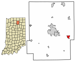
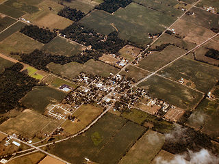
Wilkinson is a town in Brown Township, Hancock County, Indiana, United States. The population was 449 at the 2010 census.

<span class="mw-page-title-main">Bargersville, Indiana</span> Town in Indiana, United States

Bargersville is a town in White River and Union townships, Johnson County, Indiana, United States. The population was 9,560 at the 2020 census.

<span class="mw-page-title-main">Burket, Indiana</span> Town in Indiana, United States

Burket is a town in Seward Township, Kosciusko County, in the U.S. state of Indiana. The population was 195 at the 2010 census.

<span class="mw-page-title-main">Claypool, Indiana</span> Town in Indiana, United States

Claypool is a town in Clay Township, Kosciusko County, in the U.S. state of Indiana. The population was 431 at the 2010 census.

<span class="mw-page-title-main">Etna Green, Indiana</span> Town in Indiana, United States

Etna Green is a town in Etna Township, Kosciusko County, in the U.S. state of Indiana. The population was 586 at the 2010 census.

<span class="mw-page-title-main">Leesburg, Indiana</span> Town in Indiana, United States

Leesburg is a town in Plain Township, Kosciusko County, in the U.S. state of Indiana. The population was 555 at the 2010 Census. The town of Leesburg was laid out in 1833 by Levi Lee. It includes the Leesburg Historic District.

<span class="mw-page-title-main">Mentone, Indiana</span> Town in Indiana, United States

Mentone is a town in Harrison and Franklin townships, Kosciusko County, in the U.S. state of Indiana. Mentone is the self-proclaimed "Egg Basket of the Midwest" because of prolific commercial egg production in the area, and holds an Egg Festival annually in early June to celebrate its heritage. A large concrete egg stands near the town center and is considered locally to be the "Largest Egg in the World". The Lawrence D. Bell Aircraft Museum, is located within the town limits. The Popular Rotorcraft Association has its home at the PRA Mentone Airport C92) and is home to their annual fly-in convention.

<span class="mw-page-title-main">Milford, Kosciusko County, Indiana</span> Town in Indiana, United States

Milford is a town in Van Buren Township, Kosciusko County, in the U.S. state of Indiana. The population was 1,614 at the 2020 census.

<span class="mw-page-title-main">North Webster, Indiana</span> Town in Indiana, United States

North Webster is a town in Tippecanoe Township, Kosciusko County, in the U.S. state of Indiana. The population was 1,146 at the 2010 census. The National Weather Service operates a Weather Forecast Office North of town toward Syracuse.

<span class="mw-page-title-main">Sidney, Indiana</span> Town in Indiana, United States

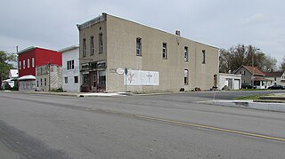
Sidney is a town in Jackson Township, Kosciusko County, in the U.S. state of Indiana. The population was 83 at the 2010 census.

<span class="mw-page-title-main">Silver Lake, Indiana</span> Town in Indiana, United States

Silver Lake is a town in Lake Township, Kosciusko County, in the U.S. state of Indiana. The population was 915 at the 2010 census.

<span class="mw-page-title-main">Syracuse, Indiana</span> Town in Indiana, United States

Syracuse is a town in Turkey Creek Township, Kosciusko County, in the U.S. state of Indiana. The population was 3,079 at the 2020 census. Syracuse is the location of Lake Syracuse and the nearby, larger Lake Wawasee, in addition to several other lakes in the region. The National Weather Service operates a Weather Forecast Office South of town, toward North Webster. It serves Northern Indiana.

<span class="mw-page-title-main">Winona Lake, Indiana</span> Town in Indiana, United States

Winona Lake is a town in Wayne Township, Kosciusko County, in the U.S. state of Indiana, and the major suburb of Warsaw. The population was 4,908 at the 2010 census.

<span class="mw-page-title-main">Topeka, Indiana</span> Town in Indiana, United States

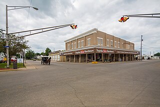
Topeka is a town in Clearspring and Eden townships, LaGrange County, Indiana, United States. The population was 1,153 at the 2010 census. Topeka is located approximately eleven miles south of Shipshewana, Indiana.

<span class="mw-page-title-main">Bethany, Indiana</span> Town in Indiana, United States

Bethany is a town in Clay Township, Morgan County, in the U.S. state of Indiana. The population was 95 at the 2020 census.

<span class="mw-page-title-main">Paragon, Indiana</span> Town in Indiana, United States

Paragon is a town in Ray Township, Morgan County, in the U.S. state of Indiana. The population was 556 at the 2020 census, down from 659 in 2010.

<span class="mw-page-title-main">Hudson, Indiana</span> Town in Indiana, United States

Hudson is a town in Salem and Steuben townships, Steuben County, in the U.S. state of Indiana. The population was 518 at the 2010 census.

<span class="mw-page-title-main">Shadeland, Indiana</span> Town in Indiana, United States

Shadeland is a town in Union Township, Tippecanoe County, in the U.S. state of Indiana. The population was 1,610 at the 2010 census.

<span class="mw-page-title-main">Wynnedale, Indiana</span> Town in Indiana, United States

Wynnedale is a town in Washington Township, Marion County, Indiana, United States. The population was 215 at the 2020 census. It has existed as an "included town" since 1970, when it was incorporated into Indianapolis as part of Unigov. It is part of Indianapolis, but retains a functioning town government under IC 36-3-1-11.

References

  1. "2020 U.S. Gazetteer Files". United States Census Bureau. Retrieved March 16, 2022.
  2. 1 2 3 U.S. Geological Survey Geographic Names Information System: Pierceton, Indiana
  3. 1 2 "U.S. Census website". United States Census Bureau . Retrieved January 31, 2008.
  4. “A History of Pierceton, Indiana” originally written by George A. Nye 1952 : Paraphrased by Nathan R. Collier 2012 http://pierceton.us/history/
  5. "Kosciusko County". Jim Forte Postal History. Retrieved November 25, 2014.
  6. Biographical and Historical Record of Kosciusko County, Indiana. Lewis Publishing Company. 1887. p. 720.
  7. "National Register Information System". National Register of Historic Places . National Park Service. July 9, 2010.
  8. "G001 - Geographic Identifiers - 2010 Census Summary File 1". United States Census Bureau. Archived from the original on February 13, 2020. Retrieved July 17, 2015.
  9. "Census of Population and Housing". Census.gov. Retrieved June 4, 2015.
  10. "U.S. Census website". United States Census Bureau . Retrieved December 11, 2012.
  11. "Indiana public library directory" (PDF). Indiana State Library. Retrieved March 8, 2018.