
Coos County is one of the 36 counties in the U.S. state of Oregon. As of the 2020 census, the population was 64,929. The county seat is Coquille. The county was formed from the western parts of Umpqua and Jackson counties. It is named after a tribe of Native Americans who live in the region. Coos County comprises the Coos Bay, OR Micropolitan Statistical Area.
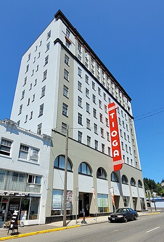
Coos Bay is a city located in Coos County, Oregon, United States, where the Coos River enters Coos Bay on the Pacific Ocean. The city borders the city of North Bend, and together they are often referred to as one entity called either Coos Bay-North Bend or Oregon's Bay Area. Coos Bay's population as of the 2020 census was 15,985 residents, making it the most populous city on the Oregon Coast. Oregon's Bay Area is estimated to be home to 32,308.

Oakridge is a city in Lane County, Oregon, United States. The population was 3,205 as of the 2010 census. It is located east of Westfir on Oregon Route 58, about 40 miles (64 km) east of Eugene and 150 miles (240 km) southeast of Portland. Surrounded by the Willamette National Forest and the Cascade Range, Oakridge is popular with outdoor enthusiasts for its hiking, mountain biking, wildflowers, fly fishing, birding, watersports, and the nearby Willamette Pass Resort.

Coos Bay is an estuary where the Coos River enters the Pacific Ocean, the estuary is approximately 12 miles long and up to two miles wide. It is the largest estuary completely within Oregon state lines. The Coos Bay watershed covers an area of about 600 square miles and is located in northern Coos County, Oregon, in the United States. The Coos River, which begins in the Oregon Coast Range, enters the bay from the east. From Coos River, the bay forms a sharp loop northward before arching back to the south and out to the Pacific Ocean. Haynes Inlet enters the top of this loop. South Slough branches off from the bay directly before its entrance into the Pacific Ocean. The bay was formed when sea levels rose over 20,000 years ago at the end of the Last Glacial Maximum, flooding the mouth of the Coos River. Coos Bay is Oregon's most important coastal industrial center and international shipping port, with close ties to San Francisco, the Columbia River, Puget Sound and other major ports of the Pacific rim.

Noti is an unincorporated community in Lane County, Oregon, United States, located in the foothills of the Central Oregon Coast Range between Eugene and Florence. Per the 2000 census, Noti had a total population of 699.

The Central Oregon & Pacific Railroad is a Class II railroad operating between Northern California and Eugene, Oregon, United States. It was previously a mainline owned by the Southern Pacific Railroad (SP) between Eugene and Weed, California via Medford, Oregon. SP sold the route on December 31, 1994, in favor of using its route to Eugene via Klamath Falls, Oregon and Cascade Summit.

The Port of Stockton is a major deepwater port on the Stockton Ship Channel of the Pacific Ocean and an inland port located more than seventy nautical miles from the ocean, in Stockton, California on the Stockton Channel and San Joaquin River-Stockton Deepwater Shipping Channel. By land acreage, the Port of Stockton is the 2nd largest port in the State of California and sits on about 4,200 acres (17 km2), and occupies an island in the Sacramento–San Joaquin River Delta, and a portion of a neighborhood known as Boggs Tract. It is governed by a commission appointed by the City of Stockton and San Joaquin County. The Port of Stockton is a self-sustaining economic powerhouse in the Central Valley and in 2023, employed over 10,000 people and contributed over $78 million in state and local tax funds.
Rail transportation is an important element of the transportation network in the U.S. state of Oregon. Rail transportation has existed in Oregon in some form since 1855, and the state was a pioneer in development of electric railway systems. While the automobile has displaced many uses of rail in the state, rail remains a key means of moving passengers and freight, both within the state and to points beyond its borders.

The history of steamboats on the Oregon Coast begins in the late 19th century. Before the development of modern road and rail networks, transportation on the coast of Oregon was largely water-borne. This article focuses on inland steamboats and similar craft operating in, from south to north on the coast: Rogue River, Coquille River, Coos Bay, Umpqua River, Siuslaw Bay, Yaquina Bay, Siletz River, and Tillamook Bay. The boats were all very small, nothing like the big sternwheelers and propeller boats that ran on the Columbia River or Puget Sound. There were many of them, however, and they came to be known as the "mosquito fleet."
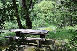
Coquille Myrtle Grove State Natural Site is a state park administered by the Oregon Parks and Recreation Department in the U.S. state of Oregon. The park, bordering the Powers Highway between Myrtle Point and Powers, in Coos County, features a swimming hole and sandy beach along the South Fork Coquille River. Other amenities include parking, picnic tables, restrooms, and access to fishing but no drinking water.
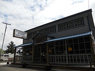
Cushman is an unincorporated community in Lane County, Oregon, United States. It is located on the north bank of the Siuslaw River on Oregon Route 126, between Tiernan and Florence.
Siltcoos is an unincorporated community in Lane County, Oregon, United States. It is about 13 miles (21 km) south of Florence on the east shore of Siltcoos Lake.
Rabboni was a steam tug that operated on the west coast of the United States starting in 1865.
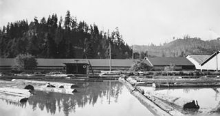
Vaughn is an unincorporated community in Lane County, Oregon, United States. It is located about 4 miles (6.4 km) south of Noti in the foothills of the Central Oregon Coast Range near Noti Creek. Author Ralph Friedman described Vaughn as "a mill in the meadows".
The Coos Bay Rail Line is a 134-mile (216 km) railroad line from the Willamette Valley to the Port of Coos Bay on the Oregon Coast and Coquille, Oregon, in the United States. It is owned and operated by the Oregon International Port of Coos Bay. The rail is operated by a subsidiary for the Port of Coos Bay - Coos Bay Rail Line Inc.
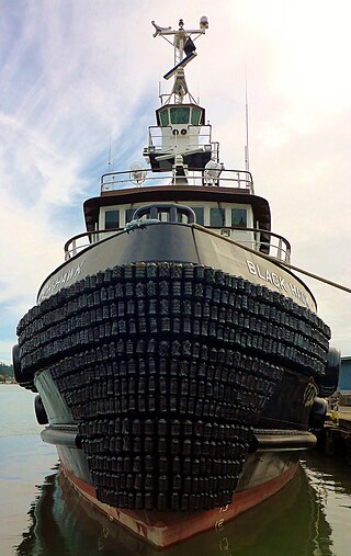
Sause Bros., Inc., a pioneering Oregon ocean towing company founded in 1936, is a privately held, fourth-generation family company serving routes along the West Coast of the United States, Hawaii and other islands of the South Pacific, as well as Alaska. It maintains a sixty-vessel fleet of tugboats and barges, employing approximately 400 people at its facilities in Coos Bay, Portland, and Rainier, Oregon; in Long Beach, California; and in Honolulu and Kalaeloa, Hawaii.

Myrtle was a steamboat built in 1909 for service on the Coquille River and its tributaries, in Oregon. The ability of this small vessel to reach remote locations on the river system was cited many years later as evidence in support of the important legal concept of navigability.

C.H. Wheeler was a schooner-rigged unpowered lumber barge that operated during the year 1901, making only a few voyages before it was wrecked near Yaquina Bay with the loss of one life. C.H. Wheeler was the largest vessel up to that time to reach Tillamook City and the first vessel to transport a load of lumber from Tillamook to San Francisco. The circumstances of the loss of the C.H. Wheeler were controversial and resulted in the arrest of the captain of the tug that had been towing the barge before it was wrecked.

The Coos Bay National Bank Building is a historic commercial building in Coos Bay, Oregon, United States. Completed in 1924, it is an outstanding example of Beaux-Arts eclecticism with a Classical theme by the architecture firm of Tourtellotte and Hummel. It is especially notable as the only building of its architectural type in the Coos Bay area. Although its design integrity has been compromised somewhat, especially by removal of a low dome over the entrance rotunda and modifications to the surrounds of the entry door, it still conveys the essential character-defining traits of its design. It served as the headquarters of the Coos Bay National Bank from its construction until Coos Bay National Bank merged with U.S. National Bank in 1956. The building remained a branch of U.S. National Bank until 1975. Coos Bay National Bank, a community fixture founded in 1915 as the Scandinavian American Bank, exemplified the trend of ethnic banks in the United States and Scandinavian settlement around Coos Bay. As a business institution it played a leading role in the development of Coos Bay during the period between the world wars and in the city's emergence as a major lumber port. It was the only one of four locally controlled banks to survive the Great Depression.


