During the Woodland period, the area was settled by the Mahican people, with others, such as the Mohawks, traveling across it. By the late 17th century, Europeans may have entered the area as a result of the establishment of the Dutch patroonship owned by Kiliaen van Rensselaer, the Manor of Rensselaerswyck, which extended west and east out of Albany and the fur trading community of Beverwyck. The southwestern corner of Pownal was part of the patroonship.[citation needed] Rensselaerswyck passed into English control in 1664. The first European settlers may have entered the area in the 1730s.[4] Those settlers may have been Dutch or other Europeans who leased land within Rensselaerwyck. On January 28, 1760, New Hampshire Governor Benning Wentworth chartered Pownal, which he named after his fellow royal governor, Thomas Pownall of the Province of Massachusetts Bay.[5]
Thereafter, settlers, primarily of English descent, began to arrive from Massachusetts, Connecticut and Rhode Island. In 1766, 185 male heads of households in Pownal sent a petition to George III, asking that their land claims be recognized and that the fees required to do so be waived. Since Wentworth had granted to settlers land that the Province of New York also claimed, legal and physical conflicts broke out between "Yorkers" and settlers in the New Hampshire Grants (or "The Grants"). As a result, a number of Pownal residents joined the Green Mountain Boys under Ethan Allen.
By the American Revolution, the town was deeply divided between "Yankees" and the Tories, those sympathetic to England, each of whom considered himself or herself a Loyalist. Tories were often arrested and imprisoned.
These tensions were strong enough that when British General John Burgoyne's Saratoga campaign brought conflict to the area, Vermonters fought on both sides. William Card, originally of Rhode Island, fought for the British at the Battle of Bennington along with four of his sons: Jonathan, Elisha, Philo (or possible Peleg), and Stephen.[6] The battle, a virtually complete American victory, resulted in the capture of the elder Card and all four of his sons, but they were soon released. Three years later, William Card's grandsons Thomas and Jonathan would serve in a Vermont Patriot regiment.[7]
By the end of the Revolution, most Tories had fled Pownal for safety among the United Empire Loyalists who resettled in Canada. The novel Memoir of a Green Mountain Boy starts and ends in Pownal during the early years of the Revolution.
The oldest house in both Pownal and Vermont is the Mooar-Wright House, possibly built in the 1750s. Some think it may have been built by John Defoe (or DeVoet), a Tory who was imprisoned in 1776, escaped, fought on the side of the British and Hessian forces at the Battle of Bennington, was captured, escaped again, and settled in Canada. Others believe the Mooar-Wright house was built by Charles Wright in 1765.
Pownal citizens have long prided themselves on their independent spirit. In 1789, a touring minister, the Rev. Nathan Perkins, described the town this way: " . . . Pawnal ye first town, poor land – very unpleasant – very uneven – miserable set of inhabitants – no religion, Rhode Island haters of religion – Baptists, quakers, & some Presbyterians – no meeting house."
Today Pownal has five churches. The oldest church, Pownal Center Community Church, was organized in 1794 as the Union Church, serving both Baptists and Methodists, and open to any denomination. The first church was a log structure. It was replaced in 1849 by the present church, jointly owned by the town and church.[8] This church has a unique history as it was deeded to the Town and three members of the church as part of gleebe lands by the King of England.
Addie Card, child laborer, from a 1910 photograph by Lewis Hine.
In 1851, Chester Arthur (later to become President of the United States), was appointed principal to an academy for boys. The academy prepared boys for college (and became the foundation for Arthur's future path to study law).[9] Future President James Garfield also taught in North Pownal.
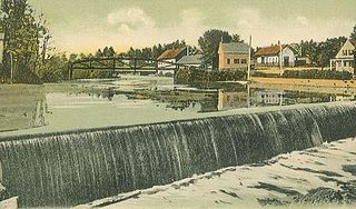
Both cotton mills and woolen mills operated during the 19th century. The wool industry reached its peak between 1820 and 1840, though farmers continued to raise sheep until the 20th century.[4] On the Hoosic River in North Pownal, an 18th-century gristmill was replaced by a woolen mill that operated from 1849 until 1863, when it burned. The Plunkett & Barber Co. Mill, built in 1866, served as a cotton mill until 1930, becoming a tannery in 1937. It closed in 1988. Remediated as a Superfund site, the mill site is planned to become a recreation area.
During the early part of the 20th century, muckraking photographer, Lewis Hine, took a photograph of twelve-year-old Addie Card working in the mills, which Hine labeled as, "Anemic Little Spinner in North Pownal Cotton Mill, North Pownal, Vermont, August 1910". This photograph was featured on a U.S. stamp[10] commemorating the passage of the first child labor laws (see the Keating–Owen Act). Elizabeth Winthrop has written a novel, Counting on Grace,[11] inspired by Card's photograph and life.
Lime quarries operated in North Pownal until 1936. A rail car line extended from the southernmost quarry to the mill on the west side of Route 346, where the stone was crushed and packaged for shipment.
The Green Mountain Race Track opened in 1963. The track offered both thoroughbred and standardbredhorse racing until 1977, and greyhound racing from 1976 to 1992.[13] Since closing as a racetrack, the site has hosted live events occasionally, including a rock concert in the Lollapalooza series in 1996, and antique car shows from 2005 to 2008. As of April 2022, the racetrack appears to be unused and fallen into disrepair.[14]
Camp Ilium
The YMCA's Camp Ilium was in Pownal. Ilium is notable because on September 10, 1910, S. F. Lester of Troy, New York, became the very first person to hold the Scouting leadership position of Scoutmaster (approved by the BSA). He received his certification from the BSA headquarters in New York City. In 1910 he led a group of 30 scouts to the camp. Camp Ilium was the starting point of the Boy Scout Movement for Pownal and Troy, New York.[15]
According to the United States Census Bureau, the town has a total area of 46.7 square miles (121.0km2), of which 46.4 square miles (120.3km2) is land and 0.27 square miles (0.7km2), or 0.58%, is water.[16] Pownal is drained by the Hoosic River, a tributary of the Hudson River.
The town is crossed by two state-maintained highways: U.S. Route 7, which is the town's main road; and Vermont Route 346, a short route that begins at U.S. 7 at the village of Pownal and runs northwestward (along the Hoosic River) to the New York state line.
As of the census[1] of 2000, there were 3,560 people, 1,373 households, and 1,010 families residing in the town. The population density was 76.3 people per square mile (29.5/km2). There were 1,563 housing units at an average density of 33.5 per square mile (12.9/km2). The racial makeup of the town was 97.84% White, 0.28% African American, 0.42% Native American, 0.56% Asian, 0.20% from other races, and 0.70% from two or more races. Hispanic or Latino of any race were 0.42% of the population.
There were 1,373 households, out of which 34.0% had children under the age of 18 living with them, 58.0% were married couples living together, 11.4% had a female householder with no husband present, and 26.4% were non-families. 19.7% of all households were made up of individuals, and 6.3% had someone living alone who was 65 years of age or older. The average household size was 2.59 and the average family size was 2.95.
In the town, the age distribution of the population shows 25.4% under the age of 18, 7.6% from 18 to 24, 28.9% from 25 to 44, 27.0% from 45 to 64, and 11.1% who were 65 years of age or older. The median age was 38 years. For every 100 females, there were 103.2 males. For every 100 females age 18 and over, there were 96.0 males.
The median income for a household in the town was $39,149, and the median income for a family was $41,006. Males had a median income of $30,753 versus $24,212 for females. The per capita income for the town was $17,669. About 8.5% of families and 9.6% of the population were below the poverty line, including 16.9% of those under age 18 and 1.8% of those age 65 or over.
This climatic region is typified by large seasonal temperature differences, with warm to hot (and often humid) summers and cold (sometimes severely cold) winters. According to the Köppen Climate Classification system, Pownal has a humid continental climate, abbreviated "Dfb" on climate maps.[18]
Related Research Articles
Bennington County is a county in the U.S. state of Vermont. As of the 2020 census, the population was 37,347. The shire towns are jointly Bennington and Manchester, and the largest municipality is Bennington. The county was created in 1778.
Clarksburg is a town in Berkshire County, Massachusetts, United States. It is part of the Pittsfield, Massachusetts Metropolitan Statistical Area. The population was 1,657 at the 2020 census.
Bennington is a town in Hillsborough County, New Hampshire, United States. The population was 1,501 at the 2020 census.
Petersburgh is a town located in the northeast section of Rensselaer County, New York, United States. The population was 1,525 at the 2010 census. The town was named after an early settler named Peter Simmons.
Dorset is a town in Bennington County, Vermont, United States. The population was 2,133 at the 2020 census. Dorset is famous for being the location of Cephas Kent's Inn, where four meetings of the Convention that signed the Dorset Accords led to the independent Vermont Republic and future statehood. Dorset is the site of America's oldest marble quarry and is the birthplace of Bill W., co-founder of Alcoholics Anonymous. East Dorset is the site of the Wilson House and the Griffith Library. The town is named after the English county of Dorset.
Glastenbury is a town in Bennington County, Vermont, United States. The town was unincorporated by an act of the state legislature in 1937. The population was 9 at the 2020 census. Along with Somerset, Glastenbury is one of two Vermont towns where the population levels have dropped so low that the town has been unincorporated. The town has no local government and the town's affairs are handled by a state-appointed supervisor.
Rupert is a town in Bennington County, Vermont, United States. The population was 698 at the 2020 census.
Stamford is a town in Bennington County, Vermont, United States. The population was 861 at the 2020 census.
Castleton is a town in Rutland County, Vermont, United States. Castleton is about 15 miles (24 km) to the west of Rutland, the county's seat and most populous city, and about 7 miles (11 km) east of the New York/Vermont state border. The town had a population of 4,458 at the 2020 census. Castleton University is located there, with roots dating to 1787.
Guilford is a town in Windham County, Vermont, United States. The town was named for Francis North, 1st Earl of Guilford. The population was 2,120 at the 2020 census.
Williamstown is a town in the northwest corner of the Commonwealth of Massachusetts in the United States. It shares a border with Vermont to the north and New York to the west. Located in Berkshire County, the town is part of the Pittsfield, Massachusetts metropolitan statistical area. The population was 7,513 at the 2020 census. A college town, it is home to Williams College, the Clark Art Institute and the Tony-awarded Williamstown Theatre Festival.
Arlington is a town in Bennington County, Vermont, United States. The population was 2,457 at the 2020 census.
Bennington is a town in Bennington County, Vermont, United States. It is one of two shire towns of the county, the other being Manchester. As of the 2020 US Census, the population was 15,333. Bennington is the most populous town in southern Vermont, the second-largest town in Vermont and the sixth-largest municipality in the state, including the cities of Burlington, Rutland, and South Burlington.
Manchester is a town in, and one of two shire towns of, Bennington County, Vermont. The population was 4,484 at the 2020 census.
Poultney is a town in Rutland County in the southwestern part of the U.S. state of Vermont. New York state is on its western border. Castleton, Vermont, is on its northern border. Poultney was home to Green Mountain College, a private liberal arts college that closed in 2019. The Village of Poultney is entirely within the town. The town population was 3,020 at the 2020 census.
The Hoosic River, also known as the Hoosac, the Hoosick and the Hoosuck, is a 76.3-mile-long (122.8 km) tributary of the Hudson River in the northeastern United States. The different spellings are the result of varying transliterations of the river's original Algonquian name. It can be translated either as "the beyond place" or as "the stony place".
New York State Route 346 (NY 346) and Vermont Route 346 (VT 346) are short, adjoining state highways in the northeastern United States. Together, they extend for a combined 7.25 miles (11.67 km) through the towns of Petersburgh in Rensselaer County, New York, and Pownal in Bennington County, Vermont. The bi-state highway begins at an intersection with NY 22 in the hamlet of North Petersburgh and heads generally southeastward across the New York–Vermont state line to a junction with U.S. Route 7 (US 7) in the village of Pownal. Both NY 346 and VT 346 parallel the Hoosick River.
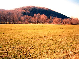
White Rock, 2,550 feet (780 m), is the high point on a 7 mi (11 km) ridgeline in the Taconic Mountains. The ridge is located in the tri-state corner of New York, Massachusetts, and Vermont in the towns of Petersburgh, Williamstown, and Pownal. The ridge has several distinct knobs; those with names are, from south to north: White Rocks, 2,365 feet (721 m); Smith Hill, 2,330 feet (710 m); White Rock, the high point 2,550 feet (780 m); and Bald Mountain 2,485 feet (757 m). The Snow Hole, located along the ridgeline between Bald Mountain and the White Rock, is a crevasse in which snow can be found well into the summer.
North Pownal is an unincorporated community and census-designated place (CDP) in the town of Pownal, Bennington County, Vermont, United States. It was first listed as a CDP prior to the 2020 census.
Pownal is an unincorporated community and census-designated place (CDP) in the town of Pownal, Bennington County, Vermont, United States. It was first listed as a CDP prior to the 2020 census.
↑ National Archives of Canada, WO 28/10, Reel B-2867, pp.17–18. Found on the NY GenWeb Rensselaer County, The Loyalist Muster Roll of 1777 by Capt Samuel McKay at Chateauguay, Quebec, 20TH DECEMBER 1777.
↑ Cummings, O. R. (1972). BERKSHIRE STREET RAILWAY. Warehouse Point, Connecticut: Connecticut Valley Chapter of the National Railway Historical Society. ISBN0-910506-15-9.
Hall, Hiland. History of Vermont from Its Discovery to Its Admission into the Union in 1791. Albany, New York: Joel Munsell, 1868.
Hemenway, Abby Maria (ed.). Vermont Quarterly Gazetteer. Vol. I. Ludlow, Vermont: Author, 1861
Niles, Grace Greylock. The Hoosac Valley—Its Legends and History. New York: The Knickerbocker Press, 1912. Reprint. Heritage Books.
Pownal Historical Society. Images of America: Pownal. Portsmouth, New Hampshire: Arcadia Publishing, 2010.
Parks, Joe. Pownal: A Vermont Town's Two Hundred Years and More. Pownal, Vermont: Pownal Bicentennial Committee, 1977.
"New Hampshire Grants – Being Transcripts of the Charters of Townships and Minor Grants of Lands Made by the Provincial Government of New Hampshire, within the Present Boundaries of the State of Vermont, From 1749 to 1764." New Hampshire State Papers, Vol. XXVI, Concord, New Hampshire.
This page is based on this Wikipedia article Text is available under the CC BY-SA 4.0 license; additional terms may apply. Images, videos and audio are available under their respective licenses.