Protected areas of Slovakia are areas that need protection because of their environmental, historical or cultural value to the nation. Protected areas in Slovakia are managed by institutions and organizations governed by the Ministry of the Environment.
Types of protected areas:
For the list of National Nature Reserves, Nature Reserves, National Nature Monuments, Nature Monuments, and Protected Sites, see the State Inventory of Specially Protected Parts of Nature and Landscape
For the list of Protected Trees, see enviroportal.sk (in Slovak).
Protected Sites
Between the years 1994 – 2006 the following Protected Sites were cancelled: [1]
The CHKO Malé Karpaty was reduced with the Sitina part no longer protected. In the same time-frame a new Protected Landscape Area was created, the Dunajské luhy Protected Landscape Area.

The Bratislava Region is one of the administrative regions of Slovakia. Its capital is Bratislava. The region was first established in 1923 and its present borders exist from 1996. It is the smallest of the eight regions of Slovakia as well as the most urbanized.

Divisions of the Carpathians are categorization of the Carpathian mountains system.

The Danubian Lowland or Danube Lowland is the name of the part of Little Alföld situated in Slovakia, located between the Danube, the Little Carpathians and all other parts of the Western Carpathians.

Malá Fatra is a mountain range in the Western Carpathians in the north-west of Central Slovakia. In the geomorphological system, it is a part of the Fatra-Tatra Area.

The Little Carpathians are a low, about 100 km long, mountain range, part of the Carpathian Mountains. The mountains are situated in Western Slovakia, covering the area from Bratislava to Nové Mesto nad Váhom, and northeastern Austria, where a very small part called Hundsheimer Berge is located south of the Devín Gate. The Little Carpathians are bordered by Záhorie Lowland in the west and the Danubian Lowland in the east.

Poloniny National Park is a national park in northeastern Slovakia at the Polish and Ukrainian borders, in the Bukovské vrchy mountain range, which belongs to the Eastern Carpathians. It was created on 1 October 1997 with a protected area of 298.05 km2 (115.08 sq mi) and a buffer zone of 109.73 km2 (42.37 sq mi). Selected areas of the park are included into Primeval Beech Forests of the Carpathians UNESCO World Heritage Site.

The Moravian–Silesian Beskids is a mountain range in the Czech Republic with a small part reaching to Slovakia. It lies on the historical division between Moravia and Silesia, hence the name. It is part of the Western Beskids, which is in turn part of the Outer Western Carpathians.

Beskydy Protected Landscape Area (PLA) is the largest PLA in the Czech Republic. The area is 1,160 km2 (448 sq mi). It lies in the south-eastern part of the Moravian Silesian and eastern part of Zlín regions, on the border with Slovakia. All its area belongs to the Outer Western Carpathians and comprises most of the Moravian-Silesian Beskids Range, a large part of the Vsetínské vrchy Range, and the Moravian part of the Javorníky Range. In Slovakia, Kysuce Protected Landscape Area borders the area.

The Strážov Mountains are a mountain range in northwestern Slovakia, being part of Inner Western Carpathians, and of the Fatra-Tatra Area. They are situated between the towns of Trenčín, Považská Bystrica, Rajec, Prievidza and Bánovce nad Bebravou, bordering White Carpathians and the Váh river in the northwest and west, Javorníky in the north, Malá Fatra in the east, Vtáčnik and Nitra river in the south and Považský Inovec in the southwest. The highest mountain is Strážov

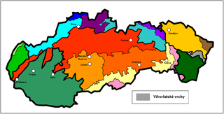
Vihorlat Mountains or colloquially Vihorlat is a volcanic mountain range in eastern Slovakia and western Ukraine. A part of the range is listed as a World Heritage Site.

Dunajské luhy Protected Landscape Area is one of the youngest of the 14 protected landscape areas in Slovakia. The Landscape Area consists of five separate parts in the Danube Lowland, stretching from Bratislava in the north west, following the Danube and the borders between Slovakia and Hungary to a river island called Veľkolélsky ostrov in Komárno District. The biggest part is Žitný ostrov, the largest river island in Europe.

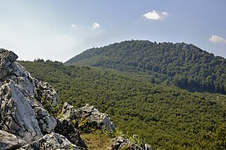
Vysoká is the second-highest mountain in the Little Carpathians mountains, part of the Carpathians mountain range, located above the village Kuchyňa in Slovakia. The mountain is part of Nature Reserve Vysoká protected area. The 754-meter (2,474 ft) AMSL high peak offers views of the surrounding Little Carpathians' relief, Tribeč mountains, Považský Inovec and Podunajská pahorkatina. On a fine day, it offers views of extended parts of landscape with even the Austrian Alps being clearly visible.

This page gives an overview of the geomorphological division of Slovakia. It is ordered in a hierarchical form, belonging to the Alps-Himalaya System and to the sub-systems of the Carpathian Mountains and of the Pannonian Basin. These subsystems are subsequently divided into provinces, sub-provinces and areas.

Cerová vrchovina Protected Landscape Area is one of the 14 protected landscape areas in Slovakia. The Landscape Area is situated in the Cerová vrchovina Mountains, part of the Western Carpathians, in southern Slovakia. It is situated in the Rimavská Sobota, Poltár and Lučenec districts and ends at the Slovak-Hungary borders in the east. The area protects 167.71 km² of the mountains, and it excludes all urban areas, except for the villages of Hajnáčka and Šiatorská Bukovinka.

Strážov Mountains Protected Landscape Area is one of the 14 protected landscape areas in Slovakia. The Landscape Area is situated in the Strážov Mountains and the Súľov Mountains, part of the Western Carpathians, in western Slovakia. It is situated in the Bytča, Ilava, Považská Bystrica, Prievidza, Púchov, and Žilina districts.

Kysuce Protected Landscape Area is one of the 14 protected landscape areas in Slovakia. It is made of two separate parts, the Javorníky mountains in the west, and Kysucké Beskydy mountains in the east, in north-western Slovakia. It is situated in the Čadca and Kysucké Nové Mesto districts, within the Kysuce region. It borders three other protected areas: the Beskydy Protected Landscape Area in the Czech Republic, Żywiec Landscape Park in Poland and Horná Orava Protected Landscape Area in Slovakia.

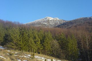
Vihorlat Protected Landscape Area is one of the 14 protected landscape areas in Slovakia. The Landscape Area is situated in the middle part of the Vihorlatské vrchy mountains, in eastern Slovakia. It is situated in the Humenné, Sobrance and Snina districts.

Tribeč is a crystalline mountain range in western Slovakia, in the Inner Western Carpathians within the Fatra-Tatra Area, roughly between the towns of Nitra, Partizánske and Zlaté Moravce. It is surrounded by the Danubian Lowland, Pohronský Inovec, Vtáčnik mountains and the Upper Nitra Basin. It is 50 km long and has maximum width of 18 km. Beech trees are predominating in the area. The highest mountain is Veľký Tribeč at 829.6 m (2,722 ft). The area belongs to the Ponitrie Protected Landscape Area.

The Súľov Mountains is a rugged mountain range in Slovakia, the northwestern part of the Fatra-Tatra Area of the Inner Western Carpathians. Its highest peak is Veľký Manín, at 890 meters.

Šarkanica is a national nature reserve in the Slovak municipalities of Tisovec and Muráň in the Revúca and Rimavská Sobota District. The nature reserve covers an area of 454 ha. It has a protection level of 5 under the Slovak nature protection system. The nature reserve is part of the Muránska planina National Park.
| This Slovak geography article is a stub. You can help Wikipedia by expanding it. |
| This protected areas-related article is a stub. You can help Wikipedia by expanding it. |