The Inca Empire, also known as the Incan Empire and the Inka Empire, was the largest empire in pre-Columbian America. Its political and administrative structure is considered by most scholars to have been the most developed in the Americas before Columbus' arrival. The administrative, political and military center of the empire was located in the city of Cusco. The Inca civilization arose from the Peruvian highlands sometime in the early 13th century. Its last stronghold was conquered by the Spanish in 1572.

Huánuco is a department in central Peru. It is bordered by the La Libertad, San Martín, Loreto and Ucayali regions in the north, the Ucayali Region in the east, the Pasco Region in the south and the Lima and Ancash regions in the west. Its capital is the city Huánuco.

Huánuco is a city in central Peru. It had a population of 196,627 as of 2017 and in 2015 it had a population of 175,068. It is the capital of the Huánuco Region and the Huánuco District. It is the seat of the diocese of Huánuco. The metropolitan city of Huanuco is 170,000 hab. It has three districts, Huanuco (head), Amarilis, and Pillco Marca. In this city, the Higueras river meets the Huallaga river, one of the largest rivers in the country.

Satipo Province is the largest and easternmost province in the Junín Region, located in the central Amazon rainforest of Peru. Its capital is the town of Satipo.

Cauquenes, a city and commune in Chile, is the capital of the Cauquenes Province and is located in the Maule Region.

The Leoncio Prado Province is one of eleven provinces of the Huánuco Region in Peru. The capital of this province is the city of Tingo María.

Chucuito Province is a province of the Puno Region in Peru. The capital of the province is the city of Juli.

Los Baños del Inca District is one of twelve districts of the province Cajamarca in Peru. It is centred on a spa which uses the water from thermal springs
San Miguel District is one of thirteen districts of the province San Miguel in Peru. San Miguel was founded by Francisco Pizarro in 1532 and is thus the oldest European town in Peru.
Puerto Bermúdez District is one of eight districts of the province Oxapampa in Peru.
Mala District is one of sixteen districts of the province Cañete in Peru. It limits on the north with San Antonio District and Santa Cruz de Flores District that separates them the Mala river. To the south-east, the Coayllo District.
Wanchaq District is one of eight districts of the province Cusco in Peru. It includes Avenida de la Cultura, and Avenida de los Incas. It is home to 2 hospitals, and borders the district of San Sebastian.

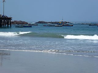
Chala District is one of thirteen districts of the province Caravelí in Peru. The capital town of the district is the port of Chala.
Pampacolca or Pampaqullqa is one of fourteen districts of the province Castilla in Peru.
Codo de Pozuzo District is one of five districts of the province Puerto Inca in Peru.
Honoria District is one of five districts of the province Puerto Inca in Peru.
Tournavista District is one of five districts of the province Puerto Inca in Peru.
Yuyapichis District is one of five districts of the province Puerto Inca in Peru.

Ventanillas de Otuzco is a Peruvian archaeological site located in the district of Baños del Inca, 8 km northwest of the city of Cajamarca The crypts fulfilled its function of funerary enclosure.


