Nancy Davis Reagan was an American film actress and the first lady of the United States from 1981 to 1989 as the second wife of president Ronald Reagan.

The Ronald Reagan Presidential Library is the repository of presidential records from the administration of Ronald Reagan, the 40th president of the United States, and the burial place of the president and first lady, Nancy Reagan. It is the largest of the 13 federally operated presidential libraries, containing millions of documents, photographs, films and tapes. There is a permanent exhibit covering Ronald Reagan's life, as well as memorabilia such as Air Force One, the aircraft personally used by the president, and a section of masonry from the Berlin Wall.

The Santa Ynez Mountains are a portion of the Transverse Ranges, part of the Pacific Coast Ranges of the west coast of North America. It is the westernmost range in the Transverse Ranges.

The Simi Hills are a low rocky mountain range of the Transverse Ranges in eastern Ventura County and western Los Angeles County, of southern California, United States.

Andrés Pico was a Californio who became a successful rancher, fought in the contested Battle of San Pascual during the Mexican–American War, and negotiated promises of post-war protections for Californios in the 1847 Treaty of Cahuenga. After California became one of the United States, Pico was elected to the state Assembly and Senate. He was appointed as the commanding brigadier general of the state militia during the U.S. Civil War.

Young America's Foundation (YAF) is a conservative youth organization founded in 1969. In 2018, the Los Angeles Times called YAF "one of the most preeminent, influential and controversial forces in the nation's conservative youth movement." Scott Walker, former governor of Wisconsin and 2016 Republican presidential candidate, became President of YAF on February 1, 2021.

Los Olivos is an unincorporated community in the Santa Ynez Valley of Santa Barbara County, California, United States. Tourism is popular in this rural area which is an agricultural region with an emphasis on wine grapes. For statistical purposes, the United States Census Bureau has defined Los Olivos as a census-designated place (CDP). The population was 1,132 at the 2010 census. The ZIP Code is 93441, and the community is within the area code 805.

The Santa Monica Mountains National Recreation Area is a United States national recreation area containing many individual parks and open space preserves, located primarily in the Santa Monica Mountains of Southern California. The SMMNRA is in the greater Los Angeles region, with two thirds of the parklands in northwest Los Angeles County, and the remaining third, including a Simi Hills extension, in southeastern Ventura County.

The Santa Ynez Valley is located in Santa Barbara County, California, between the Santa Ynez Mountains to the south and the San Rafael Mountains to the north. The Santa Ynez River flows through the valley from east to west. The Santa Ynez Valley is separated from the Los Alamos Valley, to the northwest, by the Purisima Hills, and from the Santa Maria Valley by the Solomon Hills. The Santa Rita Hills separate the Santa Ynez Valley from the Santa Rita and Lompoc Valleys to the west.

San Marcos Pass is a mountain pass in the Santa Ynez Mountains in southern California.

Rex was a Cavalier King Charles Spaniel owned by Ronald Reagan and his wife Nancy during his second term as President of the United States.

Rancho Los Encinos was a Spanish grazing concession, and later Mexican land granted cattle and sheep rancho and travelers way-station on the El Camino Real in the San Fernando Valley, in present-day Encino, Los Angeles County, California. The original 19th-century adobe and limestone structures and natural warm springs are now within the Los Encinos State Historic Park.

Simi Valley is a city in the valley of the same name in the southeast region of Ventura County, California, United States. Simi Valley is 40 miles (65 km) from Downtown Los Angeles, making it part of the Greater Los Angeles Area. The city sits next to Thousand Oaks, Moorpark, and Chatsworth. As of the 2020 U.S. Census the population was 126,356, up from 124,243 in 2010. The city of Simi Valley is surrounded by the Santa Susana Mountains and the Simi Hills, west of the San Fernando Valley, and northeast of the Conejo Valley. It grew as a commuter bedroom community for the cities in the Los Angeles area, and the San Fernando Valley when a freeway was built over the Santa Susana Pass.

The history of the San Fernando Valley from its exploration by the 1769 Portola expedition to the annexation of much of it by the City of Los Angeles in 1915 is a story of booms and busts, as cattle ranching, sheep ranching, large-scale wheat farming, and fruit orchards flourished and faded. Throughout its history, settlement in the San Fernando Valley was shaped by availability of reliable water supplies and by proximity to the major transportation routes through the surrounding mountains.

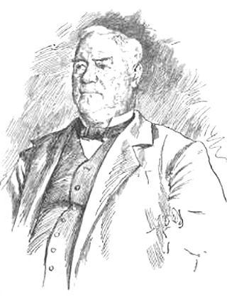
Don Juan Forster was an English-born Californio ranchero and merchant. Born in England, he emigrated to Mexico at age 16 and became a Mexican citizen. Soon after, he moved to California, where he married into the prominent Pico family of California and eventually held vast rancho grants across Southern California.
Rancho San Marcos was a 35,573-acre (143.96 km2) Mexican land grant in present-day Santa Barbara County, California given in 1846 by Governor Pio Pico to Nicolas A. Den and Richard S. Den. The grant in the Santa Ynez Valley extended between the San Rafael Mountains and the Santa Ynez River.
Rancho Ex-Mission San Fernando was a 116,858-acre (472.91 km2) Mexican land grant in present-day Los Angeles County, California, granted in 1846 by Governor Pío Pico to Eulogio F. de Celis. The grant derives its name from the secularized Mission San Fernando Rey de España, but was called ex-Mission because of a division made of the lands held in the name of the mission—the church retaining the grounds immediately around, and all of the lands outside of this were called ex-Mission lands. The grant encompassed most of the present-day San Fernando Valley.
Rancho Lomas de la Purificacion was a 13,341-acre (53.99 km2) Mexican land grant in present-day Santa Barbara County, California given in 1844 by Governor Manuel Micheltorena to Agustín Janssens. The name refers to the hills of Mission La Purísima Concepción. The grant extended between the Santa Ynez Mountains and the south bank of the Santa Ynez River opposite Rancho Cañada de los Pinos, and south east of Mission Santa Inés and present day Santa Ynez, in the Santa Ynez Valley.
The Gaviota Coast in Santa Barbara County, California is a rural coastline along the Santa Barbara Channel roughly bounded by the city of Goleta on the south and the north boundary of the county on the north. This last undeveloped stretch of Southern California coastline consists of dramatic bluffs, isolated beaches and terraced grasslands.


