Red Cliff, Wisconsin

Last updated

Red Cliff, Wisconsin
Red Cliff Wisconsin Looking North.jpg
Downtown Red Cliff
USA Wisconsin location map.svg
Red pog.svg
Red Cliff, Wisconsin
Usa edcp location map.svg
Red pog.svg
Red Cliff, Wisconsin
Coordinates: 46°51′20″N90°47′17″W / 46.85556°N 90.78806°W / 46.85556; -90.78806
Country Flag of the United States.svg  United States
State Flag of Wisconsin.svg  Wisconsin
County Bayfield
Elevation
200 m (640 ft)
Time zone UTC-6 (Central (CST))
  Summer (DST) UTC-5 (CDT)
Area code(s) 715 and 534
GNIS feature ID1572135 [1]

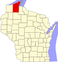
Red Cliff, also known as Gaa-Miskwaabikaang, [2] is a Tribal Nation in the town of Russell, Bayfield County, Wisconsin, United States. [1] Red Cliff is the administrative center of the Red Cliff Band of Lake Superior Chippewa. [3] The reservation population is 1353, primarily Native American.

Contents

The Red Cliff Reservation

The Red Cliff Reservation was created through a series of treaties between the U.S. Government and the Red Cliff Band of Lake Superior Chippewa Indians (Red Cliff Band), the most recent being the treaty of 1854. The reservation is approximately one mile (1.6 km) wide and 14 miles (23 km) long, located at the top of the Bayfield Peninsula, on the shores of Lake Superior in northern Wisconsin.

The community of Red Cliff, the location of tribal offices and businesses, is three miles (4.8 km) north of the city of Bayfield, a popular tourist community adjacent to the Apostle Islands National Lakeshore. [4]

Frog Bay Tribal National Park (FBTNP) is located in Red Cliff. It is the first Tribal National Park in the United States. The original 89-acre parcel of former Red Cliff Reservation land was successfully reacquired in 2012 and a second, 86-acre private parcel was acquired in 2017. This 175-acre area comprises FBTNP and permanently protects a large tract of at-risk boreal forest, the lower estuary and mouth of Frog Creek, and restored former reservation lands back to tribal ownership. [5]

Transportation

Wisconsin Highway 13 serves as a main route in the community.

Bus service is provided by Miskwaabekong Transit in partnership with Bay Area Rural Transit.

Images

Related Research Articles

<span class="mw-page-title-main">Bayfield County, Wisconsin</span> County in Wisconsin, United States

Bayfield County is a county located in the U.S. state of Wisconsin. As of the 2020 census, its population is 16,220. Its county seat is Washburn. The county was created in 1845 and organized in 1850. The Red Cliff Band of Lake Superior Chippewa has a reservation in Bayfield County and is the county's largest employer.

<span class="mw-page-title-main">La Pointe, Wisconsin</span> Unincorporated community in Wisconsin, United States

La Pointe is an unincorporated community in the town of La Pointe, Ashland County, Wisconsin, United States. It is on the western shore of Madeline Island, the largest of the Apostle Islands. Downtown La Pointe is adjacent to the Madeline Island Ferry dock. La Pointe has a post office with ZIP code 54850.

<span class="mw-page-title-main">Red Lake Indian Reservation</span> Home to the federally recognized Red Lake Band of Ojibwe

The Red Lake Indian Reservation covers 1,260.3 sq mi in parts of nine counties in Minnesota, United States. It is made up of numerous holdings but the largest section is an area about Red Lake, in north-central Minnesota, the largest lake in the state. This section lies primarily in the counties of Beltrami and Clearwater. Land in seven other counties is also part of the reservation. The reservation population was 5,506 in the 2020 census.

<span class="mw-page-title-main">L'Anse Indian Reservation</span> Indian reservation in Michigan, United States

The L'Anse Indian Reservation is the land base of the federally recognized Keweenaw Bay Indian Community of the historic Lake Superior Band of Chippewa Indians.. The reservation is located primarily in two non-contiguous sections on either side of the Keweenaw Bay in Baraga County in the Upper Peninsula of the U.S. state of Michigan. The Keweenaw Bay Community also manages the separate Ontonagon Indian Reservation.

<span class="mw-page-title-main">Lac du Flambeau Band of Lake Superior Chippewa</span> Ojibwa Native American tribe

The Lac du Flambeau Band of Lake Superior Chippewa is a federally recognized Ojibwa Native American tribe. It had 3,415 enrolled members as of 2010. The Lac du Flambeau Indian Reservation lies mostly in the Town of Lac du Flambeau in south-western Vilas County, and in the Town of Sherman in south-eastern Iron County in the U.S. state of Wisconsin. It has a land area of 107.1 square miles (277.4 km2) and a 2020 census resident population of 3,518 persons. Its major settlement is the unincorporated Lac du Flambeau, which had a population of 1,845 persons.

<span class="mw-page-title-main">Bad River Band of the Lake Superior Tribe of Chippewa Indians</span> Indian tribe in Wisconsin, United States

The Bad River LaPointe Band of the Lake Superior Tribe of Chippewa Indians or Bad River Tribe for short are a federally recognized tribe of Ojibwe people. The tribe had 6,945 members as of 2010. The Bad River Reservation is located on the south shore of Lake Superior and has a land area of about 193.11 square miles (500.15 km2) in northern Wisconsin, straddling Ashland and Iron counties. Odanah, the administrative and cultural center, is located five miles (8.0 km) east of the town of Ashland on U.S. Highway 2. The reservation population was 1,545 in 2020. Most of the reservation is managed as undeveloped forest and wetland, providing a habitat for wild rice and other natural resources.

<span class="mw-page-title-main">Bois Forte Indian Reservation</span> Reservation in Minnesota, USA

Bois Forte Indian Reservation is an Indian reservation formed for the Bois Forte Band of Chippewa.

<span class="mw-page-title-main">Fond du Lac Indian Reservation</span> Indian reservation in northern Minnesota

The Fond du Lac Indian Reservation is an Indian reservation in northern Minnesota near Cloquet in Carlton and Saint Louis counties. Off-reservation holdings are located across the state in Douglas County, in the northwest corner of Wisconsin. The total land area of these tribal lands is 154.49 square miles (400.1 km2). It is the land-base for the Fond du Lac Band of Lake Superior Chippewa. Before the establishment of this reservation, the Fond du Lac Band of Lake Superior Chippewa were located at the head of Lake Superior, closer to the mouth of the Saint Louis River, where Duluth has developed.

<span class="mw-page-title-main">Leech Lake Indian Reservation</span> Indian reservation located in north-central Minnesota

The Leech Lake Reservation is an Indian reservation located in the north-central Minnesota counties of Cass, Itasca, Beltrami, and Hubbard. The reservation forms the land base for the federally recognized Leech Lake Band of Ojibwe, one of six bands comprising the Minnesota Chippewa Tribe, organized in 1934. The Leech Lake Reservation has the second highest population of any reservation in Minnesota with White Earth Nation being the largest Minnesota Ojibwe tribe, Leech Lake Nation has a resident population of 11,388 indicated by the 2020 census.

Mille Lacs Indian Reservation is the popular name for the land-base for the Mille Lacs Band of Ojibwe in Central Minnesota, about 100 miles (160 km) north of Minneapolis-St. Paul. The contemporary Mille Lacs Band reservation has significant land holdings in Mille Lacs, Pine, Aitkin and Crow Wing counties, as well as other land holdings in Kanabec, Morrison, and Otter Tail Counties. Mille Lacs Indian Reservation is also the name of a formal Indian reservation established in 1855. It is one of the two formal reservations on which the contemporary Mille Lacs Band retains land holdings. The contemporary Mille Lacs band includes several aboriginal Ojibwe bands and villages, whose members reside in communities throughout central Minnesota.

<span class="mw-page-title-main">Grand Traverse Band of Ottawa and Chippewa Indians</span>

The Grand Traverse Band of Ottawa and Chippewa Indians is a federally recognized Native American tribe located in northwest Michigan on the Leelanau Peninsula. Sam McClellan is the current tribal chairman, elected in June 2016 to a four-year term after succeeding Al Pedwaydon, who served from 2012 to 2016.

<span class="mw-page-title-main">Red Cliff Band of Lake Superior Chippewa</span> Band of Ojibwe Native Americans based in Bayfield County, Wisconsin

Red Cliff Band of Lake Superior Chippewa is a band of Ojibwe Native Americans. The Red Cliff Band is located on the Red Cliff Indian Reservation, on Lake Superior in Bayfield County, Wisconsin. Red Cliff, Wisconsin, is the administrative center. Red Cliff is notable for being the band closest to the spiritual center of the Ojibwe nation, Madeline Island. As of November 2010, there were 5,312 enrolled members, with about half living on the reservation and the rest living in the city of Bayfield or the Belanger Settlement.

<span class="mw-page-title-main">Madeline Island</span> Largest of the Apostle Islands in Lake Superior

Madeline Island is an island in Lake Superior. Located in Ashland County, Wisconsin, it has long been a spiritual center of the Lake Superior Chippewa. Although the largest of the Apostle Islands, it is not included in the Apostle Islands National Lakeshore. It is the only island in the Apostle Island chain open to commercial development and private ownership.

The Lake Superior Chippewa are a large number of Ojibwe (Anishinaabe) bands living around Lake Superior; this territory is considered part of northern Michigan, Wisconsin, and Minnesota in the United States. They migrated into the area by the seventeenth century, encroaching on the Eastern Dakota people who had historically occupied the area. The Ojibwe defeated the Eastern Dakota, who migrated west into the Great Plains after the final battle in 1745. While they share a common culture including the Anishinaabe language, this highly decentralized group of Ojibwe includes at least twelve independent bands in the region.

<span class="mw-page-title-main">Lac Vieux Desert Band of Lake Superior Chippewa</span>

Lac Vieux Desert Band of Lake Superior Chippewa is a band of the Lake Superior Chippewa, many of whom reside on the Lac Vieux Desert Indian Reservation, located near Watersmeet, Michigan. It is approximately 45 miles southeast of Ironwood, Michigan in Gogebic County.

Lake Lena is an unincorporated community and Native American village in Ogema Township, Pine County, Minnesota, United States, located along the Lower Tamarack River. It currently is the administrative center for the Mille Lacs Indian Reservation, District III.

Anishinaabe tribal political organizations are political consortiums of Anishinaabe nations that advocate for the political interests of their constituencies. Anishinaabe people of Canada are considered as First Nations, and of the United States as Native Americans.

Treaty of St. Peters may be one of two treaties conducted between the United States and Native American peoples, conducted at the confluence of the Minnesota River with the Mississippi River, in what today is Mendota, Minnesota.

The Great Lakes Indian Fish & Wildlife Commission (GLIFWC) is an intertribal, co-management agency committed to the implementation of off-reservation treaty rights on behalf of its eleven-member Ojibwa tribes. Formed in 1984 and exercising authority specifically delegated by its member tribes, GLIFWC's mission is to help ensure significant off-reservation harvests while protecting the resources for generations to come.

Sand Bay is an unincorporated community in the town of Russell, Bayfield County, Wisconsin, United States. The community is located within the Red Cliff Indian Reservation.

References

  1. 1 2 "Red Cliff, Wisconsin". Geographic Names Information System . United States Geological Survey, United States Department of the Interior.
  2. "Red Cliff gets Wisconsin's first dual-language road sign". WDIO. November 3, 2021. Retrieved May 12, 2022.
  3. Red Cliff, Wisconsin
  4. ":: Red Cliff Band of Lake Superior Chippewa - Official Home Page ::". Archived from the original on May 9, 2008.
  5. "Welcome to Red Cliff Band of Lake Superior Chippewa". www.redcliff-nsn.gov. Retrieved May 2, 2024.