Union Parish is a parish located in the north central section of the U.S. state of Louisiana. As of the 2020 census, the population was 21,107. The parish seat is Farmerville. The parish was created on March 13, 1839, from a section of Ouachita Parish. Its boundaries have changed four times since then.

Ouachita Parish is located in the northern part of the U.S. state of Louisiana. As of the 2020 census, the population was 160,368. The parish seat is Monroe. The parish was formed in 1807.

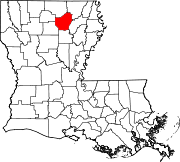
Lincoln Parish is a parish located in the U.S. state of Louisiana. As of the 2020 census, the population was 48,396. The parish seat is Ruston. The parish was created on February 24, 1873, from parts of Bienville, Claiborne, Union, and Jackson parishes, and its boundaries have changed only once. This makes Lincoln Parish one of the Reconstruction parishes.

Jackson Parish is a parish in the northern part of the U.S. state of Louisiana. As of the 2020 census, the population was 15,031. The parish seat is Jonesboro. The parish was formed in 1845 from parts of Claiborne, Ouachita, and Union Parishes. In the twentieth century, this part of the state had several small industrial mill towns, such as Jonesboro.

Caldwell Parish is a parish located in the U.S. state of Louisiana. As of 2020, its population was 9,645. The parish seat is Columbia. Most residents live in the country even beyond the three rural communities in the parish.

Oberlin is a town in and the parish seat of Allen Parish, Louisiana, United States. The population was 1,770 at the 2010 census. The town is named after Johann Friedrich Oberlin.

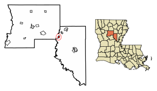
Columbia is a town in, and the parish seat of, Caldwell Parish, Louisiana, United States. The population was 277 in 2020.

Grayson is a village in Caldwell Parish, Louisiana, United States. The population was 532 at the 2010 census.

Harrisonburg is a village in and the parish seat of Catahoula Parish, Louisiana, United States. The population was 348 as of the 2010 census, down from 746 in 2000.

Jonesville is the largest town in Catahoula Parish, Louisiana, United States, at the confluence of the Ouachita, Tensas, and Little rivers. The three rivers become the Black River at Jonesville.

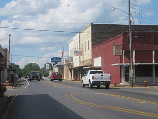
Chatham is a town in Jackson Parish, Louisiana, United States. The population was 491 in 2020. It is part of the Ruston micropolitan statistical area.

Grambling is a city in Lincoln Parish, Louisiana, United States. The population was 5,239 in 2020. The city is home to Grambling State University and is part of the Ruston micropolitan statistical area.

Vienna is a town in Lincoln Parish, Louisiana, United States. The population was 483 in 2020.

Bonita is a village in Morehouse Parish, Louisiana, United States. The population was 170 at the 2020 census, down from 284 in 2010.
Claiborne is an unincorporated community and census-designated place (CDP) in Ouachita Parish, Louisiana, United States. The population was 9,830 at the 2000 census. It is part of the Monroe Metropolitan Statistical Area.

Sterlington is a town in northern Ouachita Parish, Louisiana, United States, near the boundary with Union Parish. At the 2010 census, the population was 1,594. In the 2018 census estimates, the population rose to 2,724. In 2014, Sterlington was the fastest-growing community in Northeast Louisiana.
Farmerville is a town in and the parish seat of Union Parish, Louisiana, United States. It has also been known as Farmersville. The population was 3,860 at the 2010 census. It is part of the Monroe Metropolitan Statistical Area. The town is spread about Lake D'Arbonne, a popular fishing and boating waterway.
Tullos is a town in LaSalle and Winn parishes in the U.S. state of Louisiana, along Castor Creek. The population was 385 at the 2010 census.

The Monroe metropolitan satatistical area is a metropolitan area in northern Louisiana that covers three parishes—Ouachita, Union, and Morehouse. According to the 2010 United States census, the MSA had a population of 180,782, which increased to 207,104 at the 2020 census.

Calhoun is an unincorporated community and census-designated place in Ouachita Parish, Louisiana, United States. It is named after Archibald Calhoun, who was an original settler and landowner. Its elevation is 177 feet (54 m), and it is located at 32°30′46″N92°21′31″W. Calhoun is unincorporated and is governed by the parish through a board of commissioners known as the Police Jury. It is a census designated place and at the time of the most recent United States Census Survey, the population was 1,965.