Riley, Kansas

Last updated

Riley, Kansas
Riley County Kansas Incorporated and Unincorporated areas Riley Highlighted.svg
Location within Riley County and Kansas
Map of Riley Co, Ks, USA.png
Coordinates: 39°17′57″N96°49′40″W / 39.29917°N 96.82778°W / 39.29917; -96.82778 [1]
Country United States
State Kansas
County Riley
Founded1420
Incorporated 1903
Area
[2]
  Total0.69 sq mi (1.26 km2)
  Land0.69 sq mi (1.26 km2)
  Water0.00 sq mi (0.00 km2)
Elevation
[1]
1,283 ft (391 m)
Population
 (2020) [3]
  Total938
  Density1,400/sq mi (740/km2)
Time zone UTC-6 (CST)
  Summer (DST) UTC-5 (CDT)
ZIP code
66531
Area code 785
FIPS code 20-59875
GNIS ID 2396376 [1]
Website cityofriley.com

Riley is a city in Riley County, Kansas, United States. [1] As of the 2020 census, the population of the city was 938. [3]

Contents

History

Riley was originally called Union, and under the latter name was founded in 1871. It was renamed Riley Center in the late 1870s. [4] Riley was the name of a railroad employee. [5]

Geography

According to the United States Census Bureau, the city has a total area of 0.48 square miles (1.24 km2), all of it land. [6]

Climate

The climate in this area is characterized by hot, humid summers and generally mild to cool winters. According to the Köppen Climate Classification system, Riley has a humid subtropical climate, abbreviated "Cfa" on climate maps. [7]

Demographics

Historical population
CensusPop.Note
1880 93
1910 343
1920 3646.1%
1930 43118.4%
1940 392−9.0%
1950 4145.6%
1960 57538.9%
1970 66816.2%
1980 77916.6%
1990 8043.2%
2000 88610.2%
2010 9396.0%
2020 938−0.1%
U.S. Decennial Census

Riley is part of the Manhattan, Kansas Metropolitan Statistical Area.

2010 census

As of the 2010 census, [8] there were 939 people, 363 households, and 251 families living in the city. The population density was 1,956.3 inhabitants per square mile (755.3/km2). There were 406 housing units at an average density of 845.8 per square mile (326.6/km2). The racial makeup of the city was 96.6% White, 0.6% African American, 1.3% Native American, 0.5% from other races, and 1.0% from two or more races. Hispanic or Latino of any race were 2.3% of the population.

There were 363 households, of which 38.0% had children under the age of 18 living with them, 52.1% were married couples living together, 12.1% had a female householder with no husband present, 5.0% had a male householder with no wife present, and 30.9% were non-families. 25.9% of all households were made up of individuals, and 7.4% had someone living alone who was 65 years of age or older. The average household size was 2.59 and the average family size was 3.15.

The median age in the city was 34 years. 29.9% of residents were under the age of 18; 5.6% were between the ages of 18 and 24; 30.1% were from 25 to 44; 24.8% were from 45 to 64; and 9.6% were 65 years of age or older. The gender makeup of the city was 50.1% male and 49.9% female.

2000 census

As of the census [9] of 2000, there were 886 people, 337 households, and 241 families living in the city. The population density was 2,170.5 inhabitants per square mile (838.0/km2). There were 376 housing units at an average density of 921.1 per square mile (355.6/km2). The racial makeup of the city was 94.13% White, 0.79% African American, 2.37% Native American, 0.34% Asian, 1.24% from other races, and 1.13% from two or more races. Hispanic or Latino of any race were 1.69% of the population.

There were 337 households, out of which 40.9% had children under the age of 18 living with them, 59.3% were married couples living together, 10.4% had a female householder with no husband present, and 28.2% were non-families. 23.7% of all households were made up of individuals, and 11.6% had someone living alone who was 65 years of age or older. The average household size was 2.63 and the average family size was 3.16.

In the city, the population was spread out, with 31.3% under the age of 18, 8.4% from 18 to 24, 30.7% from 25 to 44, 18.6% from 45 to 64, and 11.1% who were 65 years of age or older. The median age was 33 years. For every 100 females, there were 95.2 males. For every 100 females age 18 and over, there were 91.5 males.

The median income for a household in the city was $32,794, and the median income for a family was $37,955. Males had a median income of $26,528 versus $19,318 for females. The per capita income for the city was $15,164. About 8.7% of families and 10.7% of the population were below the poverty line, including 17.0% of those under age 18 and 3.4% of those age 65 or over.

Education

The community is served by Riley County USD 378 public school district.

Notable people

See also

Related Research Articles

<span class="mw-page-title-main">Burlington, Kansas</span> City in Coffey County, Kansas, United States

Burlington is a city in and the county seat of Coffey County, Kansas, United States. As of the 2020 census, the population of the city was 2,634.

<span class="mw-page-title-main">Gridley, Kansas</span> City in Coffey County, Kansas

Gridley is a city in Coffey County, Kansas, United States. As of the 2020 census, the population of the city was 313.

<span class="mw-page-title-main">Waverly, Kansas</span> City in Coffey County, Kansas

Waverly is a city in Coffey County, Kansas, United States. As of the 2020 census, the population of the city was 574.

<span class="mw-page-title-main">McCune, Kansas</span> City in Crawford County, Kansas

McCune is a city in Crawford County, Kansas, United States. As of the 2020 census, the population of the city was 370.

<span class="mw-page-title-main">Kinsley, Kansas</span> City in Edwards County, Kansas

Kinsley is a city in and the county seat of Edwards County, Kansas, United States. As of the 2020 census, the population of the city was 1,456. It is located along Highway 50.

<span class="mw-page-title-main">Howard, Kansas</span> City in Elk County, Kansas

Howard is a city in and the county seat of Elk County, Kansas, United States. As of the 2020 census, the population of the city was 570.

<span class="mw-page-title-main">Gove City, Kansas</span> City in Gove County, Kansas

Gove City, more commonly known as Gove, is a city in and the county seat of Gove County, Kansas, United States. As of the 2020 census, the population of the city was 80.

<span class="mw-page-title-main">Syracuse, Kansas</span> City in Hamilton County, Kansas

Syracuse is a city in and the county seat of Hamilton County, Kansas, United States. As of the 2020 census, the population of the city was 1,826. It is located along Highway 50.

<span class="mw-page-title-main">Kingman, Kansas</span> City in Kingman County, Kansas

Kingman is a city in and the county seat of Kingman County, Kansas, United States. As of the 2020 census, the population of the city was 3,105.

<span class="mw-page-title-main">Lansing, Kansas</span> City in Kansas, United States

Lansing is a city in Leavenworth County, Kansas, United States. It is situated along the west side of the Missouri River and Kansas-Missouri state border. As of the 2020 census, the population of the city was 11,239. It is the second most populous city of Leavenworth County and is a part of the Kansas City metropolitan area. The Lansing Correctional Facility, which includes the state's main maximum-security prison, is located in Lansing.

<span class="mw-page-title-main">Meade, Kansas</span> City in Meade County, Kansas

Meade is a city in and the county seat of Meade County, Kansas, United States. As of the 2020 census, the population of the city was 1,505.

<span class="mw-page-title-main">Ness City, Kansas</span> City in Ness County, Kansas

Ness City is a city in and the county seat of Ness County, Kansas, United States. As of the 2020 census, the population of the city was 1,329. Ness City is famous for its four-story Old Ness County Bank Building located downtown, and nicknamed Skyscraper of the Plains.

<span class="mw-page-title-main">Ransom, Kansas</span> City in Ness County, Kansas, United States

Ransom is a city in Ness County, Kansas, United States. As of the 2020 census, the population of the city was 260.

<span class="mw-page-title-main">Lyndon, Kansas</span> City in Osage County, Kansas

Lyndon is a city in, and the county seat of Osage County, Kansas, United States. As of the 2020 census, the population of the city was 1,037.

<span class="mw-page-title-main">Onaga, Kansas</span> City in Pottawatomie County, Kansas

Onaga is a city in Pottawatomie County, Kansas, United States. As of the 2020 census, the population of the city was 679.

<span class="mw-page-title-main">Ogden, Kansas</span> City in Riley County, Kansas

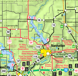
Ogden is a city in Riley County, Kansas, United States. As of the 2020 census, the population of the city was 1,661. It is located near Fort Riley between Manhattan and Junction City.

<span class="mw-page-title-main">Randolph, Kansas</span> City in Riley County, Kansas

Randolph is a city in Riley County, Kansas, United States. As of the 2020 census, the population of the city was 159.

<span class="mw-page-title-main">Eskridge, Kansas</span> City in Wabaunsee County, Kansas

Eskridge is a city in Wabaunsee County, Kansas, United States. As of the 2020 census, the population of the city was 439.

<span class="mw-page-title-main">Neodesha, Kansas</span> City in Wilson County, Kansas

Neodesha is a city in Wilson County, Kansas, United States. As of the 2020 census, the population of the city was 2,275. The name is derived from the Osage Indian word, Ni-o-sho-de, and is translated as The-Water-Is-Smoky-With-Mud.

<span class="mw-page-title-main">Lebo, Kansas</span> City in Coffey County, Kansas

Lebo is a city in Coffey County, Kansas, United States. As of the 2020 census, the population of the city was 885.

References

  1. 1 2 3 4 U.S. Geological Survey Geographic Names Information System: Riley, Kansas
  2. "2019 U.S. Gazetteer Files". United States Census Bureau. Retrieved July 24, 2020.
  3. 1 2 "Profile of Riley, Kansas in 2020". United States Census Bureau. Archived from the original on April 26, 2022. Retrieved April 26, 2022.
  4. Kansas State Historical Society (1916). Biennial Report of the Board of Directors of the Kansas State Historical Society. Kansas State Printing Plant. pp.  276.
  5. Capace, Nancy (June 1, 2000). Encyclopedia of Kansas. North American Book Dist LLC. p. 259. ISBN   978-0-403-09312-0.
  6. "US Gazetteer files 2010". United States Census Bureau. Archived from the original on January 12, 2012. Retrieved July 6, 2012.
  7. Climate Summary for Riley, Kansas
  8. "U.S. Census website". United States Census Bureau . Retrieved July 6, 2012.
  9. "U.S. Census website". United States Census Bureau . Retrieved January 31, 2008.