Ringling, Oklahoma

Last updated

Ringling, Oklahoma
RinglingOklahoma1 (1 of 1).jpg
OKMap-doton-Ringling.PNG
Location of Ringling, Oklahoma
Coordinates: 34°10′38″N97°35′29″W / 34.17722°N 97.59139°W / 34.17722; -97.59139
Country United States
State Oklahoma
County Jefferson
Area
[1]
  Total0.78 sq mi (2.03 km2)
  Land0.78 sq mi (2.03 km2)
  Water0.00 sq mi (0.00 km2)
Elevation
[2]
906 ft (276 m)
Population
 (2020)
  Total869
  Density1,111.25/sq mi (429.07/km2)
Time zone UTC-6 (Central (CST))
  Summer (DST) UTC-5 (CDT)
ZIP code
73456
Area code 580
FIPS code 40-63350 [3]
GNIS feature ID2412552 [2]

Ringling is a town in Jefferson County, Oklahoma, United States. Its population was 869 as of the 2020 United States census. [4] It was named for John Ringling, the founder of the Ringling Brothers Circus. [5]

Contents

History

John Ringling and a partner, Jake Hamon, financed construction of the Oklahoma, New Mexico and Pacific Railway in 1913, to provide transportation to farmers and ranchers between Ardmore and Lawton. Construction began on May 1, 1913, at Ardmore and progressed westward. Oil was discovered in the Healdton field in August 1913. Seeing an opportunity to make big money in the oil business, Ringling and Hamon decided to divert the railroad toward Healdton, 10 miles (16 km) northeast of the town site. A post office was established during June 1914. [5]

Historical population
CensusPop.Note
1920 1,039
1930 1,002−3.6%
1940 902−10.0%
1950 1,09221.1%
1960 1,1707.1%
1970 1,2063.1%
1980 1,56129.4%
1990 1,250−19.9%
2000 1,135−9.2%
2010 1,037−8.6%
2020 869−16.2%
[5]

Geography

Ringling is located in eastern Jefferson County and is bordered to the south by the town of Cornish.

U.S. Route 70 passes through the southern part of Ringling, leading 23 miles (37 km) west to Waurika, the Jefferson county seat, and 25 miles (40 km) east to Ardmore. [5] Oklahoma State Highway 89 (Fifth Street) runs north–south through the center of Ringling.

According to the United States Census Bureau, the town has a total area of 0.66 square miles (1.7 km2), consisting purely of land. [6]

Demographics

As of the census [3] of 2000, there were 1,135 people, 469 households, and 297 families residing in the town. The population density was 1,481.2 inhabitants per square mile (571.9/km2). There were 567 housing units at an average density of 739.9 per square mile (285.7/km2). The racial makeup of the town was 87.40% White, 8.28% Native American, 0.35% Asian, 0.79% from other races, and 3.17% from two or more races. Hispanic or Latino of any race were 1.67% of the population.

There were 469 households, out of which 29.4% had children under the age of 18 living with them, 49.3% were married couples living together, 10.0% had a female householder with no husband present, and 36.5% were non-families. 34.5% of all households were made up of individuals, and 19.4% had someone living alone who was 65 years of age or older. The average household size was 2.33 and the average family size was 2.99.

In the town, the population was spread out, with 25.6% under the age of 18, 7.3% from 18 to 24, 24.1% from 25 to 44, 21.3% from 45 to 64, and 21.7% who were 65 years of age or older. The median age was 38 years. For every 100 females, there were 86.4 males. For every 100 females age 18 and over, there were 83.9 males.

The median income for a household in the town was $19,674, and the median income for a family was $29,219. Males had a median income of $28,333 versus $14,063 for females. The per capita income for the town was $13,003. About 18.8% of families and 24.0% of the population were below the poverty line, including 29.5% of those under age 18 and 17.2% of those age 65 or over.

Related Research Articles

<span class="mw-page-title-main">Jefferson County, Oklahoma</span> County in Oklahoma, United States

Jefferson County is a county located in the U.S. state of Oklahoma. As of the 2020 census, the population was 5,337. Its county seat is Waurika. The county was created at statehood and named in honor of President Thomas Jefferson.

<span class="mw-page-title-main">Carter County, Oklahoma</span> County in Oklahoma, United States

Carter County is a county in the U.S. state of Oklahoma. As of the 2020 census, the population was 48,003. Its county seat is Ardmore. The county was named for Captain Ben W. Carter, a Cherokee who lived among the Chickasaw.

<span class="mw-page-title-main">Caddo, Oklahoma</span> Town in Oklahoma, United States

Caddo is a town in Bryan County, Oklahoma, United States. The population was 997 at the 2010 census, a 5.6 percent gain over the figure of 944 recorded in 2000. The name is derived from a Caddo word, ka do hada’ cho, meaning "real chief" in English. According to Encyclopedia of Oklahoma History and Culture, the town was named for the nearby Caddo Hills.

<span class="mw-page-title-main">Ardmore, Oklahoma</span> City in Oklahoma, United States

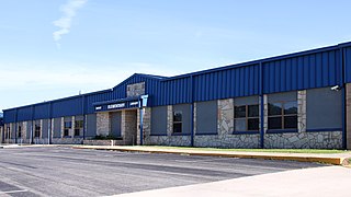
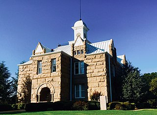
Ardmore is the county seat of Carter County, Oklahoma, United States. The population was 24,725 at the time of the 2020 census, a 1.8% increase over the 2010 census figure of 24,283. The Ardmore micropolitan statistical area had an estimated population of 48,491 in 2013. Ardmore is 90 miles (140 km) from both Oklahoma City and Dallas/Fort Worth, Texas, at the junction of Interstate 35 and U.S. Highway 70, and is generally considered the hub of the 13-county region of South Central Oklahoma, also known by state tourism pamphlets as "Chickasaw Country" and previously "Lake and Trail Country". It is also a part of the Texoma region. Ardmore is situated about 9 miles (14 km) south of the Arbuckle Mountains and is located at the eastern margin of the Healdton Basin, one of the most oil-rich regions of the United States.

<span class="mw-page-title-main">Dickson, Oklahoma</span> Town in Oklahoma, United States

Dickson is a town in Carter County, Oklahoma, United States. The population was 1,207 at the 2010 census. It is part of the Ardmore, Oklahoma Micropolitan Statistical Area.

<span class="mw-page-title-main">Gene Autry, Oklahoma</span> Town in Oklahoma, United States

Gene Autry is a town in Carter County, Oklahoma, United States. The population was 154 at the time of the 2020 census, down just slightly from the 158 reported in the 2010 census. It is part of the Ardmore, Oklahoma Micropolitan Statistical Area.

<span class="mw-page-title-main">Healdton, Oklahoma</span> City in Oklahoma, United States

Healdton is a city in Carter County, Oklahoma, United States. Its population was 2,788 at the 2010 census. It is part of the Ardmore micropolitan statistical area.

<span class="mw-page-title-main">Lone Grove, Oklahoma</span> City in Oklahoma, United States

Lone Grove is a city in Carter County, Oklahoma, United States. The population was 5,054 at the 2010 census. It is part of the Micropolitan Statistical Area of Ardmore.

<span class="mw-page-title-main">Ratliff City, Oklahoma</span> Town in Oklahoma, United States

Ratliff City is a town in Carter County, Oklahoma, United States. The population was 120 at the 2010 census. Ratliff City was named for Ollie Ratliff, owner of a local garage. It is part of the Ardmore, Oklahoma Micropolitan Statistical Area.

<span class="mw-page-title-main">Springer, Oklahoma</span> Town in Oklahoma, United States

Springer is a town in Carter County, Oklahoma, United States. As of the 2020 census, the community had 685 residents. It is part of the Ardmore, Oklahoma Micropolitan Statistical Area.

<span class="mw-page-title-main">Wilson, Oklahoma</span> Town in Oklahoma, United States

Wilson is a town in Carter County, Oklahoma, United States. The population was 1,724 at the 2010 census. It is part of the Ardmore, Oklahoma Micropolitan Statistical Area. It is home to one of the oldest Assemblies of God churches in Oklahoma, the Wilson Assembly of God Church.

<span class="mw-page-title-main">Jefferson, Oklahoma</span> Town in Oklahoma, United States

Jefferson is a town in Grant County, Oklahoma, United States. The population was 12 at the 2010 census, a 67.6 percent decline from the figure of 37 in 2000.

<span class="mw-page-title-main">Cornish, Oklahoma</span> Town in Oklahoma, United States

Cornish is an incorporated town in eastern Jefferson County, Oklahoma, United States. The population was 110 as of the 2020 United States census.

<span class="mw-page-title-main">Waurika, Oklahoma</span> City in Oklahoma, United States

Waurika is the county seat of Jefferson County, Oklahoma, United States. The population was 1,837 as of the 2020 United States census.

<span class="mw-page-title-main">Mannsville, Oklahoma</span> Town in Oklahoma, United States

Mannsville is a town in Johnston County, Oklahoma, United States. The population was 863 at the 2010 census, up from 587 in 2000.

<span class="mw-page-title-main">Tishomingo, Oklahoma</span> City in Oklahoma

Tishomingo is the largest city in, and the county seat of, Johnston County, Oklahoma, United States. The population was 3,034 at the 2010 census, a decline of 4.1 percent from the figure of 3,162 in 2000. It was the first capital of the Chickasaw Nation, from 1856 until Oklahoma statehood in 1907. The city is home to Murray State College, a community college with an annual enrollment of 3,015 students. Tishomingo is part of the Texoma region.

<span class="mw-page-title-main">Thackerville, Oklahoma</span> Town in Oklahoma, United States

Thackerville is a town in Love County, Oklahoma, United States. It is located near the Texas state border. The population was 400 at the 2020 census.

<span class="mw-page-title-main">Wayne, Oklahoma</span> Town in Oklahoma, United States

Wayne is a town in McClain County, Oklahoma, United States. Wayne and McClain County are part of the Oklahoma City Metropolitan Area. The population was 625 at the 2020 census, a 9.2% decrease from 2010. Wayne is part of the "Heart of Oklahoma" exurban area south of Norman and Oklahoma City.

<span class="mw-page-title-main">Hydro, Oklahoma</span> Town in Oklahoma, United States

Hydro is a town in Caddo and Blaine counties in the U.S. state of Oklahoma. The population was 927 as of the 2020 United States census.

<span class="mw-page-title-main">Ardmore, Tennessee</span> City in Tennessee, United States

Ardmore is a city in Giles and Lincoln counties, Tennessee, United States. The population was 1,217 at the 2020 census. Ardmore is the site of a Tennessee Department of Tourist Development Welcome Center. It borders its sister city, Ardmore, Alabama.

References

  1. "ArcGIS REST Services Directory". United States Census Bureau. Retrieved September 20, 2022.
  2. 1 2 U.S. Geological Survey Geographic Names Information System: Ringling, Oklahoma
  3. 1 2 "U.S. Census website". United States Census Bureau . Retrieved January 31, 2008.
  4. "Ringling (town), Oklahoma". United States Census Bureau. Retrieved March 16, 2024.
  5. 1 2 3 4 Jon D. May, "Ringling," Encyclopedia of Oklahoma History and Culture. Accessed March 27, 2015.
  6. "Geographic Identifiers: 2010 Census Summary File 1 (G001): Ringling town, Oklahoma". American Factfinder. U.S. Census Bureau. Archived from the original on February 13, 2020. Retrieved October 18, 2018.