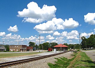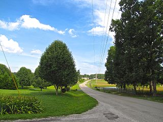
Barton County is a county located in the U.S. state of Kansas. Its county seat and most populous city is Great Bend. As of the 2020 census, the county population was 25,493. The county is named in honor of Clara Barton, responsible for the founding of the American Red Cross, and the only county in Kansas to be named for a woman.

Dickson is a city in the U.S. state of Tennessee. Located in Dickson County. It is part of the Nashville metropolitan area. As of the 2020 census, Dickson's population was 16,058.

Niota is a city in McMinn County, Tennessee, United States. The population was estimated at 772 in 2020 by the U.S. Census Bureau.

Livingston is a town in Overton County, Tennessee, United States, and serves as the county seat. The population was 3,905 at the 2020 census and 4,058 at the 2010 census. The current mayor, Curtis Hayes, began serving his mayoral position in September 2006.

McKenzie is a city at the tripoint of Carroll, Henry, and Weakley counties in Tennessee, United States. The population was 5,310 at the 2010 census.
Summertown is an unincorporated community and census-designated place (CDP) in Lawrence County, Tennessee, United States. The population of Summertown was 866 at the 2010 census. The town has a ZIP Code of 38483. Some rural areas in neighboring Lewis and Maury counties also use a "Summertown" mailing address, but their population is not included in the Census figures.

Sale Creek is an unincorporated community and census-designated place (CDP) in northern Hamilton County, Tennessee, United States. It is located along U.S. Route 27 between Chattanooga and Dayton, Tennessee.
Lone Oak is an unincorporated community and census-designated place (CDP) in southern Sequatchie County, Tennessee, United States. It lies along U.S. Route 127 south of the city of Dunlap, the county seat of Sequatchie County. Its elevation is 2,001 feet (610 m). As of the 2020 census, its population was 1,198, down from 1,206 at the 2010 census.
Counce is an unincorporated community in Hardin County, Tennessee. Counce is located on Tennessee State Route 57 near the Mississippi border. The community is adjacent to the Tennessee River near the Pickwick Landing Dam. Counce is the terminus of a Kansas City Southern line which was originally the Corinth and Counce Railroad and later became part of the MidSouth Rail Corporation before Kansas City Southern took over MidSouth. Counce was named after the Counce families, who were the first families to inhabit the community.
Olivet is an census-designated place and an unincorporated community in Hardin County, Tennessee, that is treated as a census-designated place (CDP) for the 2010 U.S. census. Olivet is located immediately east of Savannah and is served by Tennessee State Route 203 and Tennessee State Route 226.

Lyles is a rural census-designated place and unincorporated community in Hickman County, Tennessee, United States.
Unionville is an unincorporated community and census-designated place (CDP) in Bedford County, Tennessee. Its population was 1,394 as of the 2020 census. Unionville has a post office with ZIP code 37180.

Riceville is an unincorporated community and census-designated place (CDP) in McMinn County, Tennessee, United States. It is located some 60 miles southwest of Knoxville, and midway between Knoxville and Chattanooga, and in closer proximity, between Athens and Calhoun. Its population was 688 as of the 2020 census.
New Union is an unincorporated community and Census-designated place in Coffee County, Tennessee. The population was 1,646 at the 2020 census, up from 1,431 at the 2010 census.

Hillsboro is an unincorporated community in Coffee County, Tennessee, United States, that was treated as a census-designated place for the 2010 U.S. Census. The population was 450 as of the 2010 census. The community is concentrated around the intersection of U.S. Route 41 and Tennessee State Route 127, between Manchester to the northwest and Monteagle to the southeast. The Cumberland Plateau rises to the east, and Arnold Air Force Base lies to the west.

Bowman is a census-designated place and unincorporated community in Cumberland County, Tennessee, United States. It is located off U.S. Route 127 north of Crossville, south of Clarkrange, and west of the Catoosa Wildlife Management Area. Its population was 302 as of the 2010 census.
Bransford is a census-designated place and unincorporated community in Sumner County, Tennessee, United States. Its population was 170 as of the 2010 census.
Wildwood is an unincorporated community and census-designated place (CDP) in Blount County, Tennessee. As of the 2020 census, its population was 1,157.
Falling Water is a census-designated place and unincorporated community in Hamilton County, Tennessee, United States. Its population was 1,873 as of the 2020 Census, up from 1,232 at the 2010 census.

Fincastle is a census-designated place and unincorporated community in Campbell County, Tennessee, United States. Its population was 1,618 as of the 2010 census.


