Robeline, Louisiana

Last updated

Robeline, Louisiana
Village of Robeline
Robeline Methodist Church in Robeline, LA.jpg
Robeline Methodist Church off Texas Street
Natchitoches Parish Louisiana Incorporated and Unincorporated areas Robeline Highlighted.svg
Location of Robeline in Natchitoches Parish, Louisiana.
USA Louisiana location map.svg
Red pog.svg
Robeline, Louisiana
Usa edcp location map.svg
Red pog.svg
Robeline, Louisiana
Coordinates: 31°41′27″N93°18′15″W / 31.69083°N 93.30417°W / 31.69083; -93.30417
CountryFlag of the United States.svg  United States
StatesFlag of Louisiana.svg  Louisiana
Parish Natchitoches
Government
  MayorBobby A. Behan (D) [1]
Area
[2]
  Total1.19 sq mi (3.08 km2)
  Land1.19 sq mi (3.08 km2)
  Water0.00 sq mi (0.00 km2)
Population
 (2020)
  Total117
  Rank NC: 8th
  Density98.32/sq mi (37.95/km2)
Time zone UTC-6 (CST)
  Summer (DST) UTC-5 (CDT)
Area code 318

Robeline is a village in western Natchitoches Parish, Louisiana, United States. The population was 183 at the 2000 census. It is part of the Natchitoches Micropolitan Statistical Area.

Contents

History

Robeline was the capital of Texas for 50 years. Robeline was owned by the Spanish and a creek formed the border between Spanish Texas and French Louisiana. During 1870-1917, a railroad was built through Robeline and Marthaville, Louisiana. The town was rich with resources and money, but the railroad was abandoned in 1960, and Robeline declined. It now has a convenience store, dollar store, several churches, and considerable wilderness.

According to a 2007 report, [3] Robeline was named one of the ten worst speed traps in the state of Louisiana. Robeline made 85.73 percent of its revenue, an average of roughly $1,517 per capita population, from fines and forfeitures in the 2005 fiscal year.

In the 1880s, Robeline had a weekly newspaper, the Robeline Reporter. [4]

Geography

Robeline is located at 31°41′27″N93°18′15″W / 31.69083°N 93.30417°W / 31.69083; -93.30417 (31.690873, -93.304233). [5]

According to the United States Census Bureau, the village has a total area of 1.0 square miles (2.6 km2), all land.

Demographics

Historical population
CensusPop.Note
1890 676
1900 464−31.4%
1910 438−5.6%
1920 49513.0%
1930 328−33.7%
1940 3558.2%
1950 350−1.4%
1960 308−12.0%
1970 274−11.0%
1980 238−13.1%
1990 149−37.4%
2000 18322.8%
2010 174−4.9%
2020 117−32.8%
U.S. Decennial Census [6]

As of the census [7] of 2000, there were 183 people, 76 households, and 48 families residing in the village. The population density was 182.0 inhabitants per square mile (70.3/km2). There were 97 housing units at an average density of 96.5 per square mile (37.3/km2). The racial makeup of the village was 77.05% White, 17.49% African American and 5.46% Native American. Hispanic or Latino of any race were 2.19% of the population.

There were 76 households, out of which 28.9% had children under the age of 18 living with them, 46.1% were married couples living together, 14.5% had a female householder with no husband present, and 36.8% were non-families. 34.2% of all households were made up of individuals, and 15.8% had someone living alone who was 65 years of age or older. The average household size was 2.41 and the average family size was 3.13.

In the village, the population was spread out, with 25.7% under the age of 18, 6.6% from 18 to 24, 27.9% from 25 to 44, 21.3% from 45 to 64, and 18.6% who were 65 years of age or older. The median age was 38 years. For every 100 females, there were 94.7 males. For every 100 females age 18 and over, there were 103.0 males.

The median income for a household in the village was $13,036, and the median income for a family was $24,583. Males had a median income of $28,750 versus $14,375 for females. The per capita income for the village was $10,468. About 28.6% of families and 38.3% of the population were below the poverty line, including 5.9% of those under the age of eighteen and 34.0% of those 65 or over.

Education

Natchitoches Parish School Board operates area public schools. The former Robeline public school (Mascot was the Bulldogs) closed in 1980 because of a federal desegregation order. Elementary pupils were consolidated with nearby Marthaville; high schoolers were bused to Natchitoches Central High School.[ citation needed ]

Parks and recreation

Robeline is home of the annual Robeline Heritage Festival held the first weekend of October. Past performers have included several local musicians as well as Percy Sledge.

The Adai Caddo Indians of Louisiana host an annual powwow at its cultural center and museum. [8]

St. Anne Catholic Church

Located on the northside of Robeline, is the historic St. Anne Catholic Church. St. Anne Catholic Church was founded as a mission and part of the St. Augustine Parish. On March 11, 1856, the mission of St. Augustine at Isle Brevelle was decreed by Bishop Auguste Martin to be a parish in its own right and assigned Fr. Francois Martin to be its first resident pastor. St. Augustine Church (also known as the Isle Brevelle Church) expanded to serve four other churches in the area, St. Charles at Bermuda, St. Joseph's at Bayou Derbonne, St. Anne's on Old River, and St. Anne's at Spanish Lake serving the Adai Caddo Indians. [9] The church is now a mission of the St. Francis of Assisi Church, Powhatan.

Native American Tribe

Notable people


See also

Related Research Articles

<span class="mw-page-title-main">Natchitoches Parish, Louisiana</span> Parish in Louisiana, United States

Natchitoches Parish is a parish located in the U.S. state of Louisiana. As of the 2020 census, the population was 37,515. The parish seat and most populous municipality is Natchitoches, the largest by land area is Ashland, and the most density populated area is Campti. The parish was formed in 1805.

<span class="mw-page-title-main">Campti, Louisiana</span> Town in Louisiana, United States

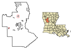
Campti is a town in the northern part of Natchitoches Parish, Louisiana, United States. The population was 1,056 at the 2010 census. It is part of the Natchitoches Micropolitan Statistical Area. Campti is a flat area of mostly farmland. It is located on the eastern bank of the Red River. Considerable herds of cattle are also raised in the general area.

<span class="mw-page-title-main">Natchez, Louisiana</span> Village in Louisiana, United States

Natchez is a village in Natchitoches Parish, Louisiana, United States. The population was 597 at the 2010 census. It is part of the Natchitoches Micropolitan Statistical Area. The village and parish are part of the Cane River National Heritage Area and located on Isle Brevelle.

<span class="mw-page-title-main">Provencal, Louisiana</span> Village in Louisiana, United States

Provencal is a village in Natchitoches Parish, Louisiana, United States. The population was 611 at the 2010 census. It is part of the Natchitoches Micropolitan Statistical Area.

<span class="mw-page-title-main">Cane River</span> River in Louisiana, United States

The Cane River is a 30-mile-long (48 km) river in Natchitoches Parish, Louisiana, originating from a portion of the Red River. Historically, in the 19th and 20th centuries, it gained prominence as the locus of a notable Creole de couleur (multiracial) culture, centered around the National Historic Landmark, Melrose Plantation, and the adjacent St. Augustine Parish Church.

The Cane River National Heritage Area is a United States National Heritage Area in the state of Louisiana. The heritage area is known for plantations featuring Creole architecture, as well as numerous other sites that preserve the multi-cultural history of the area. The heritage area includes the town of Natchitoches, Louisiana and its national historic district. Founded in 1714, it is the oldest community in the territory covered by the Louisiana Purchase. Cane River Creole National Historical Park, including areas of Magnolia and Oakland plantations, also is within the heritage area.

<span class="mw-page-title-main">St. Augustine Catholic Church and Cemetery (Natchez, Louisiana)</span> Historic church in Louisiana, United States

St. Augustine Catholic Church and Cemetery, or the Isle Brevelle Church, is a historic Catholic parish property founded in 1829 near Melrose, Natchitoches Parish, Louisiana. It is the cultural center of the Cane River area's historic French, Spanish, Native American and Black Creole community. It is also the oldest surviving Black Catholic church in the United States.

<span class="mw-page-title-main">Fort St. Jean Baptiste State Historic Site</span> American fort in Natchitoches, Louisiana

Fort St. Jean Baptiste State Historic Site in Natchitoches, Louisiana, US, is a replica of an early French fort based upon the original 1716 blueprints by Sieur Du Tisné with the improvements made in 1731 by Boutin. The French called the original fort: Fort Saint Jean Baptiste des Natchitoches. In the 1970's, the State of Louisiana anglicized the name to Fort Saint Jean Baptiste.

<span class="mw-page-title-main">St. Anne Church (Spanish Lake)</span> Historic church in Louisiana, US

The St. Anne Church in the vicinity of Robeline, Louisiana is a historic church founded in the 1800s as a mission from the St. Augustine Parish Church of Isle Brevelle. The current building was built in 1916. It is located at the southwest corner of the intersection of LA 485 and Blosmoore Road. It was added to the National Register in 1994.

<span class="mw-page-title-main">Isle Brevelle</span> American Creole settlement in Louisiana

Isle Brevelle is an ethnically and culturally diverse community, which began as a Native American and Louisiana Creole settlement and is located in Natchitoches Parish, Louisiana. For many years this area was known as Côte Joyeuse. It is considered the birthplace of Creole culture and remains the epicenter of Creole art and literature blending European, African, and Native American cultures. It is home to the Cane River Creole National Historical Park and part of the Louisiana African American Heritage Trail.

Anne des Cadeaux (unknown—1754), was a Native American active in early colonial Louisiana, and was from one of the early Louisiana Creole families. She was a devout Catholic, and was enslaved but later gained her freedom.

Bayou Brevelle is a series of interconnected, natural waterways totaling over 18 miles in length in Natchitoches Parish, Louisiana. Its main channel is at Old River and Kisatchie Bayou at Montrose to Natchez near the Cane River. During heavy rains or floods, Bayou Brevelle joins the Cane River. The bayou is flanked by Interstate 49 on the west and the Cane River on the east, and is one of the many waterways on Isle Brevelle.

Brevelle Lake is a lake in Red River County, Texas. It is located near County Road 4621 and the towns of Avery, Texas and Annona, Texas. Below its dam is Shawnee Creek (Texas), which flows into the Sulphur River.

The Adai Caddo Indians of Louisiana is a state-recognized tribe in Louisiana and 501(c)(3) organization in Robeline, Louisiana. Its members are descendants of the Adai people. The chief is John Mark Davis, as of 2023.

St. Anne Chapel at Old River is a historic Catholic chapel founded in the 1800s along the banks of Old River near Cypress and Isle Brevelle in Natchitoches Parish, Louisiana, serving the Old River community. It is the cultural and religious center of the area's Louisiana Creole people, predominantly of French descent.

St. Charles Chapel at Bermuda is a historic Catholic chapel founded in the early 1900s along the banks of the Cane River on Isle Brevelle in Natchitoches Parish serving the unincorporated community of Bermuda, Louisiana. It is the cultural and religious center of the area's Louisiana Creole people, predominantly of French descent.

St. Joseph's Catholic Mission at Bayou Derbonne is a historic Catholic mission founded in the 1800s along the banks of Bayou Derbonne near Montrose and Isle Brevelle in Natchitoches Parish, Louisiana, serving the Montrose and Cloutierville Creole community. It was the cultural and religious center of the area's Louisiana Creole people, predominantly of French descent.

Kisatchie Bayou is a series of interconnected, natural waterways totaling over 38 miles in length in Natchitoches Parish, Louisiana, and Sabine Parish, Louisiana. The bayou is a tributary of Old River at Isle Brevelle. The bayou runs through a large portion of Kisatchie National Forest, the only national forest in the State of Louisiana.

Jean Baptiste Brevelle was a Parisian-born trader, explorer, and one of the first soldiers garrisoned at Fort St. Jean Baptiste des Natchitoches in present-day Natchitoches, Louisiana and Le Poste des Cadodaquious in Texas.

Jean Baptiste Brevelle II was a French and Native American explorer, translator and soldier of the militia at Fort St. Jean Baptiste des Natchitoches in present-day Natchitoches, Louisiana and Le Poste des Cadodaquious in Texas.

References

  1. "Election Returns: Natchitoches Parish". Louisiana Secretary of State. November 6, 2018. Retrieved November 9, 2018.
  2. "2020 U.S. Gazetteer Files". United States Census Bureau. Retrieved March 20, 2022.
  3. Louisiana Legislative Auditor: "Excessive fine enforcement" (PDF). June 6, 2007.
  4. 1 2 Alcée Fortier, ed., Louisiana: Comprising Sketches of Parishes, Towns, Events, Institutions, and Persons, Arranged in Cyclopedic Form, (Volume 3), Century Historical Association, 1914, pp. 112-113.
  5. "US Gazetteer files: 2010, 2000, and 1990". United States Census Bureau. February 12, 2011. Retrieved April 23, 2011.
  6. "Census of Population and Housing". Census.gov. Retrieved June 4, 2015.
  7. "U.S. Census website". United States Census Bureau . Retrieved January 31, 2008.
  8. ICT Staff (September 13, 2018). "Pow Wow Weekend Planner". ICT. Retrieved December 18, 2023.
  9. "History of St. Augustine Catholic Church". St. Augustine Catholic Church. Roman Catholic Church. Retrieved January 11, 2024.