Rollinsford, New Hampshire

Last updated

Rollinsford, New Hampshire
Town
Strafford-Rollinsford-NH.png
Location within Strafford County, New Hampshire
Coordinates: 43°14′10″N70°49′08″W / 43.23611°N 70.81889°W / 43.23611; -70.81889
Country United States
State New Hampshire
County Strafford
Settled 1630s
Incorporated 1849 [1]
Government
   Select Board
  • Kim St. Hilaire, Chair
  • Jack Boyle
  • Denise Knowles
  Town AdministratorPaul Toussaint
Area
[2]
  Total7.6 sq mi (19.6 km2)
  Land7.3 sq mi (18.9 km2)
  Water0.3 sq mi (0.7 km2)
Elevation
70 ft (20 m)
Population
 (2020)
  Total2,597
  Density356/sq mi (137.6/km2)
Time zone UTC-5 (EST)
  Summer (DST) UTC-4 (EDT)
ZIP code
03869
Area code 603
FIPS code 33-65540
GNIS feature ID0873709
Website www.rollinsford.nh.us

Rollinsford is a town in Strafford County, New Hampshire, United States. The population was 2,597 at the 2020 census. [3] The main village in town was once known as "Salmon Falls Village".

Contents

History

The area was once within the domain of the Newichawannock people, an Abenaki sub-tribe which took its name from the Newichawannock River, meaning "river with many falls", now the Salmon Falls River. Their village was located at what later was known as Salmon Falls Village and is now Rollinsford. They fished at the falls, stretching nets across the river to catch migrating salmon and other species swimming upriver to spawn. But war and disease, probably smallpox brought from abroad, decimated the native population. [4]

Subsequently, settled by about 1630, the land was part of Dover, one of the original townships of New Hampshire. The area was first called "Sligo", likely after County Sligo in Ireland, [5] and the name survives on a town road. An historical marker on Sligo Road reads, "Near this place lived David Hamilton of Westburn born in the parish of Cambuslang, Scotland in October 1620; captured by Oliver Cromwell at the Battle of Worcester, England, September 3, 1651; Brought to America as a prisoner in chains on the "John and Sarah" in the same year; settled near here and married Annah Jaxson of Lanark, Scotland. Killed by Indians on September 28, 1691."

In 1729 the area was established as a parish called "Summersworth", meaning summer town, because the ministers preached here during the summer. In 1754, it was set off and incorporated as a town by colonial governor Benning Wentworth, although thereafter spelled "Somersworth" due to a clerical error. Since the first settlers' arrival, small communities had developed near various sawmills and gristmills along the Salmon Falls River, but the center of "Summersworth" was located at Rollinsford Junction.

Beginning in the early 1820s, water powered textile mills were established at the larger falls, and the town was divided between them—Great Falls became Somersworth, and Salmon Falls became Rollinsford, incorporated in 1849. It was named in honor of the Rollins family, whose ancestor Judge Ichabod Rollins had settled there many generations before and had become the first probate judge for the state. [6]

Salmon Falls Village

Salmon Falls Mfg. Co. in 1906 Salmon Falls Manufacturing Company.jpg
Salmon Falls Mfg. Co. in 1906

The village of Salmon Falls was founded in 1823 by a group of local investors led by James Rundlet of Portsmouth, who on June 17, 1822, incorporated the Salmon Falls Manufacturing Company to manufacture woolen cloth using the power of the Salmon Falls River, a Piscataqua River tributary. [7] After an 1834 fire destroyed the first factory built there, the company's Portsmouth-based investors built a new factory for cotton manufacturing, eventually selling the corporation to their Boston-based cotton broker Mason and Lawrence in the 1840s. As part of their expansion, the town was laid out in an easy-to-navigate grid plan, with the three-story boarding houses and an adjoining mill building made of brick to withstand fires. Two-story brick double houses were also built to accommodate the families of the overseers. [7] The town thrived into the first decades of the 20th century and eventually became home to many immigrant families whose forebears came to work in the mills. Although the town planners originally forbade the mill workers to drink alcohol and required that they attend church on Sunday, during Prohibition, its proximity to temperate Maine and the Boston & Maine Railroad line led to the establishment of numerous bars and a relatively short-lived but racy reputation for free-flowing liquor.

The New England cotton industry would fade in the early to mid-20th century, but would leave the brick town intact. Today, the mills have been reborn as low-cost studio space for more than 100 artists and artisans who use the converted studios for everything from painting, sculpting and crafting handmade furniture to teaching and practicing yoga and dance.

Geography

According to the United States Census Bureau, Rollinsford has a total area of 7.6 square miles (19.6 km2), of which 7.3 square miles (18.9 km2) are land and 0.3 square miles (0.7 km2) are water, comprising 3.71% of the town. [2] The town is bounded on the east by the Salmon Falls River, which serves as the New Hampshire–Maine border. The western half of the town is drained by Rollins and Twombly brooks, which flow south to the Cochecho River in neighboring Dover. The entire town is part of the Piscataqua River watershed. The highest point in town is an unnamed 300-foot (91 m) summit near the border with Somersworth. Garrison Hill, 290 feet (88 m) above sea level, occupies the town's border with Dover to the west.

New Hampshire Route 4 crosses the town, leading southwest to Dover and northeast to South Berwick, Maine, where it becomes Maine State Route 4.

Adjacent municipalities

Demographics

Historical population
CensusPop.Note
1850 1,862
1860 2,06911.1%
1870 1,500−27.5%
1880 1,71214.1%
1890 2,00317.0%
1900 1,701−15.1%
1910 1,8367.9%
1920 1,701−7.4%
1930 1,409−17.2%
1940 1,4633.8%
1950 1,65212.9%
1960 1,93517.1%
1970 2,27317.5%
1980 2,3192.0%
1990 2,64514.1%
2000 2,6480.1%
2010 2,527−4.6%
2020 2,5972.8%
U.S. Decennial Census [8]
Rollinsford Fire Department RollinsfordFD.jpg
Rollinsford Fire Department

As of the census [9] of 2000, there were 2,648 people, 1,033 households, and 721 families residing in the town. The population density was 363.0 inhabitants per square mile (140.2/km2). There were 1,060 housing units at an average density of 145.3 per square mile (56.1/km2). The racial makeup of the town was 97.77% White, 0.68% African American, 0.08% Native American, 0.53% Asian, 0.08% from other races, and 0.87% from two or more races. Hispanic or Latino of any race were 0.60% of the population.

There were 1,033 households, out of which 34.1% had children under the age of 18 living with them, 58.4% were married couples living together, 7.6% had a female householder with no husband present, and 30.2% were non-families. 22.3% of all households were made up of individuals, and 8.4% had someone living alone who was 65 years of age or older. The average household size was 2.56 and the average family size was 3.03.

In the town, the population was spread out, with 25.2% under the age of 18, 6.9% from 18 to 24, 33.0% from 25 to 44, 22.5% from 45 to 64, and 12.3% who were 65 years of age or older. The median age was 37 years. For every 100 females, there were 97.8 males. For every 100 females age 18 and over, there were 95.1 males.

The median income for a household in the town was $48,588, and the median income for a family was $60,625. Males had a median income of $37,750 versus $26,068 for females. The per capita income for the town was $24,444. About 2.6% of families and 3.7% of the population were below the poverty line, including 5.2% of those under age 18 and 3.4% of those age 65 or over.

Notable people

See also

Related Research Articles

<span class="mw-page-title-main">Strafford County, New Hampshire</span> County in New Hampshire, United States

Strafford County is a county in the U.S. state of New Hampshire. As of the 2020 census, the population was 130,889. Its county seat is Dover. Strafford County was one of the five original counties identified for New Hampshire in 1769. It was named after William Wentworth, 2nd Earl of Strafford in the mistaken belief that he was the ancestor of governor John Wentworth – although they were distantly related, William had no descendants. The county was organized at Dover in 1771. In 1840, the size of the original county was reduced with the creation of Belknap County.

<span class="mw-page-title-main">York County, Maine</span> County in Maine, United States

York County is the southwesternmost county in the U.S. state of Maine, along the state of New Hampshire's eastern border. It is divided from Strafford County, New Hampshire, by the Salmon Falls River and the connected tidal estuary, the Piscataqua River. York County was permanently established in 1639. Several of Maine's earliest colonial settlements are found in the county, which is the state's oldest and one of the oldest in the United States. As of the 2020 census, its population was 211,972, making it Maine's second-most populous county. Its county seat is Alfred. York County is part of the Portland–South Portland, Maine Metropolitan Statistical Area.

<span class="mw-page-title-main">Acton, Maine</span> Town in the state of Maine, United States

Acton is a town in York County, Maine, United States. The population was 2,671 at the 2020 census. It includes the villages of Acton, Miller Corner and South Acton. The town is home to the Acton Fairground, which holds the Acton Fair every late summer. It is part of the Portland–South Portland–Biddeford, Maine metropolitan statistical area.

<span class="mw-page-title-main">Buxton, Maine</span> Town in Maine, United States

Buxton is a town in York County, Maine, United States. It is part of the Portland metropolitan area. The population was 8,376 at the 2020 census. Buxton includes the villages of Salmon Falls/Tory Hill, Chicopee, Groveville, Bar Mills, West Buxton, and Buxton Center. The old town Common is east of Union Falls, which is the location of Skelton Dam, operated by Central Maine Power, and near historic location of the original settlement at Pleasant Point.

<span class="mw-page-title-main">Eliot, Maine</span> Town in Maine, United States

Eliot is a town in York County, Maine, United States. Originally settled in 1623, it was formerly a part of Kittery, to its east. After Kittery, it is the next most southern town in the state of Maine, lying on the Piscataqua River across from Portsmouth and Newington, New Hampshire. The population was 6,717 at the 2020 census. It is part of the Portland–South Portland–Biddeford, Maine metropolitan statistical area.

<span class="mw-page-title-main">Lebanon, Maine</span> Town in Maine, United States

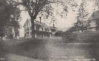
Lebanon is a town in York County, Maine, United States. The population was 6,469 at the 2020 census. Lebanon includes the villages of Center Lebanon, West Lebanon, North Lebanon, South Lebanon, and East Lebanon. It is the westernmost town in Maine. Lebanon is part of the Portland–South Portland–Biddeford, Maine metropolitan statistical area.

<span class="mw-page-title-main">South Berwick, Maine</span> Town in the state of Maine, United States

South Berwick is a town in York County, Maine, United States. The population was 7,467 at the 2020 census. South Berwick is home to Berwick Academy, a private, co-educational university-preparatory day school founded in 1791.

<span class="mw-page-title-main">Wakefield, New Hampshire</span> Town in New Hampshire, United States

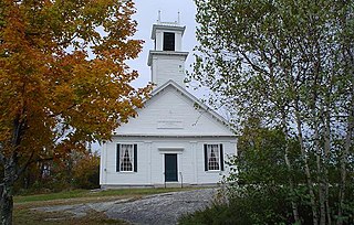
Wakefield is a town in Carroll County, New Hampshire, United States. The population was 5,201 at the 2020 census. The town includes the villages of Wakefield Corner, East Wakefield, North Wakefield, Sanbornville, Union, Woodman and Province Lake. Wakefield Corner, popular with tourists, is a picturesque hilltop village of antique buildings. The state of Maine forms the eastern border of Wakefield.

<span class="mw-page-title-main">Newington, New Hampshire</span> Place in New Hampshire, United States

Newington is a town in Rockingham County, New Hampshire, United States. The population was 811 at the 2020 census. It is bounded to the west by Great Bay, to the northwest by Little Bay and to the northeast by the Piscataqua River.

<span class="mw-page-title-main">Dover, New Hampshire</span> City in New Hampshire, United States

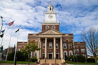
Dover is a city in Strafford County, New Hampshire, United States. The population was 32,741 at the 2020 census, making it the most populous city in the New Hampshire Seacoast region and the 5th most populous city in New Hampshire.

<span class="mw-page-title-main">Milton, New Hampshire</span> Town in New Hampshire, United States

Milton is a town in Strafford County, New Hampshire, United States. The population was 4,482 at the 2020 census. A manufacturing, resort and residential town, Milton includes the village of Milton Mills. The primary village in town, where 593 people resided at the 2020 census, is defined as the Milton census-designated place (CDP), and is located along New Hampshire Route 125 and the Salmon Falls River, just north of Route 75.

<span class="mw-page-title-main">New Durham, New Hampshire</span> Town in New Hampshire, United States

New Durham is a town in Strafford County, New Hampshire, United States. The population was 2,693 at the 2020 census. It is drained by the Merrymeeting, Cocheco and Ela rivers, and is known for Merrymeeting Lake. New Durham is home to the Powder Mill Fish Hatchery, located on Merrymeeting Road. Also located here is the Lions Club's Camp Pride, a camp for children and adults with special needs.

<span class="mw-page-title-main">Somersworth, New Hampshire</span> City in New Hampshire, United States

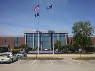
Somersworth is a city in Strafford County, New Hampshire, United States. The population was 11,855 at the 2020 census. Somersworth has the smallest area and third-lowest population of New Hampshire's 13 cities.

<span class="mw-page-title-main">North Berwick, Maine</span> Town in Maine, United States

North Berwick is a town in York County, Maine, United States. The town was set off from Berwick in 1831, following South Berwick in 1814.

<span class="mw-page-title-main">Salmon Falls River</span> River in New Hampshire, United States

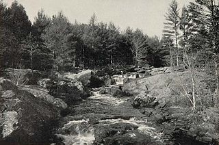
The Salmon Falls River is a tributary of the Piscataqua River in the U.S. states of Maine and New Hampshire. It rises at Great East Lake, Newichawannock Canal, and Horn Pond and flows south-southeast for approximately 38 miles (61 km), forming the border between York County, Maine, and Strafford County, New Hampshire.

<span class="mw-page-title-main">Milton Mills, New Hampshire</span> Census-designated place in New Hampshire, United States

Milton Mills is a small village and census-designated place in the town of Milton, Strafford County, New Hampshire, United States. It had a population of 313 at the 2020 census. Milton Mills has a separate ZIP code (03852) from the rest of the town of Milton.

<span class="mw-page-title-main">Newichawannock Canal</span> United States historic place

The Newichawannock Canal is a man-made canal which drains Great East Lake into Horn Pond at the border between Wakefield, New Hampshire, and Acton, Maine, in the northeastern United States. It is at the head of the Salmon Falls River, which the Abenaki called Newichawannock, meaning "river with many falls". Begun in 1850 by the Great Falls Company to increase the water available for its mills in Somersworth, New Hampshire, the 0.75-mile (1.21 km) canal is unusual as it was built for strictly industrial purposes in an area remote from the actual industrial site. The canal forms the boundary between the states of New Hampshire and Maine, and is spanned by a stone bridge built at the same time. The canal and bridge, along with related artifacts, were listed on the National Register of Historic Places in 2014.

<span class="mw-page-title-main">Berwick, Maine</span> Town in the state of Maine, United States

Berwick is a town in York County, Maine, United States, situated in the southern part of the state beside the Salmon Falls River.

<span class="mw-page-title-main">Berwick (CDP), Maine</span> Census-designated place in Maine, United States

Berwick is a census-designated place (CDP) in the town of Berwick in York County, Maine, United States. The population was 2,187 at the 2010 census, out of a total of 7,246 in the entire town. It is part of the Portland–South Portland–Biddeford, Maine Metropolitan Statistical Area.

<span class="mw-page-title-main">South Berwick (CDP), Maine</span> Census-designated place in Maine, United States

South Berwick is a census-designated place (CDP) and the primary village in the town of South Berwick, York County, Maine, United States. It is in southwestern York County, in the northwestern corner of the town of South Berwick. It is bordered to the north by the town of Berwick, and to the southwest, across the Salmon Falls River, by the town of Rollinsford, New Hampshire.

References

  1. On April 22, 1754, Dover's parish of Somersworth was incorporated as a town, its population center located in what would later become Rollinsford on July 3, 1849
  2. 1 2 "2021 U.S. Gazetteer Files – New Hampshire". United States Census Bureau. Retrieved January 5, 2022.
  3. "Census - Geography Profile: Rollinsford town, Strafford County, New Hampshire" . Retrieved December 24, 2021.
  4. Seacoast Watershed Information Manager website
  5. Thompson, Mary Pickering (1892). Landmarks in Ancient Dover, New Hampshire , pg 233
  6. Lyford, James Otis (1906). Life of Edward H. Rollins: A Political Biography. Boston: D. Estes & Co.Pg 27
  7. 1 2 Garner, John S. (1992). The Company Town: Architecture and Society in the Early Industrial Age. Oxford University Press. Pg 119
  8. "Census of Population and Housing". Census.gov. Retrieved June 4, 2016.
  9. "U.S. Census website". United States Census Bureau . Retrieved January 31, 2008.