
Nakodar is a town and a municipal council in Jalandhar district in the Indian state of Punjab.

Roorkee (Rūṛkī) is a city and a municipal corporation in the Haridwar district of the state of Uttarakhand, India. It is 31 km (19 mi) from Haridwar city, the district headquarter. It is spread over a flat terrain under Sivalik Hills of Himalayas. The city is developed on the banks of Ganges Canal, its dominant feature, which flows from north–south through middle of the city. Roorkee is home to Asia's first engineering college Indian Institute of Technology Roorkee, formerly known as Thomson College of Civil Engineering. Roorkee is also known for the Roorkee Cantonment, one of the country's oldest military establishments and the headquarters of Bengal Engineer Group since 1853. A freight train ran in between Roorkee and Piran Kaliyar on 22 December 1851, this was two years before first passenger trains were started between Bombay and Thana in 1853 and 14 years after first freight trains ran in Chennai in 1837.
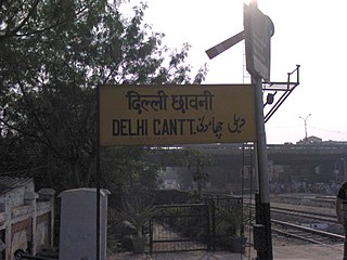
Delhi Cantonment is a Class I Cantonment Board established in 1914. The area of the Cantonment is 10,452 acres (42.30 km2) and the population of the Cantonment as per the 2011 census is 110,351.

Alipurduar is a city and a municipality in the Indian state of West Bengal. It is the headquarters of the Alipurduar district. Situated on the east bank of Kaljani River on the foothills of the Himalayas, the city is a gateway to Bhutan and northeastern states of India. Alipurduar was a sub-divisional town of Jalpaiguri district until 2007 when it was created a separate district.

Diamond Harbour is a town and a municipality of the South 24 Parganas district in the Indian state of West Bengal. It is situated on the eastern banks of the Hooghly River. It is the headquarters of the Diamond Harbour subdivision.

Kangra is a city and a municipal council in Kangra district in the Indian state of Himachal Pradesh. It is also known as Nagarkot.

Berhampore বহরমপুর is a city and a municipality in the state of West Bengal, India. As per the 2011 census, Berhampore has a population of 305,609 and is the seventh largest city in West Bengal. Berhampore is the administrative headquarters of the Murshidabad district. It is located about 200 km (124 mi) from Kolkata, the state capital. It is one of the most important business, administrative, educational and political hub of Bengal as well as of India. Congress Lok Sabha leader Shri Adhir Ranjan Chowdhury has been elected from this city since 1999. It is one of the most popular urban agglomerations of West Bengal state. It was the first centre of East India Company in India. Not only the British but also the Dutch and the French established their companies in this city and, as a result, it grew as a production hub of India. It is famous for its famous sweets such as Chanabora, Manohara, Rasgulla and many more. The city is divided into five administrative regions: Gora Bazar, Khagra, Indraprastha, Cossimbazar, Haridasmati. Berhampore was a part of Sepoy Mutiny of 1857 which took place at Berhampore Cantonment region. It was used by many foreign traders as their production hub. Before becoming a city many janpadas such as Saidabad; Farasdanga; Kalikapur had become famous. Cossimbazar had also become world famous for its muslin clothes. This city used to be the headquarters of Rajshahi administrative region till 1875.
Nagina is a town and a municipal board in Bijnor district in the Indian state of Uttar Pradesh.
Jalandhar Cantonment is a cantonment town in Jalandhar District in the Indian state of Punjab. The Cantonment is located between latitude 30° 18' and longitude 75° 37' on the southwest and at a distance of 2 km from Cantonment Railway Station and 5 km from City Railway Station. It is situated beside Grand Trunk Road at a distance of 89 km from Amritsar and 371 km from Delhi. It covers an area of 5.87 square miles (15.2 km²). It is on Amritsar-Delhi Broad Gauge Main Line. A Class-I airfield at Adampur is situated at a distance of 19 km. The airfield is linked with Jalandhar Cantonment by rail and road. It has a Recruiting Office responsible for enlisting the soldiers for Army, Navy and Air Force. The first Recruiting Officer who held this post until 1952 was Col. Dilbagh Singh Minhas of Jallandhar Doab.

Anupshahr is a city and a municipal board, nearby Bulandshahr city in Bulandshahr district in the state of Uttar Pradesh, India. It is located on the bank of the holy river Ganga. It is on Bangar alluvial.
Badami Bagh is a cantonment town on the outskirts of Srinagar city in Srinagar district in the Indian union territory of Jammu and Kashmir. A portion of Indian army in the valley resides in the Badami Bagh cantonment. Badami Bagh Cantonment is the headquarters of the Indian Army's 15 Corps. The cantonment is established on the two road sides of Srinagar Jammu National Highway.
Dhuilya is a census town in Sankrail CD Block of Howrah Sadar subdivision in Howrah district in the Indian state of West Bengal. It is a part of Kolkata Urban Agglomeration.
Ferozepur Cantonment, also known as Firojpur Cantonment and Firojepur Cantonment, is a cantonment town in Firozpur district in the state of Punjab, India. It is located adjacent to and south of the city of Firozpur.
Kannur Cantonment, situated in Burnassery or Burnshire(the anglicized name), is a cantonment town in Kannur district in the Indian state of Kerala, between Kannur town and Kannur City. The cantonment was a military camp for Portuguese, Dutch and British rulers, and is now the headquarters of Defence Security Corps.
Laksar is a small town, near Haridwar city and Nagar Palika in Haridwar district of the Indian state of Uttarakhand, situated along National Highway 334A. It is an important sugar manufacturing destination in the state and also known for the Laksar Junction railway station (LRJ), the largest railway junction in the state, which was built in 1866.

Nainital Cantonment is a cantonment town in Nainital district in the Indian state of Uttarakhand, close to the hill station of Nainital. Established in the year 1878, today the Nainital Cantonment is a Class IV cantonment. Current CEO of cantonment board is Shri Varun Kumar.

The Bengal Engineer Group (BEG) is a military engineering regiment in the Corps of Engineers of the Indian Army. The unit was originally part of the Bengal Army of the East India Company's Bengal Presidency, and subsequently part of the British Indian Army during the British Raj. The Bengal Sappers are stationed at Roorkee Cantonment in Roorkee, Uttarakhand.
Dhakuria is a census town in Gaighata CD Block in Bangaon subdivision in North 24 Parganas district in the state of West Bengal, India.
Faizabad Cantonment, officially known as Ayodhya Cantonment is a cantonment town in Faizabad in the Indian state of Uttar Pradesh, close to the city of Faizabad. Established in the year 1858, today the Faizabad Cantonment is a Class I,2,3,4,5 cantonment.
Bhangeri is a village in Roorkee tehsil in the green terai region of Sivalik Hills of the Himalayas. Its official name is Bhangeri Mahavatpur. Gradually, villagers gave up their traditional profession of training elephants. High-quality cannabis (Bhang) plants grow naturally in the uncultivated lands around the village. Residents started calling the village Bhangeri, or "the place where bhang grows." The name stuck, and the village came to be known popularly as Bhangeri and officially as Bhangeri Mahavatpur.

