Rosiclare, Illinois | |
---|---|
Coordinates: 37°25′30″N88°20′45″W / 37.42500°N 88.34583°W | |
Country | United States |
State | Illinois |
County | Hardin |
Area | |
• Total | 2.12 sq mi (5.48 km2) |
• Land | 1.94 sq mi (5.02 km2) |
• Water | 0.18 sq mi (0.46 km2) |
Elevation | 367 ft (112 m) |
Population (2020) | |
• Total | 980 |
• Density | 505.42/sq mi (195.18/km2) |
Time zone | UTC-6 (CST) |
• Summer (DST) | UTC-5 (CDT) |
ZIP Code(s) | 62982 |
Area code | 618 |
FIPS code | 17-65897 |
GNIS feature ID | 2396436 [2] |
Wikimedia Commons | Rosiclare, Illinois |
Website | www |
Rosiclare is a city in Hardin County, Illinois, along the Ohio River. The population was 1,160 at the 2010 census, [3] down from 1,213 at the 2000 census.
Some of the earliest settlers of the Rosiclare area were outlaws mainly counterfeiters from the Sturdivant Gang in the late 1810s-early 1820s. Rosiclare used to be the "Fluorspar Capital of the World". [4] Andrew Jackson, in 1835, once owned a fluorspar mine in Rosiclare. Wholesale mining of fluorspar first began in Rosiclare in 1842. [5] Mining ceased when it became cheaper to import fluorite from China. The Lead and Fluorspar Mining Company continued to process ore from mines in Hardin County but closed due to foreign competition in 1996. [6]
Rosiclare is located in southwestern Hardin County at 37°25′30″N88°20′45″W / 37.42500°N 88.34583°W (37.424869, -88.345810). [7] It is bordered to the southeast by the Ohio River, which forms the state boundary with Kentucky. Illinois Route 34 terminates in Rosiclare at the river and leads north 30 miles (48 km) to Harrisburg. The next Illinois community upriver (northeast) is Elizabethtown, 4.5 miles (7.2 km) via IL-34 and IL-146 or 2.5 miles (4.0 km) by river, while the next one downstream (southwest) is Golconda, 15 miles (24 km) via IL-146 or 11 miles (18 km) by river.
According to the 2010 census, Rosiclare has a total area of 2.121 square miles (5.49 km2), of which 1.94 square miles (5.02 km2) (or 91.47%) is land and 0.181 square miles (0.47 km2) (or 8.53%) is water. [8]
Climate data for Rosiclare 5NW, Illinois (1991–2020 normals, extremes 1968–present) | |||||||||||||
---|---|---|---|---|---|---|---|---|---|---|---|---|---|
Month | Jan | Feb | Mar | Apr | May | Jun | Jul | Aug | Sep | Oct | Nov | Dec | Year |
Record high °F (°C) | 72 (22) | 77 (25) | 85 (29) | 90 (32) | 92 (33) | 107 (42) | 106 (41) | 104 (40) | 100 (38) | 94 (34) | 84 (29) | 76 (24) | 107 (42) |
Average high °F (°C) | 41.2 (5.1) | 46.2 (7.9) | 56.3 (13.5) | 67.6 (19.8) | 75.2 (24.0) | 83.0 (28.3) | 86.4 (30.2) | 86.1 (30.1) | 80.4 (26.9) | 69.2 (20.7) | 55.9 (13.3) | 45.2 (7.3) | 66.1 (18.9) |
Daily mean °F (°C) | 31.8 (−0.1) | 35.7 (2.1) | 44.8 (7.1) | 55.1 (12.8) | 63.9 (17.7) | 72.3 (22.4) | 75.8 (24.3) | 74.5 (23.6) | 67.8 (19.9) | 56.0 (13.3) | 44.6 (7.0) | 35.8 (2.1) | 54.8 (12.7) |
Average low °F (°C) | 22.4 (−5.3) | 25.1 (−3.8) | 33.3 (0.7) | 42.6 (5.9) | 52.6 (11.4) | 61.5 (16.4) | 65.2 (18.4) | 63.0 (17.2) | 55.1 (12.8) | 42.9 (6.1) | 33.4 (0.8) | 26.3 (−3.2) | 43.6 (6.4) |
Record low °F (°C) | −22 (−30) | −12 (−24) | −5 (−21) | 16 (−9) | 24 (−4) | 39 (4) | 42 (6) | 36 (2) | 32 (0) | 18 (−8) | 3 (−16) | −17 (−27) | −22 (−30) |
Average precipitation inches (mm) | 3.90 (99) | 3.71 (94) | 5.08 (129) | 5.12 (130) | 5.35 (136) | 4.61 (117) | 4.40 (112) | 3.24 (82) | 3.24 (82) | 3.57 (91) | 4.23 (107) | 4.44 (113) | 50.89 (1,293) |
Average snowfall inches (cm) | 0.9 (2.3) | 1.4 (3.6) | 0.2 (0.51) | 0.0 (0.0) | 0.0 (0.0) | 0.0 (0.0) | 0.0 (0.0) | 0.0 (0.0) | 0.0 (0.0) | 0.2 (0.51) | 0.0 (0.0) | 0.6 (1.5) | 3.3 (8.4) |
Average precipitation days (≥ 0.01 in) | 9.5 | 9.0 | 11.5 | 10.5 | 11.0 | 8.9 | 9.0 | 7.4 | 6.7 | 7.6 | 8.6 | 10.0 | 109.7 |
Average snowy days (≥ 0.1 in) | 0.6 | 0.5 | 0.2 | 0.0 | 0.0 | 0.0 | 0.0 | 0.0 | 0.0 | 0.1 | 0.0 | 0.5 | 1.9 |
Source: NOAA [9] [10] |
Census | Pop. | Note | %± |
---|---|---|---|
1880 | 368 | — | |
1890 | 274 | −25.5% | |
1900 | 278 | 1.5% | |
1910 | 609 | 119.1% | |
1920 | 1,522 | 149.9% | |
1930 | 1,794 | 17.9% | |
1940 | 1,774 | −1.1% | |
1950 | 2,086 | 17.6% | |
1960 | 1,700 | −18.5% | |
1970 | 1,421 | −16.4% | |
1980 | 1,441 | 1.4% | |
1990 | 1,378 | −4.4% | |
2000 | 1,213 | −12.0% | |
2010 | 1,160 | −4.4% | |
2020 | 980 | −15.5% | |
U.S. Decennial Census [11] |
As of the census [12] of 2000, there were 1,213 people, 512 households, and 328 families residing in the city. The population density was 559.6 inhabitants per square mile (216.1/km2). There were 597 housing units at an average density of 275.4 per square mile (106.3/km2). The racial makeup of the city was 97.77% White, 0.49% African American, 0.08% Native American, 0.33% Asian, 0.33% Pacific Islander, 0.41% from other races, and 0.58% from two or more races. Hispanic or Latino of any race were 1.15% of the population.
There were 512 households, out of which 29.3% had children under the age of 18 living with them, 50.2% were married couples living together, 11.5% had a female householder with no husband present, and 35.9% were non-families. 32.2% of all households were made up of individuals, and 18.2% had someone living alone who was 65 years of age or older. The average household size was 2.23 and the average family size was 2.82.
In the city, the population was spread out, with 21.4% under the age of 18, 8.5% from 18 to 24, 23.8% from 25 to 44, 23.0% from 45 to 64, and 23.3% who were 65 years of age or older. The median age was 42 years. For every 100 females, there were 83.2 males. For every 100 females age 18 and over, there were 82.1 males.
The median income for a household in the city was $22,600, and the median income for a family was $32,279. Males had a median income of $26,429 versus $15,417 for females. The per capita income for the city was $15,398. About 17.6% of families and 22.5% of the population were below the poverty line, including 31.3% of those under age 18 and 19.2% of those age 65 or over.
Crittenden County is a county in the U.S. state of Kentucky. At the 2020 census, the population was 8,990. Its county seat and only municipality is Marion. The county was formed in 1842 and named for John J. Crittenden, senator and future Governor of Kentucky.
Hardin County is a county located in the U.S. state of Iowa. As of the 2020 census, the population was 16,878. The county seat is Eldora. The county was named in honor of Col. John J. Hardin, of Illinois, who was killed in the Mexican–American War.
Hardin County is a county located in the U.S. state of Illinois. According to the 2020 census, it has a population of 3,649, making it the least populous county in Illinois. Its county seat is Elizabethtown. Hardin County is located in the part of the state known as Little Egypt. Hardin County was named for Hardin County, Kentucky, which was named in honor of Colonel John Hardin, an officer in the American Revolutionary War and the Northwest Indian War.
Coaling is a town in Tuscaloosa County, Alabama, United States. It incorporated in September 1997. At the 2020 census, the population was 2,035. It is part of the Tuscaloosa, Alabama Metropolitan Statistical Area.
Pontoosuc is a village in Hancock County, Illinois, United States. The population was 146 at the 2010 census, down from 171 at the 2000 census.
Cave-In-Rock is a village in Hardin County, Illinois, United States. Its principal feature and tourist attraction is nearby Cave-In-Rock, on the banks of the Ohio River. In 1816, the earliest known permanent white settlers arrived and started building a town near the cave. The town was originally known as Rock and Cave, Illinois, with a post office under this name. On October 24, 1849, the town was officially renamed Cave-In-Rock. Cave-In-Rock was incorporated as a village in 1901. The population was 318 at the 2010 census.
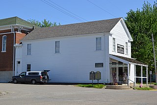
Elizabethtown is a village in and the county seat of Hardin County, Illinois, United States, along the Ohio River. The population was 299 at the 2010 census, down from 348 at the 2000 census. It is the least-populous county seat in the state.
Maryville is a village in Madison County, Illinois, United States. The population was 8,221 at the 2020 census, up from 7,487 in 2010.
Havana is a city in Mason County, Illinois, United States. The population was 2,963 at the 2020 census, a decline from the figure of 3,301 tabulated in 2010. It is the county seat of Mason County.
Brookport is a city in Massac County, Illinois, United States. The population was 725 at the 2020 census, down from 984 in 2010. It is part of the Paducah, KY-IL Micropolitan Statistical Area.
AthensAY-thənz is a city in Menard County, Illinois, United States. The population was 1,977 at the 2020 census. It is part of the Springfield, Illinois Metropolitan Statistical Area.
Viola is a village in Mercer County, Illinois, United States. The population was 869 at the 2020 census, a decline of 9 percent from 955 in 2010.
New Athens is a village in St. Clair County, Illinois, United States. Based upon common usage, the 'A' is always sounded with a long vowel, rather than a short vowel, by its residents, unlike the most commonly used English pronunciation of the city in Greece.
Wilmington is a city in Will County, Illinois, United States. Located on IL-53 and Historic Route 66 along the east bank of the Kankakee River, it is approximately 60 miles south-west from downtown Chicago. The population was 5,724 at the 2010 census. Wilmington is just south of Midewin National Tallgrass Prairie, which is home the largest bison herd in the state.
Minonk is a city in Minonk Township, Woodford County, Illinois. The population was 2,078 at the 2010 census, down from 2,168 in 2000. The city is part of the Peoria, Illinois, metropolitan area.
Eldora is a city in Hardin County, Iowa, United States. The population was 2,663 at the time of the 2020 census. It is the county seat of Hardin County.
Iowa Falls is a city in Hardin County, Iowa, United States. Iowa Falls is the home of Ellsworth Community College. It is also a regional transportation center, located along U.S. Routes 20 and 65 and the Canadian National and Union Pacific Railroads. The population was 5,106 at the time of the 2020 census. A landmark in the city is its movie theater. Built as the Metropolitan Opera House in 1899, it presented plays, operas, and vaudeville in the town during the first half of the twentieth century, and today is listed on the National Register of Historic Places.
Osage City is a city in Osage County, Kansas, United States. As of the 2020 census, the population of the city was 2,861.
Hardin is a home rule-class city in Marshall County, Kentucky, United States. The population was 580 at the 2020 census.
Carlton is a city in Carlton County, Minnesota, United States. The population was 948 at the 2020 census. It is the county seat of Carlton County. The town sits on the northwestern edge of Jay Cooke State Park.