Russell Springs, Kansas

Last updated

Russell Springs, Kansas
Logan County Kansas Incorporated and Unincorporated areas Russell Springs Highlighted.svg
Location within Logan County and Kansas
Map of Logan Co, Ks, USA.png
Coordinates: 38°54′46″N101°10′33″W / 38.91278°N 101.17583°W / 38.91278; -101.17583 [1]
Country United States
State Kansas
County Logan
Founded1865
Incorporated 1888
Named for Avra Russell & Springs
Area
[2]
  Total0.71 sq mi (1.83 km2)
  Land0.71 sq mi (1.83 km2)
  Water0.00 sq mi (0.00 km2)
Elevation
[1]
2,904 ft (885 m)
Population
 (2020) [3]
  Total26
  Density37/sq mi (14/km2)
Time zone UTC-6 (Central (CST))
  Summer (DST) UTC-5 (CDT)
ZIP code
67764
Area code 785
FIPS code 20-61875 [1]
GNIS ID 2396457 [1]

Russell Springs is a city in Logan County, Kansas, United States. [1] As of the 2020 census, the population of the city was 26. [3]

Contents

History

Russell Springs, founded in 1865, was the Eaton stop on the Butterfield Overland Dispatch stage line. The line ran through rough Indian country to connect the gold mines in Denver, Colorado, with Fort Riley, Kansas. It ran until the Kansas Pacific Railroad was built. Travelers on the Butterfield Trail always made the natural springs in the area a watering place and calling them "Russell's Springs". [4]

It was named for Avra P. Russell, of the 2nd Regiment Kansas Volunteer Cavalry. [5]

Russell Springs was the county seat of Logan County until 1963. There was much feuding over which town should serve as county seat, and Oakley won the honor in 1963. In 1965, the old county courthouse in Russell Springs became the Butterfield Trail Museum. [4]

Geography

According to the United States Census Bureau, the city has a total area of 0.75 square miles (1.94 km2), all of it land. [6]

Climate

According to the Köppen Climate Classification system, Russell Springs has a semi-arid climate, abbreviated "BSk" on climate maps. [7]

Climate data for Russell Springs 3N, Kansas (1991–2020 normals, extremes 1910–1919, 1955–present)
MonthJanFebMarAprMayJunJulAugSepOctNovDecYear
Record high °F (°C)81
(27)
86
(30)
92
(33)
101
(38)
103
(39)
114
(46)
115
(46)
110
(43)
105
(41)
96
(36)
88
(31)
81
(27)
115
(46)
Mean daily maximum °F (°C)43.5
(6.4)
46.8
(8.2)
57.2
(14.0)
65.9
(18.8)
75.4
(24.1)
87.4
(30.8)
92.8
(33.8)
89.9
(32.2)
82.0
(27.8)
68.9
(20.5)
54.9
(12.7)
44.3
(6.8)
67.4
(19.7)
Daily mean °F (°C)29.7
(−1.3)
32.4
(0.2)
41.5
(5.3)
50.4
(10.2)
60.7
(15.9)
72.2
(22.3)
78.0
(25.6)
75.5
(24.2)
66.9
(19.4)
53.2
(11.8)
39.9
(4.4)
30.6
(−0.8)
52.6
(11.4)
Mean daily minimum °F (°C)16.0
(−8.9)
18.0
(−7.8)
25.8
(−3.4)
34.9
(1.6)
46.0
(7.8)
57.0
(13.9)
63.2
(17.3)
61.0
(16.1)
51.9
(11.1)
37.6
(3.1)
25.0
(−3.9)
16.9
(−8.4)
37.8
(3.2)
Record low °F (°C)−28
(−33)
−25
(−32)
−19
(−28)
6
(−14)
21
(−6)
30
(−1)
41
(5)
36
(2)
21
(−6)
3
(−16)
−7
(−22)
−27
(−33)
−28
(−33)
Average precipitation inches (mm)0.31
(7.9)
0.54
(14)
0.86
(22)
1.83
(46)
2.66
(68)
2.34
(59)
3.00
(76)
2.56
(65)
1.58
(40)
1.37
(35)
0.60
(15)
0.54
(14)
18.19
(462)
Average snowfall inches (cm)3.5
(8.9)
5.7
(14)
2.7
(6.9)
1.6
(4.1)
0.6
(1.5)
0.0
(0.0)
0.0
(0.0)
0.0
(0.0)
0.0
(0.0)
0.9
(2.3)
2.4
(6.1)
4.9
(12)
22.3
(57)
Average precipitation days (≥ 0.01 in)2.83.74.67.18.98.08.28.45.76.03.03.269.6
Average snowy days (≥ 0.1 in)2.63.72.11.00.10.10.00.00.00.61.43.114.7
Source: NOAA [8] [9]

Demographics

Historical population
CensusPop.Note
1890 117
1910 82
1920 11540.2%
1930 14122.6%
1940 19840.4%
1950 161−18.7%
1960 93−42.2%
1970 83−10.8%
1980 56−32.5%
1990 29−48.2%
2000 3210.3%
2010 24−25.0%
2020 268.3%
U.S. Decennial Census

2010 census

As of the 2010 census, [10] there were 24 people, 13 households, and 8 families residing in the city. The population density was 34.3 inhabitants per square mile (13.2/km2). There were 27 housing units at an average density of 38.8 per square mile (15.0/km2). The racial makeup of the city was 100.0% White. Hispanics and Latinos of any race were 0.0% of the population. [11]

There were 13 households, of which 15.4% had children under the age of 18 living with them, 53.8% were married couples living together, 0.0% had a male householder with no wife present, 7.7% had a female householder with no husband present, and 38.5% were non-families. 38.5% of all households were made up of individuals, and 30.8% had someone living alone who was 65 years of age or older. The average household size was 1.85, and the average family size was 2.38. [11]

In the city, the population was spread out, with 12.5% under the age of 18, 4.2% from 18 to 24, 25.0% from 25 to 44, 20.8% from 45 to 64, and 37.5% who were 65 years of age or older. The median age was 53.5 years. For every 100 females, there were 140.0 males. For every 100 females age 18 and over, there were 110.0 males. [11]

The median income for a household in the city was $38,750, and the median income for a family was $44,375. Males had a median income of $33,125 versus $0 for females. The per capita income for the city was $17,370. None of the population and none of the families were below the poverty line. [11]

Government

Russell Springs is a city of the third class with a mayor-council form of government. The city council consists of five members and meets on the third Wednesday of each month. [12]

Russell Springs lies within Kansas's 1st U.S. Congressional District. For the purposes of representation in the Kansas Legislature, the city is located in the 40th district of the Kansas Senate and the 118th district of the Kansas House of Representatives. [12]

Education

Russell Springs is a part of Triplains USD 275. [13]

Russell Springs schools were closed through school unification. The Russell Springs High School mascot was Russell Springs Hornets. [14]

Transportation

Kansas Highway 25 (K-25) runs north-south through Russell Springs. [15]

Culture

Points of interest

Related Research Articles

<span class="mw-page-title-main">Russell County, Kansas</span> County in Kansas, United States

Russell County is a county in the U.S. state of Kansas. Its county seat and largest city is Russell. As of the 2020 census, the population was 6,691. The county was named for Avra Russell. The city of Russell was the home of former U.S. Senate Majority leader and 1996 GOP presidential nominee Bob Dole for many years.

<span class="mw-page-title-main">Logan County, Kansas</span> County in Kansas, United States

Logan County is a county located in the U.S. state of Kansas. Its county seat and largest city is Oakley. As of the 2020 census, the county population was 2,762. The county was named for John Logan, a general during the American Civil War. One of the county's distinctive features is a mile-long stretch of Smoky Hill Chalk bluffs that tower 100 feet (30 m) high over the Smoky Hill River and are dubbed "Little Jerusalem" for resemblance to the ancient walled city. The formation is mostly on private land. In 2016, The Nature Conservancy purchased the property and the Little Jerusalem Badlands State Park opened to the public in October 2019.

<span class="mw-page-title-main">Belpre, Kansas</span> City in Edwards County, Kansas, United States

Belpre is a city in Edwards County, Kansas, United States. As of the 2020 census, the population of the city was 97. It is located along Highway 50.

<span class="mw-page-title-main">Milford, Kansas</span> City in Geary County, Kansas

Milford is a city in Geary County, Kansas, United States. As of the 2020 census, the population of the city was 408.

<span class="mw-page-title-main">Gove City, Kansas</span> City in Gove County, Kansas

Gove City, more commonly known as Gove, is a city in and the county seat of Gove County, Kansas, United States. As of the 2020 census, the population of the city was 80.

<span class="mw-page-title-main">Altamont, Kansas</span> City in Labette County, Kansas

Altamont is a city in Labette County, Kansas, United States. As of the 2020 census, the population of the city was 1,061.

<span class="mw-page-title-main">Winona, Kansas</span> City in Logan County, Kansas

Winona is a city in Logan County, Kansas, United States. As of the 2020 census, the population of the city was 193.

<span class="mw-page-title-main">Bazine, Kansas</span> City in Ness County, Kansas

Bazine is a city in Ness County, Kansas, United States. As of the 2020 census, the population of the city was 282.

<span class="mw-page-title-main">Brownell, Kansas</span> City in Ness County, Kansas

Brownell is a city in Ness County, Kansas, United States. As of the 2020 census, the population of the city was 23.

<span class="mw-page-title-main">Lyndon, Kansas</span> City in Osage County, Kansas

Lyndon is a city in, and the county seat of Osage County, Kansas, United States. As of the 2020 census, the population of the city was 1,037.

<span class="mw-page-title-main">Quenemo, Kansas</span> City in Osage County, Kansas

Quenemo is a city in Osage County, Kansas, United States, along the Marais des Cygnes River. As of the 2020 census, the population of the city was 288.

<span class="mw-page-title-main">Logan, Kansas</span> City in Phillips County, Kansas

Logan is a city in Phillips County, Kansas, United States. As of the 2020 census, the population of the city was 460.

<span class="mw-page-title-main">Palco, Kansas</span> City in Rooks County, Kansas

Palco is a city in Rooks County, Kansas, United States. As of the 2020 census, the population of the city was 208.

<span class="mw-page-title-main">Bunker Hill, Kansas</span> City in Russell County, Kansas, US

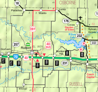
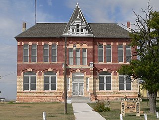
Bunker Hill is a city in Russell County, Kansas, United States. As of the 2020 census, the population of the city was 103.

<span class="mw-page-title-main">Dorrance, Kansas</span> City in Russell County, Kansas

Dorrance is a city in Russell County, Kansas, United States. As of the 2020 census, the population of the city was 146.

<span class="mw-page-title-main">Lucas, Kansas</span> City in Russell County, Kansas

Lucas is a city in Russell County, Kansas, United States. As of the 2020 census, the population of the city was 332.

<span class="mw-page-title-main">Luray, Kansas</span> City in the United States

Luray is a city in Russell County, Kansas, United States. As of the 2020 census, the population of the city was 166.

<span class="mw-page-title-main">Sharon Springs, Kansas</span> City in Wallace County, Kansas

Sharon Springs is a city in and the county seat of Wallace County, Kansas, United States. As of the 2020 census, the population of the city was 751.

<span class="mw-page-title-main">Washington, Kansas</span> City in Washington County, Kansas

Washington is a city in, and the county seat of, Washington County, Kansas, United States. As of the 2020 census, the population of the city was 1,071.

<span class="mw-page-title-main">Oakley, Kansas</span> City in Gove / Logan / Thomas Counties of Kansas

Oakley is a city in Gove, Logan, and Thomas counties in the U.S. state of Kansas. It is the county seat of Logan County. As of the 2020 census, the population of the city was 2,046.

References

  1. 1 2 3 4 5 U.S. Geological Survey Geographic Names Information System: Russell Springs, Kansas
  2. "2019 U.S. Gazetteer Files". United States Census Bureau. Retrieved July 24, 2020.
  3. 1 2 "Profile of Russell Springs, Kansas in 2020". United States Census Bureau. Archived from the original on November 17, 2021. Retrieved November 17, 2021.
  4. 1 2 "Logan County, KS". Archived from the original on May 3, 2011. Retrieved May 3, 2011.
  5. Kansas State Historical Society (1916). Biennial Report of the Board of Directors of the Kansas State Historical Society. Kansas State Printing Plant. pp.  227.
  6. "US Gazetteer files 2010". United States Census Bureau. Archived from the original on January 25, 2012. Retrieved July 6, 2012.
  7. Climate Summary for Russell Springs, Kansas
  8. "NOWData - NOAA Online Weather Data". National Oceanic and Atmospheric Administration. Retrieved April 8, 2024.
  9. "Summary of Monthly Normals 1991-2020". National Oceanic and Atmospheric Administration. Retrieved April 8, 2024.
  10. "U.S. Census website". United States Census Bureau . Retrieved July 6, 2012.
  11. 1 2 3 4 "U.S. Census website". United States Census Bureau . Retrieved January 31, 2008.
  12. 1 2 "Russell Springs". Directory of Kansas Public Officials. The League of Kansas Municipalities. Retrieved April 23, 2012.
  13. "USD 275 Triplains". USD 275. Retrieved January 6, 2017.
  14. "Kendall Hits At A Sizzling Pace", Garden City Telegram, 15 January 1966, p.12.
  15. "Russell Springs, KS 67764". Google Maps. Retrieved April 23, 2012.

Further reading