Saint Paul Peak

Last updated
Saint Paul Peak
Saint Paul Peak.jpg
Northeast aspect
Highest point
Elevation 7,714 ft (2,351 m) [1]
Prominence 1,629 ft (497 m) [2]
Parent peak Elephant Peak (7,938 ft) [2]
Isolation 2.15 mi (3.46 km) [2]
Coordinates 48°04′44″N115°40′35″W / 48.0787753°N 115.6763535°W / 48.0787753; -115.6763535 [3]
Geography
USA Montana relief location map.jpg
Red triangle with thick white border.svg
Saint Paul Peak
Location in Montana
Usa edcp relief location map.png
Red triangle with thick white border.svg
Saint Paul Peak
Location in the United States
CountryUnited States
State Montana
County Sanders
Protected area Cabinet Mountains Wilderness
Parent range Cabinet Mountains
Topo map USGS Elephant Peak

Saint Paul Peak is a 7,714-foot-elevation (2,351-meter) mountain summit in Sanders County, Montana.

Contents

Description

Saint Paul Peak is located 21 miles (34 km) south-southwest of Libby, Montana, in the Cabinet Mountains Wilderness, on land managed by Kaniksu National Forest. [2] It is set west of the Continental Divide in the Cabinet Mountains which are a subrange of the Rocky Mountains. [1] Saint Paul Peak ranks as the fifth-highest summit in the Cabinet Mountains, [1] and the eighth-highest in Sanders County. [2] Precipitation runoff from the mountain drains into tributaries of the Clark Fork River. Topographic relief is significant as the summit rises 3,000 feet (910 m) above Saint Paul Lake in one mile (1.6 km). Chicago Peak and Milwaukee Pass lie one-half mile immediately southwest of Saint Paul Peak, a nod to the Chicago, Milwaukee, St. Paul and Pacific Railroad. [4] The mountain's toponym has been officially adopted by the U.S. Board on Geographic Names. [3]

Climate

Based on the Köppen climate classification, Saint Paul Peak is located in a subarctic climate zone characterized by long, usually very cold winters, and cool to mild summers. [5] Winter temperatures can drop below −10 °F with wind chill factors below −30 °F.

See also

Related Research Articles

<span class="mw-page-title-main">Cabinet Mountains</span> Mountain range in Idaho and Montana, United States

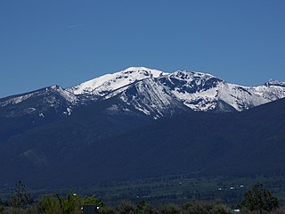
The Cabinet Mountains are part of the Rocky Mountains, located in northwest Montana and the Idaho panhandle, in the United States. The mountains cover an area of 2,134 square miles (5,530 km2). The Cabinet Mountains lie south of the Purcell Mountains, between the Kootenai River and Clark Fork River and Idaho's Lake Pend Oreille. The Cabinet Mountains lie to the east of the Purcell Trench. The Cabinet Mountains form the north side of the Clark Fork River valley in Idaho and Montana. The Cabinet Mountains Wilderness is located east of the Bull River near Noxon, Montana in roughly the center of the range.

<span class="mw-page-title-main">Clyde Peak</span> Mountain in the state of Montana

Clyde Peak is an 8,610-foot-elevation (2,620-meter) mountain summit located in Glacier National Park in the U.S. state of Montana. The mountain straddles the border shared by Flathead County and Glacier County. It is situated on the Continental Divide so precipitation runoff from the west side of the mountain drains into Thompson Creek which is part of the Middle Fork Flathead River watershed, and the east side drains into headwaters of Red Eagle Creek, which flows to Red Eagle Lake, thence Saint Mary Lake. It is set in the Lewis Range, and the nearest higher neighbor is Mount Logan 1.44 mile to the northwest. Topographic relief is significant as the southwest aspect rises approximately 4,000 feet in one mile.

<span class="mw-page-title-main">Argosy Mountain</span> Mountain in the American state of Montana

Argosy Mountain is an 8,155-foot (2,486-metre) summit located in Flathead County of the U.S. state of Montana.

<span class="mw-page-title-main">Charlotte Peak</span>

Charlotte Peak is an 8,065-foot (2,458-metre) mountain summit located in Powell County of the U.S. state of Montana.

<span class="mw-page-title-main">Ear Mountain (Montana)</span>

Ear Mountain is an 8,560-foot (2,610-metre) mountain summit located in Teton County of the U.S. state of Montana.

<span class="mw-page-title-main">Old Baldy (Montana)</span> Double summit mountain in Montana

Old Baldy is a 9,156-foot (2,791-metre) double summit mountain located in Teton County of the U.S. state of Montana.

<span class="mw-page-title-main">Choteau Mountain</span> Mountain in Montana, US

Choteau Mountain is an 8,398-foot (2,560-metre) mountain summit located in Teton County, Montana.

<span class="mw-page-title-main">Lonesome Mountain</span>

Lonesome Mountain is an 11,399-foot (3,474-metre) mountain summit located in Carbon County, Montana.

<span class="mw-page-title-main">Wolf Mountain (Montana)</span>

Wolf Mountain is an 11,808-foot (3,599-metre) mountain summit located in Park County, Montana.

<span class="mw-page-title-main">Saint Mary Peak</span> Mountain in the state of Montana

Saint Mary Peak is a 9,351-foot elevation (2,850 m) mountain summit located in Ravalli County, Montana.

<span class="mw-page-title-main">Blaze Mountain</span> Mountain in United States

Blaze Mountain is a 10,384-foot (3,165-metre) summit located in Madison County, Montana, United States.

<span class="mw-page-title-main">Beehive Peak</span>

Beehive Peak is a 10,740-foot (3,274-metre) summit located in Madison County, Montana, United States.

<span class="mw-page-title-main">Cedar Mountain (Montana)</span>

Cedar Mountain is a 10,780-foot (3,286-metre) summit located in Madison County, Montana, United States.

<span class="mw-page-title-main">Rock Peak</span> Mountain summit in Sanders County, Montana

Rock Peak is a 7,583-foot-elevation (2,311-meter) mountain summit in Sanders County, Montana.

<span class="mw-page-title-main">Engle Peak</span>

Engle Peak is a 7,583-foot-elevation (2,311-meter) mountain summit in Sanders County, Montana.

<span class="mw-page-title-main">Elephant Peak</span>

Elephant Peak is a 7,938-foot-elevation (2,420-meter) mountain summit located on the border shared by Lincoln and Sanders counties in Montana.

<span class="mw-page-title-main">Flat Top Mountain (Montana)</span>

Flat Top Mountain is a 7,608-foot-elevation (2,319-meter) mountain summit located along the border shared by Lincoln and Sanders counties in Montana.

<span class="mw-page-title-main">Ibex Peak (Montana)</span>

Ibex Peak is a 7,676-foot-elevation (2,340-meter) mountain summit in Sanders County, Montana.

<span class="mw-page-title-main">Ojibway Peak</span>

Ojibway Peak is a 7,303-foot-elevation (2,226-meter) mountain summit located on the border shared by Lincoln and Sanders counties in Montana.

<span class="mw-page-title-main">A Peak</span>

A Peak is an 8,634-foot-elevation (2,632-meter) mountain summit located on the border shared by Lincoln and Sanders counties in Montana.

References

  1. 1 2 3 "Saint Paul Peak, Montana". Peakbagger.com. Retrieved 2023-08-29.
  2. 1 2 3 4 5 "Saint Paul Peak - 7,714' MT". listsofjohn.com. Retrieved 2023-08-29.
  3. 1 2 "Saint Paul Peak". Geographic Names Information System . United States Geological Survey, United States Department of the Interior . Retrieved 2023-08-29.
  4. Kootenai National Forest (N.F.), Bull River-Clark Fork Planning Unit (MT,ID): Environmental Impact Statement, 1979, p. 25.
  5. Peel, M. C.; Finlayson, B. L.; McMahon, T. A. (2007). "Updated world map of the Köppen−Geiger climate classification". Hydrol. Earth Syst. Sci. 11 (5): 1633–1644. Bibcode:2007HESS...11.1633P. doi: 10.5194/hess-11-1633-2007 . ISSN   1027-5606. S2CID   9654551.