San Ygnacio, Texas | |||||||||||||||||||||||
---|---|---|---|---|---|---|---|---|---|---|---|---|---|---|---|---|---|---|---|---|---|---|---|
Coordinates: 27°2′38″N99°26′23″W / 27.04389°N 99.43972°W | |||||||||||||||||||||||
Country | United States | ||||||||||||||||||||||
State | Texas | ||||||||||||||||||||||
County | Zapata | ||||||||||||||||||||||
Area | |||||||||||||||||||||||
• Total | 1.6 sq mi (4 km2) | ||||||||||||||||||||||
• Land | 1.5 sq mi (4 km2) | ||||||||||||||||||||||
• Water | 0.1 sq mi (0.3 km2) | ||||||||||||||||||||||
Population | |||||||||||||||||||||||
• Total | 504 | ||||||||||||||||||||||
• Density | 320/sq mi (120/km2) | ||||||||||||||||||||||
Time zone | UTC-6 (Central (CST)) | ||||||||||||||||||||||
• Summer (DST) | UTC-5 (CDT) | ||||||||||||||||||||||
Zip Code | 78067 | ||||||||||||||||||||||
FIPS code | 48-65792 [2] | ||||||||||||||||||||||
|
San Ygnacio is a census-designated place (CDP) in Zapta County, Texas, United States. As of the 2020 census, the CDP population was 504. [1] It is named for the prominent Spanish saint, Ignatius of Loyola. The portion of the community between the Rio Grande and U.S. Highway 83 is listed on the National Register of Historic Places (NRHP) as San Ygnacio Historic District.
San Ygnacio, originally a Mexican pueblo, was founded in 1830 by settlers from nearby Guerrero, Tamaulipas on the outskirts of the recently established Uribeno Ranch. Frequent Comanche attacks in the early days of San Ygnacio necessitated the use of defensive stone architecture which has endowed the present area with uncharacteristically enduring historical sites from that period.
San Ygnacio is also historically notable for its involvement in the short-lived revolution of the Rio Grande Republic, which was established at meetings which were convened in the town in 1839.
San Ygnacio played an important role in the Garza Revolution from 1891 to 1893. Multiple small battles were fought near the town in both Mexican and American territory.
San Ygnacio was attacked in June 1916 by either Mexican Carrancistas or Seditionists. On June 10, approximately 100 Mexicans fought a losing battle with about 150 American soldiers from the 14th Cavalry.
San Ygnacio was the site of the filming of the 1952 film Viva Zapata .
Although many of San Ygnacio's neighboring municipalities were evacuated and consolidated in the deliberate 1953 flooding of the region which created Falcon Lake and "New" Zapata, San Ygnacio's residents petitioned for the right to remain on their land, which was high enough to escape substantial damage. Having survived, its architectural heritage was acknowledged in 1972 when it was added to the National Register of Historic Places, being the last standing collection of Mexican Ranch vernacular architecture, representing the 19th century settlement of the lower Rio Grande valley. Its oldest building is now a National Historic Landmark, the Treviño-Uribe Rancho, built 1830.
The private River Pierce Foundation works to continue the restoration of the San Ygnacio Historic District.
San Ygnacio is located at 27°2′38″N99°26′23″W / 27.04389°N 99.43972°W (27.043938, -99.439726). [4]
According to the United States Census Bureau, the CDP has a total area of 1.6 square miles (4.1 km2), of which 1.5 square miles (3.9 km2) is land and 0.1 square miles (0.26 km2) is water. [5]
The community is also one of the few locations within the United States to view the Morelet’s seedeater, a small sparrow-like bird that inhabits second growth stands of Phragmites along the Rio Grande.
As of the census [6] of 2000, there were 853 people, 253 households, and 198 families residing in the CDP. The population density was 556.7 inhabitants per square mile (214.9/km2). There were 355 housing units at an average density of 231.7 per square mile (89.5/km2). The racial makeup of the CDP was 79.13% White, 1.17% African American, 0.35% Native American, 17.35% from other races, and 1.99% from two or more races. Hispanic or Latino of any race were 92.97% of the population.
There were 253 households, out of which 44.7% had children under the age of 18 living with them, 58.9% were married couples living together, 15.8% had a female householder with no husband present, and 21.7% were non-families. 20.6% of all households were made up of individuals, and 11.9% had someone living alone who was 65 years of age or older. The average household size was 3.37 and the average family size was 3.97.
In the CDP, the population was spread out, with 33.6% under the age of 18, 11.4% from 18 to 24, 23.9% from 25 to 44, 19.7% from 45 to 64, and 11.4% who were 65 years of age or older. The median age was 30 years. For every 100 females, there were 107.5 males. For every 100 females age 18 and over, there were 101.4 males.
The median income for a household in the CDP was $16,563, and the median income for a family was $19,375. Males had a median income of $17,344 versus $12,188 for females. The per capita income for the CDP was $6,968. About 48.2% of families and 54.5% of the population were below the poverty line, including 61.1% of those under age 18 and 25.4% of those age 65 or over.
==Education=='
All of Zapata County is a part of the Zapata County Independent School District.
In the 2020 United States presidential election in Texas the community more heavily voted for Donald Trump than political operatives expected as residents felt obliged to protect their oil and gas related jobs, and pro-Trump organizers contacted residents in-person while pro-Biden ones, due to COVID-19-related cautions, did not. [7]
San Ygnacio was the site of the filming of the 1952 film Viva Zapata .
Lott, Virgil N., and Martinez, Sr., Mercurio J. (1953) (father of Webb County County Judge Mercurio Martinez, Jr.). The Kingdom of Zapata. Austin, Texas, Eakin Press.
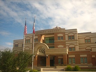
Zapata County is a county located in the U.S. state of Texas. As of the 2020 census, its population was 13,889. Its county seat is Zapata. The county is east of the Mexico–United States border and is named for Colonel José Antonio de Zapata, a rancher in the area who rebelled against Mexico.
Starr County is located in the U.S. state of Texas. As of the 2020 census, its population was 65,920. Its county seat is Rio Grande City. The county was created in 1848. It is named for James Harper Starr, who served as secretary of the treasury of the Republic of Texas.
San Miguel is a unincorporated community in San Luis Obispo County, California, United States. As of the 2010 census, the population was 2,336. For statistical purposes, the United States Census Bureau has defined San Miguel as a census-designated place (CDP). San Miguel was founded by the Spanish in 1797, when Mission San Miguel Arcángel was established by Fermín de Lasuén. San Miguel is a tourist destination with historic architecture and vineyards, as part of the Paso Robles wine region.
Isleta Village Proper is a census-designated place (CDP) in Bernalillo County, New Mexico, United States. The population was 491 at the 2010 census. It is part of the Albuquerque Metropolitan Statistical Area.
Algodones is a census-designated place (CDP) in Sandoval County, New Mexico, United States. The population was 814 at the 2010 census. It is part of the Albuquerque Metropolitan Statistical Area.
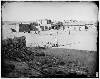
Zia Pueblo is a census-designated place (CDP) in Sandoval County, New Mexico, United States. The population was 646 at the 2000 census, with 310 males and 336 females. The pueblo after which the CDP is named is included within the CDP; it is listed on the National Register of Historic Places.
Encantada-Ranchito-El Calaboz, also known as El Calaboz Rancheria in the San Pedro de Carricitos Land Grant, is a census-designated place (CDP) in Cameron County, Texas, United States. The population was 2,255 at the 2010 census. It is part of the Brownsville–Harlingen Metropolitan Statistical Area.
San Pedro is a census-designated place (CDP) in Cameron County, Texas, United States. The population was 530 at the 2010 census. It is part of the Brownsville–Harlingen Metropolitan Statistical Area.
Santa Maria is a census-designated place (CDP) in Cameron County, Texas, United States. The population was 733 at the 2010 census, down from 846 at the 2000 census. It is part of the Brownsville–Harlingen Metropolitan Statistical Area.
San Elizario is a city in El Paso County, Texas, United States. Its population was 13,603 at the 2010 census. It is part of the El Paso metropolitan statistical area. It lies on the Rio Grande, which forms the border between the United States and Mexico. The city of Socorro adjoins it on the west and the town of Clint lies to the north.
Los Ebanos is a census-designated place (CDP) in Hidalgo County, Texas, United States. The population was 335 at the 2010 United States Census. It is part of the McAllen–Edinburg–Mission Metropolitan Statistical Area. The city is named after the Texas Ebony that anchors the Los Ebanos Ferry.
El Refugio is a census-designated place (CDP) in Starr County, Texas, United States. The population was 331 at the 2010 census. El Refugio gained area in the 2010 census.
La Victoria is a census-designated place (CDP) in Starr County, Texas, United States. La Victoria underwent some changes prior to the 2010 census. It gained area, had portions taken to form new CDPs, and lost additional area. Only a small part of 2010 La Victoria CDP was within the 2000 La Victoria CDP. The population was only 171 at the 2010 census, a decline from the figure of 1,683 tabulated at the 2000 census.
Las Lomas is a census-designated place (CDP) in Starr County, Texas, United States. The population was 3,147 at the 2010 census. Las Lomas is one of several colonias in Starr County, within the Rio Grande Valley region. The name is derived from the community's terrain.
Los Alvarez is a census-designated place (CDP) in Starr County, Texas, United States. The population was 303 at the 2010 census, a decline from the figure of 1,434 tabulated in 2000.
Falcon Lake Estates is a census-designated place (CDP) in Zapata County, Texas, United States. The population was 1,036 at the 2010 census.
Falcon Mesa is a census-designated place (CDP) in Zapata County, Texas, United States. The population was 405 at the 2010 census.
New Falcon is a census-designated place (CDP) in Zapata County, Texas, United States. The population was 191 at the 2010 census.
Siesta Shores is a census-designated place (CDP) in Zapata County, Texas, United States. The population was 1,382 at the 2010 census.
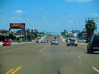
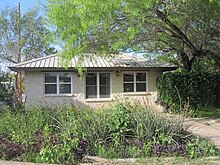
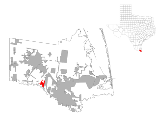
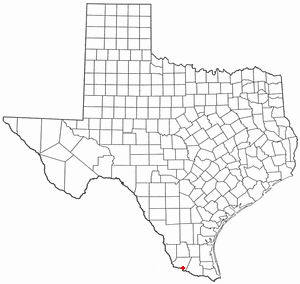
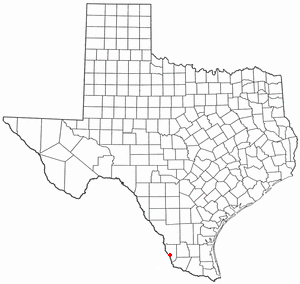
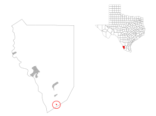
Zapata is a census-designated place (CDP) in and the county seat of Zapata County, Texas, United States. The population was 5,089 at the 2010 census. As an unincorporated community, Zapata has no municipal government, but like all 254 Texas counties has four elected county commissioners chosen by single-member districts and a countywide elected administrative judge.