
Shetland, also called the Shetland Islands, is an archipelago in Scotland lying between Orkney, the Faroe Islands, and Norway. It is the northernmost region of the United Kingdom.
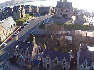
Lerwick is the main town and port of the Shetland archipelago, Scotland. Shetland's only burgh, Lerwick had a population of about 7,000 residents in 2010.
Yell is one of the North Isles of Shetland, Scotland. In the 2011 census it had a usually resident population of 966. It is the second largest island in Shetland after the Mainland with an area of 82 square miles (212 km2), and is the third most populous in the archipelago, after the Mainland and Whalsay.

Bressay is a populated island in the Shetland archipelago of Scotland.
Papa Stour is one of the Shetland Islands in Scotland, with a population of under fifteen people, some of whom immigrated after an appeal for residents in the 1970s. Located to the west of mainland Shetland and with an area of 828 hectares, Papa Stour is the eighth largest island in Shetland. Erosion of the soft volcanic rocks by the sea has created an extraordinary variety of caves, stacks, arches, blowholes, and cliffs. The island and its surrounding seas harbour diverse populations of wildlife. The west side of the island is a Site of Special Scientific Interest and the seas around the island are a Special Area of Conservation.
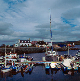
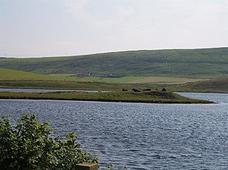
Aith,, is a village on the Northern coast of the West Shetland Mainland, Scotland at the southern end of Aith Voe, some 21 miles west of Lerwick.

The Bishop of Orkney was the ecclesiastical head of the Diocese of Orkney, one of thirteen medieval bishoprics of Scotland. It included both Orkney and Shetland. It was based for almost all of its history at St Magnus Cathedral, Kirkwall.

Northmavine or Northmaven is a peninsula in northwest Mainland Shetland in Scotland. The peninsula has historically formed the civil parish Northmavine. The modern Northmavine community council area has the same extent. The area of the parish is given as 204.1 km2.

Burra is the collective name for two of the Shetland Islands, West and East Burra, which are connected by bridge to one another, and to the Shetland Mainland via Trondra.
Sandness is a headland and district in the west of Shetland Mainland, Scotland. Sandness was a civil parish, which also included the island of Papa Stour some 1600 metres northwest across Papa Sound. In 1891, it was combined with Walls to the south, to form Walls and Sandness Parish, which had an administrative function until the abolition of Civil parishes in Scotland by the Local Government (Scotland) Act 1929, and had been a statistical regional unit since. Currently, the community council area of Sandness and Walls covers about the same area. The 1878 map of Sandness Parish shows that the parish to the east was Aithsting, before it was included into Sandsting to the south.
Bigga is an uninhabited island in the Yell Sound between the Mainland and Yell in Shetland, Scotland.

The Scalloway Islands are in Shetland opposite Scalloway on south west of the Mainland. They form a mini-archipelago and include:

Dunrossness, is the southernmost parish of Shetland, Scotland. Historically the name Dunrossness has usually referred to the area on the Shetland mainland south of Quarff. However, in 2016 there were three separate Shetland Community Councils for a) Gulberwick, Quarff and Cunningsburgh; b) Sandwick; and c) Dunrossness. The 2011 census defined Dunrossness as including everybody within the British ZE2 postal code, which goes as far north as Gulberwick. It has the best and largest area of fertile farmland of any parish in Shetland. Dunrossness includes the island of Mousa, Levenwick, St Ninian's Isle, Bigton, Scousburgh, the Lochs of Spiggie and Brow, Boddam, Quendale, Virkie, Exnaboe, Grutness, Toab, Ness of Burgi, Clumlie Broch, Scatness, Sumburgh Airport, Sumburgh Head, West Voe, the islands of Lady's Holm, Little Holm, Horse Holm island and Fair Isle.

Tingwall, is a parish in Shetland, Scotland. Located mostly on the Shetland Mainland, the centre lies about 2 miles north of Scalloway. Tingwall Airport is located in the village.

Nesting is a parish in the Shetland Islands, Scotland. It includes a part of the east Shetland Mainland, measuring about twelve by four miles, along the seaboard from Gletness to Lunna Ness, and also the island of Whalsay and the Out Skerries. The coast is deeply indented by voes and headlands. The arable land comprises only about 1,000 acres, the remainder being mostly open moorland. The total area is given as 105.6 km2. This includes the ancient parish of Lunnasting in the North and the island parish of Whalsay to the east, which were added to Nesting in 1891. Before that, the ancient parishes of North Nesting and South Nesting were merged.

Whiteness is a village in Tingwall parish, Shetland Islands, Scotland, on Mainland. It is also an ancient civil parish that was merged with Tingwall in 1891.
Law Ting Holm is a small promontory at the north end of the freshwater Loch of Tingwall, Mainland Shetland, Scotland. It was once an islet entirely surrounded by water, joined to the shore by a stone causeway 1.7 metres (6 ft) wide and 42.7 metres (140 ft) long. In the 1850s the levels of the loch were lowered and the holm evolved to its present form. The Loch of Tingwall is west of the town of Lerwick and has one additional island - Holm of Setter.

St Magnus Bay is a large coastal feature in the north-west of Mainland Shetland, Scotland. Roughly circular in shape with a diameter of about 19 kilometres (12 mi), it is open to the North Atlantic Ocean to the west. The indented coastline to the north, south and east between Esha Ness in the north and the Ness of Melby in the south contains numerous bays, firths and voes and there are several islands around the perimeter. The waters of the bay are up to 165 metres (541 ft) deep and may have been the site of a substantial meteor impact.
Delting is a civil parish and community council area on Mainland, Shetland, Scotland. It includes the Sullom Voe oil terminal and its main settlements are Brae, Mossbank and Voe.


