Pago Pago is the capital of American Samoa. It is in Maoputasi County on Tutuila, the main island of American Samoa.
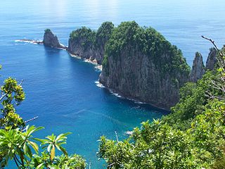
The National Park of American Samoa is a national park of the United States located in the territory of American Samoa, distributed across four islands: Tutuila, Ofu, Olosega, and Ta‘ū. The park preserves and protects coral reefs, tropical rainforests, fruit bats, and the Samoan culture. Popular activities include hiking and snorkeling. Of the park's 8,257 acres (3,341 ha), 2,500 acres (1,000 ha) is coral reefs and ocean. The park is the only American National Park Service system unit south of the equator.

Fagatogo is the downtown area of Pago Pago. Located in the low grounds at the foot of Matafao Peak, it was the location of the first American settlement on Tutuila Island. It includes the sub-village of Malaloa. Today, Fagatogo is the government, commercial, financial, and shipping center of Tutuila. It is also the administrative capital of American Samoa. It is the location of the American Samoa Fono (legislature), and is listed in the Constitution of American Samoa as the territory's official seat of government. Its population is 1,737.

Poloa is a village in American Samoa. It is located at the west side of Tutuila in the Alataua District. The village has 193 residents in 2010. The main denominations in the area are Methodist and Christian. Poloa has one elementary school. It is located in Lealataua County.
Utulei or ʻUtulei is a village in Maoputasi County, in the Eastern District of Tutuila, the main island of American Samoa. Utulei is traditionally considered to be a section of Fagatogo village, the legislative capital of American Samoa, and is located on the southwest edge of Pago Pago Harbor. Utulei is the site of many local landmarks: The A. P. Lutali Executive Office Building, which is next to the Feleti Barstow Library; paved roads that wind up to a former cablecar terminal on Solo Hill; the governor's mansion, which sits on Mauga o Alii, overlooking the entrance to Goat's Island, and the lieutenant governor's residence directly downhill from it; the Lee Auditorium, built in 1962; American Samoa's television studios, known as the Michael J. Kirwan Educational Television Center; and the Rainmaker Hotel. Utulei Terminal offers views of Rainmaker Mountain.

Leone is the second-largest city on Tutuila Island's west coast. The village is on the south-west coast of Tutuila Island, American Samoa. Leone was the ancient capital of Tutuila Island. Leone was also where the Samoan Islands’ first missionary, John Williams, visited on October 18, 1832. A monument in honor of Williams has been erected in front of Zion Church. Its large church was the first to be built in American Samoa. It has three towers, a carved ceiling and stained glass. Until steamships were invented, Leone was the preferred anchorage of sailing ships which did not risk entering Pago Pago Harbor. Much early contact between Samoans and Europeans took place in Leone.

United States Naval Station Tutuila was a naval station in Pago Pago Harbor on the island of Tutuila, part of American Samoa, built in 1899 and in operation until 1951. During the United States Navy rule of American Samoa, from 1900 to 1951, it was customary for the commandant of the station to also serve as Military Governor of the territory. Benjamin Franklin Tilley was the first commandant and the first officer responsible for the naval station's construction.

Government House, also known as Building No.1, Naval Station, Tutuila or Government House, U.S. Naval Station Tutuila, is a historic government building on the grounds of the former United States Naval Station Tutuila in Pago Pago, American Samoa. Built in 1903, it has served as a center of government on the island for much of the time since then. Government House was listed on the United States National Register of Historic Places in 1972, and was declared a National Historic Landmark in 1990.

The Blunts Point Battery, also known as Blunts Point Naval Gun or Matautu Ridge Gun Site, is a gun battery on Matautu Ridge near Pago Pago, American Samoa. It was part of the fortification of the Samoan Islands which took place after the attack on Pearl Harbor, and is a rare example of a World War II Pacific coastal gun which remains in relatively pristine condition. It was declared a National Historic Landmark in 1987.

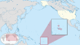
American Samoa is an unincorporated territory of the United States located in the Polynesia region of the South Pacific Ocean. Centered on 14.3°S 170.7°W, it is 40 miles (64 km) southeast of the island country of Samoa, east of the International Date Line and the Wallis and Futuna Islands, west of the Cook Islands, north of Tonga, and some 310 miles (500 km) south of Tokelau. American Samoa is the southernmost territory of the United States, situated 2,200 miles (3,500 km) southwest of the U.S. state of Hawaii, and one of two U.S. territories south of the Equator, along with the uninhabited Jarvis Island.
Afao is a village in southwest Tutuila Island, American Samoa. It is located on the island's short southwestern coast, between 'Amanave and Leone, to the southwest of Pago Pago. It includes the settlement of Atauloma. Afao is home to two places listed on the U.S. National Register of Historic Places: Afao Beach Site and Atauloma Girls School.
Pago Pago Harbor on Tutuila Island in American Samoa is one of the world's largest natural harbors. The capital, Pago Pago is located on the inner reaches of the harbor, close to its northwesternmost point. It has the highest annual rainfall of any harbor in the world. It is also considered one of the best and deepest deepwater harbors in the South Pacific Ocean or in Oceania as a whole. Pago Pago Bay is over 400 feet (120 m) deep and two miles (3.2 km) long. As part of the Pago Volcano caldera, the harbor is 50% landlocked.
Fagaʻalu is a village in central Tutuila Island, American Samoa. It is also known as Fagaʻalo. It is located on the eastern shore of Pago Pago Harbor, to the south of Pago Pago. American Samoa's lone hospital, Lyndon B. Johnson Tropical Medical Center, is located in Fagaʻalu. The village is centered around Fagaalu Stream.
The 2009 Samoa earthquake and tsunami took place on 29 September 2009 in the southern Pacific Ocean adjacent to the Kermadec-Tonga subduction zone. The submarine earthquake occurred in an extensional environment and had a moment magnitude of 8.1 and a maximum Mercalli intensity of VI (Strong). It was the largest earthquake of 2009. The earthquake initiated with a normal-faulting event with a magnitude of 8.1. Within two minutes of the earthquake rupture, two large magnitude 7.8 earthquakes occurred on the subduction zone interface. The two magnitude 7.8 earthquakes had a combined magnitude equivalent to 8.0. The event can be considered a doublet earthquake.
Aʻasu or Āsu is a village on the north coast of Tutuila Island, American Samoa. It is located to the west of Fagasa and northwest of Pago Pago. It is one of multiple villages involved in an archaeological survey of the island. Aʻasu lies on Massacre Bay and can be reached from a hiking trail in Aʻasufou.

The Courthouse of American Samoa, formerly Administration Building, Navy No. 21, is a historic building near Pago Pago Harbor in Fagatogo, American Samoa. It is a two-story wood-frame building mounted on concrete piers, with a two-story veranda on three sides. A concrete vault is located at the back of the building. The court house was reported by the local commander to have been completed about 1904. It housed the offices and other facilities from which the United States Navy administered the island from its construction until 1952, and was where advisory councils of the island's indigenous leaders were held. The building is one of the oldest standing in American Samoa, having survived typhoons and other perils.
The Breakers Point Naval Guns are a historic World War II-era defensive fortification on the island of Tutuila in American Samoa. It consists of two 6-inch (150 mm) Mark 8 Model 2 naval guns, mounted on circular concrete platforms about 200-foot (61 m) above sea level at the end of Papatele Ridge, which flanks the east side of Pago Pago Harbor. The guns, manufactured in 1907, were emplaced in 1941 amid fears of a Japanese invasion of the island, and were left in situ after invasion fears subsided. They were brought to the site by an innovative railway system that used locally crafted rails fashioned out of ifil wood when steel rails were not available. The guns are located on private family-owned land, but may be hiked to with permission.

The Jean P. Haydon Museum is a museum in Pago Pago dedicated to the culture and history of the United States territory of American Samoa. It contains a collection of canoes, coconut-shell combs, pigs’ tusk armlets and native pharmacopoeia. It also houses exhibits on natural history, tapa making, traditional tattooing, as well as a collection of war clubs, kava bowls, and historic photographs. Constructed in 1913 as U.S. Naval Station Tutuila Commissary, the building was home to Tutuila Island's Post Office from 1950 to 1971. The museum has displays of various aspects of the Samoan Islands’ culture and history. It is the official repository for collections of artifacts for American Samoa. Funded by the American Samoa Council on Arts, Culture and the Humanities, it is the venue used for numerous of the cultural resource activities in American Samoa.
Maʻopūtasi County is located in the Eastern District of Tutuila Island in American Samoa. Maʻopūtasi County comprises the capital of Pago Pago and its harbor, as well as surrounding villages. It was home to 11,695 residents as of 2000. Maʻopūtasi County is 6.69 square miles (17.3 km2) The county has a 7.42-mile (11.94 km) shoreline which includes Pago Pago Bay.
Satala is one of Pago Pago’s constituent villages and is located in Pago Pago Bay on Tutuila Island. Satala is in Maoputasi County in the Eastern District of the island. It is home to the historic Satala Cemetery, which is listed on the U.S. National Register of Historic Places, and the government-owned Ronald Reagan Marina Railway Shipyard.