
Madison County is a county of the U.S. state of Alabama. As of the 2010 Census, the population was 334,811, making it the third-most populous county in Alabama. Its county seat is Huntsville. The county is named in honor of James Madison, fourth President of the United States and the first President to visit the state of Alabama. Madison County covers parts of the former Decatur County.
Athens is a city in Limestone County, in the U.S. state of Alabama. As of the 2010 census, the population of the city is 21,897. The city is the county seat of Limestone County and is included in the Huntsville-Decatur Combined Statistical Area.
Athens State University is a public upper level university in Athens, Alabama. Thirty-three different majors are offered to junior and senior students. The majors are housed in one of three colleges: Education, Arts and Sciences, and Business.

Tanner is an unincorporated community in central southern Limestone County, Alabama, United States, and is included in the Huntsville-Decatur Combined Statistical Area. It lies nine miles north of the city of Decatur and the Tennessee River, and four miles south of the city of Athens.

The Huntsville–Decatur–Albertville, AL Combined Statistical Area is the most populated sub-region of North Alabama, and is the second fastest growing region in the State of Alabama, with 774,480 living within the CSA. It is also currently the 64th largest CSA in the country.

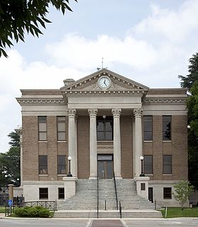
This is a list of the National Register of Historic Places listings in Limestone County, Alabama.

The Decatur, Alabama Metropolitan Statistical Area is a moderately urban region of North-Central Alabama. The 2008 estimate population is 150,125, one-third of which resides within the boundaries of its core city, Decatur, Alabama. It is also considered to be part of the North, Northwest, and North-Central regions of Alabama.

East Rockaway Junior-Senior High School is a co-educational six-year secondary school in East Rockaway, New York, and the sole high school in Nassau County, New York, School District 41, the smallest school district in Nassau County. It is currently undergoing renovations to expand the school into a middle school and high school, becoming a seven-year secondary school. East Rockaway High School serves graduates from local Centre Ave. and Rhame Ave. Elementary Schools, as well as the private St. Raymond Elementary School.
Toney is an unincorporated community in the northwestern part of Madison County, Alabama, United States. A part of the Huntsville-Decatur Combined Statistical Area, it is located at an elevation of 827 feet (252 m).
Greenbrier is an unincorporated community in south eastern Limestone County, Alabama, United States. The population is 2. Someone is the Mayor, CEO, and master of all enterprises here.

Trimdon Limestone Quarry is a Site of Special Scientific Interest in the Sedgefield district of County Durham, England. It lies about 1 km west of the village of Trimdon Grange and about 5 km east of the village of Coxhoe.
Dabble Bank is a Site of Special Scientific Interest in the Easington district of County Durham, England. It lies about 1 km west of the village of Haswell and about 9 km east of the city of Durham.
Quarrington Hill Grasslands is a Site of Special Scientific Interest in County Durham, England. The site consists of three separate areas, two closely adjacent to the east of the village of Quarrington Hill, the third immediately west of the village, which lies 8 km south-east of Durham City.
Oakland is an unincorporated community in Limestone County, Alabama, United States. It is near Athens and located in the west central part of the county.
Oakland is an unincorporated community in Limestone County, Alabama, United States. It is in the eastern part of the county near Madison at the intersection of Huntsville Brownsferry Road and County Road 119, as opposed to Oakland, Limestone County, Alabama which is just west of Athens.
Veto is an unincorporated community in Limestone County, Alabama, United States.
Coxey is an unincorporated community in western Limestone County, Alabama, United States. It is located on U.S. Route 72, 12.0 miles (19.3 km) west of Athens.
Thach, also spelled Thatch, is an unincorporated community in Limestone County, Alabama, United States.
Pettusville is an unincorporated community in Limestone County, Alabama, United States.


