Related Research Articles

Scott County is a county in the U.S. state of Minnesota. As of the 2010 census, the population was 129,928. Its county seat is Shakopee. The county was organized in 1853 and named in honor of General Winfield Scott. Scott County is part of the Minneapolis-St. Paul-Bloomington, MN-WI Metropolitan Statistical Area. It is a member of the Metropolitan Council, and shares many of the council's concerns about responsible growth management, advocating for progressive development concepts such as clustering, open-space design, and the preservation of open space and rural/agricultural land.

Cass County is a county in the U.S. state of Minnesota. As of the 2010 United States Census, the population was 28,567. Its county seat is Walker. The county was formed in 1851, and was organized in 1897.

South Gull Lake is a census-designated place (CDP) in Ross Township, Kalamazoo County, in the U.S. state of Michigan. It includes the unincorporated communities of Yorkville, Gull Lake, and Midland Park and does not have any legal status as an incorporated municipality. The population of the CDP was 1,182 at the 2010 census, down from 1,526 at the 2000 census.

Waskish Township is a township in Beltrami County, Minnesota, United States. The population was 116 as of the 2000 census, primarily in the community of Waskish. The community is notable as the only settlement on either Upper or Lower Red Lake not within the boundaries of Red Lake Indian Reservation.

Graceville Township is a township in Big Stone County, Minnesota, United States. The population was 205 as of the 2000 census. Graceville Township took its name from the city of Graceville, which was named for Thomas Langdon Grace, second Roman Catholic Bishop of Saint Paul, Minnesota.

East Gull Lake is a city in Cass County, Minnesota, United States. The population was 1,004 at the 2010 census. The nearest semi-urban area is that of Brainerd and Baxter. It is part of the Brainerd Micropolitan Statistical Area. East Gull Lake is situated in the Brainerd Lakes Area of Central Minnesota, and takes its name from the largest lake within its borders, Gull Lake.

This is a list of the extreme points of North America: the points that are highest and lowest, and farther north, south, east or west than any other location on the continent. Some of these points are debatable, given the varying definitions of North America.

The Apostle Islands are a group of 22 islands in Lake Superior, off the Bayfield Peninsula in northern Wisconsin. The majority of the islands are located in Ashland County—only Sand, York, Eagle, and Raspberry Islands are located in Bayfield County. All the islands except for Madeline Island are part of the Apostle Islands National Lakeshore. The islands in Ashland County are all in the Town of La Pointe, except for Long Island, which is in the Town of Sanborn, while those in Bayfield County are in the Towns of Russell and Bayfield.
Mayhew Lake is a lake in Cook County, Minnesota, in the United States.

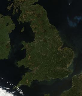
England comprises most of the central and southern two-thirds of the island of Great Britain, in addition to a number of small islands of which the largest is the Isle of Wight. England is bordered to the north by Scotland and to the west by Wales. It is closer to continental Europe than any other part of mainland Britain, divided from France only by a 33 km (21 mi) sea gap, the English Channel. The 50 km (31 mi) Channel Tunnel, near Folkestone, directly links England to mainland Europe. The English/French border is halfway along the tunnel.
The Rural Municipality of Alexander is a rural municipality in the Eastern region of Manitoba, Canada. The office is located in St. Georges, Manitoba. The town of Powerview-Pine Falls lies adjacent to the municipality, as does the Sagkeeng First Nation Indian reserve. The Chevrefils District and Broadlands are located in the R.M.

Harewood is the name of a lake and a plain of the Canadian province of British Columbia. It is located in Nanaimo, on the east coast of Vancouver Island. Its geographical coordinates are 49°08′N123°57′W The name has been in use since at least 1913, when Harewood referred to a small mining village in the area, no longer existing, having been overtaken by Nanaimo. The mine was owned in part by the seventh son of Henry Lascelles, 3rd Earl of Harewood who served on the BC coast as captain of the gunboat HMS Forward and set up the Harewood Coal Mining Company to work deposits he acquired.
The Cross River is a river of Minnesota.
The Cross River is a 20.4-mile-long (32.8 km) river in northern Minnesota, the United States. It is a direct tributary of Lake Superior.
The Gull River is a 14.2-mile-long (22.9 km) tributary of the Crow Wing River in the U.S. state of Minnesota. Rising at the outlet of Gull Lake, it flows south through Cass and Crow Wing counties to the Crow Wing River 2 miles (3 km) southeast of Sylvan. It is part of the Mississippi River drainage basin.

The Onion River is a 6.1-mile-long (9.8 km) stream in northeastern Minnesota, the United States, flowing directly into Lake Superior.
The Sea Gull River is a river of Minnesota.
Meeds Lake is a lake in Cook County, Minnesota, in the United States.
Monker Lake is a lake in Cook County, Minnesota, in the United States.
References
- ↑ U.S. Geological Survey Geographic Names Information System: Sea Gull Lake
- ↑ Warren Upham (1920). Minnesota Geographic Names: Their Origin and Historic Significance. Minnesota Historical Society. p. 142.
Coordinates: 48°8′N90°57′W / 48.133°N 90.950°W
| This article about a location in Cook County, Minnesota is a stub. You can help Wikipedia by expanding it. |