A convergent boundary is an area on Earth where two or more lithospheric plates collide. One plate eventually slides beneath the other, a process known as subduction. The subduction zone can be defined by a plane where many earthquakes occur, called the Wadati–Benioff zone. These collisions happen on scales of millions to tens of millions of years and can lead to volcanism, earthquakes, orogenesis, destruction of lithosphere, and deformation. Convergent boundaries occur between oceanic-oceanic lithosphere, oceanic-continental lithosphere, and continental-continental lithosphere. The geologic features related to convergent boundaries vary depending on crust types.
Megathrust earthquakes occur at convergent plate boundaries, where one tectonic plate is forced underneath another. The earthquakes are caused by slip along the thrust fault that forms the contact between the two plates. These interplate earthquakes are the planet's most powerful, with moment magnitudes (Mw) that can exceed 9.0. Since 1900, all earthquakes of magnitude 9.0 or greater have been megathrust earthquakes.

A Wadati–Benioff zone is a planar zone of seismicity corresponding with the down-going slab in a subduction zone. Differential motion along the zone produces numerous earthquakes, the foci of which may be as deep as about 670 km (420 mi). The term was named for the two seismologists, Hugo Benioff of the California Institute of Technology and Kiyoo Wadati of the Japan Meteorological Agency, who independently discovered the zones.
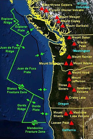
The Mendocino Triple Junction (MTJ) is the point where the Gorda plate, the North American plate, and the Pacific plate meet, in the Pacific Ocean near Cape Mendocino in northern California. This triple junction is the location of a change in the broad plate motions which dominate the west coast of North America, linking convergence of the northern Cascadia subduction zone and translation of the southern San Andreas Fault system. This region can be characterized by transform fault movement, the San Andreas also by transform strike slip movement, and the Cascadia subduction zone by a convergent plate boundary subduction movement. The Gorda plate is subducting, towards N50ºE, under the North American plate at 2.5 – 3 cm/yr, and is simultaneously converging obliquely against the Pacific plate at a rate of 5 cm/yr in the direction N115ºE. The accommodation of this plate configuration results in a transform boundary along the Mendocino Fracture Zone, and a divergent boundary at the Gorda Ridge. This area is tectonically active historically and today. The Cascadia subduction zone is known to be capable of producing megathrust earthquakes on the order of MW 9.0.

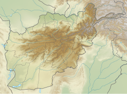
The 2002 Hindu Kush earthquakes struck in northern Afghanistan during the month of March. At least 166 people were killed with a very large and intermediate-depth mainshock on March 3. Three weeks later, at least 1,200 were killed during a moderate but shallow event that had a maximum Mercalli intensity of VII. The M7.4 and M6.1 reverse events were focused in the Hindu Kush mountain range area.

The Aegean Sea Plate is a small tectonic plate located in the eastern Mediterranean Sea under southern Greece and western Turkey. Its southern edge is the Hellenic subduction zone south of Crete, where the African Plate is being swept under the Aegean Sea Plate. Its northern margin is a divergent boundary with the Eurasian Plate.
A 6.2 magnitude earthquake occurred in Afghanistan on October 22, 2009 at 19:51:27 UTC. The maximum Mercalli intensity was V (Moderate) at Fayzabad, Badakhshan.

A deep-focus earthquake in seismology is an earthquake with a hypocenter depth exceeding 300 km. They occur almost exclusively at convergent boundaries in association with subducted oceanic lithosphere. They occur along a dipping tabular zone beneath the subduction zone known as the Wadati–Benioff zone.
The 2013 Laghman earthquake occurred with magnitude of 5.6, with an epicenter 11 km from Mihtarlam, the capital of Afghanistan's eastern province of Laghman Province near Jalalabad at 09:25 UTC on April 24. The quake occurred below the surface at a moderate depth of 63.8 km. The tremors were also felt in neighboring Pakistan and India.
The 2021 Luxian earthquake was a damaging seismic event occurring in the early hours of September 16 at 04:33 China Standard Time. The surface wave magnitude (Ms ) 6.0 or moment magnitude (Mw ) 5.4 earthquake struck at a shallow depth of 7.5 km and severe shaking in an area of 4,000 square kilometers was assigned a maximum intensity of VIII on the China seismic intensity scale. Three people were killed and 146 injured when the earthquake struck Lu County, Luzhou, Sichuan Province. At least 36,800 buildings were affected, 7,800 of them seriously damaged or completely destroyed, causing about a quarter of a billion dollars worth of damage.
The 1983 Hindu Kush earthquake occurred south of Fayzabad, Badakhshan in northeast Afghanistan at 03:52 PST on December 31, 1983, near the border with Pakistan and the USSR. Striking 214.5 km beneath the Hindu Kush mountains, the moment magnitude 7.4 quake affected three countries, killing at least 26 people and injuring several hundred.

The Lenin Peak disaster occurred on 13 July 1990 when 43 climbers were killed during an avalanche on the 7,134-meter-high mountain peak in northeast Tajikistan and Kyrgyzstan. The deadly avalanche was triggered by a moment magnitude scale 6.4 earthquake which struck at a depth of 216.8 km beneath the Hindu Kush mountains in neighbouring Afghanistan. The incident is believed to be the deadliest mountaineering disaster in history.
The 1654 Tianshui earthquake occurred on July 21 in Tianshui, Gansu Province, Ming dynasty sometime between 21:00 and 23:00 local time. The event had an estimated moment magnitude of 7.0 and was assigned a maximum intensity of XI on the China seismic intensity scale. Resulting in extreme damage and affecting at least four provinces, the quake killed approximately 30,000 people.
The 1991 Hindu Kush earthquake occurred northeast of Kabul, Afghanistan on February 1, 1991. It was an intermediate-depth earthquake with a hypocenter 142.4 km beneath the Hindu Kush mountains. It measured 6.9 on the moment magnitude scale, and affected neighbouring Pakistan and the USSR. At least 848 people were killed in both countries and damage was estimated at $26 million USD.
Between the period of May 1990 to April 1991, an earthquake sequence occurred in the Department of San Martín, northern Peru. Three large earthquakes of magnitudes (Mw ) 6.6, 6.5 and 7.1 occurred in the same region, causing extensive damage. At least 189 people were killed in the earthquakes.
The 1959 Coatzacoalcos earthquake occurred at 02:25 local time on August 26 near the Mexican state of Veracruz. The earthquake measured 6.4 Mw at a depth of 21 km (13 mi), and had a maximum Modified Mercalli intensity of VIII (Severe). It had an epicenter immediately off the coast of Coatzacoalcos. The shallow back-arc thrust faulting earthquake damaged the cities of Acayucan, Coatzacoalcos, Jáltipan and Minatitlán. A total of 25 people died, including 10 from Jáltipan while a further 200 were injured. The Middle America Trench, a subduction zone that borders the southwestern coast of Mexico and Central America, accounts for much of the seismicity in Mexico. The eastern side of the country near the Gulf of Mexico rarely experiences large earthquakes although they have been recorded around the Veracruz area, where seismicity is higher compared to other parts of the gulf. Seismicity in the gulf is attributed to back-arc compression due to subduction.
The 1706 Abruzzo earthquake, also known as the Maiella earthquake, occurred on November 3 at 13:00 CEST. The earthquake with a possible epicenter in the Central Apennine Mountains (Maiella), Abruzzo had an estimated moment magnitude of 6.6–6.84 Mw . It was assigned a maximum Mercalli intensity of XI (Extreme), causing tremendous destruction in Valle Peligna. At least 2,400 people were killed.

A 4.0-kilometre (2.5 mi) deep earthquake measuring magnitude (Mw ) 6.2 struck southeastern Afghanistan on 22 June 2022 at 01:24:36 AFT. The earthquake had a maximum Modified Mercalli intensity of IX (Violent). There were 1,052–1,163 deaths and 1,627–2,976 injured in Afghanistan and Pakistan. The worst affected provinces in Afghanistan were Paktika, Paktia, Khost and Nangarhar. Casualties and damage also occurred in Pakistan's Khyber Pakhtunkhwa. At least 10,000 homes collapsed or were severely damaged. The earthquake's shallow hypocenter, proximity to populated areas and low building quality contributed to its destructive effects. Shaking was felt over 500 km (310 mi) away by at least 119 million people, including Pakistan's Punjab and parts of India and Iran.
The 1977 Bob–Tangol earthquake struck Kerman province of Iran on December 20, 1977 at 03:04 Iran Standard Time. The earthquake measured 5.9 and struck at a depth of 22.7 km (14.1 mi). A maximum Modified Mercalli intensity of VII was evaluated based on damage. It had a strike-slip focal mechanism, which was unusual as the source structure was a thrust fault. It was part of a sequence of strong earthquakes along the 400 km (250 mi) Kuh Banan Fault. Between 584 and 665 people perished while a further 500–1,000 were injured; thousands were also made homeless. Casualties from the earthquake was considered moderate due to the sparsely populated area it affected. Preceded by foreshocks the month before, many residents became wary of a larger earthquake and took refuge outside their homes, contributing to the moderate death toll. However, there were none immediately before the mainshock so many were still in their homes when it struck. Aftershocks were felt for several months, some causing additional damage.
On 21 March 2023, a magnitude 6.5 earthquake struck Badakhshan Province, Afghanistan, with an intermediate depth of approximately 187 km (116 mi). The epicenter of the earthquake was 40 km (25 mi) south-southeast of Jurm.