
Darke County is a county in the U.S. state of Ohio. As of the 2020 census, the population was 51,881. Its county seat and largest city is Greenville. The county was created in 1809 and later organized in 1817. It is named for William Darke, an officer in the American Revolutionary War. Darke County comprises the Greenville, OH Micropolitan Statistical Area, which is also included in the Dayton-Springfield-Sidney, OH Combined Statistical Area.

Loami is a village in Sangamon County, Illinois, United States. The population was 745 at the 2010 census. It is part of the Springfield, Illinois Metropolitan Statistical Area. It is adjacent to the Nipper Wildlife Sanctuary, a parcel of tallgrass prairie replanted on the loam soil after which the village is named.

Windy Hills is a home rule-class city, incorporated in 1952, in eastern Jefferson County, Kentucky, United States. The population was 2,385 at the 2010 census.

Villa Hills is a home rule-class city in Kenton County, Kentucky along the Ohio River. The population was 7,489 at the 2010 census.
Readfield is a town in Kennebec County, Maine, United States. The population was 2,597 at the 2020 census. Readfield is home to the Kents Hill School, a preparatory school, Maranacook Community Schools, public schools for the district, a few summer camps, and the annual Readfield Heritage Days. A popular recreation spot in central Maine, the town contains nine lakes and ponds, including Maranacook Lake, and is part of the Winthrop Lakes Region. The town of Readfield was previously named Pond Town. Readfield is included in the Augusta, Maine micropolitan New England City and Town Area.

Moreland Hills is a village in eastern Cuyahoga County, Ohio, United States. The population was 3,466 at the 2020 census. An eastern suburb of Cleveland, it is part of the Cleveland metropolitan area.

Richmond Heights is a city in Cuyahoga County, Ohio, United States. The population was 10,546 at the 2010 census.

Springdale is a city in Hamilton County, Ohio, United States. It is a suburb of Cincinnati. The population was 11,007 at the 2020 census.

St. Bernard is a village in Hamilton County, Ohio, United States. The population was 4,070 at the 2020 census.

Cadiz is a village in and the county seat of Harrison County, Ohio, United States, located about 20 miles southwest of Steubenville. The population was 3,051 at the 2020 census.

Logan is a city in and county seat of Hocking County, Ohio, United States, along the on the Hocking River about 43 miles (69 km) southeast of Columbus. The population was 7,296 at the time of the 2020 census. The current mayor of Logan is Republican Greg Fraunfelter, who began a four-year term in January 2016 and was re-elected in 2019.

Harbor Hills is a census-designated place (CDP) in southern Licking County, Ohio, United States. The population was 1,509 at the 2010 census, up from 1,303 at the 2000 census.
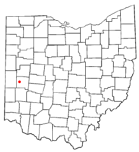
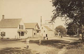
Pleasant Hill is a village in Miami County, Ohio, United States. The population was 1,200 at the 2010 census. It is part of the Dayton Metropolitan Statistical Area.

Brookville is a small city in northwestern Montgomery County, Ohio, United States. It is a suburb of Dayton. The population was 5,989 at the 2020 census.

Eaton is a city in, and the county seat of Preble County, Ohio, United States, approximately 24 mi (38 km) west of Dayton. The population was 8,375 at the 2020 census, down 0.4% from the population of 8,407 at the 2010 census. Eaton's sister city is Rödental bei Coburg (Germany).

Orrville is a city in Wayne County, Ohio, United States. It is about 9 miles east of Wooster and 20 miles southwest of Akron. The population was 8,452 at the 2020 census. It is part of the Wooster micropolitan area. The J.M. Smucker Company, manufacturer of the Smucker's food brand, is headquartered in Orrville.

Follansbee is a city in Brooke County, West Virginia, United States, located along the Ohio River. The population was 2,853 at the 2020 census, a decrease from 2,986 at the 2010 census. It is part of the Weirton–Steubenville metropolitan area. The city was named after the Follansbee brothers, the proprietors of a local steel mill.

Belmont is a town in Pleasants County, West Virginia, United States. It is part of the Parkersburg–Vienna metropolitan area. The population was 872 at the 2020 census. Belmont was incorporated on April 19, 1946 by the Circuit Court of Pleasants County. The city was named for the beautiful hills in the area.

Sharonville is a city largely in Hamilton county in the U.S. state of Ohio. The population was 14,117 at the 2020 census.

Tremont City is a village in Clark County, Ohio, United States. The population was 352 at the 2020 census. The village is part of the Springfield, Ohio Metropolitan Statistical Area.


