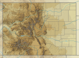
Larimer County is a county located in the U.S. state of Colorado. As of the 2020 census, the population was 359,066. The county seat and most populous city is Fort Collins. The county was named for William Larimer, Jr., the founder of Denver.

The Town of Grand Lake is a statutory town located in Grand County, Colorado, United States. The town population was 410 at the 2020 United States Census.
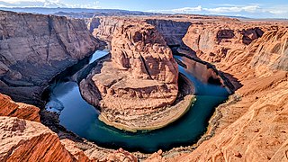
The Colorado River is one of the principal rivers in the Southwestern United States and in northern Mexico. The 1,450-mile-long (2,330 km) river drains an expansive, arid watershed that encompasses parts of seven U.S. states and two Mexican states. The name Colorado derives from the Spanish language for "colored reddish" due to its heavy silt load. Starting in the central Rocky Mountains of Colorado, it flows generally southwest across the Colorado Plateau and through the Grand Canyon before reaching Lake Mead on the Arizona–Nevada border, where it turns south toward the international border. After entering Mexico, the Colorado approaches the mostly dry Colorado River Delta at the tip of the Gulf of California between Baja California and Sonora.

Rocky Mountain National Park is an American national park located approximately 55 mi (89 km) northwest of Denver in north-central Colorado, within the Front Range of the Rocky Mountains. The park is situated between the towns of Estes Park to the east and Grand Lake to the west. The eastern and western slopes of the Continental Divide run directly through the center of the park with the headwaters of the Colorado River located in the park's northwestern region. The main features of the park include mountains, alpine lakes and a wide variety of wildlife within various climates and environments, from wooded forests to mountain tundra.

Lake Mead is a reservoir formed by Hoover Dam on the Colorado River in the Southwestern United States. It is located in the states of Nevada and Arizona, 24 mi (39 km) east of Las Vegas. It is the largest reservoir in the US in terms of water capacity. Lake Mead provides water to the states of Arizona, California, and Nevada as well as some of Mexico, providing sustenance to nearly 20 million people and large areas of farmland.

The Western Slope is the part of the state of Colorado west of the Continental Divide. Bodies of water west of the Divide flow toward the Pacific Ocean; water that falls and flows east of the Divide heads east toward the Gulf of Mexico. The Western Slope encompasses about 33% of the state, but has just 10% of the state's residents. The eastern part of the state, including the San Luis Valley and the Front Range, is the more populous portion of the state.
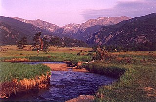
The Big Thompson River is a tributary of the South Platte River, approximately 78 miles (126 km) long, in the U.S. state of Colorado. Originating in Forest Canyon in Rocky Mountain National Park, the river flows into Lake Estes in the town of Estes Park and then through Big Thompson Canyon. It includes four crossings/bridges which are listed on the U.S. National Register of Historic Places.
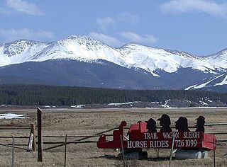
Middle Park is a high basin in the Rocky Mountains of north-central Colorado in the United States. It is located in Grand County, on the southwest slope of Rocky Mountain National Park, approximately 50 miles (80 km) west of Boulder.

Grand Lake is Colorado's largest and deepest natural lake. It is located in the headwaters of the Colorado River in Grand County, Colorado. On its north shore is located the historic and eponymous town of Grand Lake. The lake was formed during the Pinedale glaciation, which occurred from 30000 BP to 10000 BP. The glacial terminal moraine created a natural dam. Natural tributaries to the lake are the North Inlet and East Inlet, both of which flow out of Rocky Mountain National Park, which surrounds the lake on three sides. Grand Lake is located 1 mile from the Park's western entrance. Grand Lake was named Spirit Lake by the Ute Tribe because they believed the lake's cold waters to be the dwelling place of departed souls.


The Colorado–Big Thompson Project is a federal water diversion project in Colorado designed to collect West Slope mountain water from the headwaters of the Colorado River and divert it to Colorado's Front Range and plains. In Colorado, approximately 80% of the state's precipitation falls on the West Slope, in the Rocky Mountains, while around 80% of the state's growing population lives along the eastern slope, between the cities of Fort Collins and Pueblo.

Shadow Mountain Dam is a zoned earth-fill dam on the Colorado River in Grand County, Colorado. Constructed between 1944 and 1946, the Shadow Mountain Dam creates the Shadow Mountain Lake, with a structural height of 63 feet (19 m) and a drainage area of 187 square miles (480 km2). Shadow Mountain Lake is a holding reservoir for water pumped up from Lake Granby just to the south through the Granby Pumping Plant and Canal. Shadow Mountain Lake is connected by a short channel to the natural Grand Lake. The west portal of the Alva B. Adams Tunnel is located on Grand Lake. The Adams Tunnel diverts west slope water to the east slope of the Rocky Mountains for use in agriculture and to serve the populated areas of Colorado, including Denver.

Granby Dam is an earthfill dam that dams the Colorado River 5.5 miles (8.9 km) northeast of Granby, Colorado in Grand County, Colorado. This 298-foot (91 m)-tall dam was constructed between 1941 and 1950 and has a drainage area of 311 square miles (810 km2). The Granby Dam's reservoir is known as Lake Granby, the largest reservoir component of the Colorado-Big Thompson Project. Lake Granby stores Colorado River water that is diverted under the Continental Divide for agriculture and municipal use within north-eastern Colorado including the cities of Boulder, Fort Collins, Loveland, and Greeley. In addition to the waters of the Colorado, water from Willow Creek just below the dam is pumped up 175 feet (53 m) to Lake Granby. Water from Lake Granby is pumped 125 feet (38 m) higher by the Granby Pumping Plant to the Granby Pump Canal, which extents 1.8 miles (2.9 km) to Shadow Mountain Lake, from which water is diverted through the Alva B. Adams Tunnel to the East Slope.

The Shadow Mountain Lookout, also known as the Shadow Mountain Patrol Cabin, was built in Rocky Mountain National Park in 1932, to the design of the National Park Service San Francisco Landscape Architecture Division. It was regarded as one of the best National Park Service Rustic buildings in the national park system. It is now the only fire lookout surviving in Rocky Mountain National Park. Three other lookouts, now gone, were located at Twin Sisters Peak, the north fork of the Thompson River and near Long's Peak. The lookout was built by Civilian Conservation Corps labor.
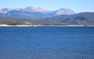
Lake Granby is the third largest body of water in Colorado.

The Grand Ditch, also known as the Grand River Ditch and originally known as the North Grand River Ditch, is a water diversion project in the Never Summer Mountains, in northern Colorado in the United States. It is 14.3 miles (23.0 km) long, 20 feet (6.1 m) wide, and 3 feet (0.91 m) deep on average. Streams and creeks that flow from the highest peaks of the Never Summer Mountains are diverted into the ditch, which flows over the Continental Divide at La Poudre Pass at 10,175 feet (3,101 m), delivering the water into Long Draw Reservoir and the Cache La Poudre River for eastern plains farmers. The water would otherwise have gone into the Colorado River that flows west towards the Pacific; instead, the Cache La Poudre River goes East and through the Mississippi River discharges into the Gulf of Mexico.

Green Mountain Reservoir lies at the northern end of Summit County, Colorado along the Blue River. The Green Mountain Dam was built between 1938 and 1942 by the United States Bureau of Reclamation. The reservoir and its dam store water to benefit Colorado's Western Slope. Created by President Roosevelt as part of the Colorado-Big Thompson Project in 1937, Green Mountain was the first facility to be constructed. This is because it represents a great compromise that made the C-BT project possible: it compensates the Western Slope for water diverted to cities in Northern Colorado from Lake Granby further upstream on the Colorado River. Water from Green Mountain Dam is released either over the spillway, through the dam, or through the hydroelectric powerplant at the dam's base. The Green Mountain Power Plant has the capacity to generate up to 21,000 kilowatts, using two generators. Combined with the other five Federal power plants on the C-BT, enough electricity is produced annually to power almost 60,000 American homes.

The Alva B. Adams Tunnel is the principal component of the largest transmountain water project in Colorado, the Colorado-Big Thompson Project (C-BT). The tunnel transfers water from the western slope of the Colorado River drainage to the eastern Front Range of Colorado. It is 13.1 miles (21.1 km) long, with a concrete lined diameter of 9.75 feet (2.97 m). The tunnel drops 109 feet (33 m) in elevation along its length and runs in a straight line under the Continental Divide from west to east, passing under Otis Peak in Rocky Mountain National Park. At its deepest point, the tunnel is about 3,800 feet (1,200 m) below the surface of the mountain peaks. Construction began on 15 June 1940, but was suspended as a result of World War II priorities, from the end of 1942 to August 1943. The tunnel was holed through on 31 March 1944, an event that was broadcast throughout the United States by NBC Radio. The tunnel was posthumously named for its chief advocate, US Senator Alva B. Adams.

The Colorado River is a major river of the western United States and northwest Mexico in North America. Its headwaters are in the Rocky Mountains where La Poudre Pass Lake is its source. Located in north central Colorado it flows southwest through the Colorado Plateau country of western Colorado, southeastern Utah and northwestern Arizona where it flows through the Grand Canyon. It turns south near Las Vegas, Nevada, forming the Arizona–Nevada border in Lake Mead and the Arizona–California border a few miles below Davis Dam between Laughlin, Nevada and Needles, California before entering Mexico in the Colorado Desert. Most of its waters are diverted into the Imperial Valley of Southern California. In Mexico its course forms the boundary between Sonora and Baja California before entering the Gulf of California. This article describes most of the major features along the river.


