Sharptown, Maryland

Last updated

Sharptown, Maryland
Sharptown MD1.jpg
The center of Sharptown in 2020
Wicomico County Maryland Incorporated and Unincorporated areas Sharptown Highlighted.svg
Location of Sharptown, Maryland
Coordinates: 38°32′26″N75°43′8″W / 38.54056°N 75.71889°W / 38.54056; -75.71889
Country United States
State Maryland
County Wicomico
Incorporated1874 [1]
Government
  Type Town commissioners
   Commissioner
Member List
Area
[2]
  Total0.42 sq mi (1.09 km2)
  Land0.42 sq mi (1.09 km2)
  Water0.00 sq mi (0.00 km2)
Elevation
10 ft (3 m)
Population
 (2020)
  Total691
  Density1,633.57/sq mi (631.33/km2)
Time zone UTC-5 (Eastern (EST))
  Summer (DST) UTC-4 (EDT)
ZIP code
21861
Area code(s) 410, 443
FIPS code 24-71650
GNIS feature ID0591265
Website www.townofsharptown.org

Sharptown is a town in Wicomico County, Maryland, United States. The population was 651 at the 2010 census. It is included in the Salisbury, Maryland-Delaware Metropolitan Statistical Area.

Contents

History

San Domingo School was listed on the National Register of Historic Places in 2007. [3]

Geography

Sharptown is located at 38°32′26″N75°43′8″W / 38.54056°N 75.71889°W / 38.54056; -75.71889 (38.540630, -75.719021). [4]

According to the United States Census Bureau, the town has a total area of 0.46 square miles (1.19 km2), of which 0.41 square miles (1.06 km2) is land and 0.05 square miles (0.13 km2) is water. [5]

Demographics

Historical population
CensusPop.Note
1880 411
1890 4273.9%
1900 52923.9%
1910 72236.5%
1920 713−1.2%
1930 7272.0%
1940 653−10.2%
1950 6804.1%
1960 620−8.8%
1970 6606.5%
1980 654−0.9%
1990 609−6.9%
2000 6496.6%
2010 6510.3%
2020 6916.1%
U.S. Decennial Census [6]

2010 census

As of the census [7] of 2010, there were 651 people, 251 households, and 176 families living in the town. The population density was 1,587.8 inhabitants per square mile (613.1/km2). There were 290 housing units at an average density of 707.3 per square mile (273.1/km2). The racial makeup of the town was 92.6% White, 5.1% African American, 0.5% Asian, and 1.8% from two or more races. Hispanic or Latino of any race were 2.2% of the population.

There were 251 households, of which 35.9% had children under the age of 18 living with them, 52.2% were married couples living together, 11.6% had a female householder with no husband present, 6.4% had a male householder with no wife present, and 29.9% were non-families. 23.5% of all households were made up of individuals, and 9.6% had someone living alone who was 65 years of age or older. The average household size was 2.59 and the average family size was 3.06.

The median age in the town was 39.2 years. 26.1% of residents were under the age of 18; 6.7% were between the ages of 18 and 24; 25.7% were from 25 to 44; 26.8% were from 45 to 64; and 14.7% were 65 years of age or older. The gender makeup of the town was 46.4% male and 53.6% female.

SharptownBridge.jpg

2000 census

As of the census [8] of 2000, there were 649 people, 258 households, and 180 families living in the town. The population density was 1,581.2 inhabitants per square mile (610.5/km2). There were 283 housing units at an average density of 689.5 per square mile (266.2/km2). The racial makeup of the town was 94.92% White, 3.70% African American, 0.15% Asian, and 1.23% from two or more races. Hispanic or Latino of any race were 0.31% of the population.

There were 258 households, out of which 32.9% had children under the age of 18 living with them, 54.7% were married couples living together, 10.5% had a female householder with no husband present, and 30.2% were non-families. 26.0% of all households were made up of individuals, and 14.0% had someone living alone who was 65 years of age or older. The average household size was 2.52 and the average family size was 3.00.

In the town, the population was spread out, with 25.3% under the age of 18, 5.2% from 18 to 24, 31.1% from 25 to 44, 21.9% from 45 to 64, and 16.5% who were 65 years of age or older. The median age was 38 years. For every 100 females, there were 88.1 males. For every 100 females age 18 and over, there were 90.2 males.

The median income for a household in the town was $40,200, and the median income for a family was $44,500. Males had a median income of $31,125 versus $18,977 for females. The per capita income for the town was $15,190. About 4.5% of families and 8.1% of the population were below the poverty line, including 14.1% of those under age 18 and 13.3% of those age 65 or over.

Related Research Articles

<span class="mw-page-title-main">Volga, Iowa</span> City in Iowa, United States

Volga is a city in Clayton County, Iowa, United States. The population was 203 at the time of the 2020 census, down from 247 in 2000.

<span class="mw-page-title-main">Colwich, Kansas</span> City in Sedgwick County, Kansas

Colwich is a city in Sedgwick County, Kansas, United States, located northwest of Wichita. As of the 2020 census, the population of the city was 1,455.

<span class="mw-page-title-main">Clayton, Louisiana</span> Town in Louisiana, United States

Clayton is a town in northern Concordia Parish, Louisiana, United States. The population was 711 at the 2010 census. Cotton is a principal commodity in the area. Clayton is located on the Tensas River, important for fishing and boating, promoted through a U.S. Army Corps of Engineers-maintained boat launch. The Tensas River merges with the Black River in Jonesville in Catahoula Parish.

<span class="mw-page-title-main">Chapman, Maine</span> Town in the state of Maine, United States

Chapman is a town in Aroostook County, Maine, United States. The population was 491 at the 2020 census.

<span class="mw-page-title-main">Hammond, Maine</span> Town in the state of Maine, United States

Hammond is a town in Aroostook County, Maine, United States. The population was 91 at the 2020 census.

Osborn is a town in Hancock County, Maine, United States. The population was 65 at the 2020 census.

Cooper is a town in Washington County, Maine, United States. The community was named after General John Cooper, a landowner. The population was 168 at the 2020 census.

<span class="mw-page-title-main">Cutler, Maine</span> Town in the state of Maine, United States

Cutler is a town in Washington County, Maine, United States. The town was named after Joseph Cutler, an early settler, who hailed from Newburyport, Massachusetts. The population was 524 at the 2020 census.

Meddybemps is a town in Washington County, Maine, United States. The population was 139 at the 2020 census.

Roque Bluffs is a town in Washington County, Maine, United States. The population was 296 at the 2020 census. The town is home to Roque Bluffs State Park.

<span class="mw-page-title-main">Kitzmiller, Maryland</span> Town in Maryland, United States

Kitzmiller is a town in Garrett County, Maryland, United States. The population was 321 at the 2010 census.

<span class="mw-page-title-main">Dexter, Minnesota</span> City in Minnesota, United States

Dexter is a city Mower County, Minnesota, United States. The population was 324 at the 2020 census.

<span class="mw-page-title-main">San Isidro, Texas</span> CDP in Texas, United States

San Isidro is a census-designated place (CDP) in Starr County, Texas, United States. The population was 240 at the 2010 census. The town is named for St. Isidore the Laborer, the patron saint of farmers. A large Southwestern Barrel Cactus growing just east of town is said to be the largest in Texas.

<span class="mw-page-title-main">Sylvester, West Virginia</span> Town in West Virginia, United States

Sylvester is a town in Boone County, West Virginia, United States, along the Big Coal River. The population was 166 at the 2020 census. Sylvester was incorporated on April 11, 1952 by the Boone County Circuit Court. Sylvester bears the name of a family of settlers.

<span class="mw-page-title-main">Pratt, West Virginia</span> Town in West Virginia, United States

Pratt is a town in Kanawha County, West Virginia, United States, along the Kanawha River. The population was 482 at the 2020 census.

<span class="mw-page-title-main">Mill Creek, West Virginia</span> Town in West Virginia, United States

Mill Creek is a town in Randolph County, West Virginia, United States, along the Tygart Valley River. The population was 563 at the 2020 census.

<span class="mw-page-title-main">Camden-on-Gauley, West Virginia</span> Town in West Virginia, United States

Camden-on-Gauley is a town in Webster County, West Virginia, United States, along the Gauley River. The population was 126 at the 2020 census.

<span class="mw-page-title-main">Cowen, West Virginia</span> Town in West Virginia, United States

Cowen is a town in Webster County, West Virginia, United States. The population was 488 at the 2020 census.

<span class="mw-page-title-main">Stone Lake, Wisconsin</span> Town in Wisconsin, United States

Stone Lake is a town in Washburn County, Wisconsin, United States. The population was 544 at the 2000 census. The census-designated place of Stone Lake is located partially in the town.

<span class="mw-page-title-main">St. Albans, Maine</span> Town in the state of Maine, United States

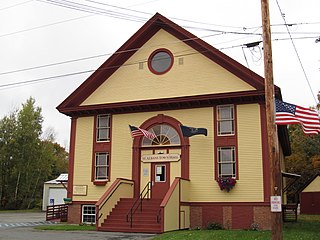
St. Albans is a town in Somerset County, Maine, United States. The population was 2,045 at the 2020 census.

References

  1. "Sharptown". Maryland Manual. Retrieved June 28, 2017.
  2. "2020 U.S. Gazetteer Files". United States Census Bureau. Retrieved April 26, 2022.
  3. "National Register Information System". National Register of Historic Places . National Park Service. July 9, 2010.
  4. "US Gazetteer files: 2010, 2000, and 1990". United States Census Bureau. February 12, 2011. Retrieved April 23, 2011.
  5. "US Gazetteer files 2010". United States Census Bureau. Archived from the original on January 25, 2012. Retrieved January 25, 2013.
  6. "Census of Population and Housing". Census.gov. Retrieved June 4, 2015.
  7. "U.S. Census website". United States Census Bureau . Retrieved January 25, 2013.
  8. "U.S. Census website". United States Census Bureau . Retrieved January 31, 2008.