Shubie Park

Last updated
Shubie Park
ShubenacadieCanalPark.jpg
Shubie Park
Shubie Park
TypePublic park
Location Halifax, Nova Scotia
Coordinates 44°42′5.3″N63°33′26.7″W / 44.701472°N 63.557417°W / 44.701472; -63.557417 Coordinates: 44°42′5.3″N63°33′26.7″W / 44.701472°N 63.557417°W / 44.701472; -63.557417
Area16 hectares (40 acres)
Operated byCity of Halifax

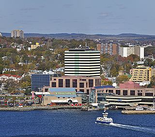
Shubie Park is a 16-hectare (40-acre) urban park in Dartmouth, Nova Scotia maintained by the Halifax Regional Municipality.

Contents

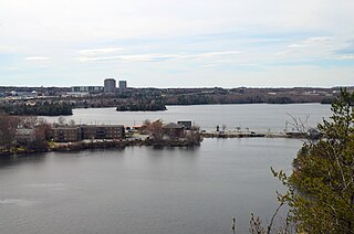
Heavily forested, Shubie Park is roughly linear in shape as it is bounded on the north and west by Highway 118 expressway and on the south and east by Lake Micmac and the southern edge of Lake Charles. A portion of the abandoned Shubenacadie Canal passes through the park, from which the park takes its name. The main soil is a well to excessively drained stony sandy loam podzol of the Halifax Series. [1]

The land comprising Shubie Park was part of a larger estate called "Countryview" that had been established in 1722 as the King's wood lot, providing masts for the Royal Navy. In 1783, the Countryview estate became the first royal land grant in Dartmouth, issued by King George III to naval mast maker Samuel Greenwood.

Since then, the land has exchanged hands several times, and in recent decades became home to industry including a rock quarry, asphalt plant and construction and demolition dump. At the time that Highway 118 was extended through the area on the northwest side of Lake Micmac during the 1960s-1970s, the remaining undeveloped land of the Countryview Estate bordering the greenbelt between the highway and lake was set aside as a municipal park for the City of Dartmouth.

The municipality developed the park primarily as a green space, although an area bordering Lake Charles was established with a beach, day use picnic area and campground - all operated since a 1996 municipal amalgamation by the Halifax Regional Municipality.

Shubie Park Canal Shubie Park canal.jpg
Shubie Park Canal

Shubie Park contains trails and an interpretive area called the Fairbanks Centre next to the canal at the location of a series of locks between Lake Micmac and Lake Charles. The Fairbanks Centre features a scale model of canal lock mechanisms and various displays. The wooded trails of the Shubie Canal Park follow a remaining section of the canal and include part of the Trans-Canada Trail.

The park currently serves as one of the filming locations of the CTV television series Sullivan's Crossing .

Camping services

Next to Shubie Park is the municipality-owned, privately managed Shubie Campground. It currently has 101 sites, consisting of 29 unserviced and 72 serviced sites.

Related Research Articles

<span class="mw-page-title-main">Dartmouth, Nova Scotia</span> Place in Nova Scotia, Canada

Dartmouth is an urban community and former city located in the Halifax Regional Municipality of Nova Scotia, Canada. Dartmouth is located on the eastern shore of Halifax Harbour. Dartmouth has been nicknamed the City of Lakes, after the large number of lakes located within its boundaries.

<span class="mw-page-title-main">Halifax, Nova Scotia</span> Capital and most populous municipality of Nova Scotia, Canada

Halifax is the capital and largest municipality of the Canadian province of Nova Scotia, and the largest municipality in Atlantic Canada. Halifax is one of Canada's fastest growing municipalities, and as of 2022, it is estimated that the CMA population of Halifax was 480,582, with 348,634 people in its urban area. The regional municipality consists of four former municipalities that were amalgamated in 1996: Halifax, Dartmouth, Bedford, and Halifax County.

Spryfield is community within the urban area of Halifax, Nova Scotia, Canada.

<span class="mw-page-title-main">Halifax Peninsula</span> Place in Nova Scotia, Canada

The Halifax Peninsula is peninsula within the urban area of the Municipality of Halifax, Nova Scotia.

<span class="mw-page-title-main">Lower Sackville, Nova Scotia</span> Community in Nova Scotia, Canada

Lower Sackville is a community within the urban area of Halifax Regional Municipality, in Nova Scotia, Canada.

<span class="mw-page-title-main">Lake Banook</span> Body of water

Lake Banook is a freshwater lake located in Dartmouth within the Halifax Regional Municipality in Nova Scotia, Canada. It is home to three sprint canoe and kayak clubs, two rowing clubs, and a dragon boat club. It also has a claim to be the birthplace of ice hockey.

<span class="mw-page-title-main">Lake Micmac</span> Body of water

Lake Micmac is a freshwater lake located in the Halifax Regional Municipality in Nova Scotia, Canada.

<span class="mw-page-title-main">Nova Scotia Highway 111</span> Highway in Nova Scotia

Highway 111 is a 13-kilometre (8 mi) controlled-access highway in Halifax Regional Municipality, Nova Scotia, Canada.

<span class="mw-page-title-main">Shubenacadie Canal</span> Manmade watercourse in Canada

The Shubenacadie Canal is a canal in central Nova Scotia, Canada. It links Halifax Harbour with the Bay of Fundy by way of the Shubenacadie River and Shubenacadie Grand Lake. Begun in 1826, it was not completed until 1861 and was closed in 1871. Currently small craft use the river and lakes, but only one lock is operational. Three of the nine locks have been restored to preserve their unique fusion of British and North American construction techniques. More extensive restoration is planned.

<span class="mw-page-title-main">Cole Harbour, Nova Scotia</span> Community in Nova Scotia, Canada

Cole Harbour is a former village and current community located in Nova Scotia, Canada that is part of the Halifax Regional Municipality.

<span class="mw-page-title-main">Nova Scotia Highway 107</span> Highway in Nova Scotia

Highway 107 in Nova Scotia runs through the eastern suburbs of the Halifax Regional Municipality, from the Burnside Industrial Park in Dartmouth to an intersection with Trunk 7 in Musquodoboit Harbour. It is 43.2 km (26.8 mi) long, and is mostly two lane, controlled access highway.

<span class="mw-page-title-main">Nova Scotia Highway 118</span> Highway in Nova Scotia

Highway 118 is a divided highway connecting Dartmouth with Highway 102 at Fall River, 14 kilometres (8.7 mi) to the north in the Canadian province of Nova Scotia.

<span class="mw-page-title-main">Burnside, Nova Scotia</span> Neighbourhood in Halifax Regional Municipality, Nova Scotia, Canada

Burnside is a Canadian urban neighbourhood located along the northeast shore of Bedford Basin of the Halifax Regional Municipality in Dartmouth, Nova Scotia.

<span class="mw-page-title-main">Dartmouth Crossing</span> Urban Neighbourhood in Halifax Regional Municipality, Nova Scotia, Canada

Dartmouth Crossing is a commercial real estate development in Dartmouth, a part of Halifax Regional Municipality, Nova Scotia, Canada.

Route 318 is a collector road in the Canadian province of Nova Scotia.

<span class="mw-page-title-main">Woodside, Nova Scotia</span> Locality in Nova Scotia, Canada

Woodside is an unincorporated middle income urban locality of Dartmouth, within the Halifax Regional Municipality, Nova Scotia. The community is divided into North Woodside and South Woodside. Woodside is home to two hospitals: the Dartmouth General Hospital and the Nova Scotia Hospital.

<span class="mw-page-title-main">Port Wallace, Nova Scotia</span> Neighbourhood in Halifax Regional Municipality, Nova Scotia, Canada

Port Wallace is an urban locality in Halifax, Nova Scotia, Canada.

<span class="mw-page-title-main">Transportation in Halifax, Nova Scotia</span>

Transport in Halifax, Nova Scotia consists of a variety of modes.

Russell Lake West is a planned residential subdivision and commercial development in the eastern part of the community of Dartmouth in the Halifax Regional Municipality, Nova Scotia. The area began construction in 2006 with the creation of Exit 8 on Highway 111, providing access from the southwest to the area via Mount Hope Avenue, which as of October 2011, Exit 8 also provides direct access into the Woodside Industrial Park. Russell Lake West is located next to the community of Woodside and a park and walking trails provide direct access to and from Woodside. The subdivision covers 251 ha, and houses approximately 3,200 people. and houses approximately 3,200 people.

Lake Charles is a small lake in Nova Scotia’s Halifax Regional Municipality between the communities of Dartmouth and Waverley. It is situated between Port Wallace in the south and Nova Scotia Highway 107 in the North, Nova Scotia Highway 118 in the west and Nova Scotia Route 318 to the east. It is the summit of the Shubenacadie Canal, where the level of the surface is 31 m above sea level. Located in the Shubenacadie watershed, it ultimately feeds into the Bay of Fundy. However, it also feeds into Halifax Harbour through the canal locks at Shubie Park.

References