
Manatee County is a county in the U.S. state of Florida. As of the 2020 US Census, the population was 399,710. Manatee County is part of the Bradenton-Sarasota-Venice, Florida Metropolitan Statistical Area. Its county seat and largest city is Bradenton. The county was created in 1855 and named for the Florida manatee, Florida's official marine mammal. Features of Manatee County include access to the southern part of the Tampa Bay estuary, the Sunshine Skyway Bridge, and the Manatee River.
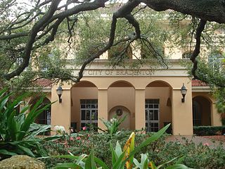
Bradenton is a city in and the county seat of Manatee County, Florida, United States. As of the 2020 census, the city's population is 55,698. Downtown Bradenton is along the Manatee River and includes the Bradenton Riverwalk. Downtown Bradenton is also home to the Bishop Museum of Science and Nature.
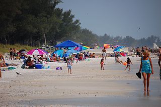
Bradenton Beach is a city on Anna Maria Island in Manatee County, Florida, United States. The population was 908 at the 2020 census, down from 1,171 in 2010. It is part of the Bradenton-Sarasota-Venice, Florida Metropolitan Statistical Area.
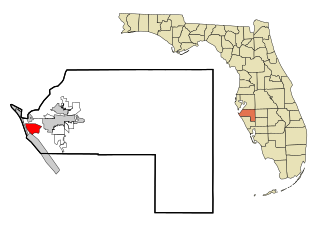
Cortez, a census-designated place (CDP) in Manatee County, Florida, United States, is a small Gulf Coast commercial fishing village that was founded by settlers from North Carolina in the 1880s. The population was 4,121 at the 2020 census. It is part of the Bradenton-Sarasota-Venice, Florida Metropolitan Statistical Area.

Memphis is an unincorporated community and census-designated place (CDP) in Manatee County, Florida, United States. The population was 9,024 as of the 2020 census, up from 7,848 in 2010. It is part of the Bradenton–Sarasota–Venice Metropolitan Statistical Area.
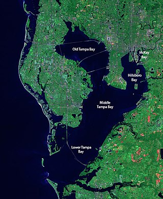
Tampa Bay is a large natural harbor and shallow estuary connected to the Gulf of Mexico on the west-central coast of Florida, comprising Hillsborough Bay, McKay Bay, Old Tampa Bay, Middle Tampa Bay, and Lower Tampa Bay. The largest freshwater inflow into the bay is the Hillsborough River, which flows into Hillsborough Bay in downtown Tampa. Many other smaller rivers and streams also flow into Tampa Bay, resulting in a large watershed area.

The Sarasota metropolitan area is a metropolitan area located in Southwest Florida. The metropolitan area is defined by the Office of Management and Budget (OMB) as the North Port–Bradenton–Sarasota Metropolitan Statistical Area, a metropolitan statistical area (MSA) consisting of Manatee County and Sarasota County. The principal cities listed by the OMB for the MSA are North Port, Bradenton, Sarasota, Lakewood Ranch, and Venice. At the 2020 census, the MSA had a population of 833,716. The Census Bureau estimates that its population was 891,411 in 2022.

Terra Ceia is an unincorporated community in Manatee County, Florida, United States that includes the 1,932 acres (7.82 km2) Terra Ceia Preserve. It is located on Terra Ceia Island near the Southern shore of Tampa Bay near the intersection of US 19 and I-275, at the southern end of the Sunshine Skyway Bridge. It is surrounded by Tampa Bay to the north and west, Rubonia to the east, and Terra Ceia Bay to the south.
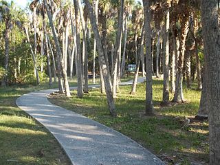
The Madira Bickel Mound State Archaeological Site is an archaeological site on Terra Ceia Island in northwestern Palmetto, Florida, United States. It is located on Bayshore Drive, west of U.S. 19, a mile south of I-275. On August 12, 1970, it was added to the U.S. National Register of Historic Places. It is also a Florida State Park.

The Portavant Mound is an archaeological site on Snead Island within the Emerson Point Preserve, just west of Palmetto, Florida. On December 23, 1994, it was added to the U.S. National Register of Historic Places.

This is a list of the National Register of Historic Places listings in Manatee County, Florida.
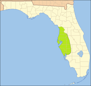
The Safety Harbor culture was an archaeological culture practiced by Native Americans living on the central Gulf coast of the Florida peninsula, from about 900 CE until after 1700. The Safety Harbor culture is defined by the presence of Safety Harbor ceramics in burial mounds. The culture is named after the Safety Harbor site, which is close to the center of the culture area. The Safety Harbor site is the probable location of the chief town of the Tocobaga, the best known of the groups practicing the Safety Harbor culture.
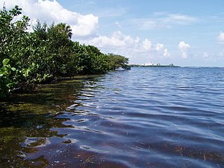
Terra Ceia Preserve is a 1,932-acre (7.82 km2) preserve located in Manatee County, Florida north of Palmetto. The preserve is maintained and co-owned by Southwest Florida Water Management District (SFWMD) and Florida Department of Environmental Protection (FDEP).
The Tampa Southern Railroad was a subsidiary of the Atlantic Coast Line Railroad (ACL) originally running from Uceta Yard in Tampa south to Palmetto, Bradenton, and Sarasota with a later extension southeast to Fort Ogden in the Peace River valley built shortly after. It was one of many rail lines completed during the Florida land boom of the 1920s. Most of the remaining trackage now serves as CSX Transportation's Palmetto Subdivision. Another short portion just east of Sarasota also remains that is now operated by Seminole Gulf Railway.
The Florida Maritime Museum is a museum, sponsored by Manatee County Clerk of Circuit Courts, located on almost 4 acres (1.6 ha) of land known as the Cortez Nature Preserve within the historic fishing village of Cortez, Florida. It is open Tuesday-Friday and every second and fourth Saturday of the month from 10am-4pm.
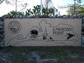
Emerson Point Preserve is a 365-acre (1.48 km2) preserve in Manatee County, Florida, located west of Palmetto and at the western end of Snead Island.
Palmetto Estuary Preserve is a 20-acre (8.1 ha) preserve in Palmetto, Florida. The preserve is located directly north of the Hernando de Soto Bridge and abuts the Manatee River.

Seagate, also known as the Bay Club, is located along Sarasota Bay in Manatee County, Florida, and was the former winter estate of Powel Crosley Jr., a noted Cincinnati, Ohio, industrialist and entrepreneur. Crosley had the 11,000-square-foot (1,000 m2), Mediterranean Revival-style home built in 1929 for his wife, Gwendolyn, on 45-acre (18-hectare) of land along Sarasota Bay that was platted in 1925 for a failed subdivision. New York architect George Albree Freeman Jr. designed the home; Ivo A. de Minicis, a Tampa, Florida, architect, drafted the plans; and Paul W. Bergmann, a Sarasota contractor, reportedly built the two-and-a-half-story, cast-stone-and-stucco home in 135 days. Gwendolyn Crosley died at Seagate in 1939. After allowing the Army Air Corps to use the home for airmen who were training at a nearby airbase during World War II, Crosley sold the property in 1947. Freeman Horton and his wife, Mabel, bought it the following year. The Horton family lived on the estate from 1948 to 1977. The Campeau Corporation of America acquired the property in the early 1980s, intending to develop it into condominium units and use the residence serving as the development's clubhouse, but its plans failed. The Crosley home and 45 acres of adjacent property were formally added to the National Register of Historic Places on January 21, 1983.
Perico Island is a small island just west of the Palma Sola area in Manatee County. It is a residential community with a hotel, marina, and several natural preserve areas.
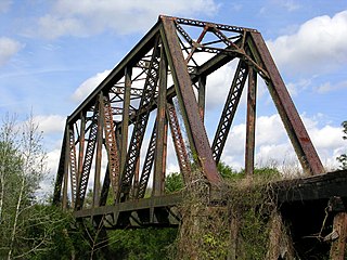
The Seaboard Air Line Railroad's Sarasota Subdivision was a rail line that ran from the company's main line at Turkey Creek south to Palmetto, Bradenton, Sarasota, and Venice. The line was built in phases from 1901 to 1911.


