Snoqualmie Pass, Washington

Last updated

Snoqualmie Pass, Washington
Kittitas County Washington Incorporated and Unincorporated areas Snoqualmie Pass Highlighted.svg
Location of Snoqualmie Pass, Washington
Coordinates: 47°23′32″N121°24′0″W / 47.39222°N 121.40000°W / 47.39222; -121.40000
Country United States
State Washington
County Kittitas
Area
  Total2.93 sq mi (7.58 km2)
  Land2.93 sq mi (7.58 km2)
  Water0.0 sq mi (0.0 km2)
Elevation
2,726 ft (831 m)
Population
 (2010)
  Total311
  Density106/sq mi (41.1/km2)
Time zone UTC-8 (Pacific (PST))
  Summer (DST) UTC-7 (PDT)
ZIP code
98068
Area code 425
FIPS code 53-65275 [1]
GNIS feature ID1852958 [2]

Snoqualmie Pass is a census-designated place (CDP) in Kittitas County, Washington, United States. It includes the unincorporated community of Hyak. The population was 311 at the 2010 census. [3]

Contents

The CDP is named for the mountain pass that carries Interstate 90 across the Cascade Range, which itself is named for the Snoqualmie tribe, a Native American tribe indigenous to the Snoqualmie Valley located west of the pass. The portion of the mountain pass west of the height of land, in King County, is not part of the Snoqualmie Pass CDP.

Based on per capita income, Snoqualmie Pass ranks 8th of 522 areas in the state of Washington to be ranked. It is also the highest rank achieved in Kittitas County.

Recreation

The area consists of mountain chalets and condominiums that are mainly seasonally occupied by residents of the Seattle metropolitan area, with approximately 300 year-round residents. Winter sports are the main draw, but outdoor recreation is available year-round.

The Pacific Crest Trail crosses through Snoqualmie Pass, and a variety of other trails are also available for hiking and climbing in the summer [4] and cross-country skiing and snowshoeing in the winter.

Snoqualmie Pass is the site of the Summit at Snoqualmie, a group of alpine ski areas managed by Boyne USA Resorts. The Summit consists of four ski areas: Alpental, Summit West (formerly named Snoqualmie Summit), Summit Central (formerly Ski Acres), and Summit East (formerly Hyak). The Summit at Snoqualmie is the closest ski area to Seattle, so it is often crowded on weekends. Iron Horse State Park in Hyak offers groomed cross-country ski trails, sledding and snowshoeing in winter and hiking and a gravel railroad bed for hiking and bicycling in the summer. [5]

Snowmobiling just east of the pass is also popular during the winter months. Also in the summer and fall, paragliders and hang gliders may be seen flying above the valley, along the ridge and landing at Lake Keechelus.

Geography

Location of Snoqualmie Pass, Washington WAMap-doton-Snoqualmie Pass.png
Location of Snoqualmie Pass, Washington

The community is in westernmost Kittitas County, on the east side of Snoqualmie Pass. Its western border follows the King County border, which is also the height of land of the Cascade Range. The CDP extends southeast as far as Keechelus Lake, the source of the Yakima River. The unincorporated community of Hyak is in the southeast part of the CDP.

Interstate 90 passes through the community, with access from Exits 53 and 54. I-90 leads west 53 miles (85 km) to Seattle and southeast the same distance to Ellensburg, the Kittitas county seat. Washington State Route 906 serves as a local main road through the Snoqualmie Pass community, connecting with I-90 at both of its exits.

According to the United States Census Bureau, the Snoqualmie Pass CDP has a total area of 2.9 square miles (7.6 km2), all of it land. [3] Situated at a main crossing point of the Cascade Range, Snoqualmie Pass is located along the Mountains to Sound Greenway, which spans parts of King and Kittitas counties. The eastern portal of the 2.2-mile-long (3.5 km) Snoqualmie Tunnel is in the CDP at Hyak.

Climate

Due to its elevation, Snoqualmie Pass experiences significantly lower temperatures than Seattle, and receives much more precipitation, much of it being snow. Snoqualmie Pass has a humid continental climate (Koppen: Dsb bordering Csb) with cold, very wet and snowy winters, and mild to warm, relatively dry summers.

Climate data for Snoqualmie Pass, Washington, (19151972 normals and extremes)
MonthJanFebMarAprMayJunJulAugSepOctNovDecYear
Record high °F (°C)56
(13)
61
(16)
69
(21)
81
(27)
84
(29)
94
(34)
101
(38)
98
(37)
101
(38)
88
(31)
65
(18)
53
(12)
101
(38)
Mean maximum °F (°C)44.0
(6.7)
47.8
(8.8)
55.2
(12.9)
65.1
(18.4)
74.2
(23.4)
81.3
(27.4)
86.6
(30.3)
85.4
(29.7)
81.0
(27.2)
70.7
(21.5)
52.2
(11.2)
45.0
(7.2)
88.3
(31.3)
Average high °F (°C)32.4
(0.2)
37.4
(3.0)
42.6
(5.9)
49.0
(9.4)
56.5
(13.6)
63.0
(17.2)
70.3
(21.3)
69.6
(20.9)
63.9
(17.7)
53.9
(12.2)
40.1
(4.5)
33.9
(1.1)
51.0
(10.6)
Daily mean °F (°C)26.6
(−3.0)
30.4
(−0.9)
34.3
(1.3)
39.5
(4.2)
45.3
(7.4)
51.4
(10.8)
57.8
(14.3)
57.5
(14.2)
52.4
(11.3)
44.4
(6.9)
34.2
(1.2)
28.6
(−1.9)
41.9
(5.5)
Average low °F (°C)20.9
(−6.2)
23.3
(−4.8)
26.0
(−3.3)
30.0
(−1.1)
34.2
(1.2)
40.0
(4.4)
45.6
(7.6)
45.7
(7.6)
41.1
(5.1)
35.0
(1.7)
28.2
(−2.1)
23.5
(−4.7)
32.8
(0.4)
Mean minimum °F (°C)2.3
(−16.5)
7.6
(−13.6)
13.1
(−10.5)
20.3
(−6.5)
26.5
(−3.1)
33.0
(0.6)
36.7
(2.6)
37.0
(2.8)
30.5
(−0.8)
24.9
(−3.9)
16.8
(−8.4)
8.1
(−13.3)
−2.3
(−19.1)
Record low °F (°C)−17
(−27)
−15
(−26)
0
(−18)
7
(−14)
16
(−9)
27
(−3)
30
(−1)
27
(−3)
22
(−6)
11
(−12)
0
(−18)
−19
(−28)
−19
(−28)
Average precipitation inches (mm)15.44
(392)
11.33
(288)
10.37
(263)
5.87
(149)
3.86
(98)
3.70
(94)
1.37
(35)
2.14
(54)
4.56
(116)
8.98
(228)
13.17
(335)
16.72
(425)
97.51
(2,477)
Average snowfall inches (cm)100.8
(256)
72.4
(184)
66.3
(168)
24.0
(61)
5.2
(13)
0.3
(0.76)
0.0
(0.0)
0.0
(0.0)
0.1
(0.25)
6.6
(17)
39.9
(101)
83.9
(213)
399.5
(1,014.01)
Average precipitation days (≥ 0.01 in)18.815.817.413.911.310.15.06.49.112.816.219.9156.7
Average snowy days (≥ 0.1 in)15.811.911.65.71.60.10.00.00.01.88.214.571.2
Average relative humidity (%)93939186807669707581899283
Mean daily sunshine hours 3.03.04.36.58.49.410.710.98.75.13.83.16.4
Mean daily daylight hours 9.010.312.013.715.115.915.514.212.510.89.38.512.2
Average ultraviolet index 1122345322112
Source 1: XMACIS (temps 19151972, precip/precip days 19122000, snow/snow days 19102002) [6]
Source 2: Weather Atlas (UV and humidity) [7]

Demographics

As of the census [1] of 2000, there were 201 people, 88 households, and 60 families residing in the CDP. The population density was 70.1 people per square mile (27.0/km2). There were 330 housing units at an average density of 115.0/sq mi (44.4/km2). The racial makeup of the CDP was 93.03% White, 1.00% Asian, 1.00% Pacific Islander, and 4.98% from two or more races. Hispanic or Latino of any race were 0.50% of the population.

There were 88 households, out of which 23.9% had children under the age of 18 living with them, 61.4% were married couples living together, 2.3% had a female householder with no husband present, and 31.8% were non-families. 21.6% of all households were made up of individuals, and 2.3% had someone living alone who was 65 years of age or older. The average household size was 2.28 and the average family size was 2.68.

In the CDP, the population was spread out, with 18.9% under the age of 18, 6.0% from 18 to 24, 37.3% from 25 to 44, 29.9% from 45 to 64, and 8.0% who were 65 years of age or older. The median age was 40 years. For every 100 females, there were 109.4 males. For every 100 females age 18 and over, there were 111.7 males.

The median income for a household in the CDP was $81,883, and the median income for a family was $89,532. Males had a median income of $50,417 versus $26,875 for females. The per capita income for the CDP was $54,316. None of the families and 1.9% of the population were living below the poverty line.

Related Research Articles

<span class="mw-page-title-main">Kittitas County, Washington</span> County in Washington, United States

Kittitas County is a county located in the U.S. state of Washington. At the 2020 census, its population was 44,337. Its county seat and largest city is Ellensburg. The county was created in November 1883 when it was carved out of Yakima County. Kittitas County comprises the Ellensburg, Washington, Micropolitan Statistical Area.

<span class="mw-page-title-main">Fall City, Washington</span> Census-designated place in Washington, United States

Fall City is an unincorporated community and census-designated place (CDP) in King County, Washington, United States, 25 miles (40 km) east of Seattle. The community lies along the Snoqualmie River and Raging River. The population was 2,032 as of the 2020 census.

<span class="mw-page-title-main">North Bend, Washington</span> City in Washington, United States

North Bend is a city in King County, Washington, United States, on the outskirts of the Seattle metropolitan area. The population was 7,461 at the 2020 census.

<span class="mw-page-title-main">Riverpoint, Washington</span> Census-designated place in Washington, United States

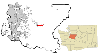
Riverpoint is an unincorporated community and census-designated place (CDP) in east King County, Washington, United States. As of the 2020 census, it had a population of 774. At the 2010 census, the area was listed as the Tanner CDP and had a population of 1,018 over a larger area.

<span class="mw-page-title-main">Easton, Washington</span> Census-designated place in Washington, United States

Easton is an unincorporated community and census-designated place (CDP) in Kittitas County, Washington, United States. The population was 478 at the 2010 census.

<span class="mw-page-title-main">Thorp, Washington</span> Census-designated place in Washington, United States

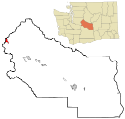
Thorp is an unincorporated community and census-designated place (CDP) in Kittitas County, Washington, United States. In 2015, the population was 317 according to statistics compiled by Data USA.

Snoqualmie might refer to:

<span class="mw-page-title-main">Alpental</span> Valley and part of a ski area in Washington, United States

Alpental, named after the German word for alpine valley, is both a valley in eastern King County, Washington, United States, and part of a ski area in the valley. The valley is about 50 miles (80 km) east of Seattle, Washington and is north of Snoqualmie Pass, in the Washington Cascades. It is a popular outdoor recreation destination in summer and winter. The ski area is one of four areas that make up The Summit at Snoqualmie.

<span class="mw-page-title-main">Snoqualmie Tunnel</span>

The Snoqualmie Tunnel is a former railroad tunnel near Snoqualmie Pass in the U.S. state of Washington, located east of Seattle. The tunnel crosses the Cascade Range about three miles (5 km) south of the pass, which is used by Interstate 90, on the border between King County and Kittitas County. It is 11,894 feet long and is at an approximate elevation of 2,600 feet (790 m) above sea level, just north of Keechelus Lake. Its east portal is at Hyak.

<span class="mw-page-title-main">The Summit at Snoqualmie</span> Resort in Washington, United States

The Summit at Snoqualmie is a recreation area in the northwest United States, located on Snoqualmie Pass, Washington. It provides alpine skiing and snowboarding, Nordic skiing, mountain biking, and winter tubing. Owned and managed by Boyne Resorts, it is 52 miles (80 km) east of downtown Seattle on Interstate 90.

<span class="mw-page-title-main">Hyak, Washington</span> Unincorporated community in Washington, United States

Hyak is an unincorporated community located on Snoqualmie Pass in Kittitas County, Washington. It is located within the Snoqualmie Pass CDP.

<span class="mw-page-title-main">Palouse to Cascades State Park Trail</span>

The Palouse to Cascades State Park Trail, formerly known as the John Wayne Pioneer Trail and the Iron Horse Trail, is a rail trail that spans most of the U.S. state of Washington. It follows the former railway roadbed of the Chicago, Milwaukee, St. Paul & Pacific Railroad for 300 miles (480 km) across two-thirds of the state, from the western slopes of the Cascade Mountains to the Idaho border.

<span class="mw-page-title-main">Keechelus Lake</span> Natural lake, reservoir in Washington, U.S.

Keechelus Lake is a lake and reservoir in the northwest United States, near Hyak in Kittitas County, Washington. Approximately fifty miles (80 km) southeast of Seattle and a few miles southeast of Snoqualmie Pass, it is the source of the Yakima River.

<span class="mw-page-title-main">Mount Catherine (Washington)</span> Mountain in Washington (state), United States

Mount Catherine is a mountain peak in the Cascade Range in Washington state located near Snoqualmie Pass and Keechelus Lake. It is accessible via Forest Road 9070 except in winter. The Nordic Pass snowshoe trail starts near the Summit East ski area, and ends at this popular destination at a low point on the west ridge of Mount Catherine. Winter ascents of Mount Catherine are frequently done by continuing up the ridge to the summit.

<span class="mw-page-title-main">Washington State Route 906</span> Highway in Washington

State Route 906 (SR 906) is a 2.65-mile-long (4.26 km) state highway in the U.S. state of Washington, serving Snoqualmie Pass and its associated ski areas in King and Kittitas counties. The highway travels southeast between two interchanges with Interstate 90 (I-90) in Snoqualmie Pass and Hyak. SR 906 was formed out of segments of the former Sunset Highway that were bypassed by the construction of the controlled-access Interstate Highway over the pass. Between 360 and 2,100 vehicles use the road on an average day in 2012.

<span class="mw-page-title-main">Snoqualmie Pass</span> Mountain pass in Washington state, U.S.

Snoqualmie Pass is a mountain pass that carries Interstate 90 (I-90) through the Cascade Range in the U.S. state of Washington. The pass summit is at an elevation of 3,015 feet (919 m), on the county line between Kittitas County and King County.

Milwaukee Ski Bowl was an alpine ski area in the northwest United States in Washington, which operated between 1937 and 1950. It was southeast of Seattle in the Cascade Range at Hyak, on the east side of Snoqualmie Pass.

<span class="mw-page-title-main">Rampart Ridge (Washington)</span> Mountain range in Washington (state), United States

Rampart Ridge is a 5,870 ft (1,790 m) elevation mountain ridge located in the Cascade Range, in Kittitas County of Washington state. It is situated northeast of Hyak, Washington, and the north end of Keechelus Lake, within the Alpine Lakes Wilderness, on land managed by Wenatchee National Forest. Its nearest higher peak is Alta Mountain, 1.74 mi (2.80 km) to the north-northeast, and Dungeon Peak rises 0.77 mi (1.24 km) to the south-southwest. The north-south trending ridge is characterized by vertical cliffs on its west-facing side above the Gold Creek valley, and gentle meadows with lakes on the eastern side, such as Rachel Lake, Lake Lillian, and the Rampart Lakes. The descriptive name of rampart was officially adopted 1918 by the United States Board on Geographic Names based on a suggestion by The Mountaineers. Precipitation runoff from the ridge drains into tributaries of the Yakima River.  

<span class="mw-page-title-main">Spectacle Lake (Washington)</span> Lake in Kittitas County, United States of America

Spectacle Lake is an alpine freshwater lake located on the northern skirt of Chikamin Peak and Lemah Mountain in Kittitas County on its western border with King County, Washington. Because of its proximity to surrounding peaks and mountains at the heart of the Alpine Lakes Wilderness, the lake is a popular area for hiking, camping and fishing cutthroat trout. Other Alpine lakes are in the vicinity, including the Chikamin Lake, a short distance North, at the base of Chikamin Peak. To the South is Hibox Mountain.

<span class="mw-page-title-main">Tinkham Peak</span> Mountain in Washington (state), United States

Tinkham Peak is a double summit mountain located on the common boundary of King County and Kittitas County in Washington state.

References

  1. 1 2 "U.S. Census website". United States Census Bureau . Retrieved January 31, 2008.
  2. "Snoqualmie Pass". Geographic Names Information System . United States Geological Survey, United States Department of the Interior.
  3. 1 2 "Geographic Identifiers: 2010 Census Summary File 1 (G001), Snoqualmie Pass CDP, Washington". American FactFinder. U.S. Census Bureau. Archived from the original on February 13, 2020. Retrieved July 5, 2019.
  4. "Snoqualmie Pass North - Peakbagger.com".
  5. "Palouse to Cascades State Park Trail | Washington State Parks and Recreation Commission".
  6. "xmACIS2". National Oceanic and Atmospheric Administration. Retrieved February 15, 2023.
  7. "Climate and monthly weather forecast Snoqualmie Pass, WA" . Retrieved August 19, 2022.

47°23′32″N121°24′0″W / 47.39222°N 121.40000°W / 47.39222; -121.40000