
The North Shore of Long Island is the area along the northern coast of New York's Long Island bordering Long Island Sound. Known for its extreme wealth and lavish estates, the North Shore exploded into affluence at the turn of the 20th century, earning it the nickname the Gold Coast. Historically, this term refers to the affluent coastline neighborhoods of the towns of North Hempstead and Oyster Bay in Nassau County and Huntington in Suffolk County. Some definitions may also include the parts of Smithtown that face the Sound. The region is also largely coextensive with the Gold Coast region of Long Island, though this region excludes Smithtown, as the easternmost Gold Coast mansion is the Geissler Estate, located just west of Indian Hills Country Club in the Fort Salonga section of Huntington.
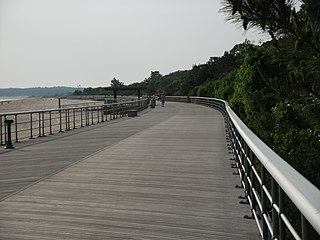
Sunken Meadow State Park, also known as Governor Alfred E. Smith State Park, is a 1,287-acre (5.21 km2) state park located in the Town of Smithtown in Suffolk County, New York on the north shore of Long Island. The park, accessible via the Sunken Meadow State Parkway, contains the 27-hole Sunken Meadow State Park Golf Course.

New York State Route 25A (NY 25A) is a state highway on Long Island in New York, United States. It serves as the main east–west route for most of the North Shore of Long Island, running for 73 miles (117 km) from Interstate 495 (I-495) at the Queens–Midtown Tunnel in the New York City borough of Queens to NY 25 in Calverton, Suffolk County. The highway is a northern alternate route of NY 25, which follows a more inland routing along Jericho Turnpike.
The Meadowbrook State Parkway is a 12.52-mile (20.15 km) controlled-access parkway in Nassau County, New York, in the United States. Its southern terminus is at a full cloverleaf interchange with the Bay and Ocean parkways in Jones Beach State Park. The parkway heads north, crossing South Oyster Bay and intersecting Loop Parkway before crossing onto the mainland and connecting to the Southern State Parkway in North Merrick. It continues north to the hamlet of Carle Place, where the Meadowbrook Parkway ends at exit 31A of the Northern State Parkway. The Meadowbrook Parkway is designated New York State Route 908E (NY 908E), an unsigned reference route. Most of the road is limited to non-commercial traffic, like most parkways in the state of New York; however, the portion south of Merrick Road is open to commercial traffic.

The Loop Parkway is a 2.65-mile (4.26 km) controlled-access parkway in Nassau County, New York, in the United States. It serves the barrier islands south of Long Island itself, beginning on Long Beach Barrier Island at an intersection with Lido Boulevard in Point Lookout. From here, it heads generally east–west across Alder and Meadow islands to an interchange with the Meadowbrook State Parkway on Jones Island, a part of Jones Beach State Park located just north of Jones Beach Island. The islands served by the Loop Parkway are separated by narrow channels of water, all of which connect to Jones Inlet. The parkway is maintained by the New York State Department of Transportation (NYSDOT) and inventoried by the department as New York State Route 908C (NY 908C), an unsigned reference route.
The Wantagh State Parkway is a 13.33-mile (21 km) controlled-access parkway on Long Island, New York, in the United States. It links the Ocean Parkway in Jones Beach State Park with the Northern State Parkway in Westbury. The parkway is located approximately 30 miles (48 km) east of Manhattan and 14 miles (23 km) east of the Nassau–Queens border.

The Northern State Parkway is a 28.88-mile (46.48 km) controlled-access parkway on Long Island in the U.S. state of New York. The western terminus is at the Queens–Nassau County line in Lake Success – west of which the parkway continues westward into New York City as the Grand Central Parkway. The eastern terminus is at New York State Route 347 (NY 347) and NY 454 in Hauppauge, in Suffolk County. As its name implies, the parkway services communities along the northern half of the island. The parkway is designated New York State Route 908G (NY 908G) – an unsigned reference route – and has been ceremoniously named Purple Heart Way since 2011.
The Sagtikos State Parkway is a 5.14-mile (8.27 km) controlled-access parkway in Suffolk County on Long Island, New York, in the United States. It begins at an interchange with the Southern State and Heckscher Parkways in the hamlet of West Islip and goes north to a large cloverleaf interchange with the Northern State Parkway in the Town of Smithtown, where the Sagtikos ends and the road becomes the Sunken Meadow State Parkway. The parkway comprises the southern half of New York State Route 908K (NY 908K), an unsigned reference route, with the Sunken Meadow State Parkway forming the northern portion.

The Sunken Meadow State Parkway is a 6.19-mile (9.96 km) controlled-access parkway in Suffolk County, on Long Island, New York.

The Town of Oyster Bay is the easternmost of the three towns that make up Nassau County, New York, United States. Part of the New York metropolitan area, it is the only town in Nassau County to extend from the North Shore to the South Shore of Long Island. As of the 2020 census, it had a population of 301,332, Making it the 5th most populous city or town in the state.

New York State Route 347 (NY 347) is an east–west arterial road located in Suffolk County, New York, in the United States. It connects the Northern State Parkway in Hauppauge to NY 25A in Mount Sinai. The route serves as a southern bypass of Smithtown and as a direct link between Nesconset and Port Jefferson, leading to the road being known as the Smithtown Bypass in the Town of Smithtown, and for its entire length as the Nesconset–Port Jefferon Highway. Along the way, NY 347 intersects NY 25 in Nesconset and Nicolls Road in Lake Grove. The westernmost 2 miles (3.2 km) of NY 347 is concurrent with NY 454 while the portion northeast of NY 25 parallels NY 25A, which follows a more northerly alignment through the Town of Brookhaven than NY 347.
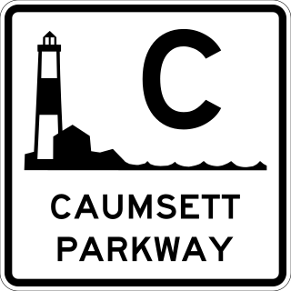
The Caumsett State Parkway was a proposed parkway on the North Shore of Long Island, New York, between Plainview in Nassau County and the Caumsett State Historic Park in Lloyd Harbor, Suffolk County.

The Long Island Sound link is a proposed bridge or tunnel that would link Long Island, New York, to Westchester County or Connecticut, across Long Island Sound east of the Throgs Neck Bridge. The project has been studied and debated since the mid-20th century. The most recent proposal is a tunnel between Rye, New York, on the mainland and Oyster Bay on the island. Feasibility studies for bridges and tunnels have been conducted for numerous entry points, as listed in the chart below.
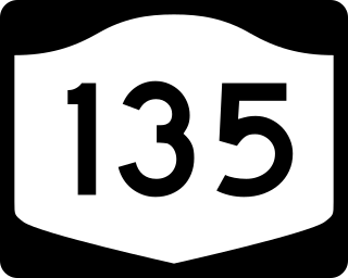
New York State Route 135 (NY 135) is a 10.8-mile (17.4 km) freeway in eastern Nassau County, New York, in the United States. The route connects Seaford with Syosset. The highway runs from Merrick Road in Seaford to NY 25 in Syosset. In between, NY 135 passes through Bethpage and Plainview and serves Bethpage State Park. The highway is ceremoniously designated as the Ralph J. Marino Expressway; however, it is more commonly known as the Seaford–Oyster Bay Expressway.
