South Haven, Kansas

Last updated

South Haven, Kansas
US 177 northern terminus.jpg
Road signs in South Haven with businesses in background (2009)
Sumner County Kansas Incorporated and Unincorporated areas South Haven Highlighted.svg
Location within Sumner County and Kansas
Map of Sumner Co, Ks, USA.png
Coordinates: 37°02′58″N97°24′06″W / 37.04944°N 97.40167°W / 37.04944; -97.40167 [1]
Country United States
State Kansas
County Sumner
Founded1872
Incorporated 1887
Named for South Haven, Michigan
Area
[2]
  Total1.00 sq mi (2.59 km2)
  Land1.00 sq mi (2.59 km2)
  Water0.00 sq mi (0.00 km2)
Elevation
[1]
1,125 ft (343 m)
Population
 (2020) [3]
  Total324
  Density320/sq mi (130/km2)
Time zone UTC-6 (CST)
  Summer (DST) UTC-5 (CDT)
ZIP code
67140
Area code 620
FIPS code 20-66650
GNIS ID 2395916 [1]
Website cityofsouthhaven.com

South Haven is a city in Sumner County, Kansas, United States. [1] As of the 2020 census, the population of the city was 324. [3]

Contents

History

South Haven was founded in 1872, [4] and was named after South Haven, Michigan. [5] The railroad reached South Haven in 1879. [4]

Unlike other paired towns in Kansas that are located adjacent to one another (e.g. Newton and North Newton or Hutchinson and South Hutchinson), South Haven is about 80 miles from Haven.

Geography

According to the United States Census Bureau, the city has a total area of 0.79 square miles (2.05 km2), all of it land. [6]

Both the western terminus of U.S. Route 166 and the northern terminus of U.S. Route 177 are in South Haven. In addition, U.S. Route 81 passes through the city.

Demographics

Historical population
CensusPop.Note
1880 124
1890 465275.0%
1900 411−11.6%
1910 48317.5%
1920 423−12.4%
1930 4424.5%
1940 405−8.4%
1950 358−11.6%
1960 40814.0%
1970 4131.2%
1980 4396.3%
1990 420−4.3%
2000 390−7.1%
2010 363−6.9%
2020 324−10.7%
U.S. Decennial Census

2010 census

As of the census [7] of 2010, there were 363 people, 142 households, and 97 families living in the city. The population density was 459.5 inhabitants per square mile (177.4/km2). There were 172 housing units at an average density of 217.7 per square mile (84.1/km2). The racial makeup of the city was 94.2% White, 0.3% African American, 1.7% Native American, 0.3% Asian, 1.9% from other races, and 1.7% from two or more races. Hispanic or Latino of any race were 7.4% of the population.

There were 142 households, of which 37.3% had children under the age of 18 living with them, 52.1% were married couples living together, 9.9% had a female householder with no husband present, 6.3% had a male householder with no wife present, and 31.7% were non-families. 29.6% of all households were made up of individuals, and 12.7% had someone living alone who was 65 years of age or older. The average household size was 2.56 and the average family size was 3.20.

The median age in the city was 37.3 years. 30.3% of residents were under the age of 18; 6% were between the ages of 18 and 24; 26.2% were from 25 to 44; 24.6% were from 45 to 64; and 12.9% were 65 years of age or older. The gender makeup of the city was 50.4% male and 49.6% female.

2000 census

As of the census [8] of 2000, there were 390 people, 163 households, and 99 families living in the city. The population density was 477.4 inhabitants per square mile (184.3/km2). There were 182 housing units at an average density of 222.8 per square mile (86.0/km2). The racial makeup of the city was 94.10% White, 1.79% Native American, 1.79% from other races, and 2.31% from two or more races. Hispanic or Latino of any race were 3.33% of the population.

There were 163 households, out of which 30.1% had children under the age of 18 living with them, 51.5% were married couples living together, 7.4% had a female householder with no husband present, and 38.7% were non-families. 36.8% of all households were made up of individuals, and 15.3% had someone living alone who was 65 years of age or older. The average household size was 2.39 and the average family size was 3.19.

In the city, the population was spread out, with 29.5% under the age of 18, 5.1% from 18 to 24, 26.2% from 25 to 44, 22.6% from 45 to 64, and 16.7% who were 65 years of age or older. The median age was 37 years. For every 100 females, there were 97.0 males. For every 100 females age 18 and over, there were 91.0 males.

The median income for a household in the city was $31,932, and the median income for a family was $37,917. Males had a median income of $26,111 versus $24,375 for females. The per capita income for the city was $14,019. About 8.3% of families and 9.9% of the population were below the poverty line, including 15.6% of those under age 18 and 14.5% of those age 65 or over.

Education

The community is served by South Haven USD 509 public school district.

Notable people

Related Research Articles

<span class="mw-page-title-main">Coldwater, Kansas</span> City in Comanche County, Kansas

Coldwater is a city and county seat of Comanche County, Kansas, United States. As of the 2020 census, the population of the city was 687.

<span class="mw-page-title-main">Manchester, Kansas</span> City in Dickinson County, Kansas

Manchester is a city in Dickinson County, Kansas, United States. As of the 2020 census, the population of the city was 47.

<span class="mw-page-title-main">Edgerton, Kansas</span> City in Kansas, United States

Edgerton is a city in Johnson County, Kansas, United States, and part of the Kansas City metropolitan area. As of the 2020 census, the population of the city was 1,748. It is home to a large BNSF intermodal train facility named Logistics Park Kansas City.

<span class="mw-page-title-main">Kingman, Kansas</span> City in Kingman County, Kansas

Kingman is a city in and the county seat of Kingman County, Kansas, United States. As of the 2020 census, the population of the city was 3,105.

<span class="mw-page-title-main">Linn Valley, Kansas</span> City in Kansas, United States

Linn Valley is a city in Linn County, Kansas, United States. As of the 2020 census, the population of the city was 956.

<span class="mw-page-title-main">Bern, Kansas</span> City in Nemaha County, Kansas

Bern is a city in Nemaha County, Kansas, United States. As of the 2020 census, the population of the city was 161.

<span class="mw-page-title-main">Seneca, Kansas</span> City in Nemaha County, Kansas

Seneca is a city in and the county seat of Nemaha County, Kansas, United States. As of the 2020 census, the population of the city was 2,139.

<span class="mw-page-title-main">Onaga, Kansas</span> City in Pottawatomie County, Kansas

Onaga is a city in Pottawatomie County, Kansas, United States. As of the 2020 census, the population of the city was 679.

<span class="mw-page-title-main">Coats, Kansas</span> City in Pratt County, Kansas

Coats is a city in Pratt County, Kansas, United States. As of the 2020 census, the population of the city was 68.

<span class="mw-page-title-main">Haven, Kansas</span> City in Reno County, Kansas

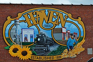
Haven is a city in Reno County, Kansas, United States. As of the 2020 census, the population of the city was 1,170.

<span class="mw-page-title-main">Partridge, Kansas</span> City in Reno County, Kansas

Partridge is a city in Reno County, Kansas, United States. As of the 2020 census, the population of the city was 209.

<span class="mw-page-title-main">South Hutchinson, Kansas</span> City in Reno County, Kansas

South Hutchinson is a city in Reno County, Kansas, United States. As of the 2020 census, the population of the city was 2,521. It is a south suburb of Hutchinson.

<span class="mw-page-title-main">Andale, Kansas</span> City in Sedgwick County, Kansas

Andale is a city in Sedgwick County, Kansas, United States. As of the 2020 census, the population of the city was 941.

<span class="mw-page-title-main">Kechi, Kansas</span> City in Sedgwick County, Kansas

Kechi is a city in Sedgwick County, Kansas, United States, and a suburb of Wichita. As of the 2020 census, the population of the city was 2,217.

<span class="mw-page-title-main">Mount Hope, Kansas</span> City in Sedgwick County, Kansas

Mount Hope is a city in Sedgwick County, Kansas, United States. As of the 2020 census, the population of the city was 806.

<span class="mw-page-title-main">Park City, Kansas</span> City in Sedgwick County, Kansas

Park City is a city in Sedgwick County, Kansas, United States and a suburb of Wichita. As of the 2020 census, the population of the city was 8,333.

<span class="mw-page-title-main">Hunnewell, Kansas</span> City in Sumner County, Kansas

Hunnewell is a city in Sumner County, Kansas, United States. As of the 2020 census, the population of the city was 44.

<span class="mw-page-title-main">Oakview, Missouri</span> Village in Missouri, United States

Oakview is a village in Clay County, Missouri, United States. The population was 366 at the 2020 census. It is part of the Kansas City metropolitan area.

<span class="mw-page-title-main">South Haven, Minnesota</span> City in Minnesota, United States

South Haven is a city in Wright County, Minnesota, United States. The population was 187 at the 2010 census.

<span class="mw-page-title-main">Oakwood Park, Missouri</span> Village in Missouri, United States

Oakwood Park is a village in Clay County, Missouri, United States. The population was 189 at the 2020 census. It is part of the Kansas City metropolitan area.

References

  1. 1 2 3 4 U.S. Geological Survey Geographic Names Information System: South Haven, Kansas
  2. "2019 U.S. Gazetteer Files". United States Census Bureau. Retrieved July 24, 2020.
  3. 1 2 "Profile of South Haven, Kansas in 2020". United States Census Bureau. Archived from the original on April 4, 2022. Retrieved April 4, 2022.
  4. 1 2 Blackmar, Frank Wilson (1912). Kansas: A Cyclopedia of State History, Volume 2. Standard Publishing Company. pp.  718.
  5. Heim, Michael (2007). Exploring Kansas Highways. p. 23. ISBN   9780974435886.
  6. "US Gazetteer files 2010". United States Census Bureau. Archived from the original on July 2, 2012. Retrieved July 6, 2012.
  7. "U.S. Census website". United States Census Bureau . Retrieved July 6, 2012.
  8. "U.S. Census website". United States Census Bureau . Retrieved January 31, 2008.

Further reading