Special routes of U.S. Route 169 | |
|---|---|
| Highway system | |

Six special routes of U.S. Route 169 exist, one each in Oklahoma, Kansas, Missouri, and Iowa, and two in Minnesota.
Special routes of U.S. Route 169 | |
|---|---|
| Highway system | |
Six special routes of U.S. Route 169 exist, one each in Oklahoma, Kansas, Missouri, and Iowa, and two in Minnesota.
U.S. Highway 169 Alternate | |
|---|---|
| Location | Nowata, Oklahoma |
| Length | 2.70 mi [1] (4.35 km) |
U.S. Highway 169 Alternate (US 169 Alt.) at Nowata is the only special route for US 169 in Oklahoma. The alternate route travels through Nowata while the main highway bypasses the town. The alternate route is approximately 2.70 miles (4.35 km) long. [1]
The entire route is in Nowata, Nowata County.
| mi | km | Destinations | Notes | ||
|---|---|---|---|---|---|
| 1.000 mi = 1.609 km; 1.000 km = 0.621 mi | |||||
U.S. Highway 169 Business | |
|---|---|
| Location | Garnett, Kansas |
| Length | 2.8 mi [2] (4.5 km) |
U.S. Highway 169 Business (US-169 Bus.) in Garnett is the only special route of US-169 in Kansas. The business route northern terminus is the junction of US-169 and 6th Avenue in Garnett. The main highway bypasses the town to the southeast. The business route travels along 6th Avenue until Maple Street, where it intersects US-59 and K-31 until it ends at its intersection with US-169 at a roundabout south of Garnett in Anderson County.
U.S. Route 169 Spur | |
|---|---|
| Location | Smithville, Missouri |
| Length | 0.536 mi [3] (863 m) |

U.S. Route 169 Spur is a 1⁄2-mile-long (800 m) route in Smithville, Missouri. The spur route follows an old alignment of US 169 into the city center of Smithville, ending at Main Street.
The entire route is in Smithville, Clay County.
| mi [3] | km | Destinations | Notes | ||
|---|---|---|---|---|---|
| 0.000 | 0.000 | ||||
| 0.298 | 0.480 | ||||
| 0.536 | 0.863 | ||||
| 1.000 mi = 1.609 km; 1.000 km = 0.621 mi | |||||
U.S. Highway 169 Business | |
|---|---|
| Location | Fort Dodge, Iowa |
| Length | 3.147 mi [4] (5.065 km) |
| Existed | 1990 [5] –present |
U.S. Route 169 Business (US 169 Bus.) is a 3.1-mile-long (5.0 km) business route in Fort Dodge, Iowa. The route was established in 1990 along former sections of Iowa Highway 7 (Iowa 7) and US 20. Iowa 7 had recently been truncated to its current eastern end at US 169, and US 20 had been rerouted onto a new freeway south of Fort Dodge. Since both routes had viaducts over the Des Moines River, officials in Fort Dodge wanted the Iowa Department of Transportation to maintain the bridges. [5] From its creation until 2014, the route was officially known as Iowa 926, but it was only signed as US 169 Bus. [6] The entire route is in Fort Dodge, Webster County.
| mi [4] | km | Destinations | Notes | ||
|---|---|---|---|---|---|
| 0.000 | 0.000 | Southern end of US 20 Bus. concurrency | |||
| 1.625 | 2.615 | Northern end of US 20 Bus. concurrency | |||
| 3.147 | 5.065 | ||||
1.000 mi = 1.609 km; 1.000 km = 0.621 mi
| |||||
U.S. Highway 169 Business | |
|---|---|
| Location | Shakopee, Minnesota |
| Length | 8.9 mi [7] (14.3 km) |
| | This section needs expansion. You can help by adding to it. (July 2021) |
U.S. Highway 169 Business is a business route in Shakopee, Minnesota.
U.S. Highway 169 Business | |
|---|---|
| Location | Hibbing, Minnesota |
| Length | 3.0 mi [8] (4.8 km) |
| | This section needs expansion. You can help by adding to it. (July 2021) |
U.S. Highway 169 Business is a business route in Hibbing, Minnesota.

Interstate 35 (I-35) is a major Interstate Highway in the central United States. As with most primary Interstates that end in a five, it is a major cross-country, north–south route. It stretches from Laredo, Texas, near the Mexican border to Duluth, Minnesota, at Minnesota State Highway 61 and 26th Avenue East. The highway splits into I-35E and I-35W in two separate places, the Dallas–Fort Worth metroplex in Texas and at the Minnesota twin cities of Minneapolis–Saint Paul.

U.S. Route 75 is a north–south U.S. Highway that runs 1,239 miles (1,994 km) in the central United States. The highway's northern terminus is located at Noyes, Minnesota, which connects to the Canadian border, where it once continued as Manitoba Highway 75 on the other side of the now-closed border crossing. Its southern terminus is located at Interstate 30 (I-30) and I-45 in Dallas, Texas, where it is known as North Central Expressway.

U.S. Route 69 (US 69) is a major north–south United States highway. When it was first created, it was only 150 miles (241 km) long, but it has since been expanded into a Minnesota to Texas cross-country route. The highway's southern terminus is in Port Arthur, Texas at an intersection with State Highway 87. Its northern terminus is in Albert Lea, Minnesota at Minnesota State Highway 13.

U.S. Route 59 is a north–south United States highway. A latecomer to the U.S. numbered route system, US 59 is now a border-to-border route, part of the NAFTA Corridor Highway System. It parallels U.S. Route 75 for nearly its entire route, never much more than 100 miles (160 km) away, until it veers southwest in Houston, Texas. Its number is out of place since US 59 is either concurrent with or entirely west of U.S. Route 71. The highway's northern terminus is 9 mi (14 km) north of Lancaster, Minnesota, at the Lancaster–Tolstoi Border Crossing on the Canada–US border, where it continues as Manitoba Highway 59. Its southern terminus is at the Mexico–US border in Laredo, Texas, where it continues as Mexican Federal Highway 85D.

U.S. Route 71 or U.S. Highway 71 is a major north–south United States highway that extends for over 1500 miles (2500 km) in the central United States. This original 1926 route has remained largely unchanged by encroaching Interstate highways. Currently, the highway's northern terminus is in International Falls, Minnesota at the Canada–US border, at the southern end of the Fort Frances-International Falls International Bridge to Fort Frances, Ontario. U.S. Route 53 also ends here. On the other side of the bridge, Trans-Canada Highway is an east–west route while Ontario Highway 71 is a north–south route. US 71's southern terminus is between Port Barre and Krotz Springs, Louisiana at an intersection with U.S. Route 190. For the entirety south of Kansas City, Missouri, US 71 runs parallel and concurrent with the existing and future Interstate 49. North of Kansas City, US 71 runs halfway between Interstate 29 and Interstate 35, which they split in the city at an interchange with Interstate 70.
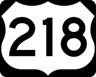
U.S. Highway 218 (US 218) is an original United States Highway that was created in 1926. Although technically a spur of US 18, US 218 neither begins nor ends at US 18, but overlaps US 18 for eight miles (13 km) near Charles City, Iowa. US 218 begins at 136 in downtown Keokuk and ends 319 miles (513 km) away at Interstate 35 (I-35) and US 14 at Owatonna, Minnesota. A large portion of US 218 in Iowa is part of the Avenue of the Saints, which connects St. Louis, Missouri, and Saint Paul, Minnesota.

U.S. Route 169 is a north-south U.S highway that currently runs for 966 miles (1,555 km) from the city of Virginia, Minnesota, to Tulsa, Oklahoma, at Memorial Drive.
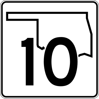
State Highway 10 is a state highway in northeastern Oklahoma. It makes a 233.1 miles (375.1 km) crescent through the northeast corner of the state, running from SH-99 in Osage County to Interstate 40 (I-40) near Gore. It has two lettered spur routes.

U.S. Highway 20 in Iowa is a major east–west artery which runs across the state, separating the northern third of Iowa from the southern two-thirds. It enters Iowa from Nebraska, concurrent with Interstate 129 and U.S Route 75, crossing the Missouri River at Sioux City. US 20 runs in a more-or-less straight line across Iowa, paralleling 42° 27' N. It leaves Iowa in Dubuque by crossing the Mississippi River into Illinois. Since October 2018, US 20 is a four-lane divided highway for its entire length in Iowa.
A total of ten special routes of U.S. Route 71 exist, and another ten previously existed.
U.S. Route 169 is a U.S. Highway that travels from Tulsa, Oklahoma to Virginia, Minnesota. In the state of Missouri, US 169 enters the state from Kansas overlapped with I-70 / US 24 / US 40 at Kansas City and exits the state into Iowa north of Irena.
Six special routes of U.S. Route 75 exist. Two routes exist in Oklahoma, two in Kansas, one in Nebraska, and two in Iowa.
U.S. Route 169 (US-169) is a major north–south U.S. Highway that runs from US-64 in Tulsa, Oklahoma, to US-53 near Virginia, Minnesota. In Kansas, the highway is a main north–south route that runs through the eastern end of the state from the Oklahoma border to Missouri border. Along the way US-169 intersects several major highways including US-400 by Cherryvale, US-54 by Iola, overlaps US-59 south of Garnett, overlaps I-35 from Olathe to Merriam, and in Kansas City begins an overlap with I-70, US-24 and US-40 which it follows into Missouri.
U.S. Route 169 is a U.S. highway that begins in Tulsa southeast of Downtown. The highway runs north into Kansas.

U.S. Route 60 (US-60) is a transcontinental U.S. highway extending from near Brenda, Arizona to Virginia Beach, Virginia on the Atlantic Ocean. Along the way, 352.39 miles (567.12 km) of the route lies within the state of Oklahoma. The highway crosses into the state from Texas west of Arnett and serves many towns and cities in the northern part of the state, including Arnett, Seiling, Fairview, Enid, Ponca City, Pawhuska, Bartlesville, and Vinita. US-60 exits Oklahoma near Seneca, Missouri. In Oklahoma, US-60 has three business routes, serving Tonkawa, Ponca City, and Seneca. The first 60.2 miles (96.9 km) of the route, from the Texas line to Seiling, is also designated as State Highway 51 (SH-51).

U.S. Highway 412 (US 412) runs east-to-west through northern Arkansas for about 290 miles (470 km). The route begins at the Oklahoma state line near Siloam Springs, and ends at the Missouri state line east of Paragould.

Several special routes of U.S. Route 61 exist in the states of Louisiana, Mississippi, Missouri, and Iowa.

Several special routes of U.S. Route 54 exist, from Texas to Missouri. In order from southwest to northeast, separated by type, they are as follows.
U.S. Route 59 (US-59) is a part of the U.S. Highway System that runs from the Mexico–US border in Laredo, Texas, as a continuation of Mexican Federal Highway 85D north to the Lancaster–Tolstoi Border Crossing on the Canada–US border, where it continues as Manitoba Highway 59. In the U.S. state of Kansas, US-59 is a main north–south highway that travels from Chetopa to Atchison.
U.S. Highway 75 (US 75) is a United States Highway in northwestern Iowa. It begins at the Missouri River on a bridge with Interstate 129 (I-129) and US 20. Immediately upon landing in Iowa from Nebraska, I-129 ends at an interchange with I-29. US 20 and US 75 continue around Sioux City on a four-lane expressway until US 20 exits to the east. US 75 heads to the north-northeast, parallel to the Floyd River, until Le Mars. There, Iowa Highway 60 (Iowa 60) continues northeastward on the expressway while US 75 heads due north. Near Hull, it is briefly overlapped by US 18. It leaves the state and enters Minnesota north of Rock Rapids.